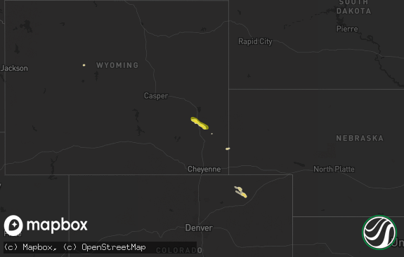
Hail Map in Wyoming on May 31, 2018
The weather event in Wyoming on May 31, 2018 includes Hail map. 16 states and 316 cities were impacted and suffered possible damage. The total estimated number of properties impacted is 978.

Hail
978
Estimated number of impacted properties by a 1.00" hail or larger197
Estimated number of impacted properties by a 1.75" hail or larger0
Estimated number of impacted properties by a 2.50" hail or largerStorm reports in Wyoming
Wyoming
| Date | Description |
|---|---|
| 05/31/20182:46 AM CDT | At 746 PM MDT, a severe thunderstorm was located 9 miles north of New Haven, or 39 miles northwest of Sundance, moving northeast at 25 mph. HAZARD...Ping pong ball size hail and 60 mph wind gusts. SOURCE...Radar indicated. IMPACT...People and animals outdoors will be injured. Expect hail damage to roofs, siding, windows, and vehicles. Expect wind damage to roofs, siding, and trees. This severe thunderstorm will remain over mainly rural areas of northwestern Crook County. |
| 05/31/20181:43 AM CDT | At 643 PM MDT, a severe thunderstorm was located near Devils Tower Junction, or 13 miles west of Sundance, moving north at 45 mph. Quarter sized hail was recently reported near Pine Haven. HAZARD...Ping pong ball size hail and 60 mph wind gusts. SOURCE...Trained weather spotters. IMPACT...People and animals outdoors will be injured. Expect hail damage to roofs, siding, windows, and vehicles. Expect wind damage to roofs, siding, and trees. Locations impacted include... Hulett, Alva, Devils Tower National Monument, Warren Peak, Bear Lodge Campground, Cook Lake and Devils Tower Junction. |
| 05/31/20181:17 AM CDT | At 616 PM MDT, a severe thunderstorm was located 8 miles southeast of Moorcroft, or 25 miles southwest of Sundance, moving northeast at 30 mph. Trained spotters recently reported quarter sized hail with this storm. HAZARD...Ping pong ball size hail and 60 mph wind gusts. SOURCE...Trained weather spotters. IMPACT...People and animals outdoors will be injured. Expect hail damage to roofs, siding, windows, and vehicles. Expect wind damage to roofs, siding, and trees. Locations impacted include... Pine Haven, Carlile and Keyhole Reservoir. This Includes Interstate 90 in Wyoming between Mile Markers 156 and183. |
| 05/30/201811:54 PM CDT | At 454 PM MDT, a severe thunderstorm was located near Medicine Wheel, or 20 miles north of Greybull, moving northeast at 30 mph. HAZARD...60 mph wind gusts and quarter size hail. SOURCE...Radar indicated. IMPACT...Hail damage to vehicles is expected. Expect wind damage to roofs, siding, and trees. This severe thunderstorm will remain over mainly rural areas of northwestern Sheridan County. |
| 05/30/201811:12 PM CDT | At 412 PM MDT, a severe thunderstorm was located 11 miles northwest of Greybull, moving northeast at 30 mph. HAZARD...60 mph wind gusts and quarter size hail. SOURCE...Radar indicated. IMPACT...Hail damage to vehicles is expected. Expect wind damage to roofs, siding, and trees. This severe thunderstorm will be near, Medicine Wheel around 450 PM MDT. Other locations impacted by this severe thunderstorm includePorcupine Campground, Bald Mountain Campground and Bighorn CanyonNational Recreation Area. |
| 05/30/20189:21 PM CDT | At 219 PM MDT, a severe thunderstorm was located 10 miles north of Felt, Idaho, moving northeast at 40 mph. HAZARD...Quarter size hail. SOURCE...The public has reported rotation with this storm, inculding several funnel clouds. IMPACT...Damage to vehicles is expected. This severe thunderstorm will be near, South Entrance around 255 PM MDT. Lewis Falls and Lewis Lake around 300 PM MDT. Other locations impacted by this severe thunderstorm include FlaggRanch Village. |
| 05/30/20188:48 PM CDT | A local report indicates 1.00 inch wind near 10 NNE NEW HAVEN |
| 05/30/20188:08 PM CDT | A local report indicates 1.00 inch wind near ALVA |
| 05/30/20187:28 PM CDT | A local report indicates 1.00 inch wind near 4 SE PINE HAVEN |
| 05/30/20187:00 PM CDT | A local report indicates 1.00 inch wind near 12 W UPTON |
All States Impacted by Hail Map on May 31, 2018
Cities Impacted by Hail Map on May 31, 2018
- Carson, ND
- Big Timber, MT
- Melville, MT
- Hulett, WY
- Crow Agency, MT
- Moorcroft, WY
- Gladstone, ND
- Taylor, ND
- Eminence, MO
- Birch Tree, MO
- Winona, MO
- Wolf Creek, MT
- New England, ND
- Potosi, MO
- Belgrade, MO
- Lavina, MT
- Roundup, MT
- Doniphan, MO
- Lebanon, TN
- Richardton, ND
- Halliday, ND
- Beulah, ND
- Paul, ID
- Dickinson, ND
- South Heart, ND
- Duke, MO
- Licking, MO
- Billings, MT
- Salem, MO
- Bixby, MO
- Steelville, MO
- Cherryville, MO
- Davisville, MO
- Viburnum, MO
- Caledonia, MO
- Irondale, MO
- Ingomar, MT
- Kissee Mills, MO
- Powersite, MO
- Rockaway Beach, MO
- Taneyville, MO
- Forsyth, MO
- Branson, MO
- Zap, ND
- Hartsville, TN
- Dixon Springs, TN
- Lafayette, TN
- Bradleyville, MO
- Lynchburg, TN
- West Yellowstone, MT
- Island Park, ID
- Drummond, MT
- Hall, MT
- Thornfield, MO
- Eldorado, IL
- Carmi, IL
- Norris City, IL
- Broughton, IL
- Omaha, IL
- Miles City, MT
- Mott, ND
- Dunn Center, ND
- Ashton, ID
- Sugar City, ID
- Chester, ID
- Rexburg, ID
- Saint Anthony, ID
- Scranton, ND
- New Leipzig, ND
- Lefor, ND
- Glen Ullin, ND
- Elgin, ND
- Amidon, ND
- Reeder, ND
- Regent, ND
- Fremont, MO
- Van Buren, MO
- Red Boiling Springs, TN
- Burley, ID
- Strasburg, ND
- Fort Yates, ND
- Selfridge, ND
- Shawmut, MT
- Ryegate, MT
- Decker, MT
- Lodge Grass, MT
- Wyola, MT
- Ringgold, GA
- Corvallis, MT
- Hamilton, MT
- Napoleon, ND
- Isabella, MO
- Rupert, ID
- Heyburn, ID
- Ash Flat, AR
- Pleasant Shade, TN
- Cherokee Village, AR
- Castalian Springs, TN
- Bethpage, TN
- Hebron, ND
- Ellington, MO
- Koshkonong, MO
- Thayer, MO
- Almont, ND
- Boss, MO
- Sturgis, SD
- Ririe, ID
- Idaho Falls, ID
- Iona, ID
- Rigby, ID
- Glencoe, AR
- Hardy, AR
- Williford, AR
- Mammoth Spring, AR
- Camp, AR
- Hillsboro, TN
- Tullahoma, TN
- Decherd, TN
- Winchester, TN
- Estill Springs, TN
- Manchester, TN
- Ridgway, IL
- Roberts, ID
- Menan, ID
- Lewisville, ID
- Belleview, MO
- Bunker, MO
- Gainesville, MO
- Spokane, MO
- Highlandville, MO
- Ponce De Leon, MO
- Galena, MO
- Crane, MO
- Billings, MO
- Theodosia, MO
- Dodge, ND
- Bucyrus, MO
- Huggins, MO
- Plato, MO
- Satanta, KS
- Terreton, ID
- Blackfoot, ID
- Moore, ID
- Upton, WY
- Harrisburg, IL
- Walnut Shade, MO
- Kirbyville, MO
- Cairo, IL
- Musselshell, MT
- Macedonia, IL
- Newdale, ID
- Driggs, ID
- Tetonia, ID
- Kintyre, ND
- Linton, ND
- Livingston, MT
- Wilsall, MT
- McLeansboro, IL
- Benton, KY
- Tunnel Hill, GA
- Dalton, GA
- Adair, IA
- West Plains, MO
- Hammond, MT
- Boyes, MT
- Hazelton, ND
- Braddock, ND
- Missoula, MT
- Custer, MT
- Melstone, MT
- Barlow, KY
- Alva, WY
- Hazen, ND
- Richfield, ID
- Cook Sta, MO
- Greybull, WY
- Solen, ND
- Gamaliel, AR
- Hardin, MT
- Reeds Spring, MO
- Rueter, MO
- Aladdin, WY
- Sundance, WY
- Bunker Hill, IL
- Staunton, IL
- Ekalaka, MT
- Ulysses, KS
- Tecumseh, MO
- Caulfield, MO
- Dora, MO
- Mansfield, MO
- Shelley, ID
- Wasola, MO
- West Paducah, KY
- Hamer, ID
- Redford, MO
- Lesterville, MO
- Franklin, AR
- Sage, AR
- Sidney, AR
- Horseshoe Bend, AR
- Centerville, MO
- Covington, IN
- Aurora, MO
- Mountain Home, AR
- Buffalo, SD
- Laurel, MT
- Brandsville, MO
- Philipsburg, MT
- Macomb, MO
- Hartville, MO
- Evening Shade, AR
- Alzada, MT
- Montello, NV
- Chickamauga, GA
- Mount Judea, AR
- Westmoreland, TN
- Arco, ID
- Ovando, MT
- Seeley Lake, MT
- Junction, IL
- Shields, ND
- Kevil, KY
- Moody, MO
- Ravenden, AR
- Imboden, AR
- Salem, AR
- Ravenden Springs, AR
- Ava, MO
- Chestnutridge, MO
- Riverdale, ND
- Forsyth, MT
- Norwood, MO
- Sedgewickville, MO
- Perryville, MO
- Friedheim, MO
- Grandin, MO
- Mill Spring, MO
- Williamsville, MO
- Wappapello, MO
- Jerome, ID
- Shoshone, ID
- Clarkridge, AR
- Clever, MO
- Reva, SD
- Metropolis, IL
- Henderson, AR
- Atomic City, ID
- Parker, ID
- Squires, MO
- Yellowstone National Park, WY
- Marquand, MO
- Bismarck, MO
- Belfield, ND
- Poplar Bluff, MO
- Equality, IL
- Bozeman, MT
- Daisy, MO
- New Haven, IL
- Raleigh, IL
- Patton, MO
- Gepp, AR
- Udall, MO
- Sturkie, AR
- Bakersfield, MO
- Viola, AR
- Black, MO
- Sheridan, MT
- Carey, ID
- Flasher, ND
- Alder, MT
- Birney, MT
- Parkman, WY
- Success, MO
- Nixa, MO
- Oakland, AR
- Seymour, MO
- Elk City, ID
- Enfield, IL
- Dale, IL
- Gassville, AR
- Carmen, ID
- Saint Xavier, MT
- Portland, IN
- Hardenville, MO
- Annapolis, MO
- Summersville, MO
- Carthage, TN
- Mineral Point, MO
- Riddleton, TN
- Cadet, MO
- Bloomfield, MT
- Moffit, ND
- American Falls, ID
- Hettinger, ND
- Wickliffe, KY
- Paducah, KY
- Du Quoin, IL
- Rocky Face, GA
- Altamont, TN
- Shelby, NC
- Lawndale, NC
- Felt, ID
- Jasper, AR
- Vendor, AR
- Brockwell, AR
- Calico Rock, AR
- Melbourne, AR
- Mount Pleasant, AR
- Lovell, WY
- Shell, WY
- Marysville, MT
- Canyon Creek, MT
- Lame Deer, MT
- Dayton, WY
- Ismay, MT


