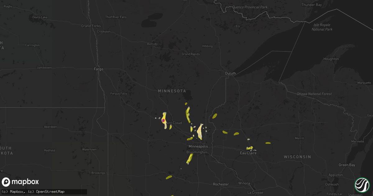
Hail Map in Minnesota on May 28, 2018
Get this storm
May 28 map
$229
one time, instant access
Download today. No call, no setup
Keep the $229
Bought the map and want the full workflow? Apply the entire $229 to a subscription within 7 days. None of it is wasted.
Every map, not just this one
This buys you this map. Subscription and you get every map we run, in the markets you choose from a few cities to whole states to nationwide. Plus real-time alerts the moment a storm fires.
Contact data
Name, contact info, occupancy, even credit band for addresses in the footprint. You go from where it hit to who to call.
Become the source they trust
Unlimited branding weather history reports on demand. You already have the documented answer ready for the property owner, and you are the one who showed up with it.
Property data and RoofTrace estimates
Pull up any address you have got, its value and the exact code rules for that jurisdiction, straight from One Click Code. Then RoofTrace estimates the squares, pitch, and roof value, priced the way you price.
Storm reports in Minnesota
Minnesota
| Date | Description |
|---|---|
| 05/28/20186:45 PM CDT | A local report indicates 1.00 inch wind near 1 S PEASE |
| 05/28/20186:39 PM CDT | A local report indicates 1.00 inch wind near 2 E PEASE |
| 05/28/20185:57 PM CDT | Numerous large trees down and intertwined in live power lines. Reported at 128th and harper st... Blaine... Mn. |
| 05/28/20185:47 PM CDT | Numerous large trees...up to 70 inch diameter down at this intersection in a unidirectional fashion. Spotty power outages. Reported at 125th ave ne... Harper st... Lino |
| 05/28/20185:45 PM CDT | A local report indicates 1.75 inch wind near EAST BETHEL |
| 05/28/20185:40 PM CDT | Asos station msp... Minneapolis-st. Paul ap-msp. |
| 05/28/20185:00 PM CDT | Roof blown off and out building. |
| 05/28/20184:10 PM CDT | A local report indicates 60 MPH wind near 1 WSW SHAKOPEE |
| 05/28/20184:00 PM CDT | Reported at 150th and marystown rd... And shakopee... Mn mostly nickel sized hail and small branches down. |
| 05/28/20183:54 PM CDT | Reported at 115 stcounty road 6... Hanska... Mn 30 power poles sheared off on east side or road. Also small boat blown off car trailer and into the road. |
| 05/28/20183:35 PM CDT | Reported at church ave... And 250th... Jordan... Mn. |
| 05/28/20184:11 AM CDT | At 911 PM CDT, a severe thunderstorm was located near Minneota, or 15 miles northwest of Marshall, moving north at 30 mph. HAZARD...60 mph wind gusts and quarter size hail. SOURCE...Radar indicated. IMPACT...Hail damage to vehicles is expected. Expect wind damage to roofs, siding, and trees. This severe thunderstorm will be near, Clarkfield around 940 PM CDT. Other locations impacted by this severe thunderstorm include St. Leoand Spring Creek. |
| 05/28/20182:40 AM CDT | At 740 PM CDT, a severe thunderstorm was located near Vineland, or 10 miles south of Mille Lacs Lake, moving north at 40 mph. HAZARD...60 mph wind gusts and quarter size hail. SOURCE...Radar indicated. IMPACT...Hail damage to vehicles is expected. Expect wind damage to roofs, siding, and trees. Boats on Mille Lacs Lake should seek shelter. Locations impacted include... Mille Lacs Lake, Aitkin, Deerwood, Malmo, Garrison, Cedar Lake, Bay Lake, Glen, Wealthwood, Ripple Lake, Glory, Rossburg, and Farm Island Lake. |
| 05/28/20182:32 AM CDT | At 731 PM CDT, a severe thunderstorm was located over Onamia, or 17 miles south of Mille Lacs Lake, moving north at 15 mph. HAZARD...60 mph wind gusts and half dollar size hail. SOURCE...Radar indicated. IMPACT...Hail damage to vehicles is expected. Expect wind damage to roofs, siding, and trees. This severe thunderstorm will be near, Wahkon around 745 PM CDT. Isle around 755 PM CDT. Vineland around 800 PM CDT. Other locations impacted by this severe thunderstorm include Bayviewand Lake Mille Lacs.This includes U.S. Highway 169 between mile markers 208 and 222. |
| 05/28/20182:29 AM CDT | At 729 PM CDT, a severe thunderstorm was located over Holdingford, or 17 miles south of Little Falls, moving north at 15 mph. HAZARD...Ping pong ball size hail and 60 mph wind gusts. SOURCE...Trained weather spotters. IMPACT...People and animals outdoors will be injured. Expect hail damage to roofs, siding, windows, and vehicles. Expect wind damage to roofs, siding, and trees. This severe thunderstorm will be near, Upsala around 745 PM CDT. Bowlus around 750 PM CDT. Other locations impacted by this severe thunderstorm include Elmdale,St Wendel and Opole.This includes Interstate 94 in Minnesota between mile markers 148 and157. |
| 05/28/20182:26 AM CDT | At 726 PM CDT, a severe thunderstorm was located near Wykoff, or 10 miles northwest of Preston, moving northeast at 15 mph. HAZARD...60 mph wind gusts and quarter size hail. SOURCE...Radar indicated. IMPACT...Hail damage to vehicles is expected. Expect wind damage to roofs, siding, and trees. This severe thunderstorm will be near... Fountain around 740 PM CDT. Chatfield around 750 PM CDT. Other locations impacted by this severe thunderstorm includeFillmore and Washington. |
| 05/28/20182:10 AM CDT | At 710 PM CDT, a severe thunderstorm was located near Branstad, or 17 miles southeast of Pine City, moving northeast at 15 mph. HAZARD...60 mph wind gusts and half dollar size hail. SOURCE...Radar indicated. IMPACT...Hail damage to vehicles is expected. Expect wind damage to roofs, siding, and trees. Locations impacted include... Grantsburg, Trade Lake, Siren, Branstad, Falun, Four Corners, Alpha, Trade River, and Phantom Lake. |
| 05/28/20182:06 AM CDT | At 706 PM CDT, a severe thunderstorm was located over Collegeville, or 9 miles west of St. Cloud, moving north at 30 mph. 2" hail was reported in Avon. HAZARD...Two inch hail and 60 mph wind gusts. SOURCE...Public. IMPACT...People and animals outdoors will be injured. Expect hail damage to roofs, siding, windows, and vehicles. Expect wind damage to roofs, siding, and trees. This severe thunderstorm will be near, Holdingford around 725 PM CDT. Other locations impacted by this severe thunderstorm include StWendel, Farming and St. Stephen.This includes the following highways... Interstate 94 in Minnesota between mile markers 147 and 163. U.S. Highway 10 in Minnesota between mile markers 165 and 178. |
| 05/28/20181:56 AM CDT | At 656 PM CDT, a severe thunderstorm was located 8 miles northwest of Bock, or 29 miles south of Mille Lacs Lake, moving north at 40 mph. HAZARD...60 mph wind gusts and quarter size hail. SOURCE...Public. IMPACT...Hail damage to vehicles is expected. Expect wind damage to roofs, siding, and trees. This severe thunderstorm will be near, Onamia around 715 PM CDT. This includes U.S. Highway 169 between mile markers 191 and 216. |
| 05/28/20181:22 AM CDT | At 622 PM CDT, a severe thunderstorm was located near St Augusta, or 7 miles south of St. Cloud, moving north at 35 mph. HAZARD...60 mph wind gusts and half dollar size hail. SOURCE...Radar indicated. IMPACT...Hail damage to vehicles is expected. Expect wind damage to roofs, siding, and trees. This severe thunderstorm will remain over mainly rural areas of Benton...northwestern Sherburne and eastern Stearns Counties, including the following locations: Duelm, Mayhew, Glendorado, Parent, St Cloud Airport, St Augusta, Oak Park, Opole, Pleasant Lake and St. Stephen.This includes the following highways... Interstate 94 in Minnesota between mile markers 151 and 178. U.S. Highway 10 in Minnesota between mile markers 158 and 196. |
| 05/28/20181:13 AM CDT | At 613 PM CDT, a severe thunderstorm was located over Northwood, moving north at 25 mph. HAZARD...60 mph wind gusts and quarter size hail. SOURCE...Radar indicated. IMPACT...Hail damage to vehicles is expected. Expect wind damage to roofs, siding, and trees. This severe thunderstorm will be near, Glenville around 635 PM CDT. London around 640 PM CDT. Hayward around 650 PM CDT. Other locations impacted by this severe thunderstorm include Myrtleand Albert Lea Airport.This includes the following highways... Interstate 35 between mile markers 1 and 14. Interstate 90 between mile markers 152 and 173. |
| 05/28/20181:09 AM CDT | At 608 PM CDT, a severe thunderstorm was located over Princeton, or 15 miles west of Cambridge, moving north at 25 mph. This storm has a history of producing wind damage. HAZARD...60 mph wind gusts and half dollar size hail. SOURCE...Public. IMPACT...Hail damage to vehicles is expected. Expect wind damage to roofs, siding, and trees. This severe thunderstorm will be near, Milaca around 640 PM CDT. Bock around 645 PM CDT. Other locations impacted by this severe thunderstorm includeSherburne National Wildlife Refuge, Orrock, Spencer Brook, Dalbo,Pease, Lewis Lake and Princeton Airport.This includes U.S. Highway 169 between mile markers 167 and 194. |
| 05/28/201812:59 AM CDT | At 558 PM CDT, a severe thunderstorm was located over Athens, or near Cambridge, moving north at 25 mph. HAZARD...Ping pong ball size hail and 60 mph wind gusts. SOURCE...Radar indicated. IMPACT...People and animals outdoors will be injured. Expect hail damage to roofs, siding, windows, and vehicles. Expect wind damage to roofs, siding, and trees. This severe thunderstorm will be near, Cambridge and Isanti around 605 PM CDT. Other locations impacted by this severe thunderstorm include SpringLake, Weber, Oak Grove, Bodum, Athens, Bethel, Cambridge Airport andCedar. |
| 05/28/201812:49 AM CDT | At 548 PM CDT, a severe thunderstorm was located near St. Francis, or 15 miles southwest of Cambridge, moving north at 20 mph. HAZARD...Ping pong ball size hail and 60 mph wind gusts. SOURCE...Radar indicated. IMPACT...People and animals outdoors will be injured. Expect hail damage to roofs, siding, windows, and vehicles. Expect wind damage to roofs, siding, and trees. This severe thunderstorm will remain over mainly rural areas of northwestern Anoka...southwestern Isanti and east central Sherburne Counties, including the following locations: Nowthen.This includes U.S. Highway 169 between mile markers 163 and 168. |
| 05/28/201812:41 AM CDT | At 540 PM CDT, a severe thunderstorm was located near Clear Lake, or 8 miles southwest of Mason City, moving north at 20 mph. HAZARD...70 mph wind gusts and half dollar size hail. SOURCE...Trained weather spotters. IMPACT...Hail damage to vehicles is expected. Expect considerable tree damage. Wind damage is also likely to mobile homes, roofs, and outbuildings. Locations impacted include... Mason City, Forest City, Northwood, Lake Mills, Nora Springs, Manly, Emmons, Clear Lake, Mason City Municipal Airport, Rice Lake, Ventura, Plymouth, Fertile, Leland, Kensett, Grafton, Hanlontown, Joice, Rock Falls and Scarville.This includes Interstate 35 between mile markers 191 and 218. |
| 05/28/201812:29 AM CDT | At 528 PM CDT, a severe thunderstorm was located over Blaine, or 15 miles north of Minneapolis, moving north at 25 mph. HAZARD...60 mph wind gusts and quarter size hail. SOURCE...Radar indicated. IMPACT...Hail damage to vehicles is expected. Expect wind damage to roofs, siding, and trees. This severe thunderstorm will be near, Ham Lake around 545 PM CDT. Forest Lake and East Bethel around 600 PM CDT. Other locations impacted by this severe thunderstorm include Nowthen,Hanover, Willernie, Hilltop, Cedar, Circle Pines, Dayton, Lexington,Pine Springs and Osseo.This includes the following highways... Interstate 35 between mile markers 130 and 132. Interstate 94 in Minnesota between mile markers 199 and 205. U.S. Highway 10 in Minnesota between mile markers 206 and 217. U.S. Highway 169 between mile markers 159 and 162. U.S. Highway 8 in Minnesota between mile markers 0 and 1. |
| 05/28/201812:04 AM CDT | At 504 PM CDT, a severe thunderstorm was located over Corcoran, or 15 miles southeast of Buffalo, moving north at 35 mph. HAZARD...60 mph wind gusts and quarter size hail. SOURCE...Radar indicated. IMPACT...Hail damage to vehicles is expected. Expect wind damage to roofs, siding, and trees. This severe thunderstorm will be near, St. Michael, Otsego and Rogers around 520 PM CDT. Albertville around 525 PM CDT. Other locations impacted by this severe thunderstorm include Loretto,Hanover, Greenfield, Long Lake, Dayton, Hamel and Medicine Lake.This includes Interstate 94 in Minnesota between mile markers 198 and205. |
| 05/28/201812:01 AM CDT | At 500 PM CDT, a severe thunderstorm was located over Mounds View, or 10 miles north of Minneapolis, moving northeast at 15 mph. HAZARD...60 mph wind gusts and quarter size hail. SOURCE...Radar indicated. IMPACT...Hail damage to vehicles is expected. Expect wind damage to roofs, siding, and trees. This severe thunderstorm will be near, Blaine, Lino Lakes and Hugo around 530 PM CDT. Other locations impacted by this severe thunderstorm include NorthOaks, Lauderdale, Blaine Airport, Hilltop, Circle Pines, Lexington,Centerville, Falcon Heights and Crystal. |
| 05/27/201811:03 PM CDT | At 403 PM CDT, a severe thunderstorm was located over Shakopee, or 17 miles southwest of Minneapolis, moving north at 25 mph. HAZARD...60 mph wind gusts and quarter size hail. SOURCE...Radar indicated. IMPACT...Hail damage to vehicles is expected. Expect wind damage to roofs, siding, and trees. This severe thunderstorm will be near, Chaska around 420 PM CDT. Eden Prairie and Chanhassen around 425 PM CDT. Minnetonka, Edina, St. Louis Park, Hopkins and Wayzata around 430 PM CDT. Other locations impacted by this severe thunderstorm includeMarystown, Flying Cloud Airport, Greenwood, Deephaven, Woodland andShorewood.This includes Mystic Lake Casino. |
| 05/27/20189:02 PM CDT | Trees and power-lines down. |
| 05/27/20187:04 PM CDT | A local report indicates 2.00 inch wind near 2 W AVON |
| 05/27/20187:00 PM CDT | Photo of a large tree limb down relayed via twitter. |
All States Impacted by Hail Map on May 28, 2018
Cities Impacted by Hail Map on May 28, 2018
- Avoca, NE
- Texhoma, OK
- Goodwell, OK
- Hill City, KS
- Bogue, KS
- Hoxie, KS
- Perryton, TX
- Wakeeney, KS
- Collyer, KS
- Colorado Springs, CO
- Fountain, CO
- Stratford, TX
- Dumas, TX
- Arnett, OK
- Seiling, OK
- Taloga, OK
- Woodward, OK
- Sharon, OK
- Fargo, OK
- Vici, OK
- Mutual, OK
- Kensington, KS
- Anton, CO
- Cope, CO
- Booker, TX
- McDonald, KS
- Quinter, KS
- Pueblo, CO
- Chippewa Falls, WI
- Isanti, MN
- Bethel, MN
- Cedar, MN
- Andover, MN
- Wyoming, MN
- Wallace, KS
- Akron, CO
- Chisago City, MN
- Stacy, MN
- Ulysses, KS
- Richfield, KS
- Rolla, KS
- Hugoton, KS
- Halliday, ND
- Keyes, OK
- Hayes Center, NE
- Milaca, MN
- Onamia, MN
- Louviers, CO
- Sedalia, CO
- Littleton, CO
- Lone Tree, CO
- Englewood, CO
- Castle Rock, CO
- Morland, KS
- Morse, TX
- Stinnett, TX
- Vona, CO
- Flagler, CO
- Seibert, CO
- Kirk, CO
- Joes, CO
- Yuma, CO
- Melrose, MN
- Grinnell, KS
- Gruver, TX
- Stratton, CO
- Salem, NE
- Shakopee, MN
- Belle Plaine, MN
- Jordan, MN
- New Prague, MN
- Zimmerman, MN
- Elk River, MN
- Park, KS
- Tarkio, MO
- Rock Port, MO
- Burlington, CO
- Fairview, KS
- Denver, CO
- Manning, ND
- Dunn Center, ND
- Gladstone, ND
- Dickinson, ND
- Taylor, ND
- Vail, IA
- Humboldt, NE
- Atwood, KS
- Healy, KS
- Garden City, KS
- Scott City, KS
- Holcomb, KS
- White Cloud, KS
- Troy, KS
- Highland, KS
- Bird City, KS
- Eagle Grove, IA
- Dalhart, TX
- Indian Hills, CO
- Morrison, CO
- La Crosse, KS
- Morrill, KS
- Sabetha, KS
- Avon, MN
- Saint Joseph, MN
- Holdingford, MN
- Albany, MN
- Spearman, TX
- Canadian, TX
- Follett, TX
- Sunray, TX
- Harrison, NE
- Guymon, OK
- Anoka, MN
- Evergreen, CO
- Golden, CO
- Trenton, NE
- Stratton, NE
- Colby, KS
- Shattuck, OK
- Mitchellville, IA
- Ness City, KS
- State Center, IA
- Marshalltown, IA
- Melbourne, IA
- Clemons, IA
- Gove, KS
- Beaver, OK
- Winona, KS
- Leoti, KS
- Cactus, TX
- Calhan, CO
- Stockton, KS
- Dawson, NE
- New Richland, MN
- Goodell, IA
- Belmond, IA
- Kearney, NE
- Riverdale, NE
- Lakin, KS
- Elkhart, KS
- Johnson, KS
- Boyd, WI
- Cadott, WI
- Minneapolis, MN
- Circle Pines, MN
- Cambridge, MN
- Chillicothe, MO
- New England, ND
- Rulo, NE
- Princeton, MN
- Cold Spring, MN
- Saint Cloud, MN
- Bowlus, MN
- Richmond, MN
- Royalton, MN
- Agra, KS
- Bethune, CO
- Yoder, CO
- Dows, IA
- Idalia, CO
- Wray, CO
- Phillipsburg, KS
- Levant, KS
- Brewster, KS
- Rush, CO
- Balko, OK
- Hardesty, OK
- Clarion, IA
- Runnells, IA
- Franklin, NE
- Kiron, IA
- Odebolt, IA
- Hugo, CO
- Holyoke, CO
- Imperial, NE
- Eckley, CO
- Champion, NE
- Penokee, KS
- Granada, MN
- Winnebago, MN
- Walsh, CO
- Kimball, MN
- Wood River, NE
- Shelton, NE
- Grantsburg, WI
- Max, NE
- Marienthal, KS
- Verdon, NE
- Stella, NE
- Irwin, IA
- Maxwell, IA
- Thief River Falls, MN
- Saint Francis, KS
- Wheat Ridge, CO
- Des Moines, IA
- Carlisle, IA
- Ogallah, KS
- Dighton, KS
- Ellis, KS
- Utica, KS
- Logan, KS
- Damar, KS
- Glade, KS
- Grainfield, KS
- Palco, KS
- Plainville, KS
- Turpin, OK
- Forgan, OK
- Vincent, IA
- Duncombe, IA
- Fort Dodge, IA
- Tribune, KS
- Hamburg, IA
- Westboro, MO
- Oral, SD
- Eden Prairie, MN
- Benkelman, NE
- Freeport, MN
- Prairie City, IA
- Rockford, IA
- Rockwell, IA
- Mason City, IA
- Nora Springs, IA
- Haigler, NE
- Vernon, CO
- Sharon Springs, KS
- Sheffield, IA
- Bondurant, IA
- Newton, IA
- Monett, MO
- Beeler, KS
- Rogers, MN
- Dayton, MN
- Aurora, CO
- Riverton, NE
- Amidon, ND
- North Branch, MN
- Hooker, OK
- Bloomer, WI
- Bazine, KS
- Watson, MO
- Monument, KS
- Klemme, IA
- Keenesburg, CO
- Briggsdale, CO
- Lake Crystal, MN
- Hanska, MN
- New Ulm, MN
- Clear Lake, IA
- Beulah, ND
- Auburn, NE
- Nemaha, NE
- Oakley, KS
- Le Sueur, MN
- Campbell, NE
- Hartley, TX
- Saint Francis, MN
- Johnson, NE
- Northboro, IA
- Texhoma, TX
- Saint Joseph, MO
- Goodridge, MN
- Alexander, IA
- Thornton, IA
- Meservey, IA
- Hiawatha, KS
- Saint Ansgar, IA
- Wathena, KS
- Brook Park, MN
- Waite Park, MN
- South Haven, MN
- Bainbridge, IN
- Edson, KS
- Commerce City, CO
- Thorp, WI
- Lublin, WI
- Swaledale, IA
- Ventura, IA
- Peru, NE
- Collins, IA
- Sterling, CO
- Idledale, CO
- Dallas, WI
- Prairie Farm, WI
- Selden, KS
- Lyle, MN
- Northwood, IA
- Colo, IA
- Malvern, IA
- Borger, TX
- Liberal, KS
- Pleasant Hill, IA
- Palisade, NE
- Hays, KS
- Jim Falls, WI
- Tremonton, UT
- Arapahoe, CO
- Cheyenne Wells, CO
- Jamesport, MO
- Cozad, NE
- Lindstrom, MN
- Sidney, IA
- Latimer, IA
- Rowan, IA
- Eau Claire, WI
- Karval, CO
- Rexford, KS
- Saint Paul, MN
- Pepin, WI
- Kanorado, KS
- Webster City, IA
- Gothenburg, NE
- Holstein, NE
- Blairsburg, IA
- Scranton, ND
- Pierce City, MO
- Bailey, CO
- Woodland Park, CO
- Grover, CO
- Ault, CO
- Stoneham, CO
- Padroni, CO
- Higgins, TX
- Kirwin, KS
- Satanta, KS
- Ransom, KS
- Pleasanton, NE
- Kenesaw, NE
- Minden, NE
- Gibbon, NE
- Hildreth, NE
- Bladen, NE
- Cambridge, IA
- Saint Anthony, IA
- Woolstock, IA
- Stanhope, IA
- Dougherty, IA
- Prior Lake, MN
- Madelia, MN
- Nicollet, MN
- Courtland, MN
- Blue Earth, MN
- Loretto, MN
- Hanover, MN
- Maple Grove, MN
- Osseo, MN
- Hamel, MN
- Pease, MN
- Clear Lake, WI
- Amery, WI
- Clayton, WI
- Barron, WI


