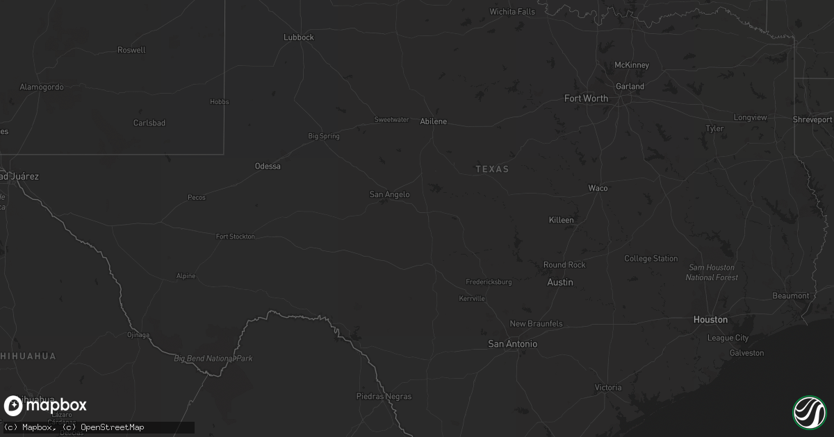
Hail Map in Texas on May 28, 2014
Get this storm
May 28 map
$229
one time, instant access
Download today. No call, no setup
Keep the $229
Bought the map and want the full workflow? Apply the entire $229 to a subscription within 7 days. None of it is wasted.
Every map, not just this one
This buys you this map. Subscription and you get every map we run, in the markets you choose from a few cities to whole states to nationwide. Plus real-time alerts the moment a storm fires.
Contact data
Name, contact info, occupancy, even credit band for addresses in the footprint. You go from where it hit to who to call.
Become the source they trust
Unlimited branding weather history reports on demand. You already have the documented answer ready for the property owner, and you are the one who showed up with it.
Property data and RoofTrace estimates
Pull up any address you have got, its value and the exact code rules for that jurisdiction, straight from One Click Code. Then RoofTrace estimates the squares, pitch, and roof value, priced the way you price.
Storm reports in Texas
Texas
| Date | Description |
|---|---|
| 05/28/20144:37 PM CDT | Several one to two foot diameter trees snapped. Winds estimated at 60 mph. |
| 05/28/20144:10 PM CDT | Asos reported at 58 knot 67 mph wind gusts. |
| 05/27/20147:30 PM CDT | Penny to quarter size hail and wind gusts 50 to 60 mph |
| 05/27/20147:30 PM CDT | Penny to quarter size hail and wind gusts 50 to 60 mph |
| 05/27/20147:20 PM CDT | Penny to quarter size hail reported off fm755 |
All States Impacted by Hail Map on May 28, 2014
Cities Impacted by Hail Map on May 28, 2014
- Dodson, MT
- Harlem, MT
- Big Sandy, MT
- Loma, MT
- Fort Benton, MT
- Providence Forge, VA
- Charles City, VA
- Quinton, VA
- Port Wentworth, GA
- Rincon, GA
- Guyton, GA
- Norman Park, GA
- Howard, OH
- Danville, OH
- San Benito, TX
- Harlingen, TX
- La Feria, TX
- Cascade, MT
- Yemassee, SC
- Woodsfield, OH
- Loring, MT
- South Padre Island, TX
- Port Isabel, TX
- Rio Hondo, TX
- Los Fresnos, TX
- Uvalda, GA
- Lyons, GA
- Bayboro, NC
- Hays, MT
- Perrysville, OH
- Chinook, MT
- Wrightsville, GA
- Kite, GA
- Adrian, GA
- Smithfield, WV
- Geyser, MT
- Box Elder, MT
- Havre, MT
- Gambier, OH
- Blowing Rock, NC
- Collettsville, NC
- Whitewater, MT
- Turner, MT
- Raynesford, MT
- Malta, MT
- Savannah, GA
- Okeechobee, FL
- Goode, VA
- Bedford, VA
- McAlpin, FL
- Sun River, MT
- Doswell, VA
- Beaverdam, VA
- Lloyd, MT
- Bath, NC
- Warrenton, VA
- Marshall, VA
- Midland, VA
- Catlett, VA
- Rio Grande City, TX
- Garciasville, TX
- Clover, VA
- Hardin, MT
- Seabrook, SC
- Hogeland, MT
- North Port, FL
- Geraldine, MT
- Lithia, FL
- Riverview, FL
- Ashland, VA
- Highwood, MT
- Carter, MT
- Fargo, GA
- Myakka City, FL
- Parrish, FL
- Kokomo, IN
- Greentown, IN
- Forsyth, MT
- Eighty Four, PA
- Nathalie, VA
- Scottsburg, VA
- Sistersville, WV
- Friendly, WV
- Lake City, FL
- White Springs, FL
- Great Falls, MT
- Thomaston, AL
- Arlington, AL
- Varnville, SC
- Early Branch, SC
- Kewanna, IN
- Weslaco, TX
- Mercedes, TX
- Live Oak, FL
- Center Point, WV
- Gordo, AL
- Elrod, AL
- Pooler, GA
- Star City, IN
- Mazon, IL
- Ulm, MT
- Sardis, OH
- Sand Coulee, MT
- Proctor, WV
- Clarington, OH
- Linn, KS
- East Dublin, GA
- Rochester, IN
- Zurich, MT
- Cameron, OH
- Beallsville, OH
- Jerusalem, OH
- Swanton, OH
- Whitehouse, OH
- Angela, MT
- Bloomfield, MT
- Merry Hill, NC
- Roper, NC
- Dunkirk, OH
- Forest, OH
- Kenton, OH
- Dixie, GA
- Alva, FL
- Lehigh Acres, FL
- Kinsey, MT
- San Juan, TX
- Floweree, MT
- Clay Center, KS
- Stockett, MT
- Amboy, IN
- Arcadia, FL
- Port Charlotte, FL
- Colony, KS
- Grulla, TX
- Sullivan City, TX
- Royal Center, IN
- Punta Gorda, FL
- North Fort Myers, FL
- Canonsburg, PA
- Washington, PA
- Houston, PA
- Coffee Creek, MT
- Islandton, SC
- Halifax, VA
- Bighorn, MT
- Washington, NC
- Lindsay, MT
- Bealeton, VA
- Jacobsburg, OH
- Powhatan Point, OH
- Belmont, OH
- Pembroke, GA
- Wetumpka, AL
- Windsor, NC
- Medora, ND
- Brownsville, TX
- Ochopee, FL
- Boston, GA
- Quitman, GA
- Millen, GA
- Caret, VA
- Glen Easton, WV
- Moundsville, WV
- Greenville, FL
- Dover, OH
- Sugarcreek, OH
- Rosebud, MT
- Eureka, KS
- Crossville, TN
- Richmond, OH
- Palmer, KS
- Belhaven, NC
- Fredericksburg, VA
- Black Eagle, MT
- Parsons, WV
- Edinburg, TX
- Lawtey, FL
- Saint Marys, WV
- Glendive, MT
- Montross, VA
- Colonial Beach, VA
- Morriston, FL
- Steubenville, OH
- Toronto, OH


