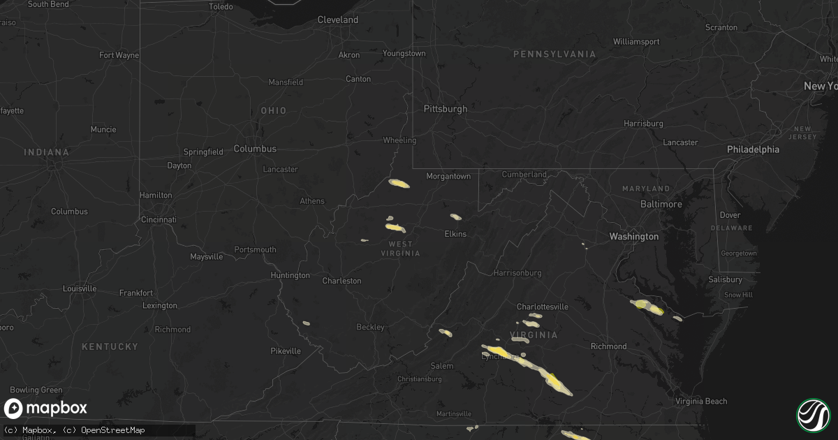
Hail Map in West Virginia on May 27, 2026
Get this storm
May 27 map
$229
one time, instant access
Download today. No call, no setup
Keep the $229
Bought the map and want the full workflow? Apply the entire $229 to a subscription within 7 days. None of it is wasted.
Every map, not just this one
This buys you this map. Subscription and you get every map we run, in the markets you choose from a few cities to whole states to nationwide. Plus real-time alerts the moment a storm fires.
Contact data
Name, contact info, occupancy, even credit band for addresses in the footprint. You go from where it hit to who to call.
Become the source they trust
Unlimited branding weather history reports on demand. You already have the documented answer ready for the property owner, and you are the one who showed up with it.
Property data and RoofTrace estimates
Pull up any address you have got, its value and the exact code rules for that jurisdiction, straight from One Click Code. Then RoofTrace estimates the squares, pitch, and roof value, priced the way you price.
Storm reports in West Virginia
West Virginia
| Date | Description |
|---|---|
| 05/27/20264:35 PM CDT | Tree down partially blocking tallmansville rd in the vicinity of tallmansville baptist church near goodwin rd and preacher tenney rd. Time estimated by radar. |
| 05/27/20264:35 PM CDT | A large tree was blown down by thunderstorm winds onto an unoccupied vehicle along mike stuart road. |
| 05/27/20264:30 PM CDT | Tree is down on highland trail near alderson... Wv... Blocking one lane. Time is estimated from radar. |
| 05/27/20264:29 PM CDT | Tree in roadway at 270 poca rd. Time estimated from radar. |
| 05/27/20264:15 PM CDT | Trees down along route 219. |
| 05/27/20264:11 PM CDT | Tree damage resulting in approximately 100 customers without power. Time is estimated by radar. |
| 05/27/20264:06 PM CDT | Tree down on powerlines along haw run rd at alpin ridge rd. Time estimated by radar. |
| 05/27/20263:55 PM CDT | Tree in roadway on cr-40/4 |
| 05/27/20263:37 PM CDT | Tree down in the 2300 block of baier ridge road near bar ridge road time estimated via radar. |
| 05/27/20263:35 PM CDT | Several trees down along valley chapel road reported through social media. Time estimated by radar. |
| 05/27/20263:32 PM CDT | Received pictures via social media of various large hardwood trees down along left freemans creek road... Churchville road... And freemans creek road. Time estimated vi |
| 05/27/20263:27 PM CDT | Pictures on social media of a large tree down blocking the entire road in the 3800 block of ten mile creek rd. |
| 05/27/20263:24 PM CDT | Pictures on social media of a tree down blocking part of bear wallow rd near thomas ridge rd. Time estimated by radar. |
| 05/27/20262:47 PM CDT | Tree down at the 600 blk of trouser leg rd near benedum hollow rd. Time estimated via radar. |
| 05/27/20262:46 PM CDT | Power lines and tree down in the 2900 block of gregorys run rd outside of clarksburg. No power in the area. Time estimated via radar. |
| 05/27/20262:36 PM CDT | Tree down blocking sycamore fork rd near the doddridge county line. Time estimated by radar. |
| 05/27/20262:29 PM CDT | Tree down near bates run rd... Blocking both lanes of traffic... Very hard to see due to weather conditions... There are busses being blocked by the tree as well |
| 05/27/20262:27 PM CDT | Power line down on shortline hwy. |
| 05/27/20262:27 PM CDT | Tree blocking mannington road. |
| 05/27/20262:18 PM CDT | Tree down on lines near richwood run rd. Timing based on radar. |
| 05/27/20262:12 PM CDT | Trees and lines down along ashford-nellis rd at casey fork. Tree is blocking the roadway. Time estimated from radar. |
| 05/27/20262:12 PM CDT | Tree down in the 4300 block of ashford-nellis rd near ashford... Wv. Time estimated via radar. |
| 05/27/20262:04 PM CDT | Tree down on middle horse creek rd in julian. Time estimated by radar. |
All States Impacted by Hail Map on May 27, 2026
Cities Impacted by Hail Map on May 27, 2026
- Ingleside, TX
- Corpus Christi, TX
- Port Aransas, TX
- Los Fresnos, TX
- Port Isabel, TX
- Loretto, VA
- Montross, VA
- Champlain, VA
- Hustle, VA
- Colonial Beach, VA
- Caret, VA
- Warsaw, VA
- Kinsale, VA
- Callao, VA
- Hague, VA
- Farnham, VA
- Middlebourne, WV
- New Martinsville, WV
- Pine Grove, WV
- Reader, WV
- Porters Falls, WV
- Burgess, VA
- Reedville, VA
- Heathsville, VA
- Sistersville, WV
- Jacksonburg, WV
- Smithfield, WV
- Charlottesville, VA
- Cascade, VA
- Pelham, NC
- Big Springs, WV
- Coxs Mills, WV
- Auburn, WV
- Berea, WV
- West Union, WV
- Ola, ID
- Ruffin, NC
- Troy, WV
- Linn, WV
- Alum Bridge, WV
- Gleason, WI
- Merrill, WI
- Glenville, WV
- Deerbrook, WI
- Montrose, WV
- Philippi, WV
- Parsons, WV
- Antigo, WI
- Wausau, WI
- Athens, WI
- Weston, WV
- Schofield, WI
- Cascade, ID
- Faber, VA
- Indian Valley, ID
- Spencer, WV
- Rothschild, WI
- North Garden, VA
- Scottsville, VA
- Esmont, VA
- Schuyler, VA
- Mosinee, WI
- Marathon, WI
- Lovingston, VA
- Arnoldsburg, WV
- Alderson, WV
- Ringle, WI
- Keene, VA
- Council, ID
- Mccall, ID
- Edgar, WI
- Shipman, VA
- Wingina, VA
- Warrenton, NC
- Norlina, NC
- Junction City, WI
- Stevens Point, WI
- Covington, VA
- Stratford, WI
- New Meadows, ID
- Macon, NC
- Amherst, VA
- Norwood, VA
- Gladstone, VA
- Arrington, VA
- Plover, WI
- Littleton, NC
- Auburndale, WI
- Eagle Rock, VA
- Lakeview, OR
- Buckingham, VA
- Roanoke Rapids, NC
- Halifax, NC
- Wisconsin Rapids, WI
- Loyal, WI
- Chili, WI
- Spencer, WI
- Granton, WI
- Arpin, WI
- Marshfield, WI
- Milladore, WI
- Enfield, NC
- Bancroft, WI
- Bedford, VA
- Big Island, VA
- Bonanza, OR
- Coleman Falls, VA
- Lynchburg, VA
- Monroe, VA
- Greenwood, WI
- Bly, OR
- Goode, VA
- Owen, WI
- Sprague River, OR
- Beatty, OR
- Chiloquin, OR
- Madison Heights, VA
- Pittsville, WI
- Fall Creek, WI
- Hancock, WI
- Forest, VA
- Neillsville, WI
- Concord, VA
- Coloma, WI
- Appomattox, VA
- Friendship, WI
- Augusta, WI
- Warrenton, VA
- The Plains, VA
- Dairy, OR
- Klamath Falls, OR
- Westfield, WI
- Oxford, WI
- Grand Marsh, WI
- Spout Spring, VA
- Wisconsin Dells, WI
- Bennett, NC
- Seagrove, NC
- Pamplin, VA
- Briggsville, WI
- Portage, WI
- Endeavor, WI
- Baraboo, WI
- Keno, OR
- Ashland, OR
- Prospect, VA
- Hampden Sydney, VA
- Farmville, VA
- Meherrin, VA
- Green Bay, VA
- Burkeville, VA
- Black River Falls, WI
- Victoria, VA
- Polebridge, MT
- Hixton, WI
- Keysville, VA
- Victor, MT
- Merrimac, WI
- Crewe, VA
- Prairie Du Sac, WI
- Lenore, WV
- Dingess, WV
- Elk City, ID
- Kenbridge, VA
- Dundas, VA
- Blackstone, VA
- Marshall, VA
- Nokesville, VA
- Catlett, VA
- Trementina, NM
- Las Vegas, NM
- Ocate, NM
- Crowell, TX
- Seymour, TX
- Bonner, MT
- Boulder, MT
- Choteau, MT
- Fairfield, MT
- Dutton, MT


