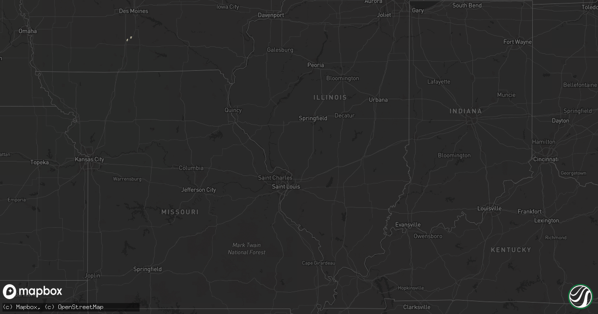
Hail Map in Nebraska on May 27, 2012
Get this storm
May 27 map
$229
one time, instant access
Download today. No call, no setup
Keep the $229
Bought the map and want the full workflow? Apply the entire $229 to a subscription within 7 days. None of it is wasted.
Every map, not just this one
This buys you this map. Subscription and you get every map we run, in the markets you choose from a few cities to whole states to nationwide. Plus real-time alerts the moment a storm fires.
Contact data
Name, contact info, occupancy, even credit band for addresses in the footprint. You go from where it hit to who to call.
Become the source they trust
Unlimited branding weather history reports on demand. You already have the documented answer ready for the property owner, and you are the one who showed up with it.
Property data and RoofTrace estimates
Pull up any address you have got, its value and the exact code rules for that jurisdiction, straight from One Click Code. Then RoofTrace estimates the squares, pitch, and roof value, priced the way you price.
Storm reports in Nebraska
Nebraska
| Date | Description |
|---|---|
| 05/27/20126:55 PM CDT | A local report indicates 2.00 inch wind near FRANKLIN |
| 05/27/20126:52 PM CDT | Up to golfball size hail but mostly ping pong and smaller. |
| 05/27/20126:42 PM CDT | A local report indicates 1.00 inch wind near 3 E FARWELL |
| 05/27/20126:40 PM CDT | Numerous tree branches down along with pea sized hail |
| 05/27/20126:38 PM CDT | Fell from 638 to 642 |
| 05/27/20126:37 PM CDT | Delayed - law enforcement reported ping pong size hail. |
| 05/27/20126:35 PM CDT | A local report indicates 1.00 inch wind near 1 S ALBION |
| 05/27/20126:30 PM CDT | A local report indicates a tornado near 2 SW BATTLE CREEK |
| 05/27/20126:30 PM CDT | Delayed - ping pong hail for 5 minutes and covered ground. |
| 05/27/20126:21 PM CDT | A local report indicates 1.00 inch wind near 2 E HARTINGTON |
| 05/27/20126:18 PM CDT | Golfball size hail on interstate 80 at mm363 |
| 05/27/20126:17 PM CDT | Near mile marker 366 south of utica. |
| 05/27/20126:15 PM CDT | Golf ball size hail in town. |
| 05/27/20126:13 PM CDT | Quarter size hail in town. |
| 05/27/20126:05 PM CDT | A local report indicates a tornado near 7 NW NEWMAN GROVE |
| 05/27/20126:00 PM CDT | Quarter hail reported in town. |
| 05/27/20125:57 PM CDT | A local report indicates 2.75 inch wind near 5 W RANDOLPH |
| 05/27/20125:48 PM CDT | Time estimated |
| 05/27/20125:46 PM CDT | A local report indicates 1.00 inch wind near 2 E OHIOWA |
| 05/27/20125:39 PM CDT | A local report indicates 1.25 inch wind near 2 SE BRUNING |
| 05/27/20125:37 PM CDT | A local report indicates 1.75 inch wind near PIERCE |
| 05/27/20125:30 PM CDT | Public reported when they arrived home small branches were down...3 windows on the north side of house were broken...and a windshield broken in a vehicle. Time estimate |
| 05/27/20125:30 PM CDT | Pivot turned over |
| 05/27/20125:29 PM CDT | A local report indicates 1.75 inch wind near GREELEY |
| 05/27/20125:25 PM CDT | A local report indicates 1.00 inch wind near 1 E ASHTON |
| 05/27/20125:25 PM CDT | Hailed from 515 pm to 525 pm. |
| 05/27/20125:24 PM CDT | Corrected location from 1st report |
| 05/27/20125:20 PM CDT | A local report indicates 1.00 inch wind near HEBRON |
| 05/27/20125:15 PM CDT | Delayed report from coop observer. Hail lasted until 527 pm cdt. Damage to vehicle was reported with hail as well. |
| 05/27/20125:12 PM CDT | Windows broken out of cars and buildings. Large tree down on road 4 miles se of elgin. |
| 05/27/20125:10 PM CDT | A local report indicates 1.75 inch wind near 6 W WAYNE |
| 05/27/20125:09 PM CDT | A local report indicates 1.75 inch wind near ELGIN |
| 05/27/20125:06 PM CDT | Tornado 6 miles east and 5 miles south of elgin |
| 05/27/20125:05 PM CDT | A local report indicates 1.00 inch wind near ELGIN |
| 05/27/20125:05 PM CDT | Dime to quarter sized hail |
| 05/27/20125:00 PM CDT | Also reported a funnel cloud with this storm. |
| 05/27/20124:57 PM CDT | A local report indicates 1.75 inch wind near 5 S WINSIDE |
| 05/27/20124:54 PM CDT | A local report indicates 1.75 inch wind near 6 NE BARTLETT |
| 05/27/20124:42 PM CDT | A local report indicates 1.25 inch wind near 13 SE BARTLETT |
| 05/27/20124:40 PM CDT | A local report indicates 1.75 inch wind near 6 ESE BARTLETT |
| 05/27/20124:37 PM CDT | Left moving storm |
| 05/27/20124:33 PM CDT | Mostly pea to penny sized hail |
| 05/26/201210:17 PM CDT | Mostly dimes mixed with a few quarters. |
| 05/26/20129:50 PM CDT | Pivots have been overturned along an approximately 6 miles long path near 140th road south to near the interstate south of town. In town...large trees have been damaged |
| 05/26/20129:46 PM CDT | Deplayed report from nebraska rain observer. Time estimated from radar. Two pivots overturned. Estimated speed from radar was 64 kts. |
| 05/26/20129:45 PM CDT | Grain bin destroyed. |
| 05/26/20129:45 PM CDT | Grain bin destroyed. |
| 05/26/20129:45 PM CDT | At dispatch office. |
| 05/26/20129:30 PM CDT | Delayed report from coop observer. Nickel and quarter size hail was also observed. |
| 05/26/20129:25 PM CDT | Wind gusts 60 to 70 mph and quarter size hail on highway 281 |
| 05/26/20129:20 PM CDT | A local report indicates 1.50 inch wind near 1 E OSCEOLA |
| 05/26/20129:15 PM CDT | A local report indicates 60 MPH wind near OSCEOLA |
| 05/26/20129:15 PM CDT | Delayed report from nebraska rain observer. Time estimated from radar. Pea to ping pong hail reported. Corrected time. |
| 05/26/20129:13 PM CDT | Tree branches of 2 to 3 inches in diameter were blown down. |
| 05/26/20128:49 PM CDT | Delayed report from nebraska rain observer. Time estimated from radar. Pea to ping pong hail reported |
| 05/26/20128:49 PM CDT | Delayed report from nebraska rain observer. Pea to quarter size hail reported. Damage to crop...roof...and siding. |
| 05/26/20128:20 PM CDT | A local report indicates 1.00 inch wind near 3 S HUMPHREY |
| 05/26/20127:35 PM CDT | A local report indicates 58 MPH wind near 1 NE WAHOO |
| 05/26/20127:25 PM CDT | A local report indicates 1.25 inch wind near 2 ESE SEWARD |
| 05/26/20127:12 PM CDT | A local report indicates 1.00 inch wind near 1 N BLOOMINGTON |
| 05/26/20127:09 PM CDT | Delayed report from nebraska rain observer. Time estimated from radar. 35 foot linden tree snapped from the base of the tree. |
All States Impacted by Hail Map on May 27, 2012
Cities Impacted by Hail Map on May 27, 2012
- Dalbo, MN
- Greensburg, PA
- Penn, PA
- Jeannette, PA
- Youngwood, PA
- Reese, MI
- Munger, MI
- Fairgrove, MI
- Hordville, NE
- Clarks, NE
- Tioga, WV
- Camden On Gauley, WV
- Calvin, WV
- Craigsville, WV
- Summersville, WV
- Wood River, NE
- Hebron, NE
- Bogue, KS
- Clearfield, PA
- Woodland, PA
- Lake Lillian, MN
- Willmar, MN
- Isanti, MN
- Saint Francis, MN
- Cedar, MN
- Anoka, MN
- Bethel, MN
- Pierce, NE
- Randolph, NE
- Osmond, NE
- Mclean, NE
- Bigelow, MN
- Worthington, MN
- Sibley, IA
- Ocheyedan, IA
- Hudson, SD
- Canton, SD
- Inwood, IA
- Fairview, SD
- Westfield, IA
- Elk Point, SD
- Jackson, NE
- Jefferson, SD
- Chesterland, OH
- Novelty, OH
- Newbury, OH
- Chardon, OH
- Burton, OH
- Petersburg, NE
- Elgin, NE
- Meadow Grove, NE
- Oakdale, NE
- Battle Creek, NE
- Tilden, NE
- Ellis, KS
- Columbus, NE
- Hampton, NE
- Bellwood, NE
- Bradshaw, NE
- Benedict, NE
- Osceola, NE
- Shelby, NE
- Polk, NE
- Stromsburg, NE
- Silver Creek, NE
- Stockton, KS
- Plainville, KS
- Woodston, KS
- Little Rock, IA
- Ashton, IA
- George, IA
- Boyden, IA
- Sheldon, IA
- Fort Stockton, TX
- Kensington, KS
- Smith Center, KS
- Sandstone, MN
- Le Mars, IA
- Ireton, IA
- Akron, IA
- Lawton, IA
- Moville, IA
- Normalville, PA
- Rockwood, PA
- Champion, PA
- Interlochen, MI
- Thompsonville, MI
- Ponca, NE
- Ransom, KS
- Marinette, WI
- Exeter, NE
- York, NE
- Utica, NE
- Waco, NE
- Beaver Crossing, NE
- Tower City, PA
- Muir, PA
- Pine Grove, PA
- Long Prairie, MN
- Grey Eagle, MN
- Maxbass, ND
- Lansford, ND
- Freeland, MI
- Hemlock, MI
- Hospers, IA
- Alton, IA
- Rock Valley, IA
- Doon, IA
- Rock Rapids, IA
- Alvord, IA
- Avonmore, PA
- Apollo, PA
- Spring Church, PA
- Inavale, NE
- Bladen, NE
- Blue Hill, NE
- Red Cloud, NE
- Confluence, PA
- Addison, PA
- Mill Run, PA
- Ohiopyle, PA
- Markleysburg, PA
- Geneva, NE
- Strang, NE
- Shickley, NE
- Hialeah, FL
- Morgan, MN
- Sleepy Eye, MN
- Milford, NE
- Seward, NE
- Hull, IA
- Lake Ann, MI
- Beulah, MI
- Lena, WI
- Oconto, WI
- Currie, MN
- Walnut Grove, MN
- Hinckley, MN
- Newman Grove, NE
- Clearwater, MN
- South Haven, MN
- Imperial, TX
- Essexville, MI
- Bay City, MI
- Niobrara, NE
- Vermillion, SD
- Madison, NE
- Beresford, SD
- Worthing, SD
- Wakeeney, KS
- Bloomsburg, PA
- Maple Lake, MN
- Good Thunder, MN
- Amboy, MN
- Winnebago, MN
- Wolbach, NE
- Karns City, PA
- West Sunbury, PA
- Hilliards, PA
- Spalding, NE
- Primrose, NE
- Scotia, NE
- Albion, NE
- Elba, NE
- Greeley, NE
- Lawrence, NE
- Glenvil, NE
- Fairfield, NE
- Clay Center, NE
- Pine City, MN
- Brook Park, MN
- Hawarden, IA
- Harman, WV
- Glady, WV
- Carleton, NE
- Bruning, NE
- Fairmont, NE
- Clymer, PA
- Commodore, PA
- Wayne, NE
- Winside, NE
- Hoskins, NE
- Stanton, NE
- Orange City, IA
- Clearwater, NE
- Republican City, NE
- Hildreth, NE
- Naponee, NE
- Upland, NE
- Bloomington, NE
- Franklin, NE
- Heartwell, NE
- Minden, NE
- Osseo, MN
- Maple Grove, MN
- Brussels, WI
- Sioux Center, IA
- Minnetonka, MN
- Excelsior, MN
- Chanhassen, MN
- Brewster, MN
- Ogallah, KS
- Carver, MN
- Le Sueur, MN
- Henderson, MN
- Belle Plaine, MN
- Lake Placid, FL
- Logan, KS
- Minneapolis, MN
- Eden Prairie, MN
- Aitkin, MN
- Kilkenny, MN
- Jordan, MN
- New Prague, MN
- Montgomery, MN
- Shakopee, MN
- Bethel Park, PA
- Scottdale, PA
- Dawson, PA
- Smithton, PA
- Shelton, NE
- Chapman, NE
- Saint Libory, NE
- Grand Island, NE
- Kenesaw, NE
- Cairo, NE
- Gibbon, NE
- Le Center, MN
- Madison Lake, MN
- Cleveland, MN
- Garland, NE
- Glade, KS
- Saint Edward, NE
- Creston, NE
- Lindsay, NE
- Genoa, NE
- Monroe, NE
- Humphrey, NE
- Dorchester, NE
- Friend, NE
- Six Mile Run, PA
- Allen, NE
- Dixon, NE
- Archer, NE
- Central City, NE
- Ness City, KS
- Emerson, NE
- Waterbury, NE
- Trumbull, NE
- Hastings, NE
- Ewing, NE
- Ericson, NE
- Bartlett, NE
- Cadillac, MI
- Baileys Harbor, WI
- Denton, NE
- Pleasant Dale, NE
- Comfrey, MN
- Jetmore, KS
- Bazine, KS
- Hanston, KS
- Alexander, KS
- Lincoln, NE
- Shafer, MN
- Centuria, WI
- Luck, WI
- Siren, WI
- Cushing, WI
- Center City, MN
- North Branch, MN
- Lindstrom, MN
- Taylors Falls, MN
- Frederic, WI
- Webster, WI
- Grantsburg, WI
- Saint Croix Falls, WI
- Webster Springs, WV
- West Decatur, PA
- Osceola Mills, PA
- Houtzdale, PA
- Madera, PA
- Palmer, NE
- Belgrade, NE
- Norfolk, NE
- Gaylord, KS
- Cedar Rapids, NE
- Markleton, PA
- Somerset, PA
- Greenock, PA
- Irwin, PA
- Herminie, PA
- Mckeesport, PA
- Rillton, PA
- West Newton, PA
- Hays, KS
- Palisade, MN
- Ayr, NE
- Danube, MN
- Olivia, MN
- Saronville, NE
- Ravenna, NE
- Okabena, MN
- Heron Lake, MN
- Melvin, IA
- Fulda, MN
- Round Lake, MN
- Lakefield, MN
- Belleville, KS
- Milligan, NE
- Scandia, KS
- Alexandria, NE
- Gresham, NE
- Staplehurst, NE
- David City, NE
- Belvidere, NE
- Ohiowa, NE
- Chester, NE
- Dwight, NE
- Ulysses, NE
- Bruno, NE
- Western, NE
- Wilber, NE
- Crete, NE
- Daykin, NE
- Tobias, NE
- North Versailles, PA
- Andover, MN
- Gorham, KS
- Russell, KS
- Lucas, KS
- Dorrance, KS
- Bunker Hill, KS
- Gladwin, MI
- Prudenville, MI
- Houghton Lake, MI
- Valparaiso, NE
- Alton, KS
- Cedar, KS
- Kirwin, KS
- Lincoln, KS
- Sylvan Grove, KS
- Barnard, KS
- Agra, KS
- Phillipsburg, KS
- Empire, MI
- La Crosse, KS
- Lynch, NE
- Oneill, NE
- Windom, MN
- Montevideo, MN
- Carroll, NE
- Suring, WI
- Darwin, MN
- Hutchinson, MN
- Litchfield, MN
- Clarkfield, MN
- Avoca, MN
- Campbell, NE
- Champlin, MN
- Elk River, MN
- Hopkins, MN
- Saint Paul, MN
- Annandale, MN
- Riverton, NE
- Kennerdell, PA
- Emlenton, PA
- Hanska, MN
- Dresser, WI
- Chisago City, MN
- Milltown, WI
- Laurel, NE
- Neligh, NE
- Yale, MI
- Melvin, MI
- Brown City, MI
- Athol, KS
- Pilger, NE
- Fullerton, NE
- Vernon Center, MN
- Concord, NE
- Coleridge, NE
- Plainview, NE
- Newcastle, NE
- Wakefield, NE
- Belden, NE
- Hartington, NE
- Pender, NE
- Dayton, MN
- Palco, KS
- Ashton, NE
- McCool Junction, NE
- Wayzata, MN
- Hamel, MN
- Long Island, KS
- Prairie View, KS
- Lenora, KS
- Benson, MN
- Harrison, MI
- Holstein, NE
- Curwensville, PA
- Olanta, PA
- New Millport, PA
- Columbiaville, MI
- North Branch, MI
- Lapeer, MI
- Brownell, KS
- Kandiyohi, MN
- Antler, ND
- Caro, MI
- Slippery Rock, PA
- Harrisville, PA
- Grove City, PA
- Osceola, IA
- Midland, MI
- Sanford, MI
- Penn Run, PA
- Northern Cambria, PA
- Heilwood, PA
- Saltsburg, PA
- Darragh, PA
- Buena Vista, PA
- New Stanton, PA
- East McKeesport, PA
- Yukon, PA
- Madison, PA
- Ruffs Dale, PA
- Duquesne, PA
- Wyano, PA
- Lowber, PA
- Lock Haven, PA
- Saint Paul, NE
- Long Lake, SD
- Latrobe, PA
- East Palestine, OH
- Darlington, PA
- Indiana, PA
- Clare, MI
- Mount Pleasant, MI
- Coleman, MI
- Rosebush, MI
- Henderson, NE
- Sutton, NE
- Prior Lake, MN
- Burbank, SD
- Danbury, WI
- Saint Peter, MN
- Vassar, MI
- Mayville, MI
- Harvard, NE
- Reading, MN
- Hansford, WV
- Eskdale, WV
- Gallagher, WV
- Ligonier, PA
- Derry, PA
- Forest Lake, MN
- Cook, MN
- Truman, MN
- Brandon, SD
- Garretson, SD
- Sturgeon Bay, WI
- Export, PA
- Delmont, PA
- Weston, NE
- Clifford, MI
- Silverwood, MI
- Stanchfield, MN
- Rush City, MN
- Blomkest, MN
- Monterville, WV
- Dannebrog, NE
- Farwell, NE
- Grafton, NE
- Harrisburg, SD
- Lowellville, OH
- Pulaski, PA
- Acme, PA
- Stahlstown, PA
- Donegal, PA
- Murrysville, PA
- Slickville, PA
- New Alexandria, PA
- Silver Lake, MN
- Glencoe, MN
- Lester Prairie, MN
- Arnett, OK
- Shattuck, OK
- Eagle Lake, MN
- Elysian, MN
- Janesville, MN
- Waterville, MN
- Stewart, MN
- Gilead, NE
- Deweese, NE
- Edgar, NE
- Carrolltown, PA
- Ebensburg, PA
- Elmora, PA
- Nicktown, PA
- Manton, MI
- Farwell, MI
- Kitzmiller, MD
- Elk Garden, WV
- Babbitt, MN
- Maurice, IA
- Revere, MN
- Lamberton, MN
- Ashley, ND
- Irvona, PA
- Schuyler, NE
- North Sioux City, SD
- Maskell, NE
- Thurston, NE
- Hubbard, NE
- Wisner, NE
- Parkston, SD
- Sharon, OK
- Drybranch, WV
- Harris, MN
- New Castle, PA
- Fargo, OK
- Gage, OK
- Westhope, ND
- Larchwood, IA
- Wynot, NE
- South Sioux City, NE
- Sioux City, IA
- Alcester, SD
- Clarkson, NE
- Hills, MN
- Loup City, NE
- Valley Springs, SD
- Magnet, NE
- Boelus, NE
- Leigh, NE
- Chatsworth, IA
- Rockville, NE
- Gillett, WI
- Oconto Falls, WI
- Hannah, ND
- Cambridge, MN
- Chambers, NE
- Axtell, NE
- Saxton, PA
- Cologne, MN
- Chaska, MN
- Waconia, MN
- Montville, OH
- Blairsville, PA
- Redwood Falls, MN
- Renville, MN
- Indore, WV
- Wyoming, MN
- Clarksburg, PA
- New Ulm, MN
- Courtland, MN
- Luverne, MN
- Plato, MN
- Volant, PA
- Mercer, PA
- Hegins, PA
- Mount Pleasant, PA
- Bedford, PA
- Youngstown, OH
- New Springfield, OH
- Pittsburgh, PA
- Verona, PA
- Appleton, MN
- Danvers, MN
- Ormsby, MN
- Gordon, WI
- Nicollet, MN
- Raymond, NE
- Malcolm, NE
- Egg Harbor, WI
- Surprise, NE
- Forestville, WI
- Munich, ND
- Calvin, ND
- Matlock, IA
- Mud Butte, SD
- Avoca, MI
- Emmett, MI
- Bison, KS
- Litchfield, NE
- Gibbon, MN
- Ford City, PA
- Shelocta, PA
- Vandergrift, PA
- Minong, WI
- Cowen, WV
- Upperglade, WV
- Mohawk, MI
- Cordova, NE
- Rising City, NE
- Hubbell, NE
- Bee, NE
- Republic, KS
- Deshler, NE
- Brainard, NE
- Davenport, NE
- Foley, MN
- Clear Lake, MN
- Oak Park, MN
- Becker, MN
- Princeton, MN
- Mill Creek, WV
- Huttonsville, WV
- Butterfield, MN
- Darfur, MN
- Liberty, PA
- Blossburg, PA
- Nettie, WV
- Bovey, MN
- Copemish, MI
- Buckley, MI
- Zimmerman, MN
- Jersey Shore, PA
- Allenwood, PA
- Williamsport, PA
- New Derry, PA
- Loyalhanna, PA
- Bradenville, PA
- Platte Center, NE
- Dakota City, NE
- Wausa, NE
- Merrill, IA
- Kearney, NE
- North Loup, NE
- Inman, NE
- Bowden, WV
- Ogilvie, MN
- Victoria, MN
- Norwood Young America, MN
- Green Isle, MN
- Askov, MN
- Howells, NE
- Goodman, WI
- Fostoria, MI
- Gaylord, MN
- Foreston, MN
- Milaca, MN
- Pond Gap, WV
- Kasota, MN
- Braham, MN
- La Jose, PA
- Swanton, MD
- Coleman, WI
- Peshtigo, WI
- Isle, MN
- Millington, MI
- Boyers, PA
- Almena, KS
- Byron, NE
- Norway, KS
- Juniata, NE
- McCracken, KS
- Linwood, NE
- Aurora, NE
- Courtland, KS
- Goehner, NE
- Damar, KS
- Giltner, NE
- Roseland, NE
- Natoma, KS
- Inland, NE
- Fairbury, NE
- Miami, FL
- Remsen, IA
- Glen Hope, PA
- New Galilee, PA
- Enon Valley, PA
- Wampum, PA
- Aspers, PA
- Rome, OH
- Edinburg, PA
- Homer City, PA
- Vintondale, PA
- Winthrop, MN
- Arlington, MN
- Belview, MN
- Rock Creek, OH
- Akron, MI
- Avis, PA
- Whitmer, WV
- Liebenthal, KS
- Hugo, MN
- Hastings, PA
- Cherry Tree, PA
- Tripp, SD
- James Creek, PA
- Handley, WV
- London, WV
- Miami, WV
- Guide Rock, NE
- Woodward, OK
- Saint James, MN
- Kerrick, MN
- Holyoke, MN
- Frenchville, PA
- Stoystown, PA
- Friedens, PA
- Central City, PA
- Clearville, PA
- Lafayette, MN
- Dante, SD
- Kimball, MN
- Dassel, MN
- Long Lake, MN
- Monticello, MN
- Mifflintown, PA
- Thompsontown, PA
- Bartow, WV
- Durbin, WV
- Rimersburg, PA
- Sligo, PA
- Petersburg, OH
- New Middletown, OH
- Abie, NE
- Fort Lauderdale, FL
- Alda, NE
- Verdigre, NE
- Catawissa, PA
- Pemberton, MN
- Howard Lake, MN
- Cokato, MN
- Winsted, MN
- Tracy, MN
- Kingston, MI
- Deford, MI
- Slayton, MN
- Hollywood, FL
- Pembroke Pines, FL
- Granville, IA
- Sanborn, IA
- Pleasanton, NE
- Bancroft, NE
- Hinton, IA
- Harris, IA
- Duncan, NE
- Beemer, NE
- Centerville, SD
- Dovray, MN
- Westbrook, MN
- Wakonda, SD
- Marquette, NE
- Parker, PA
- Westover, PA
- Ellwood City, PA
- Springfield, MN
- Wagner, SD
- Lake Wilson, MN
- New Virginia, IA
- Grasston, MN
- Beverly, WV
- Valley Bend, WV
- North Lima, OH
- Oakland, MD
- Clintonville, PA
- Hopewell, PA
- Saginaw, MI
- New Bethlehem, PA


