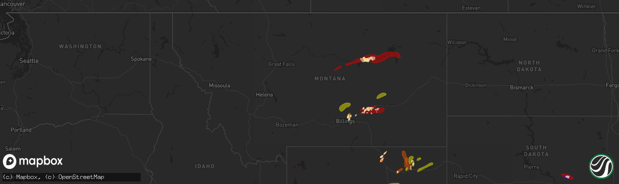
Hail Map in Montana on May 26, 2013
The weather event in Montana on May 26, 2013 includes Hail map. 8 states and 161 cities were impacted and suffered possible damage. The total estimated number of properties impacted is 3,643.
Want more than just the map?
Turn this storm into a full workflow.
- Owner + property data so you know who to knock
- OnDemand branded weather history reports to win the "did we even have hail?" argument
- RoofTrace estimate so reps stop guessing numbers at the door
Bought this map? Upgrade within 7 days and we'll credit the $230. (10-15 min setup call)
Hail
3,643
Estimated number of impacted properties by a 1.00" hail or larger1,051
Estimated number of impacted properties by a 1.75" hail or larger0
Estimated number of impacted properties by a 2.50" hail or largerStorm reports in Montana
Montana
| Date | Description |
|---|---|
| 05/26/20135:45 PM CDT | A local report indicates 1.50 inch wind near SHEPHERD |
| 05/25/201311:59 PM CDT | A local report indicates 1.00 inch wind near 13 SSE HYSHAM |
| 05/25/201310:05 PM CDT | Reported 1.25 inches of rain from this storm. |
| 05/25/20139:40 PM CDT | Also had wind gusts to 60 mph |
| 05/25/20137:30 PM CDT | Very heavy rain |
| 05/25/20137:10 PM CDT | Hail covered the ground |
All States Impacted by Hail Map on May 26, 2013
Cities Impacted by Hail Map on May 26, 2013
- Elyria, NE
- Ord, NE
- Comstock, NE
- Burwell, NE
- Custer, MT
- Buffalo, WY
- Purdum, NE
- Dunning, NE
- Sheridan, WY
- Banner, WY
- Story, WY
- Lavina, MT
- Roundup, MT
- Orchard, NE
- Verdigre, NE
- Gravity, IA
- Westerville, NE
- Arcadia, NE
- Ansley, NE
- Crab Orchard, NE
- Tecumseh, NE
- Huntley, MT
- Brusett, MT
- Gillette, WY
- Batesville, TX
- Brewster, NE
- Billings, MT
- Bighorn, MT
- Pampa, TX
- Wessington Springs, SD
- Fontanelle, IA
- Stuart, NE
- Hiawatha, KS
- Robinson, KS
- Bassett, NE
- Newport, NE
- Jamaica, IA
- Pompeys Pillar, MT
- Ballantine, MT
- Villisca, IA
- Red Oak, IA
- Stanton, IA
- Brookfield, MO
- Bedford, IA
- Jordan, MT
- Shepherd, MT
- Fairview, KS
- Zortman, MT
- Hysham, MT
- Forsyth, MT
- Roy, MT
- Bridgewater, IA
- Massena, IA
- Bagley, IA
- Jefferson, IA
- Scranton, IA
- Clearmont, WY
- Claude, TX
- Panama, IA
- Persia, IA
- Portsmouth, IA
- Earling, IA
- Westphalia, IA
- Harlan, IA
- Hale, MO
- Auburn, NE
- Meriden, IA
- Livermore, IA
- Humboldt, IA
- Elk Horn, IA
- Kirkman, IA
- Naper, NE
- Highland, KS
- Forest City, MO
- White Cloud, KS
- New Market, IA
- Goldfield, IA
- Hardy, IA
- Atlantic, IA
- Exira, IA
- Brayton, IA
- Stella, NE
- Humboldt, NE
- Diagonal, IA
- Aurelia, IA
- Winnett, MT
- Rozet, WY
- Taylor, NE
- Atkinson, NE
- Fort Peck, MT
- Johnstown, NE
- Falls City, NE
- Kiron, IA
- Dow City, IA
- Cummings, KS
- Atchison, KS
- Sheridan, MO
- Grant City, MO
- Corning, IA
- Hardin, MT
- Ainsworth, NE
- Kimballton, IA
- Nodaway, IA
- Mondamin, IA
- Logan, IA
- Pomeroy, IA
- Worden, MT
- Royal, NE
- Creighton, NE
- Winnetoon, NE
- Chambers, NE
- Oneill, NE
- Sargent, NE
- Elliott, IA
- Clearfield, IA
- Lenox, IA
- Benton, IA
- Redding, IA
- Gentry, MO
- Blockton, IA
- Albany, MO
- Stanberry, MO
- Worth, MO
- Princeton, MO
- Cainsville, MO
- Ridgeway, MO
- Elmo, MO
- Clearmont, MO
- Cherokee, IA
- Cleghorn, IA
- Storm Lake, IA
- Truesdale, IA
- Alta, IA
- Ottosen, IA
- Bradgate, IA
- Rolfe, IA
- West Bend, IA
- Gilmore City, IA
- Slater, MO
- Marshall, MO
- Gilliam, MO
- Columbia, MO
- Rocheport, MO
- Gilman City, MO
- Trenton, MO
- New Franklin, MO
- Boonville, MO
- Clarendon, TX
- Mclean, TX
- Kaycee, WY
- Recluse, WY
- Arvada, WY
- Weston, WY
- Moorcroft, WY
- Sundance, WY
- Harrisburg, NE
- Broadview, MT
- Musselshell, MT
- Circle, MT
- Malta, MT
- Gann Valley, SD


