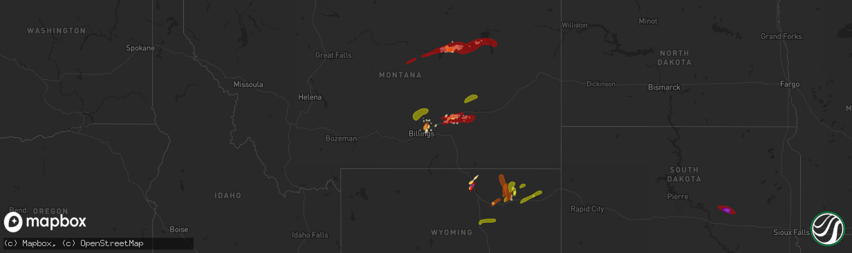
Hail Map on May 26, 2013
The weather event on May 26, 2013 includes Hail map. 8 states and 161 cities were impacted and suffered possible damage. The total estimated number of properties impacted is 15,004.
Want more than just the map?
Turn this storm into a full workflow.
- Owner + property data so you know who to knock
- OnDemand branded weather history reports to win the "did we even have hail?" argument
- RoofTrace estimate so reps stop guessing numbers at the door
Bought this map? Upgrade within 7 days and we'll credit the $230. (10-15 min setup call)
Hail
15,004
Estimated number of impacted properties by a 1.00" hail or larger7,724
Estimated number of impacted properties by a 1.75" hail or larger207
Estimated number of impacted properties by a 2.50" hail or largerStates Impacted by Hail Map on May 26, 2013
Storm reports
Texas
| Date | Description |
|---|---|
| 05/25/20139:30 PM CDT | A local report indicates 1.75 inch wind near 3 SE LAKE MCCLELLAN |
South Dakota
| Date | Description |
|---|---|
| 05/26/20138:15 AM CDT | A local report indicates 1.25 inch wind near 8 W WESSINGTON SPRINGS |
Montana
| Date | Description |
|---|---|
| 05/26/20135:45 PM CDT | A local report indicates 1.50 inch wind near SHEPHERD |
| 05/25/201311:59 PM CDT | A local report indicates 1.00 inch wind near 13 SSE HYSHAM |
| 05/25/201310:05 PM CDT | Reported 1.25 inches of rain from this storm. |
| 05/25/20139:40 PM CDT | Also had wind gusts to 60 mph |
| 05/25/20137:30 PM CDT | Very heavy rain |
| 05/25/20137:10 PM CDT | Hail covered the ground |
Iowa
| Date | Description |
|---|---|
| 05/25/201310:55 PM CDT | A local report indicates 1.00 inch wind near BRADGATE |
| 05/25/20138:21 PM CDT | A local report indicates 1.25 inch wind near 5 NW BEDFORD |
| 05/25/20138:00 PM CDT | A local report indicates 1.00 inch wind near 3 ENE CONWAY |
| 05/25/20137:30 PM CDT | A local report indicates 1.25 inch wind near 7 NNE STANTON |
| 05/25/20137:25 PM CDT | Brief tornado touchdown |
Arkansas
| Date | Description |
|---|---|
| 05/26/20133:45 PM CDT | A roof was blown off a mobile home. |
Wyoming
| Date | Description |
|---|---|
| 05/26/20136:58 PM CDT | A local report indicates 1.00 inch wind near 5 W SPOTTED HORSE |
| 05/26/20136:56 PM CDT | A local report indicates 1.25 inch wind near 7 NNW DOWNTOWN GILLETTE |
| 05/26/20136:35 PM CDT | A local report indicates 1.00 inch wind near 10 S SHERIDAN |
| 05/26/20136:08 PM CDT | A local report indicates 1.50 inch wind near 7 SSE ECHETA |
| 05/26/20136:05 PM CDT | A local report indicates 1.00 inch wind near 8 SSE ECHETA |
| 05/26/20135:45 PM CDT | A local report indicates 1.00 inch wind near 7 N DOWNTOWN GILLETTE |
| 05/26/20135:25 PM CDT | A local report indicates 2.50 inch wind near 13 SSE SHERIDAN |
| 05/26/20134:50 PM CDT | A local report indicates 1.75 inch wind near 1 WNW STORY |
| 05/26/20134:37 PM CDT | A local report indicates 1.75 inch wind near 1 W STORY |
| 05/26/20134:35 PM CDT | A local report indicates 1.00 inch wind near BIG HORN |
| 05/26/20134:09 PM CDT | A local report indicates 1.75 inch wind near 1 W STORY |
| 05/26/20133:53 PM CDT | A local report indicates 1.75 inch wind near 1 WNW STORY |
| 05/26/201312:00 AM CDT | Time estimated |
| 05/25/201310:05 PM CDT | A local report indicates 1.00 inch wind near 9 S RECLUSE |
| 05/25/20139:47 PM CDT | A local report indicates 1.00 inch wind near 12 NE ECHETA |
| 05/25/20139:33 PM CDT | Hail sizes vary from nickel to quarter |
| 05/25/20139:28 PM CDT | A local report indicates 1.00 inch wind near 1 W STORY |
| 05/25/20138:50 PM CDT | A local report indicates 1.00 inch wind near 4 NW ECHETA |
| 05/25/20138:31 PM CDT | Hail lasted off and on for about 20 minutes. |
| 05/25/20138:25 PM CDT | A local report indicates 1.00 inch wind near 3 NNE KAYCEE |
| 05/25/20138:00 PM CDT | A local report indicates 1.00 inch wind near 1 E WESTON |
| 05/25/20137:37 PM CDT | A local report indicates 1.00 inch wind near 7 SSE ECHETA |
| 05/25/20137:30 PM CDT | A local report indicates 1.00 inch wind near 7 NNW SPOTTED HORSE |
| 05/25/20137:10 PM CDT | A local report indicates 1.00 inch wind near 7 NNW SPOTTED HORSE |
Missouri
| Date | Description |
|---|---|
| 05/26/20136:30 PM CDT | At leisure lake |
| 05/26/20135:45 AM CDT | Grain bin and shed near us 169 hwy were damaged from high winds. Time estimated from radar. |
| 05/25/20137:15 PM CDT | Up to quarter size hail |
Nebraska
| Date | Description |
|---|---|
| 05/26/20132:27 AM CDT | Some branches blown down. Miller park area. |
| 05/26/20132:25 AM CDT | 3 inch limbs down near 61st and blondo |
| 05/26/20132:22 AM CDT | 3 inch diameter limbs down near 61st and blondo. |
| 05/26/20131:40 AM CDT | Trees down on power lines. |
| 05/26/20131:37 AM CDT | A local report indicates 77 MPH wind near FREMONT |
| 05/26/201312:45 AM CDT | 6 to 8 inch trees limbs down across highway 57 in stanton. Numerous other branches blown down. |
| 05/26/201312:39 AM CDT | Trees and power lines blown down. |
| 05/26/201312:39 AM CDT | Trees and power lines blown down. |
| 05/26/201312:30 AM CDT | Highway sign blown down. |
| 05/26/201312:20 AM CDT | A local report indicates 1.00 inch wind near 6 NE TAYLOR |
| 05/25/201311:30 PM CDT | Tree branches blown down. |
| 05/25/201310:35 PM CDT | Hail was maily pea size with some quarter size. |
| 05/25/201310:08 PM CDT | A local report indicates 1.00 inch wind near 1 E HALSEY |
| 05/25/20139:50 PM CDT | A local report indicates 1.50 inch wind near 6 E DUNNING |
| 05/25/20139:45 PM CDT | The largest stones were quarter size and slightly larger. |
| 05/25/20139:38 PM CDT | A local report indicates 2.00 inch wind near 7 SW ELYRIA |
| 05/25/20139:35 PM CDT | A local report indicates 1.00 inch wind near 5 NNW ASHFALL FOSSIL BE |
| 05/25/20139:35 PM CDT | Half dollar to golf ball size hail. |
| 05/25/20139:25 PM CDT | Most stones were around pea size but a few larger stones fell... Up to quarter size. |
| 05/25/20139:20 PM CDT | A local report indicates 1.75 inch wind near 8 N ARCADIA |
| 05/25/20139:04 PM CDT | A local report indicates a tornado near 5 E DUNNING |
| 05/25/20138:50 PM CDT | A local report indicates 1.00 inch wind near 8 NE ELSMERE |
| 05/25/20138:45 PM CDT | A local report indicates 1.75 inch wind near 4 N BREWSTER |
| 05/25/20138:32 PM CDT | A local report indicates 1.00 inch wind near 5 NW ARCADIA |
| 05/25/20138:20 PM CDT | A local report indicates 3.00 inch wind near E WESTERVILLE |
| 05/25/20138:15 PM CDT | A local report indicates 1.00 inch wind near 2 E WESTERVILLE |
| 05/25/20138:10 PM CDT | Tennis ball size hail reported at 810pm near berwyn. |
| 05/25/20138:10 PM CDT | A local report indicates 1.50 inch wind near 14 NE DUNNING |
| 05/25/20137:55 PM CDT | A local report indicates 2.50 inch wind near 1 E WESTERVILLE |
Idaho
| Date | Description |
|---|---|
| 05/26/20133:12 PM CDT | Two photographs of what appears to be a landspout off the interstate about 10 miles wnw of mountain home. From the size and appearance we are estimating it as an ef-0 o |
Cities Impacted by Hail Map on May 26, 2013
- Elyria, NE
- Ord, NE
- Comstock, NE
- Burwell, NE
- Custer, MT
- Buffalo, WY
- Purdum, NE
- Dunning, NE
- Sheridan, WY
- Banner, WY
- Story, WY
- Lavina, MT
- Roundup, MT
- Orchard, NE
- Verdigre, NE
- Gravity, IA
- Westerville, NE
- Arcadia, NE
- Ansley, NE
- Crab Orchard, NE
- Tecumseh, NE
- Huntley, MT
- Brusett, MT
- Gillette, WY
- Batesville, TX
- Brewster, NE
- Billings, MT
- Bighorn, MT
- Pampa, TX
- Wessington Springs, SD
- Fontanelle, IA
- Stuart, NE
- Hiawatha, KS
- Robinson, KS
- Bassett, NE
- Newport, NE
- Jamaica, IA
- Pompeys Pillar, MT
- Ballantine, MT
- Villisca, IA
- Red Oak, IA
- Stanton, IA
- Brookfield, MO
- Bedford, IA
- Jordan, MT
- Shepherd, MT
- Fairview, KS
- Zortman, MT
- Hysham, MT
- Forsyth, MT
- Roy, MT
- Bridgewater, IA
- Massena, IA
- Bagley, IA
- Jefferson, IA
- Scranton, IA
- Clearmont, WY
- Claude, TX
- Panama, IA
- Persia, IA
- Portsmouth, IA
- Earling, IA
- Westphalia, IA
- Harlan, IA
- Hale, MO
- Auburn, NE
- Meriden, IA
- Livermore, IA
- Humboldt, IA
- Elk Horn, IA
- Kirkman, IA
- Naper, NE
- Highland, KS
- Forest City, MO
- White Cloud, KS
- New Market, IA
- Goldfield, IA
- Hardy, IA
- Atlantic, IA
- Exira, IA
- Brayton, IA
- Stella, NE
- Humboldt, NE
- Diagonal, IA
- Aurelia, IA
- Winnett, MT
- Rozet, WY
- Taylor, NE
- Atkinson, NE
- Fort Peck, MT
- Johnstown, NE
- Falls City, NE
- Kiron, IA
- Dow City, IA
- Cummings, KS
- Atchison, KS
- Sheridan, MO
- Grant City, MO
- Corning, IA
- Hardin, MT
- Ainsworth, NE
- Kimballton, IA
- Nodaway, IA
- Mondamin, IA
- Logan, IA
- Pomeroy, IA
- Worden, MT
- Royal, NE
- Creighton, NE
- Winnetoon, NE
- Chambers, NE
- Oneill, NE
- Sargent, NE
- Elliott, IA
- Clearfield, IA
- Lenox, IA
- Benton, IA
- Redding, IA
- Gentry, MO
- Blockton, IA
- Albany, MO
- Stanberry, MO
- Worth, MO
- Princeton, MO
- Cainsville, MO
- Ridgeway, MO
- Elmo, MO
- Clearmont, MO
- Cherokee, IA
- Cleghorn, IA
- Storm Lake, IA
- Truesdale, IA
- Alta, IA
- Ottosen, IA
- Bradgate, IA
- Rolfe, IA
- West Bend, IA
- Gilmore City, IA
- Slater, MO
- Marshall, MO
- Gilliam, MO
- Columbia, MO
- Rocheport, MO
- Gilman City, MO
- Trenton, MO
- New Franklin, MO
- Boonville, MO
- Clarendon, TX
- Mclean, TX
- Kaycee, WY
- Recluse, WY
- Arvada, WY
- Weston, WY
- Moorcroft, WY
- Sundance, WY
- Harrisburg, NE
- Broadview, MT
- Musselshell, MT
- Circle, MT
- Malta, MT
- Gann Valley, SD