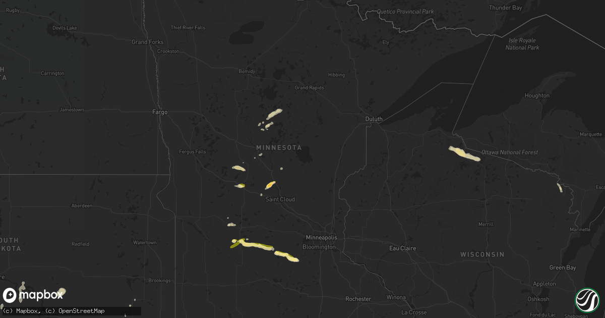
Hail Map in Minnesota on May 24, 2016
Get this storm
May 24 map
$229
one time, instant access
Download today. No call, no setup
Keep the $229
Bought the map and want the full workflow? Apply the entire $229 to a subscription within 7 days. None of it is wasted.
Every map, not just this one
This buys you this map. Subscription and you get every map we run, in the markets you choose from a few cities to whole states to nationwide. Plus real-time alerts the moment a storm fires.
Contact data
Name, contact info, occupancy, even credit band for addresses in the footprint. You go from where it hit to who to call.
Become the source they trust
Unlimited branding weather history reports on demand. You already have the documented answer ready for the property owner, and you are the one who showed up with it.
Property data and RoofTrace estimates
Pull up any address you have got, its value and the exact code rules for that jurisdiction, straight from One Click Code. Then RoofTrace estimates the squares, pitch, and roof value, priced the way you price.
Storm reports in Minnesota
Minnesota
| Date | Description |
|---|---|
| 05/24/20166:45 PM CDT | Up to 10 small trees 3 to 4 inch diameter blown down. |
| 05/24/20166:38 PM CDT | A local report indicates 1.00 inch wind near 3 S PLATO |
| 05/24/20166:35 PM CDT | A local report indicates 1.25 inch wind near 3 S GLENCOE |
| 05/24/20166:31 PM CDT | A local report indicates 1.00 inch wind near 3 S GLENCOE |
| 05/24/20166:25 PM CDT | Hwy 10 mile marker 157 windshield broke |
| 05/24/20166:00 PM CDT | A local report indicates 1.00 inch wind near 4 N BROWNTON |
| 05/24/20165:51 PM CDT | Reported via social media |
| 05/24/20165:41 PM CDT | Trained spotter reported up to 1 inch hail west of hutchinson |
| 05/24/20165:25 PM CDT | A local report indicates 1.00 inch wind near 7 SSE COSMOS |
| 05/24/20165:25 PM CDT | Hail up to 1 inch reported northwest of sauk centre |
| 05/24/20164:10 PM CDT | A local report indicates 1.00 inch wind near BLOMKEST |
| 05/24/20163:56 PM CDT | A local report indicates 1.00 inch wind near 4 E PRINSBURG |
| 05/23/20167:20 PM CDT | A local report indicates 1.00 inch wind near 5 WNW BELLE PLAINE |
| 05/23/20167:15 PM CDT | A local report indicates 1.25 inch wind near 6 N HENDERSON |
All States Impacted by Hail Map on May 24, 2016
Cities Impacted by Hail Map on May 24, 2016
- Moundridge, KS
- Hesston, KS
- Newton, KS
- Clarksville, AR
- Hanston, KS
- Burdett, KS
- Amorita, OK
- Bertrand, NE
- Edison, NE
- Oxford, NE
- Arapahoe, NE
- Beaver City, NE
- Stamford, NE
- Spivey, KS
- Nashville, KS
- Medicine Lodge, KS
- Kingman, KS
- Turon, KS
- Cunningham, KS
- Arlington, KS
- Attica, KS
- Zenda, KS
- Bristow, OK
- Kellyville, OK
- Beloit, KS
- Leon, KS
- Latham, KS
- Belvidere, SD
- McCracken, KS
- Barnard, KS
- Blue Rapids, KS
- Waterville, KS
- Mounds, OK
- Maramec, OK
- Glencoe, OK
- Drumright, OK
- Boley, OK
- Yale, OK
- Castle, OK
- Cushing, OK
- Depew, OK
- Pawnee, OK
- Sapulpa, OK
- Okmulgee, OK
- Okemah, OK
- Beggs, OK
- Mountain View, AR
- Murdock, KS
- Cheney, KS
- Perry, OK
- Morrison, OK
- Brush, CO
- Perryton, TX
- Yuma, CO
- Wray, CO
- Eckley, CO
- Stillwater, OK
- Vilonia, AR
- Conway, AR
- Wapanucka, OK
- Stewart, MN
- Brownton, MN
- Hutchinson, MN
- Indianola, NE
- Stockville, NE
- Julesburg, CO
- Amherst, CO
- Venango, NE
- Farnam, NE
- Brady, NE
- Gothenburg, NE
- Cozad, NE
- Moorefield, NE
- Willow Island, NE
- Tryon, OK
- Spearman, TX
- Mena, AR
- Pratt, KS
- Iuka, KS
- Harrison, AR
- Western Grove, AR
- Denver, CO
- Aurora, CO
- Prinsburg, MN
- Renville, MN
- Hunter, KS
- Sylvan Grove, KS
- Mills, NE
- Tupelo, OK
- Antlers, OK
- Boswell, OK
- Stringtown, OK
- Snow, OK
- Atoka, OK
- Lane, OK
- Coleman, OK
- Clayton, OK
- Moyers, OK
- Coalgate, OK
- Pawhuska, OK
- Bartlesville, OK
- Sterling, CO
- Hattieville, AR
- Jerusalem, AR
- Solgohachia, AR
- Russellville, AR
- Center Ridge, AR
- Dover, AR
- Atkins, AR
- Hector, AR
- Dexter, IA
- Plumerville, AR
- Lake Lillian, MN
- Kinsley, KS
- Albert, KS
- Otis, KS
- Great Bend, KS
- Sauk Centre, MN
- Byers, KS
- Haigler, NE
- Champion, NE
- Imperial, NE
- Burrton, KS
- Ensign, KS
- Lodgepole, NE
- Morrilton, AR
- Springfield, AR
- Meeker, OK
- Sparks, OK
- Wichita, KS
- Kechi, KS
- Greenwich, KS
- Valley Center, KS
- Benton, KS
- Muldrow, OK
- Van Buren, AR
- Roland, OK
- Bennett, CO
- Kersey, CO
- Broken Arrow, OK
- Murdo, SD
- Draper, SD
- Douglass, KS
- Augusta, KS
- Ness City, KS
- Auburn, NE
- Peru, NE
- Turpin, OK
- Hooker, OK
- Warner, OK
- Checotah, OK
- Oktaha, OK
- Muskogee, OK
- Norman, AR
- Caddo Gap, AR
- Clay Center, KS
- Kearney, NE
- Loomis, NE
- Smithfield, NE
- Overton, NE
- Elm Creek, NE
- Marenisco, MI
- Bruce Crossing, MI
- Watersmeet, MI
- Rattan, OK
- Broken Bow, OK
- Buhler, KS
- Garfield, KS
- Mercer, WI
- Manitowish Waters, WI
- Hurley, WI
- Iron Belt, WI
- Jetmore, KS
- Chandler, OK
- Davenport, OK
- Stroud, OK
- Royalton, MN
- Holdingford, MN
- Bowlus, MN
- Beaumont, KS
- Vian, OK
- Englewood, CO
- Littleton, CO
- Lewis, KS
- Shawnee, OK
- Wessington Springs, SD
- Gann Valley, SD
- Guthrie, OK
- Coyle, OK
- Ontonagon, MI
- Bergland, MI
- Miltona, MN
- Carlos, MN
- Long Prairie, MN
- Eagle Bend, MN
- Hector, MN
- Buffalo Lake, MN
- Lead Hill, AR
- Yellville, AR
- Belle Plaine, MN
- Henderson, MN
- Red Rock, OK
- Ainsworth, NE
- Kimberling City, MO
- Gillette, WY
- Kaycee, WY
- Rozel, KS
- Lucerne, CO
- Eaton, CO
- Greeley, CO
- Glencoe, MN
- Akron, CO
- Cushing, MN
- Motley, MN
- Parkston, SD
- Sumner, NE
- Midland, SD
- Westminster, CO
- Arvada, CO
- Golden, CO
- Broomfield, CO
- Henderson, CO
- Sedgwick, CO
- Crook, CO
- Kerkhoven, MN
- Umpire, AR
- Hutchinson, KS
- Partridge, KS
- Pretty Prairie, KS
- Wallace, NE
- Hoisington, KS
- Claflin, KS
- Canton, KS
- Durham, KS
- Lehigh, KS
- Couch, MO
- Damascus, AR
- Elwood, NE
- Chappell, NE
- Longville, MN
- Pine River, MN
- Backus, MN
- Cimarron, KS
- Wright, KS
- Dodge City, KS
- Greenfield, IA
- Fontanelle, IA
- Agra, OK
- Carney, OK
- Arnold, NE
- Coweta, OK
- Edmond, OK
- Hugoton, KS
- Kismet, KS
- Liberal, KS
- Eddyville, NE
- Amherst, NE
- Miller, NE
- Lexington, NE
- Pleasanton, NE
- Eustis, NE
- Riverdale, NE
- Atlanta, KS
- Osmond, NE
- Butte, NE
- Naper, NE
- Atkinson, NE
- Bonesteel, SD
- Claude, TX
- Halstead, KS
- Sedgwick, KS
- Haven, KS
- Mount Hope, KS
- Remer, MN
- Stinnett, TX
- Home, KS
- Beattie, KS
- Pequot Lakes, MN
- Fowler, KS
- Minneola, KS
- Merino, CO
- Dannebrog, NE
- Kadoka, SD
- Clifton, KS
- Morganville, KS
- Lyons, KS
- Chase, KS
- Ellinwood, KS
- Bushton, KS
- Fort Gibson, OK
- Haviland, KS
- Sterling, KS
- Enders, NE
- Otis, CO
- Olmitz, KS
- Little River, KS
- Roxbury, KS
- Lindsborg, KS
- Marquette, KS
- Geneseo, KS
- Galva, KS
- Bison, KS
- Pawnee Rock, KS
- Mcpherson, KS
- Rush Center, KS
- Larned, KS
- Windom, KS
- Edgemont, SD
- Green Isle, MN
- Lake City, KS
- Sawyer, KS
- Arlington, MN
- Hamburg, MN
- Plato, MN
- Lavaca, AR
- Charleston, AR
- Hays, KS
- Hayes Center, NE
- Brewster, NE
- Ovid, CO
- Springview, NE
- Bethel, OK
- Nashoba, OK
- Half Way, MO
- Fair Grove, MO
- Elkland, MO
- Buffalo, MO
- Ravenden, AR
- Williford, AR
- Hardy, AR
- Alma, NE
- Orleans, NE
- Fairfax, SD
- Holyoke, CO
- Wellston, OK
- Crow Agency, MT
- Palmer, KS
- Elsie, NE
- Peach Orchard, AR
- Biggers, AR
- Corning, AR
- Ogallala, NE
- Brule, NE
- Grant, NE
- Madrid, NE
- Big Springs, NE
- Pierce, NE
- Dalton, NE
- Ash Flat, AR
- Greenleaf, KS
- Beeler, KS
- Casey, IA
- Menlo, IA
- Willard, MO
- Walnut Grove, MO
- Henryetta, OK
- Johnstown, NE
- North Platte, NE
- Scott City, KS
- Barnsdall, OK
- Kyle, SD
- Manderson, SD
- Porcupine, SD
- Pine Ridge, SD
- Tescott, KS
- Salina, KS
- Clyde, KS
- Green, KS
- Greensburg, KS
- Borger, TX
- Randolph, KS
- Parks, NE
- Stafford, KS
- Dighton, KS
- Healy, KS
- Gove, KS
- Quinter, KS
- Evening Shade, AR
- Benkelman, NE
- Wakefield, KS
- Mountainburg, AR
- Mulberry, AR
- Alma, AR
- Burke, SD
- Vermillion, KS
- Frankfort, KS
- Boelus, NE
- Ravenna, NE
- Gibbon, NE
- Odessa, NE
- Hazard, NE
- Curtis, NE
- Rockville, NE
- Cairo, NE
- Hardin, MT
- Cambridge, NE
- Bartley, NE
- Harrah, OK
- Mcloud, OK
- Winterset, IA
- New Sharon, IA
- Fort Smith, AR
- Mullen, NE
- Byers, CO
- Wiggins, CO
- Fort Morgan, CO
- Strasburg, CO
- Council Hill, OK
- Boynton, OK
- Morris, OK
- Broken Bow, NE
- Oconto, NE
- Omaha, AR
- Paris, AR
- Lincoln, KS
- Windsor, CO
- Caney, OK
- Pittsburg, OK
- Caddo, OK
- Finley, OK
- Daisy, OK
- Milburn, OK
- Wanblee, SD
- Hagarville, AR
- Palisade, NE
- Wauneta, NE
- Sharon, KS
- Hazelton, KS
- Ashton, NE
- Cord, AR
- Newark, AR
- Carthage, MO
- Saint Paul, NE
- Wellfleet, NE
- Knoxville, IA
- Kennebec, SD
- Smithville, OK
- Dickens, NE
- St John, KS
- Seminole, OK
- McCook, NE
- Maywood, NE
- Hartville, MO
- Mansfield, MO
- Caulfield, MO
- Bakersfield, MO
- Presho, SD
- Wewoka, OK
- Haskell, OK
- Weleetka, OK
- Ripley, OK
- Billings, OK
- Jennings, OK
- Prague, OK
- Webbers Falls, OK
- Paden, OK
- Lusk, WY
- Okaton, SD
- Gregory, SD
- Harriet, AR
- Avon, MN
- Sidney, NE
- Mission, SD
- Humboldt, NE
- Table Rock, NE
- Elk Creek, NE
- Ellsworth, KS
- Shell Knob, MO
- Lampe, MO
- Porter, OK
- Pella, IA
- Leighton, IA
- Ault, CO
- Pennock, MN
- Magness, AR
- Mason City, NE
- Niagara, WI
- Marienthal, KS
- Fort Pierre, SD
- Mulhall, OK
- Orlando, OK
- Hillsboro, KS
- Gypsum, KS
- Maud, OK
- Greenbrier, AR
- Stapleton, NE
- Aurora, MO
- Jonesboro, AR
- Lake City, AR
- Watson, OK
- Skiatook, OK
- Pocahontas, AR
- Myrtle, MO
- Salem, SD
- Spencer, SD
- Tecumseh, OK
- Massena, IA
- Rock, KS
- Long Valley, SD
- Paoli, CO
- Haxtun, CO
- Concordia, KS
- Clarissa, MN
- Abbyville, KS
- Plevna, KS
- Sylvia, KS
- Cumberland, IA
- Blomkest, MN
- Olivia, MN
- Bird Island, MN
- Oskaloosa, IA
- Allen, SD
- Winfred, SD
- Hodgen, OK
- Randolph, UT
- Cedarville, AR
- Chester, AR
- Rudy, AR
- Bay, AR
- Wynona, OK
- Delphos, KS
- Wilmore, KS
- Oklahoma City, OK
- Meadow Grove, NE
- Hot Springs, SD
- Buffalo Gap, SD
- Ransom, KS
- Barnes, KS
- Miltonvale, KS
- Victoria, KS
- Glasco, KS
- Minneapolis, KS
- Pleasant Dale, NE
- Lincoln, NE
- Malcolm, NE
- Saint Joe, AR
- Huntsville, AR
- Kingston, AR
- Berryville, AR
- Morrowville, KS
- Russell, KS
- Axtell, KS
- Pierz, MN
- Earlsboro, OK
- Offerle, KS
- Bunker Hill, KS
- Pittsburg, KS
- Opolis, KS
- Macksville, KS
- Fullerton, NE
- Cambridge, KS
- Baileyville, KS
- Burchard, NE
- Pawnee City, NE
- Derby, KS
- Rose Hill, KS
- Ansley, NE
- Wickes, AR
- Wilson, KS
- Beverly, KS
- Albany, MN
- Fort Lupton, CO
- Platteville, CO
- Branson, MO
- Everton, AR
- Brownell, KS
- Linn, KS
- Perkins, OK
- Merriman, NE
- Earlham, IA
- Van Meter, IA
- Beatrice, NE
- Summerfield, KS
- Oelrichs, SD
- Lamar, MO
- Jasper, MO
- Liberal, MO
- Tahlequah, OK
- Luray, KS
- Waldo, KS
- Lucas, KS
- Willmar, MN
- Lamar, AR
- Ozone, AR
- Wymore, NE
- Oketo, KS
- Westerville, NE
- Melrose, IA
- Westville, OK
- Lincoln, AR
- Iliff, CO
- Olsburg, KS
- Piedmont, KS
- Stuart, IA
- Compton, AR
- Park Hill, OK
- Belpre, KS
- Palmer, NE
- Archer, NE
- Saint Libory, NE
- Grenola, KS
- Poughkeepsie, AR
- Mullinville, KS
- Nekoma, KS
- Alexander, KS
- Hanover, KS
- Washington, KS
- Marysville, KS
- Leonardville, KS
- Taft, OK
- Gore, OK
- Alden, KS
- Arcadia, KS
- Arma, KS
- Grannis, AR
- Bigelow, AR
- Udall, KS
- Mulvane, KS
- Solomon, KS
- Bennington, KS
- Longford, KS
- Harrold, SD
- Colome, SD
- Bazine, KS
- Martin, SD
- Pembine, WI
- Kingsford, MI
- Cookson, OK
- Waldron, KS
- Heavener, OK
- Cove, AR
- Hatfield, AR
- Vandervoort, AR
- Kilgore, NE
- Kaw City, OK
- Shidler, OK
- Manville, WY
- Oronogo, MO
- Asbury, MO
- Unadilla, NE
- Elmwood, NE
- Palmyra, NE
- Maxwell, NE
- Sallisaw, OK
- Hudson, KS
- Warm Springs, AR
- Canova, SD
- Wood Lake, NE
- Cape Fair, MO
- Tripp, SD
- Upson, WI
- Presque Isle, WI
- Brighton, CO
- Frostproof, FL
- Golden City, MO
- Ellis, KS
- Gans, OK
- Uniontown, AR
- Haysville, KS
- Clearwater, KS
- Jones, OK
- Luther, OK
- Matfield Green, KS
- Success, AR
- Galena, KS
- Carl Junction, MO
- Weir, KS
- Gurley, NE
- Sutherland, NE
- Neosho, MO
- Seneca, MO
- Jansen, NE
- Clarendon, TX
- Miami, TX
- Booker, TX
- Wayside, TX
- Sublette, KS
- Satanta, KS
- Plains, KS
- Miami, FL
- Evergreen, CO
- Watkins, CO
- Woodrow, CO
- Danube, MN
- Sacred Heart, MN


