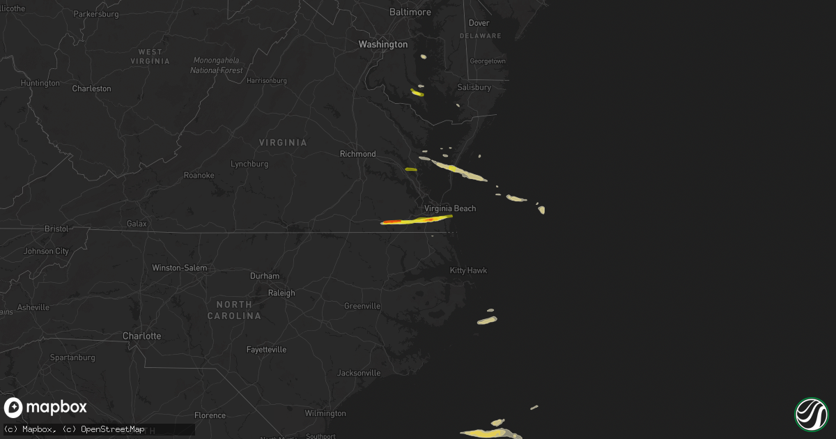
Hail Map on May 22, 2025
Get this storm
May 22 map
$229
one time, instant access
Download today. No call, no setup
Keep the $229
Bought the map and want the full workflow? Apply the entire $229 to a subscription within 7 days. None of it is wasted.
Every map, not just this one
This buys you this map. Subscription and you get every map we run, in the markets you choose from a few cities to whole states to nationwide. Plus real-time alerts the moment a storm fires.
Contact data
Name, contact info, occupancy, even credit band for addresses in the footprint. You go from where it hit to who to call.
Become the source they trust
Unlimited branding weather history reports on demand. You already have the documented answer ready for the property owner, and you are the one who showed up with it.
Property data and RoofTrace estimates
Pull up any address you have got, its value and the exact code rules for that jurisdiction, straight from One Click Code. Then RoofTrace estimates the squares, pitch, and roof value, priced the way you price.
States Impacted by Hail Map on May 22, 2025
Storm reports
Maryland
| Date | Description |
|---|---|
| 05/22/20255:56 PM CDT | A local report indicates 1.00 inch wind near 1 SSE Lexington Park |
| 05/22/20255:53 PM CDT | A local report indicates 1.00 inch wind near 3 S Hollywood |
| 05/22/20255:50 PM CDT | A local report indicates 1.25 inch wind near 1 SE California |
| 05/22/20255:50 PM CDT | Quarter size hail and some smaller stones starting to accumulate on the ground |
Oklahoma
| Date | Description |
|---|---|
| 05/22/20255:28 PM CDT | A local report indicates 1.25 inch wind near 3 SE Velma |
| 05/22/20255:15 PM CDT | A local report indicates 1.25 inch wind near 5 E Walters |
| 05/22/20255:14 PM CDT | A local report indicates 1.50 inch wind near 7 W Velma |
| 05/22/20255:13 PM CDT | A local report indicates 1.00 inch wind near 5 E Walters |
| 05/22/20255:04 PM CDT | Time estimated from radar. Report from x. |
| 05/22/20254:46 PM CDT | A local report indicates 1.50 inch wind near Cookietown |
| 05/22/20254:35 PM CDT | A local report indicates 2.00 inch wind near 2 NW Randlett |
| 05/22/20254:27 PM CDT | Time estimated from radar. |
| 05/22/20254:24 PM CDT | A local report indicates 1.75 inch wind near 3 NW Devol |
| 05/22/20254:20 PM CDT | Time estimated from radar. Report in nwschat. |
| 05/22/202512:53 PM CDT | Report from mping: golf ball |
| 05/22/202512:44 PM CDT | Wind driven hail. Time estimated from radar. |
| 05/22/202512:38 PM CDT | Outbuilding was overturned and tossed into trees north of thackerville on the east side of 35 near hutchins rd. Time based on radar. |
| 05/22/202512:30 PM CDT | A local report indicates 65 MPH wind near 2 SE Burneyville |
| 05/22/202512:25 PM CDT | A local report indicates 62 MPH wind near 2 SE Thackerville |
| 05/22/202511:34 AM CDT | A local report indicates 1.00 inch wind near 3 S Chandler |
| 05/22/202511:23 AM CDT | A local report indicates 1.00 inch wind near 1 N Covington |
| 05/22/202511:23 AM CDT | Report from mping: half dollar |
| 05/22/202511:20 AM CDT | A local report indicates 1.75 inch wind near Covington |
| 05/22/202511:17 AM CDT | Report from mping: quarter |
| 05/22/202511:13 AM CDT | Report from mping: quarter |
| 05/22/202511:00 AM CDT | A local report indicates 1.00 inch wind near Perkins |
| 05/22/202510:55 AM CDT | A local report indicates 2.00 inch wind near 1 SSE Tatums |
| 05/22/202510:45 AM CDT | A local report indicates 1.00 inch wind near 4 SSW Pink |
| 05/22/202510:38 AM CDT | Time based on radar. |
| 05/22/202510:32 AM CDT | A local report indicates 1.50 inch wind near Wilson |
| 05/22/202510:10 AM CDT | A local report indicates 1.00 inch wind near 1 S Healdton |
| 05/22/202510:10 AM CDT | Report from mping: quarter |
| 05/22/20258:46 AM CDT | Report from mping: ping pong ball |
| 05/22/20258:36 AM CDT | Report from mping: quarter |
Louisiana
| Date | Description |
|---|---|
| 05/22/20253:05 PM CDT | A picture on social media showed 1 inch hail in bourg. |
Virginia
| Date | Description |
|---|---|
| 05/22/20256:51 PM CDT | Estimated quarter sized hail reported near courtland. Time estimated from radar. |
| 05/22/20256:45 PM CDT | Public reported quarter sized hail and crop damage just north of cape charles on facebook. Time estimated based on radar. |
| 05/22/20256:10 PM CDT | Public reported nickel to quarter sized hail near deltaville in middlesex county via twitter/x. Time estimated from radar. |
| 05/22/20255:35 PM CDT | Public reported estimated quarter sized hail near rosewell area in gloucester county via twitter/x. Time estimated from radar. |
| 05/22/20255:31 PM CDT | A local report indicates 1.00 inch wind near 2 SSE Clay Bank |
| 05/21/20258:00 PM CDT | Estimated egg size hail near the grassfield high school in chesapeake. Time estimated from radar. |
| 05/21/20257:55 PM CDT | A local report indicates 1.00 inch wind near 1 W Great Bridge |
| 05/21/20257:53 PM CDT | A local report indicates 1.00 inch wind near 1 SE Herberts Corner |
| 05/21/20257:00 PM CDT | Golf ball size hail reported at the serve restaurant in downtown franklin. Others reported minor damage to their car nearby. |
Nebraska
| Date | Description |
|---|---|
| 05/21/202511:55 PM CDT | Center irrigation pivot overturned and power poles downed from thunderstorm winds. |
| 05/21/202511:45 PM CDT | Building damage from high winds... Including carport collapse... Section of tin roof from a large metal shop and part of a roof from local hotel displaced... And greenh |
| 05/21/202511:45 PM CDT | One large tree uprooted and one tree snapped in and near the cemetary. Time estimated from radar. |
| 05/21/202511:45 PM CDT | Buildi |
| 05/21/202511:40 PM CDT | Mobile home pushed off foundation and shed blown several yards from thunderstorm winds. Time estimated by radar. |
| 05/21/202511:07 PM CDT | Mping of 1.2in hail south of gerring. Storm briefly |
| 05/21/202511:07 PM CDT | Mping of 1.2in hail south of gerring. Storm briefly pulsed up before weakening a few minutes later. |
Texas
| Date | Description |
|---|---|
| 05/22/20256:55 PM CDT | A local report indicates 2.50 inch wind near 3 W Buchanan Dam |
| 05/22/20256:53 PM CDT | Picture and video via social media. |
| 05/22/20256:44 PM CDT | Mesonet station 55 5sw st. Lawrence... Tx. |
| 05/22/20256:35 PM CDT | Video on twitter showing golf ball size hail relayed via spotter. |
| 05/22/20256:30 PM CDT | Awos station kbpg big spring. |
| 05/22/20255:08 PM CDT | A local report indicates 1.25 inch wind near 6 NW Grayback |
| 05/22/20255:05 PM CDT | Photo of half dollar to ping pong ball hail on social media. |
| 05/22/20254:39 PM CDT | Delayed report of golfball... Tennis ball... And larger than baseball hail se of olney. |
| 05/22/20254:05 PM CDT | A local report indicates 1.75 inch wind near Burkburnett |
| 05/22/20254:04 PM CDT | A local report indicates 1.50 inch wind near 1 N Burkburnett |
| 05/22/20254:00 PM CDT | A local report indicates 1.25 inch wind near 6 SSW White River Lake |
| 05/22/20253:54 PM CDT | A local report indicates 1.00 inch wind near 4 W Burkburnett |
| 05/22/202512:51 PM CDT | Report from mping: tennis ball |
| 05/22/202512:49 PM CDT | Several signs along i-35 damaged and blown over between the red river and fm 372. |
| 05/22/202512:38 PM CDT | Quarter to ping pong ball size hail reported in moss lake area approximately 8 miles northwest of gainesville. |
| 05/22/20252:43 AM CDT | Large uprooted tree at corner of beaver lane and deer run way. Time estimated via radar. |
| 05/22/20252:43 AM CDT | La |
| 05/21/202511:55 PM CDT | Awos st |
| 05/21/202511:55 PM CDT | Awos station kcom coleman muni. |
| 05/21/202511:42 PM CDT | Strong winds blew down a full size hackber |
| 05/21/202511:42 PM CDT | Strong winds blew down a full size hackberry tree. |
| 05/21/202510:55 PM CDT | A local report indicates 59 MPH wind near 4 N Early |
| 05/21/202510:45 PM CDT | Golf to ping pong sized hail near kerville va medical center. |
| 05/21/202510:34 PM CDT | A local report indicates 58 MPH wind near 4 NNW Early |
| 05/21/202510:25 PM CDT | There were numerous large trees blown down across brownwood. |
| 05/21/20259:50 PM CDT | Multiple trees and powerlines downed on n. Anderson. Blocking roadway. Time estimated via radar. |
| 05/21/20259:45 PM CDT | Some small planes flipped at airport. Picture relayed via social media. |
| 05/21/20259:45 PM CDT | Corrects previous tstm wnd dmg report from 4 nnw martindale. Some small planes flipped at san marcos airport. Picture relayed via media. |
| 05/21/20259:45 PM CDT | Corrects previous tstm wnd dmg report from 4 nnw martindale. |
| 05/21/20259:44 PM CDT | Fifth wheel trailer blown over off fm 2731. Scattered tree damage. Time estimated. |
| 05/21/20259:42 PM CDT | West texas mesonet shields station |
| 05/21/20259:35 PM CDT | A local report indicates 75 MPH wind near 1 NNE Eastland |
| 05/21/20259:16 PM CDT | Cwop station gw3716 coleman. |
| 05/21/20259:16 PM CDT | Picture via social media with hail next to an actual baseball. |
| 05/21/20258:59 PM CDT | Facebook report of estimated 65 mph winds. Time estimated from radar. |
| 05/21/20258:55 PM CDT | Large limb |
| 05/21/20258:39 PM CDT | Albany west texas mesonet station. |
| 05/21/20258:34 PM CDT | Corrects previous hail report from 2 w lbj state park. Picture via social media with hail next to an actual baseball. |
| 05/21/20258:34 PM CDT | Corrects previous hail report from 2 w lbj state park. Picture via social media with hail next to an actual baseball. ( |
| 05/21/20258:30 PM CDT | Corrects previous hail report from 2 w lbj state park. Photo relayed by media. Time estimated via radar. |
| 05/21/20258:28 PM CDT | Numerous tree branches 4 to 6 inches in diameter snapped off trees. |
| 05/21/20258:22 PM CDT | Social media images of small metal shed destroyed. Scattered large tree limbs down. Time estimated via radar. |
| 05/21/20258:10 PM CDT | Estimated winds of 70-80 mph. Time estimated from radar. |
| 05/21/20258:05 PM CDT | Photo from social media. Time estimated via radar. |
| 05/21/20258:04 PM CDT | Nws employee repo |
| 05/21/20258:04 PM CDT | Nws employee reported 1.25 inch hail on hwy 180 just west of palo pinto. |
| 05/21/20258:00 PM CDT | Storm chaser reported 1 to 1.3 inch hail in eliasville |
| 05/21/20257:58 PM CDT | Multiple pictures relayed via social media. |
| 05/21/20257:58 PM CDT | Received phone call from resident stating it was hailing hard and biggest size is golf ball. |
| 05/21/20257:57 PM CDT | Picture via social media. |
| 05/21/20257:55 PM CDT | Tree branches snapped. |
| 05/21/20257:55 PM CDT | Golfball sized hail measured. |
| 05/21/20257:50 PM CDT | West texas mesonet. |
| 05/21/20257:50 PM CDT | Report from mping: quarter |
| 05/21/20257:40 PM CDT | Quarter size hail. |
| 05/21/20257:37 PM CDT | Picture via social media. |
| 05/21/20257:34 PM CDT | Photo relayed by media. Time estimated via radar. |
| 05/21/20257:32 PM CDT | A local report indicates 1.00 inch wind near 2 WNW Burkburnett |
| 05/21/20257:32 PM CDT | Video and several pictures of hail stripping leaves covering ground. |
| 05/21/20257:28 PM CDT | Hail reported via slack from broadcast media. |
| 05/21/20257:28 PM CDT | Picture via social media. |
| 05/21/20257:23 PM CDT | Picture via social media. |
| 05/21/20257:23 PM CDT | Near simon middle school. |
| 05/21/20257:14 PM CDT | Picture relayed via social media. |
| 05/21/20257:11 PM CDT | Trained spotter reported golf ball sized hail on furr rd. Northwest of newcastle. (fw |
| 05/21/20257:11 PM CDT | Trained spotter reported golf ball sized hail on furr rd. Northwest of newcastle. |
| 05/21/20257:10 PM CDT | A local report indicates 1.50 inch wind near 4 NE Martindale |
| 05/21/20257:01 PM CDT | Measured via awos. |
| 05/21/20257:00 PM CDT | Dents in cars... Shredded leaves. |
Colorado
| Date | Description |
|---|---|
| 05/21/20259:47 PM CDT | A local report indicates 1.00 inch wind near 15 NE Pawnee Buttes |
Cities Impacted by Hail Map on May 22, 2025
- Joplin, MO
- Duenweg, MO
- Lawton, OK
- Duncan, OK
- Comanche, OK
- Marlow, OK
- Chickasha, OK
- Amber, OK
- Blanchard, OK
- Foster, OK
- Elmore City, OK
- Pocasset, OK
- Lindsay, OK
- Maysville, OK
- Pauls Valley, OK
- Wynnewood, OK
- Ringling, OK
- Bristow, OK
- Okemah, OK
- Castle, OK
- Depew, OK
- Waurika, OK
- Alex, OK
- Loco, OK
- Washington, OK
- Paoli, OK
- Healdton, OK
- Okmulgee, OK
- Noble, OK
- Ratliff City, OK
- Tussy, OK
- Wilson, OK
- Purcell, OK
- Henryetta, OK
- Hennepin, OK
- Wayne, OK
- Springer, OK
- Graham, OK
- Lexington, OK
- Mulhall, OK
- Ardmore, OK
- Coyle, OK
- Davis, OK
- Stillwater, OK
- Lone Grove, OK
- Marietta, OK
- Overbrook, OK
- Burneyville, OK
- Norman, OK
- Tecumseh, OK
- Wanette, OK
- Perkins, OK
- Fairmont, OK
- Covington, OK
- Lucien, OK
- Perry, OK
- Chandler, OK
- Wellston, OK
- Sparks, OK
- Davenport, OK
- Tryon, OK
- Carney, OK
- Agra, OK
- Gainesville, TX
- Muenster, TX
- Thackerville, OK
- Whitesboro, TX
- Valley View, TX
- Tioga, TX
- Collinsville, TX
- Pilot Point, TX
- Lindsay, TX
- Sanger, TX
- Lake Placid, FL
- Venus, FL
- Madill, OK
- Arcadia, FL
- Okeechobee, FL
- Lockport, LA
- Bourg, LA
- Holliday, TX
- Seymour, TX
- Fort Stockton, TX
- Montegut, LA
- Zolfo Springs, FL
- Mill Creek, OK
- Electra, TX
- Iowa Park, TX
- Olney, TX
- Spur, TX
- Crosbyton, TX
- Ralls, TX
- Matador, TX
- Labelle, FL
- Burkburnett, TX
- Floydada, TX
- Wichita Falls, TX
- Grandfield, OK
- Devol, OK
- Randlett, OK
- Windthorst, TX
- Vernon, TX
- Post, TX
- Justiceburg, TX
- Paducah, TX
- Snyder, TX
- Newcastle, TX
- Loving, TX
- Graham, TX
- Temple, OK
- Walters, OK
- Cee Vee, TX
- Iraan, TX
- Clewiston, FL
- Dryden, TX
- Childress, TX
- Junction, TX
- Byers, TX
- Clinton, AR
- Shirley, AR
- Petrolia, TX
- Ryan, OK
- Bryson, TX
- Fairfield Bay, AR
- Higden, AR
- Mason, TX
- Crowell, TX
- Hollywood, MD
- Leonardtown, MD
- Dripping Springs, TX
- Hermleigh, TX
- Heber Springs, AR
- Marathon, TX
- Quanah, TX
- Midkiff, TX
- Llano, TX
- Great Mills, MD
- Lexington Park, MD
- California, MD
- Graford, TX
- Patuxent River, MD
- Chillicothe, TX
- Dutton, VA
- North, VA
- Searcy, AR
- Pangburn, AR
- Lusby, MD
- Mountain Home, TX
- Big Lake, TX
- Eldorado, OK
- Goree, TX
- Munday, TX
- Miami, FL
- Moon, VA
- Hudgins, VA
- Mathews, VA
- Cobbs Creek, VA
- Round Mountain, TX
- Diggs, VA
- Throckmorton, TX
- Rule, TX
- Buchanan Dam, TX
- Kingsland, TX
- Burnet, TX
- Garden City, TX
- Big Spring, TX
- Cape Charles, VA
- San Marcos, TX
- Machipongo, VA
- Kingsbury, TX
- Martindale, TX
- Oklaunion, TX
- Franklin, VA
- Suffolk, VA
- Harrold, TX
- Maxwell, TX
- Harper, TX
- Carrsville, VA
- Courtland, VA
- Palo Pinto, TX
- Ingram, TX
- Kyle, TX
- Valley Spring, TX
- Seguin, TX
- Deltaville, VA
- Fredericksburg, TX
- Willow City, TX
- Davidson, OK
- Chesapeake, VA
- Lockhart, TX
- Lampasas, TX
- New Braunfels, TX
- Newsoms, VA
- Strawn, TX
- South Bend, TX
- Gordon, TX
- Breckenridge, TX
- Lipan, TX
- Santo, TX
- Buda, TX
- Dale, TX
- Austin, TX
- Del Valle, TX
- Burns, WY
- Johnson City, TX
- Virginia Beach, VA
- Carpenter, WY
- Woodson, TX
- Stonewall, TX
- Pine Bluffs, WY
- Hye, TX
- Albany, TX
- Bushnell, NE
- Grover, CO
- Driftwood, TX
- Boerne, TX
- Blanco, TX
- Caddo, TX
- Cisco, TX
- Moran, TX
- Eastland, TX
- Miles, TX
- Wheatland, WY
- Ranger, TX
- Gorman, TX
- Desdemona, TX
- De Leon, TX
- Carbon, TX
- Rising Star, TX
- Comanche, TX
- Paint Rock, TX
- Mereta, TX
- San Angelo, TX
- Comfort, TX
- New Raymer, CO
- May, TX
- Cross Plains, TX
- Brownwood, TX
- Burkett, TX
- Ballinger, TX
- Coleman, TX
- Talpa, TX
- Novice, TX
- Clyde, TX
- Baird, TX
- Valera, TX
- Rowena, TX
- Santa Anna, TX
- Eola, TX
- Voss, TX
- Eden, TX
- Millersview, TX
- Vancourt, TX
- Gouldbusk, TX
- Melvin, TX
- Bangs, TX
- Lohn, TX
- Doole, TX
- Rockwood, TX
- Rochelle, TX
- Brookesmith, TX
- Early, TX
- Sidney, TX
- Yoder, WY
- Lingle, WY
- Kimball, NE
- Stoneham, CO
- Padroni, CO
- Kerrville, TX
- Torrington, WY
- Veteran, WY
- Richland Springs, TX
- Cheyenne, WY
- Brady, TX
- Center Point, TX
- Blanket, TX
- Sterling, CO
- Mullin, TX
- Lyman, NE
- Zephyr, TX
- Albin, WY
- Atwood, CO
- Gering, NE
- Mitchell, NE
- Morrill, NE
- San Saba, TX
- Harrisburg, NE
- Hawk Springs, WY
- Fleming, CO
- Medina, TX
- Goldthwaite, TX
- Lometa, TX
- Cherokee, TX
- Tow, TX
- Art, TX
- Voca, TX
- Castell, TX
- Fredonia, TX
- Pontotoc, TX
- Hext, TX
- Menard, TX
- London, TX
- Otis, CO
- Yuma, CO
- Haxtun, CO
- Avon, NC
- Bluffton, TX
- Sidney, NE
- Rocksprings, TX
- Lodgepole, NE
- Sonora, TX
- Horseshoe Bay, TX
- Bayard, NE
- Eldorado, TX
- Chappell, NE
- Dalton, NE
- Potter, NE
- Leakey, TX
- Gurley, NE
- Kendalia, TX
- Anson, TX
- Sylvester, TX
- Roby, TX
- McCaulley, TX
- Rio Frio, TX
- Williamsburg, VA
- Hayes, VA
- Gloucester, VA
- Concan, TX
- Shawnee, OK
- Merkel, TX
- Barksdale, TX
- Utopia, TX
- Hawley, TX
- Sabinal, TX
- Trent, TX
- Sweetwater, TX
- Knippa, TX
- Wake, VA
- Hardyville, VA