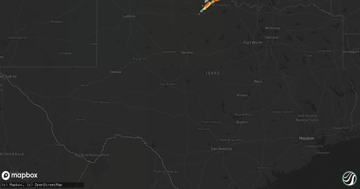
Hail Map in Texas on May 22, 2019
Get this storm
May 22 map
$229
one time, instant access
Download today. No call, no setup
Keep the $229
Bought the map and want the full workflow? Apply the entire $229 to a subscription within 7 days. None of it is wasted.
Every map, not just this one
This buys you this map. Subscription and you get every map we run, in the markets you choose from a few cities to whole states to nationwide. Plus real-time alerts the moment a storm fires.
Contact data
Name, contact info, occupancy, even credit band for addresses in the footprint. You go from where it hit to who to call.
Become the source they trust
Unlimited branding weather history reports on demand. You already have the documented answer ready for the property owner, and you are the one who showed up with it.
Property data and RoofTrace estimates
Pull up any address you have got, its value and the exact code rules for that jurisdiction, straight from One Click Code. Then RoofTrace estimates the squares, pitch, and roof value, priced the way you price.
Storm reports in Texas
Texas
| Date | Description |
|---|---|
| 05/22/20196:25 PM CDT | A local report indicates 1.00 inch wind near 3 E LAKE KEMP |
| 05/22/20192:59 AM CDT | At 759 PM CDT, a severe thunderstorm was located near Burkburnett, moving northeast at 25 mph. HAZARD...Ping pong ball size hail and 60 mph wind gusts. SOURCE...Radar indicated. IMPACT...People and animals outdoors will be injured. Expect hail damage to roofs, siding, windows, and vehicles. Expect wind damage to roofs, siding, and trees. Locations impacted include... Burkburnett and Randlett. |
| 05/22/20192:24 AM CDT | At 723 PM CDT, a severe thunderstorm was located 6 miles east of Electra, moving northeast at 25 mph. HAZARD...Ping pong ball size hail and 60 mph wind gusts. SOURCE...Radar indicated. IMPACT...People and animals outdoors will be injured. Expect hail damage to roofs, siding, windows, and vehicles. Expect wind damage to roofs, siding, and trees. Locations impacted include... Northern Wichita Falls, Burkburnett, Iowa Park, Electra, Randlett, Sheppard AFB, Pleasant Valley and Cashion. |
| 05/22/20191:43 AM CDT | At 642 PM CDT, a severe thunderstorm was located 6 miles northwest of Lake Diversion, moving northeast at 25 mph. HAZARD...Golf ball size hail and 60 mph wind gusts. SOURCE...Radar indicated. IMPACT...People and animals outdoors will be injured. Expect hail damage to roofs, siding, windows, and vehicles. Expect wind damage to roofs, siding, and trees. Locations impacted include... Electra, Oklaunion, Harrold, Grayback and Haynesville. |
| 05/22/20191:08 AM CDT | At 608 PM CDT, a severe thunderstorm was located 4 miles southwest of Lake Kemp, moving northeast at 30 mph. HAZARD...60 mph wind gusts and quarter size hail. SOURCE...Radar indicated. IMPACT...Hail damage to vehicles is expected. Expect wind damage to roofs, siding, and trees. Locations impacted include... Lake Kemp, Mabelle, Grayback and Lake Diversion. |
| 05/21/20199:44 PM CDT | At 244 PM CDT, a severe thunderstorm was located 7 miles south of Chattanooga, moving northeast at 30 mph. HAZARD...60 mph wind gusts and quarter size hail. SOURCE...Radar indicated. IMPACT...Hail damage to vehicles is expected. Expect wind damage to roofs, siding, and trees. Locations impacted include... Lawton, Duncan, Walters, Elgin, Geronimo, Fletcher, Grandfield, Sterling, Chattanooga, Devol, Faxon, Loveland, Cookietown, eastern Fort Sill, Lake Ellsworth, Central High and Hulen. |
| 05/21/20199:22 PM CDT | At 222 PM CDT, a severe thunderstorm was located near Grandfield, moving northeast at 30 mph. HAZARD...60 mph wind gusts and quarter size hail. SOURCE...Radar indicated. IMPACT...Hail damage to vehicles is expected. Expect wind damage to roofs, siding, and trees. Locations impacted include... Southwestern Lawton, Walters, Cache, Geronimo, Grandfield, Chattanooga, Devol, Faxon, Loveland, Cookietown and southwestern Fort Sill. |
| 05/21/20197:51 PM CDT | A local report indicates 1.00 inch wind near BURKBURNETT |
| 05/21/20197:42 PM CDT | A local report indicates 1.75 inch wind near 2 WSW BURKBURNETT |
| 05/21/20197:42 PM CDT | A local report indicates 1.50 inch wind near 3 SW BURKBURNETT |
All States Impacted by Hail Map on May 22, 2019
Cities Impacted by Hail Map on May 22, 2019
- McCune, KS
- Topeka, IL
- Easton, IL
- Forest City, IL
- Havana, IL
- Rushville, IL
- Electra, TX
- Shelbyville, MO
- Bethel, MO
- Ramona, OK
- Skiatook, OK
- Seymour, TX
- Iowa Park, TX
- Versailles, IN
- Hermann, MO
- Strafford, MO
- Talala, OK
- Milo, MO
- Osceola, MO
- El Dorado Springs, MO
- Litchfield, IL
- Mount Olive, IL
- Warrensburg, MO
- Camdenton, MO
- Linn Creek, MO
- Collinsville, OK
- Vera, OK
- Harrold, TX
- Saint Patrick, MO
- Carthage, IL
- Alexandria, MO
- Hamilton, IL
- Keokuk, IA
- Lewistown, MO
- Astoria, IL
- Manito, IL
- Green Valley, IL
- New Franklin, MO
- Pilot Grove, MO
- Rocheport, MO
- Boonville, MO
- Harrisburg, MO
- Sedalia, MO
- Clark, MO
- Columbia, MO
- Nelson, MO
- Fayette, MO
- Franklin, MO
- Hallsville, MO
- Blackwater, MO
- Sturgeon, MO
- Centralia, MO
- Bristow, OK
- Beggs, OK
- Escanaba, MI
- Bark River, MI
- Gulliver, MI
- McMillan, MI
- Germfask, MI
- Barnett, MO
- Eldon, MO
- Uniontown, KS
- Madison, MO
- Moberly, MO
- Eucha, OK
- Spavinaw, OK
- Morrisonville, IL
- Springfield, MO
- Greeley, KS
- Welda, KS
- Westphalia, KS
- Lane, KS
- Garnett, KS
- Osawatomie, KS
- Parker, KS
- Neodesha, KS
- Hepler, KS
- Montrose, IA
- Argyle, IA
- Salisbury, MO
- Blackburn, MO
- Santa Fe, MO
- Clifton Hill, MO
- Higbee, MO
- Huntsville, MO
- Glasgow, MO
- Keytesville, MO
- Miami, MO
- Gilliam, MO
- Paris, MO
- Dalton, MO
- Armstrong, MO
- Marshall, MO
- Malta Bend, MO
- Slater, MO
- Fort Scott, KS
- Lebanon, MO
- Niangua, MO
- Grovespring, MO
- South West City, MO
- Anderson, MO
- Wagoner, OK
- La Belle, MO
- Sheldon, MO
- Stockton, MO
- Jerico Springs, MO
- Lockwood, MO
- Lamar, MO
- Anabel, MO
- Ewing, MO
- Clarence, MO
- Leonard, MO
- Deepwater, MO
- Camp Point, IL
- Coatsburg, IL
- Jefferson City, MO
- Russellville, MO
- Eugene, MO
- Yates Center, KS
- Wheatland, MO
- Mount Vernon, MO
- Gilman, IL
- Onarga, IL
- Watseka, IL
- Crescent City, IL
- Bonnots Mill, MO
- Chamois, MO
- Lebanon, IL
- Mascoutah, IL
- New Baden, IL
- Belleville, IL
- Trenton, IL
- Scott Air Force Base, IL
- O'Fallon, IL
- Okemah, OK
- Morrison, MO
- Butler, MO
- Warsaw, IL
- Sutter, IL
- Ursa, IL
- Mendon, IL
- Saint Paul, KS
- Okmulgee, OK
- Morris, OK
- Henley, MO
- Lohman, MO
- Smithboro, IL
- Vandalia, IL
- Mulberry Grove, IL
- Fort Leonard Wood, MO
- Waynesville, MO
- Newburg, MO
- Bartlett, KS
- Edna, KS
- Pawnee, OK
- Catoosa, OK
- Claremore, OK
- Nebo, IL
- Hillview, IL
- Pearl, IL
- Republic, MO
- Bois D Arc, MO
- Ash Grove, MO
- Marionville, MO
- Foristell, MO
- Warrenton, MO
- Truesdale, MO
- Wright City, MO
- Brook, IN
- Kentland, IN
- Goodland, IN
- Sheldon, IL
- New Castle, IN
- New London, MO
- Frankford, MO
- Prescott, KS
- Hume, MO
- Foster, MO
- Rich Hill, MO
- Tulsa, OK
- Broken Arrow, OK
- Pryor, OK
- Inola, OK
- Barnsdall, OK
- Ochelata, OK
- Marthasville, MO
- Versailles, MO
- Middletown, MO
- Eureka, MO
- Oologah, OK
- Norman, IN
- Heltonville, IN
- Ulysses, KS
- Newark, MO
- Dunnegan, MO
- Quincy, IL
- La Grange, MO
- Maywood, MO
- Coffeyville, KS
- Canton, MO
- Basco, IL
- Lookeba, OK
- Adair, IL
- Table Grove, IL
- Timewell, IL
- Highland, IL
- Pocahontas, IL
- Holden, MO
- Centerview, MO
- Redfield, KS
- Erie, KS
- Richards, MO
- Nevada, MO
- Harwood, MO
- Farlington, KS
- Walker, MO
- Galesburg, KS
- Deerfield, MO
- Girard, KS
- Walnut, KS
- Moundville, MO
- Ralston, OK
- Red Rock, OK
- Perry, OK
- Walshville, IL
- Sorento, IL
- Willard, MO
- Fair Grove, MO
- Everton, MO
- Fenton, MO
- High Ridge, MO
- Pekin, IL
- Bath, IL
- Carthage, MO
- Webb City, MO
- Jasper, MO
- Dadeville, MO
- Purcell, MO
- Oronogo, MO
- Galena, KS
- Arcola, MO
- Greenfield, MO
- Carl Junction, MO
- Golden City, MO
- Fair Play, MO
- Neck City, MO
- Alba, MO
- Pittsburg, KS
- Chouteau, OK
- Mount Morris, MI
- Otisville, MI
- West Point, IL
- Elkhart, IL
- Lincoln, IL
- Nowata, OK
- Vinita, OK
- Welch, OK
- Bluejacket, OK
- Frederick, OK
- Loveland, OK
- Davidson, OK
- Seneca, MO
- Joplin, MO
- Neosho, MO
- Sarcoxie, MO
- Diamond, MO
- Chelsea, OK
- Sperry, OK
- Columbus, KS
- Holliday, MO
- Cairo, MO
- Shelbina, MO
- Jacksonville, MO
- Goodman, MO
- Afton, OK
- Wyandotte, OK
- Fairland, OK
- Grove, OK
- Fowler, IL
- Mount Sterling, IL
- Paloma, IL
- Clayton, IL
- Taylor, MO
- Saint Louis, MO
- Bolivar, MO
- Polk, MO
- Stillwater, OK
- Walters, OK
- Monticello, MO
- Canton, IL
- Durham, MO
- Jerseyville, IL
- Portage Des Sioux, MO
- La Monte, MO
- Knob Noster, MO
- Houstonia, MO
- Adair, OK
- Strang, OK
- Peoria, IL
- East Peoria, IL
- Creve Coeur, IL
- Kingston Mines, IL
- Glasford, IL
- Mapleton, IL
- Bartlesville, OK
- Seminole, OK
- Wewoka, OK
- Porter, OK
- Redbird, OK
- Boley, OK
- Haskell, OK
- Castle, OK
- Coweta, OK
- Monon, IN
- Rensselaer, IN
- Hartville, MO
- Wichita Falls, TX
- Randlett, OK
- Burkburnett, TX
- Devol, OK
- Rapid River, MI
- Martinsburg, MO
- Benton City, MO
- Bucyrus, KS
- Louisburg, KS
- Jay, OK
- Bethany, IL
- Sullivan, IL
- Findlay, IL
- Rhineland, MO
- Mulhall, OK
- Fairfax, OK
- Richland, MO
- Stoutland, MO
- Tunas, MO
- Windyville, MO
- Buffalo, MO
- Eldridge, MO
- Sand Springs, OK
- Carlock, IL
- Paola, KS
- Antwerp, OH
- Cecil, OH
- Paulding, OH
- Louisiana, MO
- Bowling Green, MO
- Hennessey, OK
- Dover, OK
- Lowry City, MO
- Appleton City, MO
- Clinton, MO
- Schell City, MO
- Rockville, MO
- Laquey, MO
- Bunker Hill, IL
- Piasa, IL
- Shipman, IL
- Brighton, IL
- Lawton, OK
- Gladstone, MI
- Delavan, IL
- Tremont, IL
- Lewistown, IL
- Hydro, OK
- Luray, MO
- Manistique, MI
- New Berlin, IL
- Thawville, IL
- Buckley, IL
- Montrose, MO
- Wynona, OK
- Marshfield, MO
- Rockport, IL
- Barry, IL
- New Canton, IL
- Fulton, KS
- Coleman, WI
- Centralia, IL
- Stover, MO
- Half Way, MO
- Collins, MO
- Concordia, MO
- Knox City, MO
- Seymour, MO
- Mansfield, MO
- Dexter, KS
- Milan, IN
- Parsons, KS
- Oswego, KS
- Preston, MO
- Hollister, OK
- Quapaw, OK
- Granby, MO
- Wentworth, MO
- Pierce City, MO
- Colony, OK
- Champaign, IL
- Cullom, IL
- Macks Creek, MO
- Lawrenceville, IL
- Monticello, IN
- Weir, KS
- Cherokee, KS
- Scammon, KS
- Chetopa, KS
- Rossville, IL
- Laddonia, MO
- Rush Hill, MO
- Macomb, IL
- Holts Summit, MO
- Tebbetts, MO
- Carnegie, OK
- Cordell, OK
- Hinton, OK
- Cole Camp, MO
- Warsaw, MO
- Carterville, MO
- La Russell, MO
- Long Lane, MO
- Reeds, MO
- Lincoln, MO
- Louisburg, MO
- Stotts City, MO
- Flemington, MO
- Urbana, MO
- Winchester, IN
- Mendon, MO
- Bellflower, IL
- Sibley, IL
- Melvin, IL
- Gibson City, IL
- Chatsworth, IL
- Strawn, IL
- Le Roy, IL
- Saybrook, IL
- Arrowsmith, IL
- Atlanta, MO
- Nauvoo, IL
- Arbela, MO
- Wyaconda, MO
- Wayland, MO
- Kahoka, MO
- Windsor, MO
- Calhoun, MO
- Neosho Falls, KS
- Staunton, IL
- Worden, IL
- New Douglas, IL
- Cuba, IL
- Groveland, IL
- Bryant, IL
- Smithfield, IL
- Saint David, IL
- Ipava, IL
- Baxter Springs, KS
- Hobart, OK
- Gotebo, OK
- Jonesburg, MO
- Toronto, KS
- Howard, KS
- Fall River, KS
- Clinton, IL
- Farmer City, IL
- Mechanicsburg, OH
- Stark City, MO
- Stella, MO
- Meredosia, IL
- Bluffs, IL
- Farmersville, IL
- Waggoner, IL
- Girard, IL
- Greenville, IL
- Winfield, MO
- Batchtown, IL
- Brussels, IL
- Glencoe, OK
- Salina, OK
- Liberal, MO
- Kiefer, OK
- Glenpool, OK
- Mounds, OK
- Hominy, OK
- Liberty, KS
- Rankin, IL
- Crawfordsville, IN
- Oaktown, IN
- Bruceville, IN
- Browning, IL
- Philadelphia, MO
- Palmyra, MO
- Williamsport, IN
- Oakwood, OH
- Defiance, OH
- Pawhuska, OK
- Maramec, OK
- Osage, OK
- Cleveland, OK
- Moran, KS
- Elsmore, KS
- Savonburg, KS
- Bronson, KS
- Marion, IN
- Labadie, MO
- Olean, MO
- Gravois Mills, MO
- Milford, IL
- Caney, KS
- Independence, KS
- Perry, MO
- Freeburg, MO
- Lenapah, OK
- Palmer, IL
- Gridley, IL
- Montreal, MO
- S Coffeyville, OK
- Dallas City, IL
- Tiff City, MO
- Big Cabin, OK
- Pittsfield, IL
- Farber, MO
- Delaware, OK
- Shobonier, IL
- Fredonia, KS
- Elk City, KS
- Nokomis, IL
- Mountain Grove, MO
- Chebanse, IL
- Clifton, IL
- Fillmore, IL
- Pleasant Plains, IL
- Springfield, IL
- East Carondelet, IL
- Washington, MO
- Valley Park, MO
- Wildwood, MO
- Defiance, MO
- Pacific, MO
- Augusta, MO
- Saint Albans, MO
- Ballwin, MO
- Villa Ridge, MO
- Dupo, IL
- Gray Summit, MO
- Kempton, IL
- Carlinville, IL
- Chesterfield, IL
- Medora, IL
- Fidelity, IL
- Prue, OK
- Owasso, OK
- Mannford, OK
- Pontiac, IL
- Ludlow, IL
- Cissna Park, IL
- Elsberry, MO
- Annada, MO
- Golden Eagle, IL
- O'Fallon, MO
- Eldred, IL
- White Hall, IL
- Carrollton, IL
- Berger, MO
- Mount Sterling, MO
- Danville, IL
- Alvin, IL
- Chilhowee, MO
- Altamont, KS
- Jenks, OK
- Sapulpa, OK
- Markle, IN
- Uniondale, IN
- Fort Loramie, OH
- Yorkshire, OH
- Versailles, OH
- Rockbridge, IL
- Kane, IL
- Ionia, MO
- Indianapolis, IN
- Buffalo, IL
- Gillespie, IL
- Emden, MO
- Ramsey, IL
- Godfrey, IL
- Alton, IL
- Bethalto, IL
- Paxton, IL
- Winchester, IL
- Jacksonville, IL
- Bronaugh, MO
- Murrayville, IL
- Alexander, IL
- Wann, OK
- Fort Sill, OK
- Thomasboro, IL
- Penfield, IL
- Armstrong, IL
- Ogden, IL
- Urbana, IL
- Saint Joseph, IL
- Potomac, IL
- Gifford, IL
- Remington, IN
- Smithton, MO
- Mora, MO
- Forsyth, IL
- Decatur, IL
- Oreana, IL
- West Alton, MO
- Saint Charles, MO
- Arma, KS
- Mindenmines, MO
- Franklin, KS
- Mulberry, KS
- Millstadt, IL
- Carrollton, MO
- Norborne, MO
- Columbiaville, MI
- Otter Lake, MI
- Dewitt, IL
- Stark, KS
- Peru, IN
- Fieldon, IL
- Linn, MO
- Wentzville, MO
- Bland, MO
- Rutledge, MO
- Gorin, MO
- Donnellson, IL
- Bingham, IL
- Coffeen, IL
- West Mineral, KS
- Dow, IL
- Columbus, IN
- Quincy, MO
- Mound Valley, KS
- Cherryvale, KS
- Lone Wolf, OK
- Wolcott, IN
- Golden, IL
- Bowen, IL
- Edgar Springs, MO
- Rolla, MO
- Grafton, IL
- Hillsboro, IL
- Panama, IL
- Alhambra, IL
- Palmyra, IL
- Greenfield, IL
- Roodhouse, IL
- Crescent, OK
- Dawson, IL
- Maud, OK
- Huntington, IN
- Warren, IN
- Ossian, IN
- Farmington, IL
- Memphis, MO
- Miami, OK
- Troy, MO
- Sentinel, OK
- Rocky, OK
- Jamestown, IN
- Waverly, MO
- Corder, MO
- Fairview, IL
- Arcadia, KS
- Treece, KS
- Riverton, KS
- Copan, OK
- Morrison, OK
- Elberton, GA
- Colony, KS
- Martinton, IL
- Rome City, IN
- Wolcottville, IN
- Lexington, IL
- Chenoa, IL
- Hudson, IL
- Forrest, IL
- Fairbury, IL
- Binger, OK
- Industry, IL
- Higginsville, MO
- Plymouth, IL
- Williamstown, MO
- Novelty, MO
- Macon, MO
- Loraine, IL
- Kinderhook, IL
- Witt, IL
- Vandalia, MO
- Brookline, MO
- Halltown, MO
- Pleasant Hope, MO
- Miller, MO
- Monett, MO
- Aurora, MO
- Billings, MO
- Alma, MO
- Covington, OK
- Fairmont, OK
- Waukomis, OK
- Marshall, OK
- Douglas, OK
- Bison, OK
- Chattanooga, OK
- Marland, OK
- Camden, IL
- Huntsville, IL
- Asbury, MO
- Revere, MO
- Wells, MI


