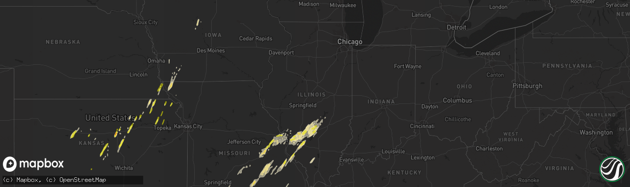
Hail Map in Illinois on May 21, 2019
The weather event in Illinois on May 21, 2019 includes Hail map. 7 states and 296 cities were impacted and suffered possible damage. The total estimated number of properties impacted is 17,937.
Want more than just the map?
Turn this storm into a full workflow.
- Owner + property data so you know who to knock
- OnDemand branded weather history reports to win the "did we even have hail?" argument
- RoofTrace estimate so reps stop guessing numbers at the door
Bought this map? Upgrade within 7 days and we'll credit the $230. (10-15 min setup call)
Hail
17,937
Estimated number of impacted properties by a 1.00" hail or larger0
Estimated number of impacted properties by a 1.75" hail or larger0
Estimated number of impacted properties by a 2.50" hail or largerStorm reports in Illinois
Illinois
| Date | Description |
|---|---|
| 05/21/20196:55 PM CDT | Two uprooted trees... Two trees tops are twisted off and other trees down at nearby neighbors hours. Could be tornado damage. |
| 05/21/20195:33 AM CDT | At 1032 PM CDT, a severe thunderstorm was located 8 miles northeast of Dongola, or 9 miles east of Anna, moving northeast at 45 mph. HAZARD...60 mph wind gusts and quarter size hail. SOURCE...Radar indicated. IMPACT...Hail damage to vehicles is expected. Expect wind damage to roofs, siding, and trees. Locations impacted include... Carbondale, Marion, Johnston City, Goreville, Pittsburg, Creal Springs, Lake Of Egypt Area, Whiteash, Cypress, New Burnside, Spillertown and Buncombe. |
| 05/21/20195:20 AM CDT | At 1019 PM CDT, a severe thunderstorm was located over Carterville, moving northeast at 55 mph. HAZARD...60 mph wind gusts and nickel size hail. A spottter near Carterville reported 55 mph wind gusts and penny size hail. SOURCE...Radar indicated. IMPACT...Expect damage to roofs, siding, and trees. Locations impacted include... Carbondale, Herrin, West Frankfort, Benton, Carterville, Johnston City, Christopher, Zeigler, Crainville, Cambria, Royalton, Energy, Hurst, West City, Buckner, Orient, Hanaford, Ewing, Freeman Spur and Bush. |
| 05/21/20194:40 AM CDT | At 940 PM CDT, a severe thunderstorm was located over Woodlawn, or 9 miles west of Mount Vernon, moving northeast at 45 mph. HAZARD...60 mph wind gusts and quarter size hail. SOURCE...Radar indicated. IMPACT...Hail damage to vehicles is expected. Expect wind damage to roofs, siding, and trees. Locations impacted include... Woodlawn and Dix. |
| 05/21/20194:30 AM CDT | At 930 PM CDT, severe thunderstorms were located along a line extending from near Westervelt to near Cowden to near Brownstown, moving northeast at 50 mph. HAZARD...60 mph wind gusts and quarter size hail. SOURCE...Radar indicated. IMPACT...Hail damage to vehicles is expected. Expect wind damage to roofs, siding, and trees. Locations impacted include... Effingham, Shelbyville, Sullivan, Altamont, Bethany, Lovington, Windsor, Stewardson, Findlay, Cowden, Dalton City, Beecher City, Shumway, Allenville, Westervelt, Moccasin, Strasburg, Clarksburg, Sigel and Gays.This includes the following highways... Interstate 57 between mile markers 157 and 171. Interstate 70 between mile markers 79 and 97. |
| 05/21/20194:05 AM CDT | At 905 PM CDT, a severe thunderstorm was located near Pinckneyville, moving northeast at 45 mph. HAZARD...60 mph wind gusts and quarter size hail. SOURCE...Radar indicated. IMPACT...Hail damage to vehicles is expected. Expect wind damage to roofs, siding, and trees. Locations impacted include... Pinckneyville and Tamaroa. |
| 05/21/20193:53 AM CDT | At 853 PM CDT, severe thunderstorms were located along a line extending from near Nokomis to near Ramsey to near Mulberry Grove, moving northeast at 60 mph. HAZARD...60 mph wind gusts and quarter size hail. SOURCE...Radar indicated. IMPACT...Hail damage to vehicles is expected. Expect wind damage to roofs, siding, and trees. Locations impacted include... Shelbyville, Pana, Moweaqua, Assumption, Cowden, Tower Hill, Westervelt, Herrick, Rosamond, Clarksburg, Owaneco, Oconee and Vanderville. |
| 05/21/20193:45 AM CDT | At 844 PM CDT, severe thunderstorms were located along a line extending from Witt to near Van Burensburg to near Shobonier, moving northeast at 35 mph. HAZARD...60 mph wind gusts and quarter size hail. SOURCE...Radar indicated. IMPACT...Hail damage to vehicles is expected. Expect wind damage to roofs, siding, and trees. Locations impacted include... Vandalia, Nokomis, St. Elmo, Ramsey, Witt, Brownstown, Patoka, Shobonier, Wrights Corner, Boulder, Van Burensburg, Avena, Irving, Shafter, Herrick, St. Peter, Fillmore, Coalton, Ohlman and Vernon.This includes Interstate 70 in Illinois between exits 61 and 76. This also includes Ramsey Lake State Park. |
| 05/21/20193:25 AM CDT | At 825 PM CDT, a severe thunderstorm was located near Daisy, or 9 miles southeast of Perryville, moving northeast at 50 mph. HAZARD...60 mph wind gusts and quarter size hail. SOURCE...Radar indicated. IMPACT...Hail damage to vehicles is expected. Expect wind damage to roofs, siding, and trees. Locations impacted include... Perryville, Frohna, Longtown and Old Appleton. |
| 05/21/20193:08 AM CDT | At 807 PM CDT, a severe thunderstorm was located near Pocahontas, moving northeast at 40 mph. HAZARD...60 mph wind gusts and quarter size hail. SOURCE...Radar indicated. IMPACT...Hail damage to vehicles is expected. Expect wind damage to roofs, siding, and trees. Locations impacted include... Vandalia, Greenville, Hillsboro, St. Rose, Pocahontas, Taylor Springs, Coffeen, Mulberry Grove, Schram City, Sorento, Beaver Creek, Woburn, Van Burensburg, Reno, Jamestown, Pleasant Mound, Pierron, Pittsburg, Irving and Shafter.This includes Interstate 70 in Illinois between exits 36 and 63. |
| 05/21/20192:56 AM CDT | At 755 PM CDT, a severe thunderstorm was located near New Athens, moving northeast at 50 mph. HAZARD...60 mph wind gusts and nickel size hail. SOURCE...Radar indicated. IMPACT...Expect damage to roofs, siding, and trees. Locations impacted include... Centralia, Mascoutah, Breese, New Baden, Carlyle, Trenton, New Athens, Aviston, Okawville, Germantown, Albers, Wamac, Central City, Beckemeyer, New Memphis, Shattuc, St. Libory, Bartelso, Hoyleton and Johannisburg.This includes Interstate 64 in Illinois between exits 27 and 41. This also includes Carlyle Lake Recreational Area. |
| 05/21/20192:36 AM CDT | At 736 PM CDT, severe thunderstorms were located along a line extending from Shipman to Carpenter to near Lebanon, moving northeast at 45 mph. HAZARD...60 mph wind gusts and penny size hail. SOURCE...Radar indicated. IMPACT...Expect damage to roofs, siding, and trees. Locations impacted include... Edwardsville, Glen Carbon, Highland, Troy, Greenville, Litchfield, Hillsboro, Carlinville, Staunton, Gillespie, Trenton, Mount Olive, Bunker Hill, Benld, St. Rose, St. Jacob, Worden, Raymond, Marine and Livingston.This includes the following highways... Interstate 70 in Illinois between exits 21 and 45. Interstate 55 in Illinois between exits 23 and 63.This also includes Beaver Dam State Park and Lake Lou Yaeger. |
| 05/21/20191:32 AM CDT | At 631 PM CDT, severe thunderstorms were located along a line extending from Clarkson Valley to near Sam A. Baker State Park, moving east at 45 mph. HAZARD...60 mph wind gusts and penny size hail. SOURCE...Radar indicated. IMPACT...Expect damage to roofs, siding, and trees. Locations impacted include... St. Louis, Belleville, Wildwood, University City, Ballwin, Granite City, O'Fallon, Kirkwood, East St. Louis, Collinsville, Edwardsville, Webster Groves, Ferguson, Arnold, Manchester, Creve Coeur, Fairview Heights, Farmington, Overland and Clayton.This includes the following highways... Interstate 64 in Illinois between exits 9 and 27. Interstate 44 in Missouri between exits 261 and 277. Interstate 55 in Missouri between exits 141 and 191.This also includes Washington State Park, St. Joe State Park, St.Francois State Park, Scott Joplin Historic Site, Route 66 State Park,Hawn State Park, Fort Davidson Historic Site, Felix Valle House StatePark, Castlewood State Park, Elephant Rocks State Park, MastodonHistoric Site, Sandy Creek Covered Bridge Historic Site, MissouriMines Historic Site, Gov. Dunklin's Grave Historic Site, andHorseshoe Lake State Park. |
| 05/21/201912:57 AM CDT | At 556 PM CDT, severe thunderstorms were located along a line extending from 7 miles east of New Hartford to near Troy to near Dutzow, moving northeast at 55 mph. HAZARD...60 mph wind gusts and penny size hail. SOURCE...Radar indicated. IMPACT...Expect damage to roofs, siding, and trees. Locations impacted include... O'Fallon, Wentzville, Lake St. Louis, Dardenne Prairie, Troy, Wright City, Elsberry, St. Paul, Moscow Mills, Winfield, Davis, Hawk Point, Innsbrook, Eolia, New Melle, Josephville, Fountain N' Lakes, Chain of Rocks, Flint Hill and Foristell.This includes Interstate 70 in Missouri between exits 199 and 217. This also includes Cuivre River State Park. |
| 05/20/201910:45 PM CDT | At 345 AM CDT, a severe thunderstorm was located near Bell City, or 8 miles southwest of Oran, moving east at 45 mph. HAZARD...60 mph wind gusts and quarter size hail. SOURCE...Radar indicated. IMPACT...Hail damage to vehicles is expected. Expect wind damage to roofs, siding, and trees. Locations impacted include... Sikeston, Scott City, Chaffee, Oran, Miner, Benton, Morley, Kelso, Bell City, Hay-Wood City, Vanduser, Blodgett, Diehlstadt, Commerce and Lambert. |
| 05/20/201910:33 PM CDT | Delayed report. One living tree uprooted and a dead tree snapped at the base. Time estimated from radar. Report relayed via facebook. |
| 05/20/201910:32 PM CDT | Delayed report. Large tree uprooted and fell onto a garage. Time estimated from radar. |
| 05/20/201910:19 PM CDT | 2.5 miles se of anna at the intersection of hwy 51 and 630n. |
| 05/20/20199:34 PM CDT | Delayed report. Measured by kmdh asos. |
| 05/20/20198:18 PM CDT | Multiple trees down... 4-6 inches in diameter. Time estimated from radar. |
| 05/20/20198:17 PM CDT | A weak tornado caused minor structural damage and tree damage in the northern section of waterloo... Il. The tornado was estimated to only be on the ground for a minute |
| 05/20/20197:37 PM CDT | Several large tree limbs were blown down. |
| 05/20/20197:21 PM CDT | Trees on two houses house along wilshire drive. |
| 05/20/20197:01 PM CDT | Power lines down. Time estimated from radar. |
| 05/20/20197:01 PM CDT | Corrects previous tornado report from 2 n waterloo. A weak tornado caused minor structural damage and tree damage in the northern section of waterloo... Il. The tornado |
Cities Impacted by Hail Map on May 21, 2019
- Bunker Hill, KS
- Lakewood, IL
- Cowden, IL
- Beecher City, IL
- Shelbyville, IL
- Junction City, KS
- Abilene, KS
- Enterprise, KS
- Chapman, KS
- Red Bud, IL
- Sainte Genevieve, MO
- Evansville, IL
- Bloomsdale, MO
- Prairie Du Rocher, IL
- Galva, KS
- Gypsum, KS
- Canton, KS
- Roxbury, KS
- Corning, IA
- Strasburg, IL
- Vermillion, KS
- Axtell, KS
- Baileyville, KS
- Adair, OK
- Big Cabin, OK
- Collinsville, IL
- Granite City, IL
- East Saint Louis, IL
- Caseyville, IL
- O'Fallon, IL
- Mulkeytown, IL
- Du Quoin, IL
- Elkville, IL
- Vergennes, IL
- Dowell, IL
- Washington, MO
- Augusta, MO
- Marthasville, MO
- Batesville, AR
- Westmoreland, KS
- Lyons, KS
- Claremore, OK
- Chelsea, OK
- Ramsey, IL
- Westboro, MO
- Fairfax, MO
- Tarkio, MO
- New Baden, IL
- Victoria, KS
- Fort Dodge, IA
- Otho, IA
- Badger, IA
- Oldfield, MO
- Seymour, MO
- Ava, MO
- Doe Run, MO
- Bonne Terre, MO
- Farmington, MO
- Park Hills, MO
- Mascoutah, IL
- Albers, IL
- Germantown, IL
- New Douglas, IL
- Hillsboro, IL
- Highland, IL
- Pocahontas, IL
- Marine, IL
- Donnellson, IL
- Sorento, IL
- Coffeen, IL
- Saint Jacob, IL
- Greenville, IL
- Salina, KS
- De Soto, IL
- Sesser, IL
- Murphysboro, IL
- Delia, KS
- Rossville, KS
- Blanchard, IA
- Saint Charles, MO
- Saint Peters, MO
- Villisca, IA
- Nodaway, IA
- Lindsborg, KS
- Belleville, IL
- Little River, KS
- Brownstown, IL
- Vandalia, IL
- Smithboro, IL
- Keyesport, IL
- Fillmore, IL
- Mulberry Grove, IL
- Boss, MO
- Steelville, MO
- Bixby, MO
- Salem, MO
- Davisville, MO
- Potosi, MO
- Bunker, MO
- Viburnum, MO
- Hutchinson, KS
- Nickerson, KS
- Bingham, IL
- Plevna, KS
- Sterling, KS
- Alden, KS
- Wappapello, MO
- Glenallen, MO
- Gipsy, MO
- Greenville, MO
- Lowndes, MO
- Troy, IL
- Lebanon, IL
- Seneca, KS
- Saint Ann, MO
- Labadie, MO
- Villa Ridge, MO
- O'Fallon, MO
- Beaufort, MO
- Sullivan, MO
- Defiance, MO
- Saint Louis, MO
- Wildwood, MO
- Union, MO
- Gray Summit, MO
- Eureka, MO
- Lake Saint Louis, MO
- Saint James, MO
- Florissant, MO
- Foristell, MO
- Rosebud, MO
- Earth City, MO
- Maryland Heights, MO
- Saint Albans, MO
- Leslie, MO
- Ballwin, MO
- Cuba, MO
- Wentzville, MO
- Hazelwood, MO
- Leasburg, MO
- Owensville, MO
- Pacific, MO
- Bourbon, MO
- Bridgeton, MO
- Chesterfield, MO
- Gerald, MO
- Hiawatha, KS
- Clarinda, IA
- Dow, IL
- Elsah, IL
- Godfrey, IL
- Fairview Heights, IL
- Alhambra, IL
- Olsburg, KS
- Manhattan, KS
- French Village, MO
- Ironton, MO
- Bismarck, MO
- Solomon, KS
- Edwardsville, IL
- Glen Carbon, IL
- Alton, IL
- West Alton, MO
- Conway, AR
- Gowrie, IA
- Dora, MO
- West Plains, MO
- Willow Springs, MO
- Taneyville, MO
- Tower Hill, IL
- Oconee, IL
- Ellis, KS
- Hays, KS
- Clay Center, KS
- Fort Leonard Wood, MO
- Newburg, MO
- Gurdon, AR
- Worden, IL
- Lesterville, MO
- Black, MO
- Centerville, MO
- Caledonia, MO
- Belleview, MO
- Hamel, IL
- Trenton, IL
- Maryville, IL
- Madison, IL
- Saint Clair, MO
- Onaga, KS
- Riley, KS
- Leonardville, KS
- Abbyville, KS
- Poplar Bluff, MO
- Williamsville, MO
- Highland, KS
- Robinson, KS
- Yukon, MO
- Elk Creek, MO
- Hartshorn, MO
- Eunice, MO
- Eminence, MO
- Mountain View, MO
- Summersville, MO
- Vinita, OK
- Claflin, KS
- Fenton, MO
- Edgar Springs, MO
- Stanton, IA
- Duncombe, IA
- Bartelso, IL
- Freeburg, IL
- Aviston, IL
- New Athens, IL
- Okawville, IL
- Clarksville, AR
- Marissa, IL
- Addieville, IL
- Lenzburg, IL
- Breese, IL
- Shenandoah, IA
- Northboro, IA
- Coin, IA
- Essex, IA
- Park Hill, OK
- Milford, KS
- Sidney, AR
- Cave City, AR
- Venice, IL
- Shobonier, IL
- Nokomis, IL
- Carlyle, IL
- Lovejoy, IL
- Witt, IL
- Dupo, IL
- Vernon, IL
- Herrick, IL
- Columbia, IL
- Irving, IL
- East Carondelet, IL
- Patoka, IL
- Summerfield, IL
- Millstadt, IL
- Atoka, OK
- Mayetta, KS
- Auburn, NE
- Jadwin, MO
- Brownville, NE
- Falcon, MO
- Lynchburg, MO
- Laquey, MO
- Waynesville, MO
- Oregon, MO
- Maitland, MO
- New Cambria, KS
- Russell, KS
- Humboldt, NE
- Dawson, NE
- Nemaha, NE
- Stella, NE
- Mcpherson, KS
- Moundridge, KS
- Pilot Knob, MO
- Middle Brook, MO
- Arcadia, MO
- Modoc, IL
- Oakland, IA
- Carson, IA
- Macedonia, IA
- Williford, AR
- Evening Shade, AR
- Poughkeepsie, AR
- Bern, KS
- Corning, KS
- Oneida, KS
- Centralia, KS
- Pryor, OK
- Webbers Falls, OK
- Gore, OK
- Tulsa, OK
- Owasso, OK
- Catoosa, OK
- Collinsville, OK
- Geneseo, KS
- Wakefield, KS
- Randolph, KS
- Bennington, KS
- Holton, KS
- Denison, KS
- Topeka, KS
- Meriden, KS
- Hoyt, KS
- Whiting, KS
- Netawaka, KS
- Peru, NE
- Watson, MO
- Pratt, KS


