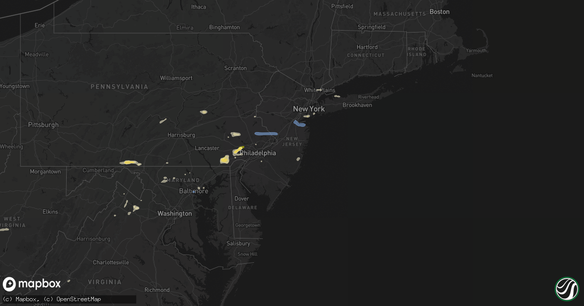
Hail Map in New Jersey on May 20, 2026
Get this storm
May 20 map
$229
one time, instant access
Download today. No call, no setup
Keep the $229
Bought the map and want the full workflow? Apply the entire $229 to a subscription within 7 days. None of it is wasted.
Every map, not just this one
This buys you this map. Subscription and you get every map we run, in the markets you choose from a few cities to whole states to nationwide. Plus real-time alerts the moment a storm fires.
Contact data
Name, contact info, occupancy, even credit band for addresses in the footprint. You go from where it hit to who to call.
Become the source they trust
Unlimited branding weather history reports on demand. You already have the documented answer ready for the property owner, and you are the one who showed up with it.
Property data and RoofTrace estimates
Pull up any address you have got, its value and the exact code rules for that jurisdiction, straight from One Click Code. Then RoofTrace estimates the squares, pitch, and roof value, priced the way you price.
Storm reports in New Jersey
New Jersey
| Date | Description |
|---|---|
| 05/20/20265:53 PM CDT | Transformer exploded. Several large poles down on seacrest rd. Time approximate from kdix radar. |
| 05/20/20265:53 PM CDT | Several trees and wires down around west long branch. Time estimated from radar. |
| 05/20/20265:52 PM CDT | Trees and wires down in neptune as well as a report of a few trees into some houses. Time estimated from radar. |
| 05/20/20265:52 PM CDT | Multiple reports of trees into homes. Time estimated from radar. |
| 05/20/20265:48 PM CDT | Swath of trees and wires down in middletown township. Time estimated from radar. |
| 05/20/20265:45 PM CDT | Wires down and snapped telephone poles on plum lane in holmdel nj. |
| 05/20/20265:30 PM CDT | Social media images of several large tree limbs down as well as some trees across edison and metuchen. Time approximate from kdix radar. |
| 05/20/20265:30 PM CDT | Picture on social media showed multiple large limbs blown down. Time estimated from radar. |
| 05/20/20265:11 PM CDT | Social media image of a large tree limb down. Time approximate from kdix radar. |
| 05/20/20265:10 PM CDT | Wires down along taunton road and himmelein road in medford... Likely due to the outflow boundary. Time estimated from radar. |
| 05/20/20265:06 PM CDT | Several wires down across bordentown and chesterfield. Time estimated from radar. |
| 05/20/20265:05 PM CDT | Wires down in hainesport along marne highway... Likely due to outflow boundary. Time estimated from radar. |
| 05/20/20264:57 PM CDT | Several trees and wires down around hopewell. Time estimated from radar. |
| 05/20/20264:50 PM CDT | Two trees were blown down by a strong wind gust ahead of the rain starting. |
All States Impacted by Hail Map on May 20, 2026
Cities Impacted by Hail Map on May 20, 2026
- Crane, TX
- Seminole, TX
- Seagraves, TX
- Warfordsburg, PA
- Needmore, PA
- Big Cove Tannery, PA
- Mercersburg, PA
- Midland, TX
- Andrews, TX
- Stanton, TX
- Lenorah, TX
- Tarzan, TX
- Goldsmith, TX
- Greencastle, PA
- Brownfield, TX
- Lebanon, TN
- Big Lake, TX
- Midkiff, TX
- Gordonsville, TN
- Carthage, TN
- Riddleton, TN
- Millerstown, PA
- Ickesburg, PA
- Gettysburg, PA
- Sandy Hook, KY
- West Liberty, KY
- Fort Valley, VA
- Knott, TX
- Gainesboro, TN
- Pleasant Shade, TN
- Big Spring, TX
- Menlo, GA
- Albany, KY
- Elkfork, KY
- Frederick, MD
- Whitleyville, TN
- Monticello, KY
- Wayne, WV
- Winchester, VA
- Alpha, KY
- White Post, VA
- Front Royal, VA
- Valley Head, AL
- Rising Fawn, GA
- Huntington, WV
- Prichard, WV
- Boyce, VA
- Celina, TN
- Tremont, PA
- Branchdale, PA
- Pottsville, PA
- Hegins, PA
- Linden, VA
- Union Bridge, MD
- Woodsboro, MD
- New Windsor, MD
- Lavalette, WV
- New Market, MD
- Walkersville, MD
- Round Hill, VA
- Mount Airy, MD
- Branchland, WV
- Barboursville, WV
- East Lynn, WV
- Markham, VA
- Delaplane, VA
- Upperville, VA
- Paris, VA
- Westminster, MD
- Hilham, TN
- Upperco, MD
- Fort Davis, TX
- Saint Albans, WV
- Poca, WV
- Nitro, WV
- Winfield, WV
- Scott Depot, WV
- Allons, TN
- Charleston, WV
- Alpine, TX
- Parkton, MD
- Reisterstown, MD
- Monroe, TN
- Livingston, TN
- Marathon, TX
- Scarsdale, NY
- White Plains, NY
- Hartsdale, NY
- Northport, NY
- Douglassville, PA
- Birdsboro, PA
- Oxford, PA
- Boyertown, PA
- Kennett Square, PA
- West Chester, PA
- Downingtown, PA
- Coatesville, PA
- Elkview, WV
- Cochranville, PA
- West Grove, PA
- Lincoln University, PA
- Pottstown, PA
- Gilbertsville, PA
- Rosedale, MD
- West Harrison, NY
- Purchase, NY
- Malvern, PA
- Immaculata, PA
- Baltimore, MD
- Clendenin, WV
- Schwenksville, PA
- Exton, PA
- Essex, MD
- Middle River, MD
- Cheyney, PA
- Thornton, PA
- Glen Mills, PA
- Kintnersville, PA
- Riegelsville, PA
- Landenberg, PA
- Avondale, PA
- Paoli, PA
- Berwyn, PA
- Fort Stockton, TX
- Procious, WV
- Amma, WV
- Bomont, WV
- Wallback, WV
- Newton, WV
- Centerport, NY
- Ivydale, WV
- Glenside, PA
- Chadds Ford, PA
- Nebo, WV
- Duck, WV
- Frametown, WV
- Blackwood, NJ
- Woodbury, NJ
- Wayne, PA
- Harleysville, PA
- Souderton, PA
- Telford, PA
- Collegeville, PA
- Oreland, PA
- Flourtown, PA
- Philadelphia, PA
- Staten Island, NY
- Sutton, WV
- Brooklyn, NY
- Myakka City, FL
- Rockford, AL
- Sylacauga, AL
- Forked River, NJ
- Goodwater, AL
- Parrish, FL
- Wimauma, FL
- Lithia, FL
- Riverview, FL
- Glasgow, VA
- Buena Vista, VA
- Lexington, VA
- Ozona, TX
- Menard, TX
- Trinidad, CO
- Eldorado, TX
- Sonora, TX
- Estillfork, AL
- Model, CO
- Brady, TX
- Chapmanville, WV
- Hext, TX
- Fort McKavett, TX
- Junction, TX
- London, TX
- Hebbronville, TX
- Laredo, TX
- Mason, TX
- Bruni, TX
- Zapata, TX
- Roma, TX
- Rio Grande City, TX
- Realitos, TX
- Concepcion, TX
- Benavides, TX
- Uvalde, TX
- Alice, TX
- Premont, TX
- Camp Wood, TX
- Barksdale, TX
- Leakey, TX
- Roanoke, VA
- Richboro, PA
- Jamison, PA
- Lawrence Township, NJ
- Warminster, PA
- New Hope, PA
- Titusville, NJ
- Morrisville, PA
- Doylestown, PA
- Trenton, NJ
- Newtown, PA
- Chalfont, PA
- Washington Crossing, PA
- Pennington, NJ
- Warrington, PA
- Furlong, PA
- Holmdel, NJ
- Hazlet, NJ
- Parlin, NJ
- Cliffwood, NJ
- Port Monmouth, NJ
- South Amboy, NJ
- Matawan, NJ
- Keansburg, NJ
- Sayreville, NJ
- Keyport, NJ
- Belford, NJ
- Middletown, NJ


