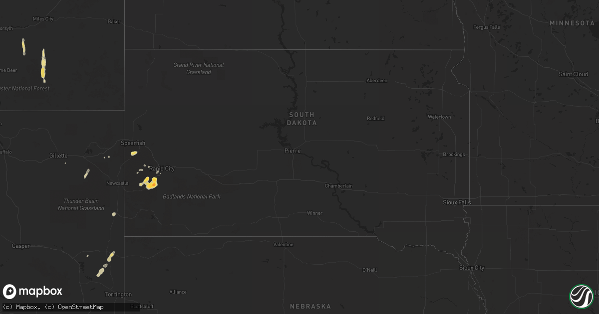
Hail Map in South Dakota on May 20, 2016
Get this storm
May 20 map
$229
one time, instant access
Download today. No call, no setup
Keep the $229
Bought the map and want the full workflow? Apply the entire $229 to a subscription within 7 days. None of it is wasted.
Every map, not just this one
This buys you this map. Subscription and you get every map we run, in the markets you choose from a few cities to whole states to nationwide. Plus real-time alerts the moment a storm fires.
Contact data
Name, contact info, occupancy, even credit band for addresses in the footprint. You go from where it hit to who to call.
Become the source they trust
Unlimited branding weather history reports on demand. You already have the documented answer ready for the property owner, and you are the one who showed up with it.
Property data and RoofTrace estimates
Pull up any address you have got, its value and the exact code rules for that jurisdiction, straight from One Click Code. Then RoofTrace estimates the squares, pitch, and roof value, priced the way you price.
Storm reports in South Dakota
South Dakota
| Date | Description |
|---|---|
| 05/20/20166:55 PM CDT | At the corner of playhouse/iron mountain road. Hail is covering road. |
| 05/20/20165:20 PM CDT | Most of ground covered by hail |
| 05/20/20165:16 PM CDT | 8 inches of hail accumulated. Motorists stranded on iron mountain road. Snow plows have been called out to clear roads. |
| 05/20/20165:00 PM CDT | Penny to quarter size hail. Still falling at time of report. |
| 05/19/20169:31 PM CDT | Quarter to ping pong ball size hail |
| 05/19/20167:39 PM CDT | Ground covered in hail |
| 05/19/20167:30 PM CDT | Ground completely covered in hail |
| 05/19/20167:00 PM CDT | A local report indicates 1.50 inch wind near 6 S KEYSTONE |
All States Impacted by Hail Map on May 20, 2016
Cities Impacted by Hail Map on May 20, 2016
- Lusk, WY
- Jay Em, WY
- Hermosa, SD
- Keystone, SD
- Volborg, MT
- Bridger, MT
- Custer, SD
- Sundance, WY
- Mims, FL
- Rapid City, SD
- Hill City, SD
- Sugar City, ID
- Rexburg, ID
- Saint Anthony, ID
- Parker, ID
- Otter, MT
- Forsyth, MT
- Broadview, MT
- Rapelje, MT
- Park City, MT
- Columbus, MT
- Molt, MT
- Moorcroft, WY
- Upton, WY
- Lance Creek, WY
- Powell, WY
- Belfry, MT
- Lead, SD
- Manville, WY
- New Smyrna Beach, FL
- Cody, WY
- Lavina, MT
- Lodge Grass, MT
- Edgewater, FL
- Oak Hill, FL
- Columbus, MS
- Caledonia, MS
- Tremont, MS
- Hamilton, AL
- Vina, AL
- Hodges, AL
- Labelle, FL
- Land O'Lakes, FL
- Tampa, FL
- Lutz, FL
- Gillette, WY
- Deadwood, SD
- Smithville, MS
- Osteen, FL


