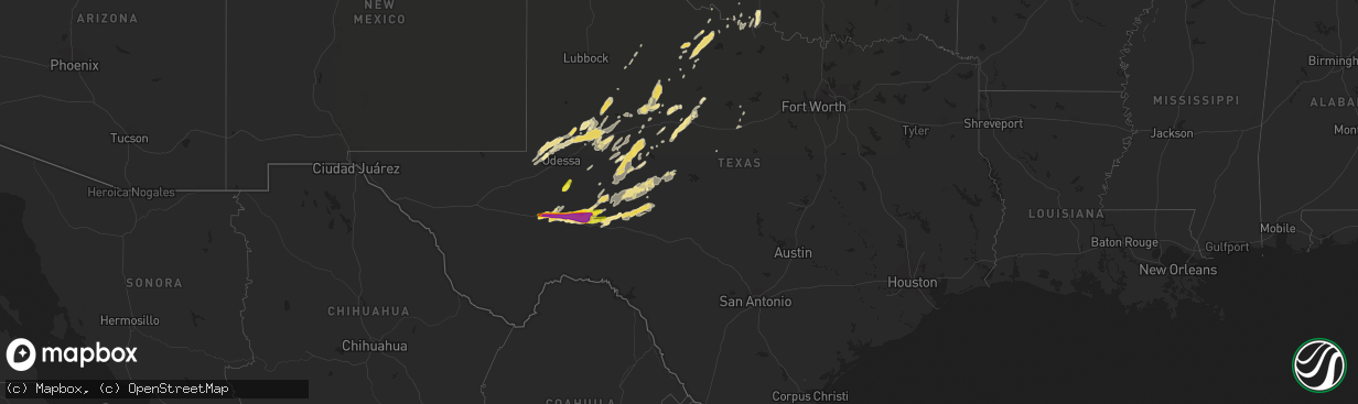
Hail Map in Texas on May 17, 2019
The weather event in Texas on May 17, 2019 includes Hail map. 19 states and 563 cities were impacted and suffered possible damage. The total estimated number of properties impacted is 1,148.
Want more than just the map?
Turn this storm into a full workflow.
- Owner + property data so you know who to knock
- OnDemand branded weather history reports to win the "did we even have hail?" argument
- RoofTrace estimate so reps stop guessing numbers at the door
Bought this map? Upgrade within 7 days and we'll credit the $230. (10-15 min setup call)
Hail
1,148
Estimated number of impacted properties by a 1.00" hail or larger972
Estimated number of impacted properties by a 1.75" hail or larger913
Estimated number of impacted properties by a 2.50" hail or largerStorm reports in Texas
Texas
| Date | Description |
|---|---|
| 05/17/20196:59 PM CDT | A local report indicates 1.75 inch wind near IRAAN |
| 05/17/20196:26 PM CDT | A local report indicates 1.50 inch wind near 12 W IRAAN |
| 05/17/20194:48 PM CDT | Public reported tornado just south of i-10 at approximately mile marker 285. |
| 05/17/20194:30 PM CDT | Hail was reported on i-10 between mile marker 274 and 276. |
| 05/17/20194:22 PM CDT | Hail was reported at the intersection of i-10 and hwy 67. |
| 05/17/20194:05 PM CDT | Hail was reported on i-10 at mile marker 267 by local emergency management. |
| 05/17/20193:54 PM CDT | Hail reported on i-10 at mile marker 267 by local emergency management. |
| 05/17/20193:48 PM CDT | A local report indicates 1.25 inch wind near 7 E FORT STOCKTON |
| 05/17/20196:40 AM CDT | At 1140 PM CDT, a severe thunderstorm was located 7 miles north of Ozona, moving northeast at 30 mph. HAZARD...Ping pong ball size hail and 60 mph wind gusts. SOURCE...Radar indicated. IMPACT...People and animals outdoors will be injured. Expect hail damage to roofs, siding, windows, and vehicles. Expect wind damage to roofs, siding, and trees. This severe thunderstorm will remain over mainly rural areas of western Schleicher and northeastern Crockett Counties, including the following locations... Us-190 Near The Crockett-Sutton County Line and The Intersection Of Us 190 And Highway 163.This includes Interstate 10 between Mile Markers 361 and 370. |
| 05/17/20196:15 AM CDT | Trees were uprooted... Home and roof were damaged... And a water trough from an unknown location was blown into the yard. |
| 05/17/20196:08 AM CDT | At 1107 PM CDT, a severe thunderstorm was located 11 miles northwest of Ozona, moving northeast at 30 mph. HAZARD...60 mph wind gusts and half dollar size hail. SOURCE...Radar indicated. IMPACT...Hail damage to vehicles is expected. Expect wind damage to roofs, siding, and trees. This severe thunderstorm will remain over mainly rural areas of west central Schleicher, northeastern Crockett and south central Irion Counties, including the following locations... Us-190 Near The Crockett-Sutton County Line and The Intersection Of Us 190 And Highway 163.This includes Interstate 10 between Mile Markers 350 and 368. |
| 05/17/20195:53 AM CDT | Damage to numerous homes was reported on south 7th street... South of downtown abilene. |
| 05/17/20195:53 AM CDT | Roofs were blown off homes... And trees are down on the northwest side of abilene. |
| 05/17/20195:38 AM CDT | Damage was reported to numerous homes on the north side of san angelo. |
| 05/17/20195:36 AM CDT | A building was collapsed at boys ranch. |
| 05/17/20195:36 AM CDT | Roofs were damaged at several homes in the dove creek subdivision. |
| 05/17/20193:24 AM CDT | At 823 PM CDT, a severe thunderstorm was located 18 miles east of Sheffield, moving east at 25 mph. HAZARD...60 mph wind gusts and quarter size hail. SOURCE...Radar indicated. IMPACT...Hail damage to vehicles is expected. Expect wind damage to roofs, siding, and trees. This severe thunderstorm will be near... Ozona around 915 PM CDT.Other locations impacted by this severe thunderstorm include TheIntersection Of I-10 And Highway 405 and The Intersection Of I-10 AndHighway 290.This includes Interstate 10 between Mile Markers 340 and 366. |
| 05/17/20192:42 AM CDT | At 738 PM CDT, a severe thunderstorm was located 13 miles east of Iraan, or 17 miles northeast of Sheffield, moving east at 25 mph. Also, another severe thunderstorm was located along Interstate 10, near the Pecos River, moving east at 25 mph. HAZARD...Ping pong ball size hail and 60 mph wind gusts. SOURCE...Radar indicated. IMPACT...People and animals outdoors will be injured. Expect hail damage to roofs, siding, windows, and vehicles. Expect wind damage to roofs, siding, and trees. This severe thunderstorm will remain over mainly rural areas of north central Crockett County, including the following locations... Ft Lancaster, The Intersection Of I-10 And Highway 405, The Intersection Of I-10 And Highway 290 and I-10 Near The Crockett-Pecos County Line.This includes Interstate 10 between Mile Markers 327 and 357. |
| 05/17/20192:14 AM CDT | Thunderstorm wind damage to a residence 12 miles north of eldorado... In northern schleicher county. Large live oak trees were blown over... A window was blown out of a |
| 05/17/20192:14 AM CDT | The schleicher county sheriff office reported a roof blown off of a residence 12 miles north of eldorado... On county road 431. |
| 05/17/20191:56 AM CDT | At 655 PM CDT, a severe thunderstorm was located 14 miles south of Texon, or 17 miles southwest of Big Lake, moving east at 25 mph. HAZARD...60 mph wind gusts and quarter size hail. SOURCE...Radar indicated. IMPACT...Hail damage to vehicles is expected. Expect wind damage to roofs, siding, and trees. This severe thunderstorm will remain over mainly rural areas of north central Crockett County. |
| 05/17/20191:44 AM CDT | At 644 PM CDT, a severe thunderstorm was located near McCamey, moving northeast at 25 mph. HAZARD...60 mph wind gusts and half dollar size hail. SOURCE...Radar indicated. IMPACT...Hail damage to vehicles is expected. Expect wind damage to roofs, siding, and trees. Locations impacted include... McCamey, Rankin and Upton County Airport. |
| 05/17/20191:30 AM CDT | At 629 PM CDT, a severe thunderstorm was located near Iraan, or 18 miles south of Rankin, moving east at 25 mph. HAZARD...60 mph wind gusts and quarter size hail. SOURCE...Radar indicated. IMPACT...Hail damage to vehicles is expected. Expect wind damage to roofs, siding, and trees. This severe thunderstorm will remain over mainly rural areas of north central Crockett County. |
| 05/17/20191:19 AM CDT | At 618 PM CDT, a severe thunderstorm was located near Crane, moving north at 30 mph. HAZARD...Golf ball size hail and 60 mph wind gusts. SOURCE...Radar indicated. IMPACT...People and animals outdoors will be injured. Expect hail damage to roofs, siding, windows, and vehicles. Expect wind damage to roofs, siding, and trees. Locations impacted include... Crane, King Mountain, Pleasant Farms and Crane County Airport. |
| 05/17/201912:43 AM CDT | At 542 PM CDT, a severe thunderstorm was located 21 miles southwest of McCamey, moving northeast at 20 mph. HAZARD...Two inch hail and 60 mph wind gusts. SOURCE...Radar indicated. IMPACT...People and animals outdoors will be injured. Expect hail damage to roofs, siding, windows, and vehicles. Expect wind damage to roofs, siding, and trees. Locations impacted include... McCamey, Upton County Airport, Bakersfield and Girvin. This includes Interstate 10 between mile markers 281 and 301. |
| 05/16/201911:39 PM CDT | At 438 PM CDT, a severe thunderstorm was located 18 miles east of Fort Stockton, moving east at 30 mph. Hail up to tennis ball size has been reported with this storm. HAZARD...Tennis ball size hail and 60 mph wind gusts. SOURCE...Radar indicated. IMPACT...People and animals outdoors will be injured. Expect hail damage to roofs, siding, windows, and vehicles. Expect wind damage to roofs, siding, and trees. Locations impacted include... McCamey, Iraan, Iraan Municipal Airport, Upton County Airport, Bakersfield and Girvin.This includes Interstate 10 between mile markers 273 and 314. |
| 05/16/201910:52 PM CDT | At 351 PM CDT, a severe thunderstorm was located near Fort Stockton, moving northeast at 30 mph. At 350PM, one and a half inch hail was reported along I-10, 7 miles east of Fort Stockton. HAZARD...60 mph wind gusts and half dollar size hail. SOURCE...Radar indicated. IMPACT...Hail damage to vehicles is expected. Expect wind damage to roofs, siding, and trees. Locations impacted include... Fort Stockton, McCamey, Fort Stockton-Pecos County Airport, Girvin, Cordona Lake and Upton County Airport.This includes Interstate 10 between mile markers 258 and 280. |
| 05/16/20197:05 PM CDT | A local report indicates 2.50 inch wind near IRAAN |
All States Impacted by Hail Map on May 17, 2019
Cities Impacted by Hail Map on May 17, 2019
- New Richland, MN
- Ewing, NE
- Valentine, NE
- Chambers, NE
- Grover, CO
- Bushnell, NE
- Cyril, OK
- Elwood, NE
- Butler, KY
- Alexandria, KY
- Geddes, SD
- Hurricane, WV
- Taylor, NE
- Thedford, NE
- Blackwell, TX
- Charleston, WV
- Elkview, WV
- Wright, KS
- Spearville, KS
- Ford, KS
- Padroni, CO
- Stanton, TX
- Broken Bow, NE
- Oconto, NE
- Roby, TX
- Sylvester, TX
- Merino, CO
- Iliff, CO
- Atwood, CO
- Fleming, CO
- Sterling, CO
- Crook, CO
- Newport, KY
- Latonia, KY
- Atwood, KS
- Mineral Wells, WV
- Elizabeth, WV
- Rockport, WV
- Belleville, WV
- Leon, WV
- Liberty, WV
- Buffalo, WV
- Stapleton, NE
- Mullen, NE
- Kinsley, KS
- Sidney, NE
- San Angelo, TX
- Ballinger, TX
- Rowena, TX
- Miles, TX
- Georgetown, OH
- Westbrook, TX
- Loraine, TX
- Robert Lee, TX
- Sterling City, TX
- Andrews, TX
- Goldsmith, TX
- Bassett, NE
- Minford, OH
- Portsmouth, OH
- Wheelersburg, OH
- Grayson, KY
- Lucasville, OH
- Fletcher, OK
- Apache, OK
- Cement, OK
- Anadarko, OK
- Elgin, OK
- Sedgwick, CO
- Ovid, CO
- Chappell, NE
- Saint Francis, SD
- Ainsworth, NE
- Long Pine, NE
- Franklin, GA
- Kersey, CO
- La Salle, CO
- Brady, NE
- Wellington, CO
- Bird City, KS
- Benkelman, NE
- Wellfleet, NE
- Meade, KS
- Plains, KS
- Forgan, OK
- Franklin, NC
- Otto, NC
- Wood Lake, MN
- Crosbyton, TX
- Springview, NE
- Johnstown, NE
- Loup City, NE
- Vernon, TX
- Seymour, TX
- Crowell, TX
- Trenton, NE
- Stratton, NE
- Iraan, TX
- Fort Stockton, TX
- Eldorado, TX
- Venango, NE
- Callaway, NE
- Arnold, NE
- Beloit, KS
- Barnard, KS
- Plainville, KS
- Macksville, KS
- Colorado City, TX
- Big Lake, TX
- Ogallala, NE
- Brule, NE
- Grant, NE
- Brewster, NE
- Palisade, NE
- Culbertson, NE
- Cimarron, KS
- Independence, KY
- Foster, KY
- Felicity, OH
- Moscow, OH
- Morning View, KY
- California, KY
- Neville, OH
- Oshkosh, NE
- Randlett, OK
- Walters, OK
- Keystone, NE
- McCamey, TX
- Arco, MN
- Tyler, MN
- French Creek, WV
- Cleveland, WV
- Crawford, WV
- Rock Cave, WV
- Big Spring, TX
- Garden City, TX
- Anson, TX
- McCaulley, TX
- Sweetwater, TX
- Elkton, SD
- Union, IA
- Platteville, CO
- Formoso, KS
- Abilene, TX
- Tye, TX
- Merkel, TX
- Augusta, KY
- Ripley, OH
- Dover, KY
- Dalton, NE
- Paradise, KS
- Russell, KS
- Gorham, KS
- Carrollton, GA
- McRae Helena, GA
- Offerle, KS
- Gothenburg, NE
- Cozad, NE
- Moorefield, NE
- Stockville, NE
- Curtis, NE
- Farnam, NE
- Willow Island, NE
- Carpenter, WY
- Burns, WY
- Coolville, OH
- Verdigre, NE
- Winnetoon, NE
- Center, NE
- Maywood, NE
- Ozona, TX
- Hartington, NE
- Wausa, NE
- Crawfordsville, IA
- Albany, TX
- Briggsdale, CO
- Hillsboro, OH
- Peebles, OH
- Electra, TX
- Chickasha, OK
- North Platte, NE
- Tryon, NE
- Albany, OH
- Wilkesville, OH
- Rutland, OH
- Langsville, OH
- Palmyra, VA
- Farmington, MN
- Rosemount, MN
- Alum Creek, WV
- Red House, WV
- Poca, WV
- Overton, NE
- Bertrand, NE
- Hermleigh, TX
- Olivet, SD
- Tyndall, SD
- Maxwell, NE
- Carrollton, KY
- Ingalls, KS
- Lewellen, NE
- Butterfield, MN
- Darfur, MN
- Mertzon, TX
- Munday, TX
- Burwell, NE
- Rotan, TX
- Aspermont, TX
- Grandfield, OK
- Scotland, SD
- Loveland, OK
- Lawrenceburg, IN
- Aurora, IN
- Guilford, IN
- Seneca, NE
- Wayland, IA
- Saint Albans, WV
- Nitro, WV
- Scott Depot, WV
- Merna, NE
- Lexington, NE
- Oak Hill, OH
- Kermit, WV
- Lenore, WV
- Eddyville, NE
- Edson, KS
- Abilene, KS
- Gurley, NE
- Rutland, SD
- Washington, WV
- Little Hocking, OH
- Athens, OH
- Stewart, OH
- Guysville, OH
- Palestine, WV
- Fort Collins, CO
- Victoria, KS
- Larned, KS
- Wagner, SD
- Egan, SD
- Flandreau, SD
- Republic, KS
- Tarzan, TX
- Ellis, KS
- Gail, TX
- Devol, OK
- Burkburnett, TX
- Broadwater, NE
- Lisco, NE
- Big Springs, NE
- Harrold, TX
- Logan, KS
- Stockton, KS
- Phillipsburg, KS
- Ness City, KS
- Jetmore, KS
- Sutherland, NE
- Arthur, NE
- Whitman, NE
- Pine Bluffs, WY
- Anselmo, NE
- Dunning, NE
- Minneola, KS
- Christoval, TX
- Haxtun, CO
- Clendenin, WV
- Stoneham, CO
- New Raymer, CO
- Odin, MN
- Americus, GA
- Belle, WV
- Cedar Grove, WV
- Glasgow, WV
- East Bank, WV
- Hayes Center, NE
- Goodland, KS
- Lesterville, SD
- Utica, SD
- Menno, SD
- Nunn, CO
- Carr, CO
- South Webster, OH
- Chillicothe, MO
- Oneill, NE
- Milan, IN
- Sunman, IN
- McDonald, KS
- Ruthton, MN
- Lake Benton, MN
- Litchfield, NE
- Arcadia, NE
- Hershey, NE
- Montgomery, WV
- Kimberly, WV
- Handley, WV
- Powellton, WV
- Hansford, WV
- Pratt, WV
- Gallagher, WV
- Midland, TX
- Erie, CO
- Springfield, SD
- Tabor, SD
- Niobrara, NE
- Buffalo, WY
- Marietta, OH
- Ninnekah, OK
- Amber, OK
- Rush Springs, OK
- Tuttle, OK
- Lake Andes, SD
- Glade Spring, VA
- Snyder, TX
- Miller, NE
- Coahoma, TX
- Lucas, KS
- Waldo, KS
- Luray, KS
- Osborne, KS
- Gallipolis Ferry, WV
- Gordon, WV
- Madison, WV
- Loveland, CO
- Greeley, CO
- Windsor, CO
- Milliken, CO
- Johnstown, CO
- Yolyn, WV
- Amherstdale, WV
- Garfield, KS
- Tuscola, TX
- Hawley, TX
- Justiceburg, TX
- Webber, KS
- Ionia, IA
- Alta Vista, IA
- White, SD
- Aurora, SD
- Ranger, TX
- Lockridge, IA
- Mount Pleasant, IA
- Sod, WV
- Ira, TX
- Great Bend, KS
- Dodge City, KS
- Lewis, KS
- St John, KS
- Pawnee Rock, KS
- McCook, NE
- Liebenthal, KS
- La Crosse, KS
- Hays, KS
- Lenorah, TX
- Lynchburg, OH
- Midland, OH
- Blanchester, OH
- Dickens, TX
- Sumner, NE
- Mason City, IA
- Scandia, KS
- Courtland, KS
- Norway, KS
- Cottonwood, MN
- Echo, MN
- Marshall, MN
- Vesta, MN
- Bartlett, NE
- Inman, NE
- Knott, TX
- Parkersburg, WV
- Belpre, OH
- Bethany, MO
- Mills, NE
- Culloden, WV
- Freeman, SD
- Marion, SD
- Cheyenne, WY
- Lincoln, KS
- Amelia, NE
- Lemoyne, NE
- Peetz, CO
- Snyder, CO
- Otis, KS
- Cynthiana, KY
- Haviland, KS
- Lynd, MN
- Russell, MN
- Everly, IA
- Hartley, IA
- Pleasanton, NE
- Amherst, NE
- Winfield, IA
- Barnhart, TX
- Letart, WV
- West Columbia, WV
- Fowler, KS
- Hoisington, KS
- Minneapolis, KS
- Tescott, KS
- Eaton, CO
- Creston, WV
- Spencer, WV
- Solomon, KS
- Lueders, TX
- Ellaville, GA
- Andersonville, GA
- Dorrance, KS
- Bunker Hill, KS
- Dante, SD
- Clay Center, KS
- Aberdeen, OH
- Maysville, KY
- Elsmere, NE
- Herrick, SD
- Burke, SD
- Clemons, IA
- Saint Anthony, IA
- Rochester, TX
- Rule, TX
- Cheshire, OH
- Scottsville, VA
- Mission, SD
- Parmelee, SD
- Deer Trail, CO
- Elyria, NE
- Sylvan Grove, KS
- Fort Morgan, CO
- Bruceton Mills, WV
- Old Glory, TX
- Viborg, SD
- Gardendale, TX
- Ackerly, TX
- Purdum, NE
- Halsey, NE
- Mason, WV
- Spur, TX
- Clio, AL
- Liscomb, IA
- Zearing, IA
- State Center, IA
- Elm Creek, NE
- Dilliner, PA
- Point Marion, PA
- Lodgepole, NE
- Randolph, KS
- Ord, NE
- Comstock, NE
- Iowa Park, TX
- Lynch, NE
- Glade, KS
- Berthoud, CO
- Longmont, CO
- Eustis, NE
- Smithfield, NE
- Colo, IA
- Albion, IA
- Afton, TX
- Eastland, TX
- Ansley, NE
- Galeton, CO
- Westerville, NE
- Mason City, NE
- Rhine, GA
- Milan, GA
- Dyess Afb, TX
- Wingate, TX
- Breckenridge, TX
- Caddo, TX
- Goodfellow Afb, TX
- Timnath, CO
- Fluvanna, TX
- Walker, KS
- Milton, WV
- Tornado, WV
- Glasco, KS
- Manchester, OH
- Marquette, KS
- Moores Hill, IN
- Ellinwood, KS
- Claflin, KS
- Bushton, KS
- Holyrood, KS
- Kaycee, WY
- McCracken, KS
- Okaton, SD
- Hunter, KS
- Downs, KS
- Esbon, KS
- Walton, KY
- De Mossville, KY
- Purdin, MO
- Browning, MO
- Hudson, KS
- Davidson, OK
- South Charleston, WV
- Natoma, KS
- Banks, AL
- Temple, OK
- Breckenridge, MO
- Mooresville, MO
- Stuart, NE
- Norborne, MO
- Cottageville, WV
- Blanchard, OK
- Wood Lake, NE
- Coleman, TX
- Wauneta, NE
- Apple Grove, WV
- Crown City, OH
- Gallipolis, OH
- Avon, SD
- Bloomfield, NE
- Winterset, IA
- Van Meter, IA
- Jewell, KS
- Lovely, KY
- Spencer, NE
- Southside, WV
- Barboursville, WV
- Ona, WV
- Kermit, TX
- Odessa, TX
- Saint Marys, WV
- Waverly, WV
- Trenton, MO
- Weinert, TX
- Olivia, MN
- O'Brien, TX
- Plains, GA
- Kiahsville, WV
- Harts, WV
- Lake Park, IA
- Harris, IA
- West Union, OH
- Wilson, KS
- Huron, SD
- Alpena, SD
- Whitesburg, GA
- Roscoe, TX
- Lake, WV
- Pecks Mill, WV
- Clothier, WV
- Hewett, WV
- Big Creek, WV
- Chapmanville, WV
- Evans, WV
- Given, WV
- Point Pleasant, WV
- Mount Alto, WV
- Beverly, KS
- Morgantown, WV
- Raymond, KS
- Chase, KS
- Paxton, NE
- Copeland, KS
- Montezuma, KS
- Cawker City, KS
- Dacono, CO
- Brighton, CO
- Hudson, CO
- Conrad, IA
- Marshalltown, IA
- Midkiff, TX


