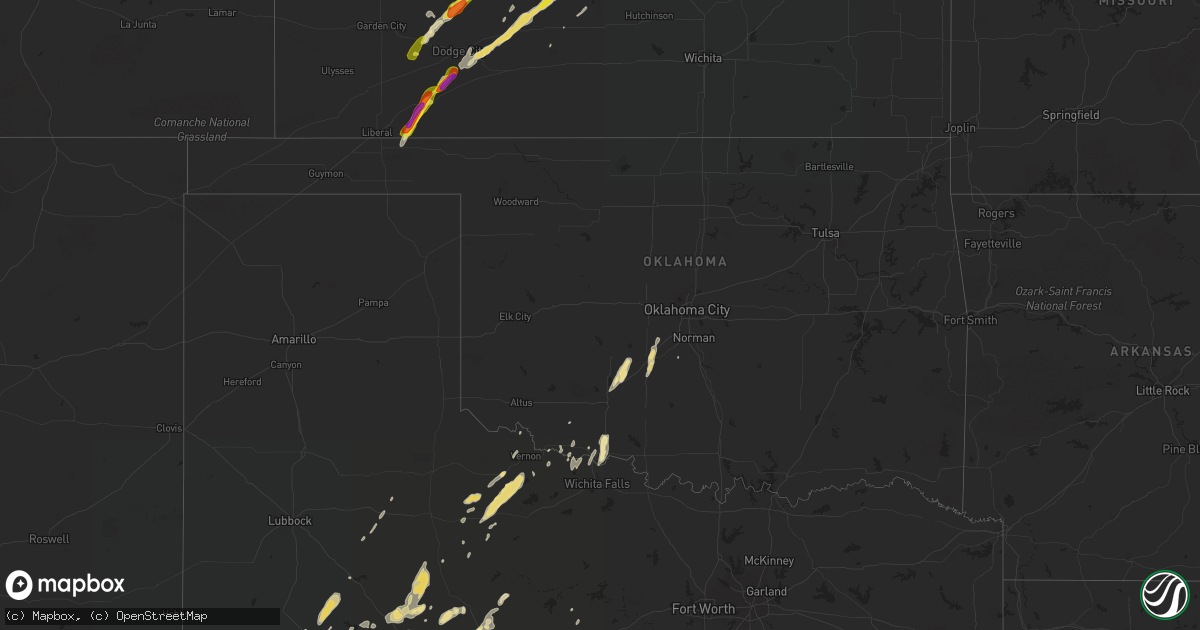
Hail Map in Oklahoma on May 17, 2019
Get this storm
May 17 map
$229
one time, instant access
Download today. No call, no setup
Keep the $229
Bought the map and want the full workflow? Apply the entire $229 to a subscription within 7 days. None of it is wasted.
Every map, not just this one
This buys you this map. Subscription and you get every map we run, in the markets you choose from a few cities to whole states to nationwide. Plus real-time alerts the moment a storm fires.
Contact data
Name, contact info, occupancy, even credit band for addresses in the footprint. You go from where it hit to who to call.
Become the source they trust
Unlimited branding weather history reports on demand. You already have the documented answer ready for the property owner, and you are the one who showed up with it.
Property data and RoofTrace estimates
Pull up any address you have got, its value and the exact code rules for that jurisdiction, straight from One Click Code. Then RoofTrace estimates the squares, pitch, and roof value, priced the way you price.
Storm reports in Oklahoma
Oklahoma
| Date | Description |
|---|---|
| 05/17/20196:40 AM CDT | Time based on radar. |
| 05/17/20196:29 AM CDT | Picture via twitter. |
| 05/17/20192:19 AM CDT | At 719 PM CDT, a severe thunderstorm was located 8 miles north of Forgan, or 11 miles southwest of Meade State Park, moving north at 40 mph. HAZARD...Golf ball size hail and 60 mph wind gusts. SOURCE...Radar indicated. IMPACT...People and animals outdoors will be injured. Expect hail damage to roofs, siding, windows, and vehicles. Expect wind damage to roofs, siding, and trees. Locations impacted include... Meade, Fowler, Kismet, Meade State Park, Missler and Plains. |
| 05/16/20197:35 PM CDT | Based on radar... Pictures... Reports... And videos... The best estimate was a touchdown around 735pm and crossed over the ok/ks state line around 741 pm. |
| 05/16/20197:35 PM CDT | The tornado spun up very quickly near the state line and moved northeast. |
| 05/16/20197:33 PM CDT | Based on radar... Pictures... Reports... And videos... The best estimate was a touchdown around 733pm and crossed over the ok/ks state line around 735 pm. It then conti |
All States Impacted by Hail Map on May 17, 2019
Cities Impacted by Hail Map on May 17, 2019
- New Richland, MN
- Ewing, NE
- Valentine, NE
- Chambers, NE
- Grover, CO
- Bushnell, NE
- Cyril, OK
- Elwood, NE
- Butler, KY
- Alexandria, KY
- Geddes, SD
- Hurricane, WV
- Taylor, NE
- Thedford, NE
- Blackwell, TX
- Charleston, WV
- Elkview, WV
- Wright, KS
- Spearville, KS
- Ford, KS
- Padroni, CO
- Stanton, TX
- Broken Bow, NE
- Oconto, NE
- Roby, TX
- Sylvester, TX
- Merino, CO
- Iliff, CO
- Atwood, CO
- Fleming, CO
- Sterling, CO
- Crook, CO
- Newport, KY
- Latonia, KY
- Atwood, KS
- Mineral Wells, WV
- Elizabeth, WV
- Rockport, WV
- Belleville, WV
- Leon, WV
- Liberty, WV
- Buffalo, WV
- Stapleton, NE
- Mullen, NE
- Kinsley, KS
- Sidney, NE
- San Angelo, TX
- Ballinger, TX
- Rowena, TX
- Miles, TX
- Georgetown, OH
- Westbrook, TX
- Loraine, TX
- Robert Lee, TX
- Sterling City, TX
- Andrews, TX
- Goldsmith, TX
- Bassett, NE
- Minford, OH
- Portsmouth, OH
- Wheelersburg, OH
- Grayson, KY
- Lucasville, OH
- Fletcher, OK
- Apache, OK
- Cement, OK
- Anadarko, OK
- Elgin, OK
- Sedgwick, CO
- Ovid, CO
- Chappell, NE
- Saint Francis, SD
- Ainsworth, NE
- Long Pine, NE
- Franklin, GA
- Kersey, CO
- La Salle, CO
- Brady, NE
- Wellington, CO
- Bird City, KS
- Benkelman, NE
- Wellfleet, NE
- Meade, KS
- Plains, KS
- Forgan, OK
- Franklin, NC
- Otto, NC
- Wood Lake, MN
- Crosbyton, TX
- Springview, NE
- Johnstown, NE
- Loup City, NE
- Vernon, TX
- Seymour, TX
- Crowell, TX
- Trenton, NE
- Stratton, NE
- Iraan, TX
- Fort Stockton, TX
- Eldorado, TX
- Venango, NE
- Callaway, NE
- Arnold, NE
- Beloit, KS
- Barnard, KS
- Plainville, KS
- Macksville, KS
- Colorado City, TX
- Big Lake, TX
- Ogallala, NE
- Brule, NE
- Grant, NE
- Brewster, NE
- Palisade, NE
- Culbertson, NE
- Cimarron, KS
- Independence, KY
- Foster, KY
- Felicity, OH
- Moscow, OH
- Morning View, KY
- California, KY
- Neville, OH
- Oshkosh, NE
- Randlett, OK
- Walters, OK
- Keystone, NE
- McCamey, TX
- Arco, MN
- Tyler, MN
- French Creek, WV
- Cleveland, WV
- Crawford, WV
- Rock Cave, WV
- Big Spring, TX
- Garden City, TX
- Anson, TX
- McCaulley, TX
- Sweetwater, TX
- Elkton, SD
- Union, IA
- Platteville, CO
- Formoso, KS
- Abilene, TX
- Tye, TX
- Merkel, TX
- Augusta, KY
- Ripley, OH
- Dover, KY
- Dalton, NE
- Paradise, KS
- Russell, KS
- Gorham, KS
- Carrollton, GA
- McRae Helena, GA
- Offerle, KS
- Gothenburg, NE
- Cozad, NE
- Moorefield, NE
- Stockville, NE
- Curtis, NE
- Farnam, NE
- Willow Island, NE
- Carpenter, WY
- Burns, WY
- Coolville, OH
- Verdigre, NE
- Winnetoon, NE
- Center, NE
- Maywood, NE
- Ozona, TX
- Hartington, NE
- Wausa, NE
- Crawfordsville, IA
- Albany, TX
- Briggsdale, CO
- Hillsboro, OH
- Peebles, OH
- Electra, TX
- Chickasha, OK
- North Platte, NE
- Tryon, NE
- Albany, OH
- Wilkesville, OH
- Rutland, OH
- Langsville, OH
- Palmyra, VA
- Farmington, MN
- Rosemount, MN
- Alum Creek, WV
- Red House, WV
- Poca, WV
- Overton, NE
- Bertrand, NE
- Hermleigh, TX
- Olivet, SD
- Tyndall, SD
- Maxwell, NE
- Carrollton, KY
- Ingalls, KS
- Lewellen, NE
- Butterfield, MN
- Darfur, MN
- Mertzon, TX
- Munday, TX
- Burwell, NE
- Rotan, TX
- Aspermont, TX
- Grandfield, OK
- Scotland, SD
- Loveland, OK
- Lawrenceburg, IN
- Aurora, IN
- Guilford, IN
- Seneca, NE
- Wayland, IA
- Saint Albans, WV
- Nitro, WV
- Scott Depot, WV
- Merna, NE
- Lexington, NE
- Oak Hill, OH
- Kermit, WV
- Lenore, WV
- Eddyville, NE
- Edson, KS
- Abilene, KS
- Gurley, NE
- Rutland, SD
- Washington, WV
- Little Hocking, OH
- Athens, OH
- Stewart, OH
- Guysville, OH
- Palestine, WV
- Fort Collins, CO
- Victoria, KS
- Larned, KS
- Wagner, SD
- Egan, SD
- Flandreau, SD
- Republic, KS
- Tarzan, TX
- Ellis, KS
- Gail, TX
- Devol, OK
- Burkburnett, TX
- Broadwater, NE
- Lisco, NE
- Big Springs, NE
- Harrold, TX
- Logan, KS
- Stockton, KS
- Phillipsburg, KS
- Ness City, KS
- Jetmore, KS
- Sutherland, NE
- Arthur, NE
- Whitman, NE
- Pine Bluffs, WY
- Anselmo, NE
- Dunning, NE
- Minneola, KS
- Christoval, TX
- Haxtun, CO
- Clendenin, WV
- Stoneham, CO
- New Raymer, CO
- Odin, MN
- Americus, GA
- Belle, WV
- Cedar Grove, WV
- Glasgow, WV
- East Bank, WV
- Hayes Center, NE
- Goodland, KS
- Lesterville, SD
- Utica, SD
- Menno, SD
- Nunn, CO
- Carr, CO
- South Webster, OH
- Chillicothe, MO
- Oneill, NE
- Milan, IN
- Sunman, IN
- McDonald, KS
- Ruthton, MN
- Lake Benton, MN
- Litchfield, NE
- Arcadia, NE
- Hershey, NE
- Montgomery, WV
- Kimberly, WV
- Handley, WV
- Powellton, WV
- Hansford, WV
- Pratt, WV
- Gallagher, WV
- Midland, TX
- Erie, CO
- Springfield, SD
- Tabor, SD
- Niobrara, NE
- Buffalo, WY
- Marietta, OH
- Ninnekah, OK
- Amber, OK
- Rush Springs, OK
- Tuttle, OK
- Lake Andes, SD
- Glade Spring, VA
- Snyder, TX
- Miller, NE
- Coahoma, TX
- Lucas, KS
- Waldo, KS
- Luray, KS
- Osborne, KS
- Gallipolis Ferry, WV
- Gordon, WV
- Madison, WV
- Loveland, CO
- Greeley, CO
- Windsor, CO
- Milliken, CO
- Johnstown, CO
- Yolyn, WV
- Amherstdale, WV
- Garfield, KS
- Tuscola, TX
- Hawley, TX
- Justiceburg, TX
- Webber, KS
- Ionia, IA
- Alta Vista, IA
- White, SD
- Aurora, SD
- Ranger, TX
- Lockridge, IA
- Mount Pleasant, IA
- Sod, WV
- Ira, TX
- Great Bend, KS
- Dodge City, KS
- Lewis, KS
- St John, KS
- Pawnee Rock, KS
- McCook, NE
- Liebenthal, KS
- La Crosse, KS
- Hays, KS
- Lenorah, TX
- Lynchburg, OH
- Midland, OH
- Blanchester, OH
- Dickens, TX
- Sumner, NE
- Mason City, IA
- Scandia, KS
- Courtland, KS
- Norway, KS
- Cottonwood, MN
- Echo, MN
- Marshall, MN
- Vesta, MN
- Bartlett, NE
- Inman, NE
- Knott, TX
- Parkersburg, WV
- Belpre, OH
- Bethany, MO
- Mills, NE
- Culloden, WV
- Freeman, SD
- Marion, SD
- Cheyenne, WY
- Lincoln, KS
- Amelia, NE
- Lemoyne, NE
- Peetz, CO
- Snyder, CO
- Otis, KS
- Cynthiana, KY
- Haviland, KS
- Lynd, MN
- Russell, MN
- Everly, IA
- Hartley, IA
- Pleasanton, NE
- Amherst, NE
- Winfield, IA
- Barnhart, TX
- Letart, WV
- West Columbia, WV
- Fowler, KS
- Hoisington, KS
- Minneapolis, KS
- Tescott, KS
- Eaton, CO
- Creston, WV
- Spencer, WV
- Solomon, KS
- Lueders, TX
- Ellaville, GA
- Andersonville, GA
- Dorrance, KS
- Bunker Hill, KS
- Dante, SD
- Clay Center, KS
- Aberdeen, OH
- Maysville, KY
- Elsmere, NE
- Herrick, SD
- Burke, SD
- Clemons, IA
- Saint Anthony, IA
- Rochester, TX
- Rule, TX
- Cheshire, OH
- Scottsville, VA
- Mission, SD
- Parmelee, SD
- Deer Trail, CO
- Elyria, NE
- Sylvan Grove, KS
- Fort Morgan, CO
- Bruceton Mills, WV
- Old Glory, TX
- Viborg, SD
- Gardendale, TX
- Ackerly, TX
- Purdum, NE
- Halsey, NE
- Mason, WV
- Spur, TX
- Clio, AL
- Liscomb, IA
- Zearing, IA
- State Center, IA
- Elm Creek, NE
- Dilliner, PA
- Point Marion, PA
- Lodgepole, NE
- Randolph, KS
- Ord, NE
- Comstock, NE
- Iowa Park, TX
- Lynch, NE
- Glade, KS
- Berthoud, CO
- Longmont, CO
- Eustis, NE
- Smithfield, NE
- Colo, IA
- Albion, IA
- Afton, TX
- Eastland, TX
- Ansley, NE
- Galeton, CO
- Westerville, NE
- Mason City, NE
- Rhine, GA
- Milan, GA
- Dyess Afb, TX
- Wingate, TX
- Breckenridge, TX
- Caddo, TX
- Goodfellow Afb, TX
- Timnath, CO
- Fluvanna, TX
- Walker, KS
- Milton, WV
- Tornado, WV
- Glasco, KS
- Manchester, OH
- Marquette, KS
- Moores Hill, IN
- Ellinwood, KS
- Claflin, KS
- Bushton, KS
- Holyrood, KS
- Kaycee, WY
- McCracken, KS
- Okaton, SD
- Hunter, KS
- Downs, KS
- Esbon, KS
- Walton, KY
- De Mossville, KY
- Purdin, MO
- Browning, MO
- Hudson, KS
- Davidson, OK
- South Charleston, WV
- Natoma, KS
- Banks, AL
- Temple, OK
- Breckenridge, MO
- Mooresville, MO
- Stuart, NE
- Norborne, MO
- Cottageville, WV
- Blanchard, OK
- Wood Lake, NE
- Coleman, TX
- Wauneta, NE
- Apple Grove, WV
- Crown City, OH
- Gallipolis, OH
- Avon, SD
- Bloomfield, NE
- Winterset, IA
- Van Meter, IA
- Jewell, KS
- Lovely, KY
- Spencer, NE
- Southside, WV
- Barboursville, WV
- Ona, WV
- Kermit, TX
- Odessa, TX
- Saint Marys, WV
- Waverly, WV
- Trenton, MO
- Weinert, TX
- Olivia, MN
- O'Brien, TX
- Plains, GA
- Kiahsville, WV
- Harts, WV
- Lake Park, IA
- Harris, IA
- West Union, OH
- Wilson, KS
- Huron, SD
- Alpena, SD
- Whitesburg, GA
- Roscoe, TX
- Lake, WV
- Pecks Mill, WV
- Clothier, WV
- Hewett, WV
- Big Creek, WV
- Chapmanville, WV
- Evans, WV
- Given, WV
- Point Pleasant, WV
- Mount Alto, WV
- Beverly, KS
- Morgantown, WV
- Raymond, KS
- Chase, KS
- Paxton, NE
- Copeland, KS
- Montezuma, KS
- Cawker City, KS
- Dacono, CO
- Brighton, CO
- Hudson, CO
- Conrad, IA
- Marshalltown, IA
- Midkiff, TX


