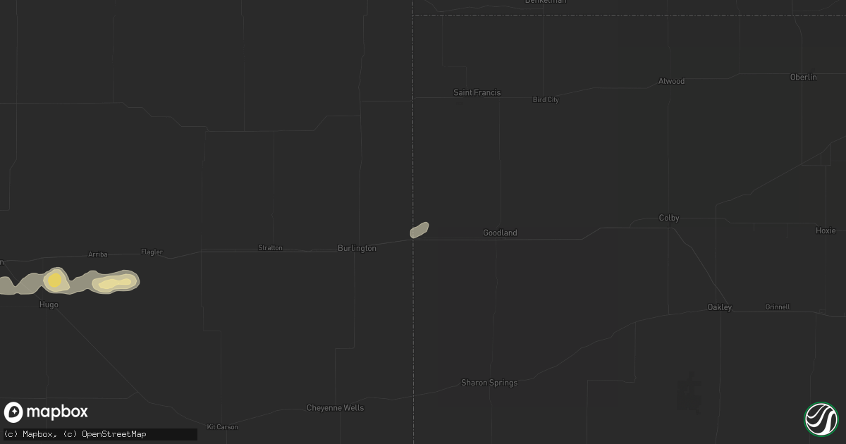
Hail Map in Kanorado, KS on May 16, 2026
Get this storm
May 16 map
$229
one time, instant access
Download today. No call, no setup
Keep the $229
Bought the map and want the full workflow? Apply the entire $229 to a subscription within 7 days. None of it is wasted.
Every map, not just this one
This buys you this map. Subscription and you get every map we run, in the markets you choose from a few cities to whole states to nationwide. Plus real-time alerts the moment a storm fires.
Contact data
Name, contact info, occupancy, even credit band for addresses in the footprint. You go from where it hit to who to call.
Become the source they trust
Unlimited branding weather history reports on demand. You already have the documented answer ready for the property owner, and you are the one who showed up with it.
Property data and RoofTrace estimates
Pull up any address you have got, its value and the exact code rules for that jurisdiction, straight from One Click Code. Then RoofTrace estimates the squares, pitch, and roof value, priced the way you price.
Storm reports in Kanorado, KS
Kanorado, KS
| Date | Description |
|---|---|
| 05/16/20266:50 PM CDT | Mesonet station fw1147 16 nw goodland. |
| 05/16/20266:40 PM CDT | Mesonet station fw1147 16 nw goodland. |
| 05/16/20266:40 PM CDT | F1147; nw sherman. |
| 05/16/20266:28 PM CDT | Relayed report from ham operator of measure 2.4 inch hail. Had been laying there a few minutes. |
| 05/16/20265:59 PM CDT | Report from mping: tennis ball |
| 05/16/20265:30 PM CDT | Social media report with video of golf ball to baseball sized hail. |
| 05/16/20265:29 PM CDT | Sherman county dispatch relayed report of one inch hail in kanorado. |
All States Impacted by Hail Map on May 16, 2026
All Cities Impacted by Hail Map on May 16, 2026
- North Vernon, IN
- Urbana, OH
- Saint Paris, OH
- Springfield, OH
- Saint Anthony, IN
- Huntingburg, IN
- Ferdinand, IN
- Celestine, IN
- Holland, IN
- Eckerty, IN
- Dale, IN
- Schnellville, IN
- Birdseye, IN
- Oblong, IL
- Sumner, IL
- Nelson, MO
- Carrollton, KY
- Vevay, IN
- Madison, IN
- Cable, OH
- Saint Meinrad, IN
- Bristow, IN
- Mechanicsburg, OH
- Canaan, IN
- Blackwater, MO
- Bennington, IN
- Taswell, IN
- English, IN
- Flat Rock, IL
- Bridgeport, IL
- Lawrenceville, IL
- Richwood, OH
- Saint Croix, IN
- Petersburg, IN
- Grantsburg, IN
- Rising Sun, IN
- Florence, IN
- Truxton, MO
- Bellflower, MO
- Moscow Mills, MO
- Old Monroe, MO
- Irwin, OH
- Milford Center, OH
- Silex, MO
- Hawk Point, MO
- Troy, MO
- Winfield, MO
- Jasper, IN
- Bethlehem, KY
- Lockport, KY
- Patriot, IN
- Riceville, IA
- Chester, IA
- McIntire, IA
- Stamping Ground, KY
- Ludlow, MO
- Gilliam, MO
- Slater, MO
- Corinth, KY
- Owenton, KY
- Utica, MO
- Hale, MO
- Chillicothe, MO
- Marshall, MO
- Sadieville, KY
- Cynthiana, KY
- Georgetown, KY
- Dawn, MO
- Salisbury, MO
- Sumner, MO
- Rothville, MO
- Mendon, MO
- Brookfield, MO
- Marceline, MO
- Pittsfield, IL
- Mount Olivet, KY
- Carlisle, KY
- Paris, KY
- Brooksville, KY
- Lock Springs, MO
- Meadville, MO
- Payson, IL
- Winchester, IL
- Meredosia, IL
- Arenzville, IL
- Beardstown, IL
- Gallatin, MO
- Shelbyville, MO
- Jamesport, MO
- Virginia, IL
- Laclede, MO
- Liberty, IL
- Sharpsburg, KY
- Emden, MO
- Bluffs, IL
- Ashland, IL
- Clayton, IL
- Linneus, MO
- Chula, MO
- Timewell, IL
- Palmyra, MO
- Trenton, MO
- Purdin, MO
- Hannibal, MO
- Bucklin, MO
- Mount Sterling, IL
- Quincy, IL
- French Lick, IN
- Winigan, MO
- New Boston, MO
- Paoli, IN
- Versailles, IL
- Hardinsburg, IN
- Milltown, IN
- Marengo, IN
- Plainville, IL
- Barry, IL
- Baylis, IL
- Bethel, MO
- Leonard, MO
- Edina, MO
- Taylor, MO
- La Grange, MO
- Knox City, MO
- Monticello, MO
- Canton, MO
- Mendon, IL
- Ursa, IL
- Coatsburg, IL
- Mulkeytown, IL
- Benton, IL
- Mount Carmel, IL
- Ramah, CO
- Hazleton, IN
- Allendale, IL
- Simla, CO
- Browning, MO
- Saint Francisville, IL
- Matheson, CO
- Monroe City, IN
- Decker, IN
- Vincennes, IN
- Smithton, IL
- Freeburg, IL
- Belleville, IL
- Limon, CO
- Aviston, IL
- Trenton, IL
- Wheatland, IN
- Washington, IN
- Jameson, MO
- Highland, IL
- Pocahontas, IL
- Vandalia, IL
- Patoka, IL
- New Athens, IL
- Vernon, IL
- Carlyle, IL
- Mascoutah, IL
- Germantown, IL
- Albers, IL
- Breese, IL
- Alma, IL
- Kinmundy, IL
- Calhan, CO
- Montgomery, IN
- Bruceville, IN
- Bicknell, IN
- Corydon, IN
- Loogootee, IN
- Saint Peter, IL
- Bartelso, IL
- Beckemeyer, IL
- Sandoval, IL
- Odin, IL
- Wellfleet, NE
- Dickens, NE
- Cannelburg, IN
- Hoyleton, IL
- Centralia, IL
- Salem, IL
- Ragsdale, IN
- Farina, IL
- Lanesville, IN
- Georgetown, IN
- Corning, IA
- Prescott, IA
- North Platte, NE
- Aurora, NE
- New Hampton, MO
- Bethany, MO
- Mount Vernon, IL
- Albany, MO
- Walnut Hill, IL
- Kell, IL
- Dix, IL
- Hugo, CO
- Peru, IA
- Lexington, NE
- Eddyville, NE
- Imogene, IA
- Woodlawn, IL
- Coffey, MO
- Central, IN
- Mauckport, IN
- Louisville, IL
- Depauw, IN
- Sumner, NE
- Marysville, OH
- Nashville, IL
- Gilman City, MO
- Villisca, IA
- Stanton, IA
- Bedford, KY
- Plainville, IN
- Battletown, KY
- West Baden Springs, IN
- Truro, IA
- Edgewood, IL
- Genoa, CO
- Pekin, IN
- Palmyra, IN
- Emerson, IA
- Brush, CO
- Red Oak, IA
- Iuka, IL
- Texico, IL
- New Salisbury, IN
- Ramsey, IN
- Clarinda, IA
- Woodstock, OH
- Ashley, IL
- Zanesfield, OH
- West Liberty, OH
- Pattonsburg, MO
- Bluford, IL
- Arriba, CO
- Ravenwood, MO
- Grant, NE
- Spickard, MO
- Martinsville, MO
- Green Castle, MO
- Green City, MO
- Milan, MO
- Akron, CO
- Bradshaw, NE
- Hampton, NE
- Xenia, IL
- Fredericksburg, IN
- Laredo, MO
- New Market, IA
- Elizabeth, IN
- Overton, NE
- Du Bois, IL
- Princeton, MO
- Saint Charles, IA
- Flora, IL
- Richview, IL
- Mason City, NE
- Madrid, NE
- Louisville, KY
- Hillrose, CO
- Clay City, IL
- Henderson, NE
- Nodaway, IA
- Oconto, NE
- New Albany, IN
- Polk, NE
- Maxwell, NE
- Noble, IL
- Maywood, NE
- Keenes, IL
- Benedict, NE
- Johnsonville, IL
- Salem, IN
- Holyoke, CO
- Atwood, CO
- Galt, MO
- Gravity, IA
- West Liberty, IL
- Stanberry, MO
- Newton, IL
- Ingraham, IL
- Olney, IL
- Merino, CO
- Kanorado, KS
- New Middletown, IN
- Ridgeway, MO
- Amherst, CO
- Sims, IL
- Stromsburg, NE
- Osceola, NE
- Clarksville, IN
- Floyds Knobs, IN
- Sailor Springs, IL
- Glenview, KY
- Prospect, KY
- Jeffersonville, IN
- Dundas, IL
- Flagler, CO
- Curtis, NE
- Miller, NE
- Wayne City, IL
- Burlington, CO
- Elliott, IA
- Sterling, CO
- Moorefield, NE
- Brady, NE
- Ravenna, NE
- Shelton, NE
- Humphreys, MO
- Broken Bow, NE
- Elm Creek, NE
- Amherst, NE
- Champion, NE
- Iliff, CO
- Griswold, IA
- Lenox, IA
- Sharpsburg, IA
- Bedford, IA
- Joes, CO
- Cairo, NE
- Farnam, NE
- Elsie, NE
- Buckner, KY
- Crestwood, KY
- La Grange, KY
- Claremont, IL
- Sellersburg, IN
- Fairfield, IL
- Geff, IL
- Kirk, CO
- Seibert, CO
- Creston, IA
- Masonic Home, KY
- Goshen, KY
- Ansley, NE
- Fleming, CO
- Lineville, IA
- Boelus, NE
- Rockville, NE
- Simpsonville, KY
- Fisherville, KY
- Finchville, KY
- Golden Gate, IL
- Clearfield, IA
- Goodland, KS
- Vona, CO
- York, NE
- Peetz, CO
- Padroni, CO
- Gothenburg, NE
- Silver Creek, NE
- Wheeling, MO
- Pewee Valley, KY
- Barnhill, IL
- Cainsville, MO
- Columbus, NE
- Shelby, NE
- Wallace, NE
- Cozad, NE
- Winona, KS
- Ellery, IL
- Albion, IL
- Carmi, IL
- Grayville, IL
- Burnt Prairie, IL
- Stratton, CO
- Browns, IL
- Corydon, IA
- Allerton, IA
- Bethune, CO
- Essex, IA
- Humeston, IA
- Eminence, KY
- Garden Grove, IA
- Pleasanton, NE
- Loup City, NE
- Litchfield, NE
- Smithfield, KY
- Edson, KS
- Idalia, CO
- Willow Island, NE
- Saint Francis, KS
- Wray, CO
- Pleasureville, KY
- Central City, NE
- Archer, NE
- Chapman, NE
- Platte Center, NE
- Crossville, IL
- Owensville, IN
- Griffin, IN
- Diagonal, IA
- Colby, KS
- Sidney, NE
- Duncan, NE
- Monroe, NE
- Benton, IA
- Blockton, IA
- Brewster, KS
- Levant, KS
- McDonald, KS
- Bird City, KS
- Scotia, NE
- Ord, NE
- Frankfort, KY
- Venango, NE
- Palmer, NE
- New Harmony, IN
- Westerville, NE
- Riverdale, NE
- Kearney, NE
- Hopkins, MO
- Immokalee, FL
- Poseyville, IN
- Arapahoe, CO
- Wallace, KS
- Weskan, KS
- Imperial, NE
- Humphrey, NE
- Creston, NE
- Comstock, NE
- North Loup, NE
- Mount Ayr, IA
- Redding, IA
- Lake Panasoffkee, FL
- Wolbach, NE
- Greeley, NE
- Elmo, MO
- Braddyville, IA
- Clearmont, MO
- Sheridan, MO
- Eustis, NE
- Fullerton, NE
- Kellerton, IA
- Plymouth, NE
- Jansen, NE
- Beatrice, NE
- De Witt, NE
- Sharon Springs, KS
- Gibbon, NE
- Newman Grove, NE
- Belgrade, NE
- Cedar Rapids, NE
- Hayes Center, NE
- Stanton, NE
- Madison, NE
- Hatfield, MO
- Grant City, MO
- Rising City, NE
- Elwood, NE
- Worth, MO
- Arcadia, NE
- Lamoni, IA
- Eagleville, MO
- Elgin, NE
- Swanton, NE
- Agenda, KS
- Clyde, KS
- Gem, KS
- Rexford, KS
- Ashton, NE
- Rock Port, MO
- Gentry, MO
- Stockville, NE
- Denver, MO
- Parnell, MO
- Mercer, MO
- Davis City, IA
- Blythedale, MO
- Branford, FL
- Bell, FL
- Breda, IA
- Maryville, MO
- Pickering, MO
- Atwood, KS
- Oakley, KS
- Monument, KS
- Smithfield, NE
- Wood River, NE
- Wilber, NE
- Hallam, NE
- Crete, NE
- Clatonia, NE
- Burlington Junction, MO
- Labelle, FL
- Moore Haven, FL
- Oakdale, NE
- Petersburg, NE
- Cuba, KS
- Clifton, KS
- Tilden, NE
- Meadow Grove, NE
- Primrose, NE
- Hamburg, IA
- Dwight, NE
- Ulysses, NE
- Bellwood, NE
- Haddam, KS
- David City, NE
- Elba, NE
- Hoxie, KS
- Bertrand, NE
- Albion, NE
- Skidmore, MO
- Oberlin, KS
- Palisade, NE
- Belleville, KS
- Clyde, MO
- Brainard, NE
- Norfolk, NE
- Selden, KS
- Grainfield, KS
- Grinnell, KS
- Loomis, NE
- Alda, NE
- McCook, NE
- Morrowville, KS
- Conception Junction, MO
- Pickrell, NE
- Denton, NE
- Mahaska, KS
- Shenandoah, IA
- Grand Island, NE
- Guilford, MO
- Barnard, MO
- Lindsay, NE
- Brownell, KS
- Campbell, NE
- Bladen, NE
- Doniphan, NE
- Darlington, MO
- Cortland, NE
- McFall, MO
- Milford, NE
- Pleasant Dale, NE
- Lincoln, NE
- King City, MO
- Conception, MO
- Indianola, NE
- Danbury, NE
- Lebanon, NE
- Wilsonville, NE
- Roseland, NE
- Holstein, NE
- Holdrege, NE
- Narka, KS
- Fairbury, NE
- Linn, KS
- Endicott, NE
- Glenvil, NE
- Hastings, NE
- Seward, NE
- Weston, NE
- Pierce, NE
- Hoskins, NE
- Tarkio, MO
- Westboro, MO
- Norton, KS
- Peru, NE
- Giltner, NE
- Phillips, NE
- Reynolds, NE
- Cambridge, NE
- Trumbull, NE
- Malcolm, NE
- Valparaiso, NE
- Morland, KS
- Saint Libory, NE
- Raymond, NE
- Ayr, NE
- Garland, NE
- Hubbell, NE
- Washington, KS
- Wahoo, NE
- Ceresco, NE
- Bartley, NE
- Park, KS
- Quinter, KS
- Collyer, KS
- Wakeeney, KS
- Penokee, KS
- Hill City, KS
- Dresden, KS
- Norcatur, KS
- Arapahoe, NE
- Holbrook, NE
- Almena, KS
- Hendley, NE
- Beaver City, NE
- Oxford, NE
- Stamford, NE
- Edison, NE
- Prairie View, KS
- Orleans, NE
- Long Island, KS
- Phillipsburg, KS
- Lenora, KS
- Funk, NE
- Farragut, IA
- Riverton, IA
- Blue Hill, NE
- Harris, MO
- Filley, NE
- Watson, MO
- Maysville, MO
- Munden, KS
- Marquette, NE
- Waverly, IA
- Tripoli, IA
- Belvidere, NE
- Graham, MO
- Rea, MO
- Sumner, IA
- Tobias, NE
- Western, NE
- Clarks, NE
- Dorchester, NE
- Ashland, NE
- Waverly, NE
- Bee, NE
- Bogue, KS
- Palco, KS
- Damar, KS
- Plainville, KS
- Stockton, KS
- Alma, NE
- Atlanta, NE
- Readlyn, IA
- Denver, IA
- Maitland, MO
- Lawrence, NE
- Minden, NE
- Newtown, MO
- Pollock, MO
- Chester, NE
- Guide Rock, NE
- Deweese, NE
- Fairfield, NE
- Natoma, KS
- Woodston, KS
- Glade, KS
- Agra, KS
- Kensington, KS
- Gaylord, KS
- Republican City, NE
- Kirwin, KS
- Axtell, NE
- Naponee, NE
- Hildreth, NE
- Bloomington, NE
- Wilcox, NE
- Davey, NE
- Sutton, NE
- Ithaca, NE
- Juniata, NE
- Upland, NE
- Hebron, NE
- Yutan, NE
- Adams, NE
- Nelson, NE
- Superior, NE
- Sterling, NE
- Grafton, NE
- Fairmont, NE
- Kenesaw, NE
- Burr, NE
- Douglas, NE
- Waterloo, NE
- Fairfax, MO
- Weatherby, MO
- Fairbank, IA
- Gilead, NE
- Edgar, NE
- Oelwein, IA
- Gretna, NE
- Hazleton, IA
- Cedar, KS
- Athol, KS
- Franklin, NE
- Riverton, NE
- Smith Center, KS
- Heartwell, NE
- McCool Junction, NE
- Hordville, NE
- Oak, NE
- Shickley, NE
- Strang, NE
- Milligan, NE
- Waco, NE
- Bolckow, MO
- Unionville, MO
- Geneva, NE
- Carleton, NE
- Alexandria, NE
- Friend, NE
- Beaver Crossing, NE
- Bruning, NE
- Lebanon, KS
- Red Cloud, NE
- Mankato, KS
- Burr Oak, KS
- Inavale, NE
- Esbon, KS
- Utica, NE
- Gresham, NE
- Staplehurst, NE
- Exeter, NE
- Surprise, NE
- Goehner, NE
- Cordova, NE
- Ohiowa, NE
- Tecumseh, NE
- Blue Springs, NE
- Manchester, IA
- Dundee, IA
- Greenwood, NE
- Davenport, NE
- Jewell, KS
- Inland, NE
- Dyersville, IA
- Earlville, IA
- Greeley, IA
- New Vienna, IA
- Edgewood, IA
- Memphis, NE
- Union Star, MO
- Charlestown, IN
- Westport, KY
- Bethlehem, IN
- Pendleton, KY
- New Washington, IN
- Republic, KS
- Peterson, IA
- Hardy, NE
- Courtland, KS
- Webber, KS
- Deshler, NE
- Sulphur, KY
- Campbellsburg, KY
- New Castle, KY
- Ruskin, NE
- Cook, NE
- Beloit, KS
- Oregon, MO
- Hunter, KS
- Sylvan Grove, KS
- Turners Station, KY
- Sanders, KY
- Worthville, KY
- Ghent, KY
- Glen Elder, KS
- Cawker City, KS
- Randall, KS
- Clay Center, NE
- Harvard, NE
- Concordia, KS
- Norway, KS
- Byron, NE
- Formoso, KS
- Scandia, KS
- Jamestown, KS
- Aurora, KS
- Glasco, KS
- Daykin, NE
- Arbela, MO
- Luray, MO
- Memphis, MO
- Rutledge, MO
- Gorin, MO
- Luxemburg, IA
- Guttenberg, IA
- Ong, NE
- Saronville, NE
- Saint Paul, NE
- Dannebrog, NE
- Palmer, KS
- Morganville, KS
- Green, KS
- Clay Center, KS
- Talmage, NE
- Brock, NE
- Johnson, NE
- Delphos, KS
- Novinger, MO
- Fillmore, MO
- Miltonvale, KS
- Wakefield, KS
- Diller, NE
- Hollenberg, KS
- Steele City, NE
- Hanover, KS
- Greenleaf, KS
- Randolph, KS
- Odell, NE
- Lucerne, MO
- Savannah, MO
- Nebraska City, NE
- Julian, NE
- Leonardville, KS
- Barnes, KS
- Bremen, KS
- Waterville, KS
- Martell, NE
- Rosendale, MO
- Auburn, NE
- Wymore, NE
- Marysville, KS
- Beattie, KS
- Oketo, KS
- Helena, MO
- Roca, NE
- Sprague, NE
- Hickman, NE
- Panama, NE
- Liberty, NE
- Bennet, NE
- Lewiston, NE
- Barneston, NE
- Crab Orchard, NE
- Summerfield, KS
- Firth, NE
- Blue Rapids, KS
- Steinauer, NE
- Home, KS
- Burchard, NE
- Virginia, NE
- Frankfort, KS
- Pawnee City, NE
- Elk Creek, NE
- Westmoreland, KS
- Centralia, KS
- Axtell, KS
- Table Rock, NE
- Onaga, KS
- Vermillion, KS
- Olsburg, KS
- Baileyville, KS
- Bern, KS
- Humboldt, NE
- Du Bois, NE
- Corning, KS
- Goff, KS
- Seneca, KS
- Havensville, KS
- Oneida, KS
- Syracuse, NE
- Sabetha, KS
- Stella, NE
- Nemaha, NE
- Verdon, NE
- Shubert, NE
- Dawson, NE
- Brownville, NE
- Soldier, KS
- Circleville, KS
- Falls City, NE
- Wetmore, KS
- Morrill, KS
- Holton, KS
- Fairview, KS
- Powhattan, KS
- Salem, NE
- Netawaka, KS
- Whiting, KS
- Hiawatha, KS
- White Cloud, KS
- Rulo, NE
- Horton, KS
- Craig, MO
- Effingham, KS
- Highland, KS
- Denton, KS
- Muscotah, KS
- Troy, KS
- Lancaster, KS
- Everest, KS
- Robinson, KS
- Hull, IA
- Rock Valley, IA
- Forest City, MO
- Mound City, MO
- Atchison, KS
- Bendena, KS
- Cummings, KS
- Nortonville, KS
- Valley Falls, KS
- Hershey, NE
- Sutherland, NE
- Paxton, NE
- Columbus, WI
- Fall River, WI
- Rio, WI
- Hazard, NE
- Farwell, NE


