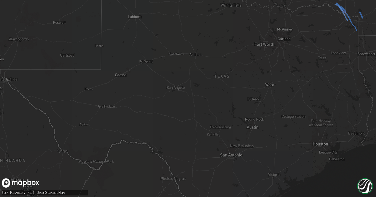
Hail Map in Texas on May 16, 2020
Get this storm
May 16 map
$229
one time, instant access
Download today. No call, no setup
Keep the $229
Bought the map and want the full workflow? Apply the entire $229 to a subscription within 7 days. None of it is wasted.
Every map, not just this one
This buys you this map. Subscription and you get every map we run, in the markets you choose from a few cities to whole states to nationwide. Plus real-time alerts the moment a storm fires.
Contact data
Name, contact info, occupancy, even credit band for addresses in the footprint. You go from where it hit to who to call.
Become the source they trust
Unlimited branding weather history reports on demand. You already have the documented answer ready for the property owner, and you are the one who showed up with it.
Property data and RoofTrace estimates
Pull up any address you have got, its value and the exact code rules for that jurisdiction, straight from One Click Code. Then RoofTrace estimates the squares, pitch, and roof value, priced the way you price.
Storm reports in Texas
Texas
| Date | Description |
|---|---|
| 05/16/20205:05 PM CDT | An ef-1 tornado with estimated maximum winds near 95 mph briefly touched down near a large home on clem ranch road and tracked northwest adjacent to a pond to akins roa |
| 05/16/20204:32 PM CDT | Storm chaser reports tornado on the ground along hwy 8 near the red river. |
| 05/16/20203:42 PM CDT | Game warden reports large tornado on lake wright patman. |
| 05/16/20203:37 PM CDT | Tornado documented by video by a game warden. Rated ef-u as no damage could be rated with the tornado touching down as a waterspout on the lake. Path width is estimated |
| 05/16/20203:26 PM CDT | Storm chaser recorded video of a tornado west of hwy 41 between foreman and new boston. |
| 05/16/20201:48 PM CDT | Significant damage to one home along kaufman cr 4007 just inside kaufman county line. Significant tree/power line damage in this area. Possible brief tornado based on c |
| 05/16/20201:47 PM CDT | Minor damage to homes and power lines. Multiple trees down near vzcr 2718 and 2719. Possible brief tornado pending survey. Time estimated by radar and so reports. |
| 05/16/20201:33 PM CDT | An ef-0 tornado with estimated maximum winds near 85 mph briefly touched down along county road nw 1019 where it tore off parts of a roof of a metal outbuilding. It the |
| 05/16/202012:32 PM CDT | Damage to a nursing home roof/trees and other buildings along hwy 31 in malakoff. Possible brief tornado pending survey. Time estimated from radar. |
| 05/16/20209:05 AM CDT | A local report indicates 61 MPH wind near 3 WNW HOLLY BEACH |
| 05/16/20207:56 AM CDT | At 1255 AM CDT, a severe thunderstorm was located near Weesatche, or near Yorktown, moving east at 30 mph. HAZARD...60 mph wind gusts and quarter size hail. SOURCE...Radar indicated. IMPACT...Hail damage to vehicles is expected. Expect wind damage to roofs, siding, and trees. Locations impacted include... Cuero, Yorktown, Thomaston, Westhoff, Arneckville, and Meyersville. |
| 05/16/20207:54 AM CDT | At 1254 AM CDT, severe thunderstorms were located along a line extending from 9 miles east of Seven Sisters to 7 miles northeast of Bruni, moving east at 50 mph. HAZARD...60 mph wind gusts and penny size hail. SOURCE...Radar indicated. IMPACT...Expect damage to roofs, siding, and trees. Locations impacted include... Alice, Mathis, San Diego, Benavides, Orange Grove, Lake City, San Patricio, Midway, Tynan, San Jose, Sandia, West Sinton, Tecalote, Annarose, Argenta, Rancho De La Parita, Rosita, Lagarto, Alfred-South La Paloma and Bluntzer. |
| 05/16/20207:32 AM CDT | At 1232 AM CDT, severe thunderstorms were located along a line extending from near Kenedy to 7 miles southeast of Karon to near Clegg, moving east at 35 mph. HAZARD...60 mph wind gusts and penny size hail. SOURCE...Radar indicated. IMPACT...Expect damage to roofs, siding, and trees. Locations impacted include... Beeville, Mathis, Goliad, Skidmore, Lake City, Weesatche, River Creek Acres, Weser, Tynan, Annarose, Argenta, Mount Lucas, Normanna, Dinero, Charco, Blanconia, Mineral, Ander, Berclair and Lagarto. |
| 05/16/20207:27 AM CDT | At 1227 AM CDT, a severe thunderstorm was located near Smiley, or 14 miles southwest of Gonzales, moving east at 40 mph. HAZARD...60 mph wind gusts and nickel size hail. SOURCE...Radar indicated. IMPACT...Expect damage to roofs, siding, and trees. Locations impacted include... Gonzales, Yoakum, Hallettsville, Shiner, Moulton, Smiley, Cheapside, Hochheim, Westhoff, Komensky, Worthing, Edgar, Henkhaus, Oak Forest, Terryville, Cost, Dilworth, Monthalia, Koerth, and Sample. |
| 05/16/20207:25 AM CDT | At 1224 AM CDT, a severe thunderstorm was located near Aguilares, or 20 miles east of Laredo, moving northeast at 45 mph. HAZARD...60 mph wind gusts and penny size hail. SOURCE...Radar indicated. IMPACT...Expect damage to roofs, siding, and trees. Locations impacted include... Oilton, Ranchitos Las Lomas, Mirando City, Aguilares and Bruni. |
| 05/16/20207:21 AM CDT | At 1221 AM CDT, a severe thunderstorm was located 11 miles southeast of Fort Ewell Site, or 20 miles northwest of Freer, moving east at 40 mph. HAZARD...60 mph wind gusts and quarter size hail. SOURCE...Radar indicated. IMPACT...Hail damage to vehicles is expected. Expect wind damage to roofs, siding, and trees. Locations impacted include... Freer, Seven Sisters, Loma Alta and Rosita. |
| 05/16/20203:52 AM CDT | At 851 AM CDT, severe thunderstorms were located along a line extending from near Los Fresnos to Rio Hondo, moving east at 25 mph. HAZARD...60 mph wind gusts. SOURCE...Radar indicated. IMPACT...Expect damage to roofs, siding, and trees. Locations impacted include... Los Fresnos, South Padre Island, Rio Hondo, Laureles, Brownsville, U.s. Coast Guard Station, Port Isabel Lighthouse, Palmer Laasko Elementary, Beach Access Four and Port Isabel Fire And Police Department. |
| 05/16/20203:06 AM CDT | At 806 AM CDT, severe thunderstorms were located along a line extending from near Lasara Elementary School to near Indian Hills to Progreso High School, moving east at 40 mph. HAZARD...60 mph wind gusts. SOURCE...Radar indicated. IMPACT...Expect damage to roofs, siding, and trees. Locations impacted include... Harlingen, San Benito, Mercedes, La Feria, Los Fresnos, Progreso, Santa Rosa, Lyford, Rancho Viejo and Rio Hondo.This includes the following highways... Interstate Highway 69 E between mile markers 1 and 43. US Highway 281 between mile markers 804 and 838. |
| 05/16/20202:47 AM CDT | At 746 AM CDT, severe thunderstorms were located along a line extending from around Mission to San Carlos, moving east at 20 mph. HAZARD...70 mph wind gusts. SOURCE...Radar indicated. IMPACT...Expect considerable tree damage. Damage is likely to mobile homes, roofs, and outbuildings. Locations impacted include... Edinburg, Mission, Pharr, Weslaco, San Juan, Alamo, Donna, Mercedes, Hidalgo and Elsa.This includes the following highways... US Highway 83 near mile marker 850. Interstate Highway 69 C between mile markers 1 and 12. US Highway 281 near mile marker 764. US Highway 281 between mile markers 784 and 810. |
| 05/16/20202:24 AM CDT | At 724 AM CDT, severe thunderstorms were located along a line extending from Red Gate to Palmhurst to 12 miles south of Penitas, moving east at 15 mph. HAZARD...60 mph wind gusts and penny size hail. SOURCE...Radar indicated. IMPACT...Expect damage to roofs, siding, and trees. Locations impacted include... Edinburg, Mission, Pharr, San Juan, Hidalgo, Palmview, Penitas, Sullivan City, La Joya and Palmhurst.This includes the following highways... US Highway 83 between mile markers 840 and 850. Interstate Highway 69 C between mile markers 1 and 12. US Highway 281 between mile markers 760 and 764. US Highway 281 between mile markers 784 and 788. |
| 05/16/20201:19 AM CDT | At 618 AM CDT, a severe thunderstorm was located near Garciasville, moving east at 20 mph. HAZARD...60 mph wind gusts and quarter size hail. SOURCE...Radar indicated. IMPACT...Hail damage to vehicles is expected. Expect wind damage to roofs, siding, and trees. Locations impacted include... Sullivan City, Garciasville, La Grulla, La Puerta, Ringgold Middle School, La Victoria, Cuevitas, Alto Bonito, Las Lomas and Grulla Middle School.This includes US Highway 83 between mile markers 822 and 836. |
| 05/15/202010:30 PM CDT | At 329 AM CDT, a severe thunderstorm was located over Rachal, moving north at 15 mph. HAZARD...Golf ball size hail and 60 mph wind gusts. SOURCE...Radar indicated. IMPACT...People and animals outdoors will be injured. Expect hail damage to roofs, siding, windows, and vehicles. Expect wind damage to roofs, siding, and trees. Locations impacted include... Rachal, Encino and El Coyote Ranch Airport. This includes US Highway 281 between mile markers 726 and 742. |
| 05/15/202010:02 PM CDT | At 302 AM CDT, a severe thunderstorm was located over Pecan Grove, moving east at 35 mph. HAZARD...60 mph wind gusts. SOURCE...Radar indicated. IMPACT...Expect damage to roofs, siding, and trees. Locations impacted include... Sugar Land, northern Missouri City, Stafford, Bellaire, Richmond, Town West, Pecan Grove, Mission Bend, southeastern Eldridge / West Oaks, Meadows Place, Westbury, New Territory, Westwood, Four Corners, Alief, Sharpstown, Meyerland Area, Gulfton, Fifth Street and Fort Bend Houston. |
| 05/15/20209:58 PM CDT | At 256 AM CDT, a severe thunderstorm was located 10 miles east of South Texas Nuclear Plant, moving northeast at 40 mph. HAZARD...60 mph wind gusts and quarter size hail. SOURCE...Radar indicated. IMPACT...Hail damage to vehicles is expected. Expect wind damage to roofs, siding, and trees. Locations impacted include... Sweeny, Sargent, Wild Peach Village and Wadsworth. |
| 05/15/20209:54 PM CDT | At 254 AM CDT, a severe thunderstorm was located near Bustamante, moving east at 25 mph. HAZARD...60 mph wind gusts and quarter size hail. SOURCE...Radar indicated. IMPACT...Hail damage to vehicles is expected. Expect wind damage to roofs, siding, and trees. Locations impacted include... Escobas, Randado and Guerra. |
| 05/15/20209:52 PM CDT | At 252 AM CDT, a severe thunderstorm was located near Pleak, or near Rosenberg, moving east at 40 mph. HAZARD...60 mph wind gusts. SOURCE...Radar indicated. IMPACT...Expect damage to roofs, siding, and trees. Locations impacted include... Southern Sugar Land, Missouri City, Rosenberg, Richmond, First Colony, Fresno, Arcola, Pleak, Fairchilds, Thompsons, Greatwood, Sienna Plantation, Fort Bend Houston and Juliff. |
| 05/15/20209:44 PM CDT | At 244 AM CDT, a severe thunderstorm was located over Blessing, or 10 miles northwest of South Texas Nuclear Plant, moving north at 25 mph. HAZARD...60 mph wind gusts and quarter size hail. SOURCE...Radar indicated. IMPACT...Hail damage to vehicles is expected. Expect wind damage to roofs, siding, and trees. Locations impacted include... Markham, Blessing, Midfield and Danevang. |
| 05/15/20209:41 PM CDT | At 241 AM CDT, a severe thunderstorm was located near Needville, or 15 miles northwest of West Columbia, moving east at 45 mph. HAZARD...60 mph wind gusts. SOURCE...Radar indicated. IMPACT...Expect damage to roofs, siding, and trees. Locations impacted include... Bonney, Brazos Bend State Park, Rosharon and Damon. |
| 05/15/20209:35 PM CDT | At 235 AM CDT, a severe thunderstorm was located over Hebbronville, moving east at 40 mph. HAZARD...60 mph wind gusts and penny size hail. SOURCE...Radar indicated. IMPACT...Expect damage to roofs, siding, and trees. Locations impacted include... Falfurrias, Hebbronville, Las Lomitas, Gruy Stadium, La Colonia Park, Thompsonville, Jim Hogg County Airport, Hebbronville High School, South Fork Estates and Hebbronville Border Patrol Station. |
| 05/15/20209:32 PM CDT | At 232 AM CDT, a severe thunderstorm was located over South Texas Nuclear Plant, moving northeast at 25 mph. HAZARD...60 mph wind gusts and quarter size hail. SOURCE...Radar indicated. IMPACT...Hail damage to vehicles is expected. Expect wind damage to roofs, siding, and trees. Locations impacted include... Matagorda, Bay City, South Texas Nuclear Plant and Wadsworth. |
| 05/15/20209:27 PM CDT | At 227 AM CDT, a severe thunderstorm was located over Wallis, or 9 miles south of Sealy, moving east at 40 mph. HAZARD...60 mph wind gusts. SOURCE...Radar indicated. IMPACT...Expect damage to roofs, siding, and trees. Locations impacted include... Northwestern Rosenberg, Richmond, Pecan Grove, Wallis, Fulshear, Simonton, Orchard, Weston Lakes, Cumings and Cinco Ranch. |
| 05/15/20209:09 PM CDT | At 209 AM CDT, a severe thunderstorm was located near Wharton, moving east at 45 mph. HAZARD...60 mph wind gusts. SOURCE...Radar indicated. IMPACT...Expect damage to roofs, siding, and trees. Locations impacted include... Wharton, Needville, Boling-Iago, Hungerford and Egypt. |
| 05/15/20208:38 PM CDT | At 137 AM CDT, a severe thunderstorm was located over El Cenizo, or 14 miles south of Laredo, moving east at 30 mph. HAZARD...60 mph wind gusts and penny size hail. SOURCE...Radar indicated. IMPACT...Expect damage to roofs, siding, and trees. Locations impacted include... Laredo, Rio Bravo, El Cenizo and Mirando City. |
| 05/15/20208:37 PM CDT | At 137 AM CDT, severe thunderstorms were located along a line extending from 6 miles southwest of Woodsboro to near Kingsville, moving east at 45 mph. HAZARD...60 mph wind gusts and penny size hail. SOURCE...Radar indicated. IMPACT...Expect damage to roofs, siding, and trees. Locations impacted include... Corpus Christi, Kingsville, Portland, Robstown, Rockport, Sinton, Port Aransas, Taft, Woodsboro, Driscoll, Corpus Christi International Airport, Lamar, Ingleside, Aransas Pass, Bishop, Odem, Gregory, St. Paul, Ingleside On The Bay and Bayside. |
| 05/15/20208:35 PM CDT | At 134 AM CDT, a severe thunderstorm was located 10 miles south of El Cenizo, or 24 miles northwest of Zapata, moving southeast at 25 mph. HAZARD...60 mph wind gusts and half dollar size hail. SOURCE...Radar indicated. IMPACT...Hail damage to vehicles is expected. Expect wind damage to roofs, siding, and trees. Locations impacted include... Las Palmas.This includes US Highway 83 between mile markers 738 and 762. |
| 05/15/20208:33 PM CDT | At 133 AM CDT, severe thunderstorms were located along a line extending from Fordtran to near Oak Village, moving east at 55 mph. HAZARD...60 mph wind gusts. SOURCE...Radar indicated. IMPACT...Expect damage to roofs, siding, and trees. Locations impacted include... Edna, Ganado, Point Comfort, La Ward, Olivia, Alamo Beach, Lolita, Port Alto, Vanderbilt and Lake Texana Dam. |
| 05/15/20208:25 PM CDT | At 125 AM CDT, severe thunderstorms were located along a line extending from near Sublime to near Ezzell to near Fordtran, moving east at 55 mph. HAZARD...60 mph wind gusts. SOURCE...Radar indicated. IMPACT...Expect damage to roofs, siding, and trees. Locations impacted include... El Campo, Wharton, Eagle Lake, Pierce, Cordele, Egypt, Louise, Sheridan, Altair, Nada, Morales, Garwood, Rock Island and Hungerford. |
| 05/15/20208:09 PM CDT | At 108 AM CDT, severe thunderstorms were located along a line extending from near Cuero to near Papalote, moving east at 35 mph. HAZARD...60 mph wind gusts and penny size hail. SOURCE...Radar indicated. IMPACT...Expect damage to roofs, siding, and trees. Locations impacted include... Victoria, Beeville, Refugio, Goliad, Woodsboro, McFaddin, Skidmore, Guadalupe, Fannin, Quintana, Victoria Colony Creek Country Club, Weesatche, Weser, Nursery, Victoria Riverside Park, Victoria College, Victoria Mall, Saxet Lakes, Argenta and Inez. |
All States Impacted by Hail Map on May 16, 2020
Cities Impacted by Hail Map on May 16, 2020
- Winchester, IL
- Murrayville, IL
- Alexander, IL
- Palmyra, IL
- Jacksonville, IL
- Waverly, IL
- Roodhouse, IL
- New Berlin, IL
- Franklin, IL
- White Hall, IL
- Louisa, KY
- Conchas Dam, NM
- Essex, IA
- Springer, NM
- Weslaco, TX
- Donna, TX
- Plattsmouth, NE
- Wagon Mound, NM
- Trementina, NM
- Evansville, IN
- Moro, IL
- Bethalto, IL
- Dorsey, IL
- Bunker Hill, IL
- Worden, IL
- Gillespie, IL
- Denton, KY
- Rush, KY
- Catlettsburg, KY
- Clewiston, FL
- Mills, NM
- Oconto, NE
- Lexington, NE
- Eddyville, NE
- Sumner, NE
- Overton, NE
- Edinburg, TX
- Mission, TX
- Westcliffe, CO
- Solano, NM
- Red Oak, IA
- Imogene, IA
- Cuervo, NM
- Penitas, TX
- Linn, TX
- Edcouch, TX
- Hidalgo, TX
- Roy, NM
- Garita, NM
- Eldred, IL
- Carrollton, IL
- Henderson, KY
- Mcallen, TX
- Randolph, IA
- Clarinda, IA
- Armstrong, TX
- Grulla, TX
- Rio Grande City, TX
- La Joya, TX
- Sullivan City, TX
- Maxwell, NM
- Haworth, OK
- New Boston, TX
- Maud, TX
- Foreman, AR
- Bloomburg, TX
- Queen City, TX
- Hooks, TX
- Texarkana, TX
- De Kalb, TX
- Idabel, OK
- Broken Bow, OK
- Ashdown, AR
- Texarkana, AR
- Ogden, AR
- El Dorado, AR
- Weeping Water, NE
- Manley, NE
- Louisville, NE
- Wilsonville, IL


