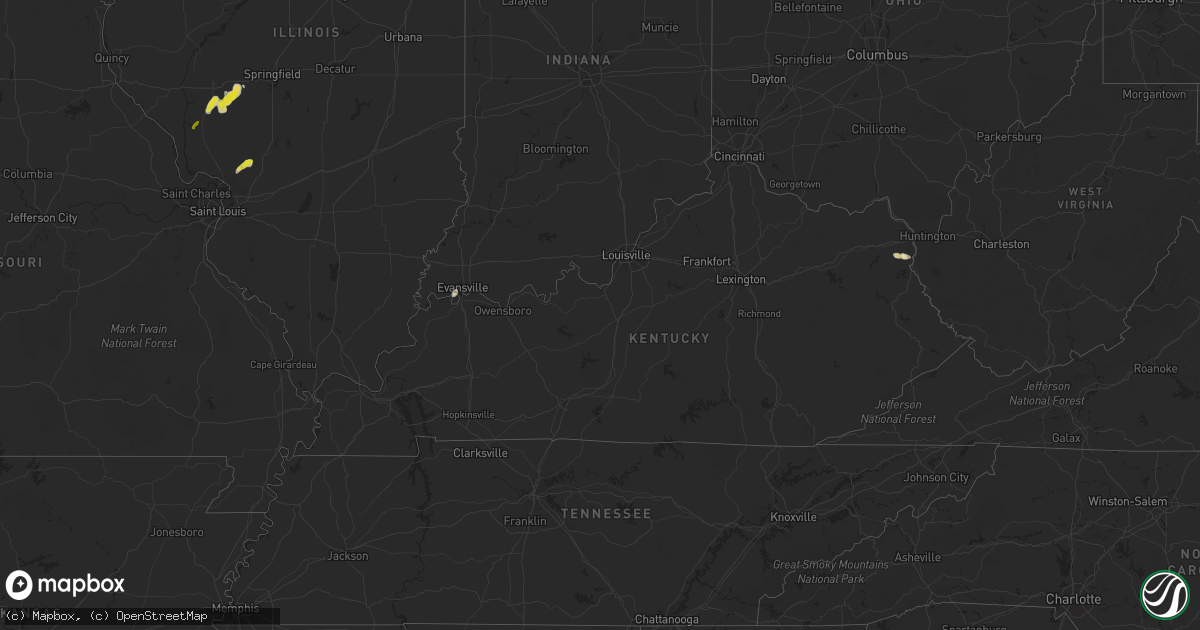
Hail Map in Kentucky on May 16, 2020
Get this storm
May 16 map
$229
one time, instant access
Download today. No call, no setup
Keep the $229
Bought the map and want the full workflow? Apply the entire $229 to a subscription within 7 days. None of it is wasted.
Every map, not just this one
This buys you this map. Subscription and you get every map we run, in the markets you choose from a few cities to whole states to nationwide. Plus real-time alerts the moment a storm fires.
Contact data
Name, contact info, occupancy, even credit band for addresses in the footprint. You go from where it hit to who to call.
Become the source they trust
Unlimited branding weather history reports on demand. You already have the documented answer ready for the property owner, and you are the one who showed up with it.
Property data and RoofTrace estimates
Pull up any address you have got, its value and the exact code rules for that jurisdiction, straight from One Click Code. Then RoofTrace estimates the squares, pitch, and roof value, priced the way you price.
Storm reports in Kentucky
Kentucky
| Date | Description |
|---|---|
| 05/16/20204:52 PM CDT | Off duty meteorologist reported damage to several large trees and off duty nws meteorologist estimated wind gust of 50 mph. |
| 05/15/202010:18 PM CDT | At 318 PM CDT, a severe thunderstorm was located near Henderson, moving north at 10 mph. HAZARD...60 mph wind gusts and quarter size hail. SOURCE...Radar indicated. IMPACT...Hail damage to vehicles is expected. Expect wind damage to roofs, siding, and trees. Locations impacted include... Evansville, Melody Hill, Darmstadt, Kasson and Blairsville. This includes Interstate 69 in Indiana between Mile Markers 14 and18. |
All States Impacted by Hail Map on May 16, 2020
Cities Impacted by Hail Map on May 16, 2020
- Winchester, IL
- Murrayville, IL
- Alexander, IL
- Palmyra, IL
- Jacksonville, IL
- Waverly, IL
- Roodhouse, IL
- New Berlin, IL
- Franklin, IL
- White Hall, IL
- Louisa, KY
- Conchas Dam, NM
- Essex, IA
- Springer, NM
- Weslaco, TX
- Donna, TX
- Plattsmouth, NE
- Wagon Mound, NM
- Trementina, NM
- Evansville, IN
- Moro, IL
- Bethalto, IL
- Dorsey, IL
- Bunker Hill, IL
- Worden, IL
- Gillespie, IL
- Denton, KY
- Rush, KY
- Catlettsburg, KY
- Clewiston, FL
- Mills, NM
- Oconto, NE
- Lexington, NE
- Eddyville, NE
- Sumner, NE
- Overton, NE
- Edinburg, TX
- Mission, TX
- Westcliffe, CO
- Solano, NM
- Red Oak, IA
- Imogene, IA
- Cuervo, NM
- Penitas, TX
- Linn, TX
- Edcouch, TX
- Hidalgo, TX
- Roy, NM
- Garita, NM
- Eldred, IL
- Carrollton, IL
- Henderson, KY
- Mcallen, TX
- Randolph, IA
- Clarinda, IA
- Armstrong, TX
- Grulla, TX
- Rio Grande City, TX
- La Joya, TX
- Sullivan City, TX
- Maxwell, NM
- Haworth, OK
- New Boston, TX
- Maud, TX
- Foreman, AR
- Bloomburg, TX
- Queen City, TX
- Hooks, TX
- Texarkana, TX
- De Kalb, TX
- Idabel, OK
- Broken Bow, OK
- Ashdown, AR
- Texarkana, AR
- Ogden, AR
- El Dorado, AR
- Weeping Water, NE
- Manley, NE
- Louisville, NE
- Wilsonville, IL


