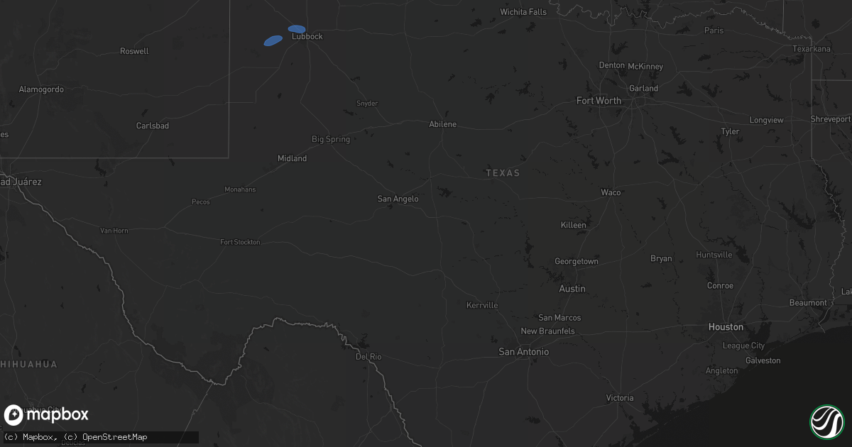
Hail Map in Texas on May 14, 2026
Get this storm
May 14 map
$229
one time, instant access
Download today. No call, no setup
Keep the $229
Bought the map and want the full workflow? Apply the entire $229 to a subscription within 7 days. None of it is wasted.
Every map, not just this one
This buys you this map. Subscription and you get every map we run, in the markets you choose from a few cities to whole states to nationwide. Plus real-time alerts the moment a storm fires.
Contact data
Name, contact info, occupancy, even credit band for addresses in the footprint. You go from where it hit to who to call.
Become the source they trust
Unlimited branding weather history reports on demand. You already have the documented answer ready for the property owner, and you are the one who showed up with it.
Property data and RoofTrace estimates
Pull up any address you have got, its value and the exact code rules for that jurisdiction, straight from One Click Code. Then RoofTrace estimates the squares, pitch, and roof value, priced the way you price.
Storm reports in Texas
Texas
| Date | Description |
|---|---|
| 05/14/20266:57 PM CDT | West texas mesonet. |
| 05/14/20266:35 PM CDT | Awos station ke01 monahans awos measured a 60 mph wind gust associated with a convective downburst. |
| 05/14/20266:17 PM CDT | West texas mesonet. |
| 05/14/20266:14 PM CDT | 68 mph gust measured at the wt mesonet site 9 miles nne of sunray... Tx. |
| 05/14/20266:01 PM CDT | Wind gust of 61 mph measured at the wt mesonet site 1 mile ene of mclean... Tx. |
| 05/14/20265:45 PM CDT | 5 power poles and an outbuilding blown down. |
| 05/14/20265:42 PM CDT | West texas mesonet. |
| 05/14/20265:31 PM CDT | Wind gust of 69 mph measured at the wt mesonet site 2 miles wnw of lake mcclellan. Severe gusts lasted from 5:31 to 5:33 pm. |
| 05/14/20265:28 PM CDT | Wind gust of 59 mph measured at wt mesonet site 2 miles ese of pampa... Tx. |
| 05/14/20265:28 PM CDT | Wind gust of 59 mph measured at wt mesonet site 2 miles ese of pampa... Tx. |
| 05/14/20265:24 PM CDT | Wind gust of 58 mph measured at the wt mesonet site in goodnight... Tx. |
| 05/14/20265:12 PM CDT | Wind gust of 63 mph recorded at the wt mesonet site 2 miles nw of hereford. Severe gusts lasted from 5:05 to 5:15 pm. |
| 05/14/20265:11 PM CDT | West texas mesonet. Substantial dust foot evident on nearby webcams. |
| 05/14/20265:11 PM CDT | West texas mesonet. |
| 05/14/20265:08 PM CDT | West texas mesonet. Zero-mile visibility from blowing dust in dimmitt. |
| 05/14/20265:07 PM CDT | Wind gust of 61 mph recorded at the wt mesonet site 2 miles nw of hereford. Severe gusts lasted from 5:05 to 5:07 pm. |
| 05/14/20265:02 PM CDT | Wind gust of 60 mph measured at the wt mesonet site 12 miles sw of claude... Tx. |
| 05/14/20264:42 PM CDT | West texas mesonet. |
| 05/14/20264:42 PM CDT | Broadcast media relayed a photo in slack of a wooden light pole that snapped at the baseball and softball fields on the south side of friona. Time estimated from radar |
| 05/14/20264:37 PM CDT | West texas mesonet. Near-zero visibility from blowing dust. |
| 05/14/20264:36 PM CDT | Mesonet station 159 orla 20wsw measured a 60 mph wind gust associated with a convective downburst. |
| 05/14/20264:28 PM CDT | 60 mph wind gust observed at wt mesonet site 11 miles wnw of bootleg... Tx at 4:17 pm. Maximum wind gust of 64 mph recorded at 4:28 pm. The last wind gust occurred at 4 |
| 05/14/20264:23 PM CDT | West texas mesonet. |
| 05/14/20264:23 PM CDT | Corrected source. West texas mesonet. |
| 05/14/20264:17 PM CDT | 60 mph wind gust observed at wt mesonet site 11 miles wnw of bootleg... Tx. |
| 05/14/20263:36 PM CDT | 59 mph wind gust measured at 6 wsw adrian west texas mesonet site. |
| 05/13/20268:45 PM CDT | Media viewer sent in video and pictures of front porch blowing off. |
| 05/13/20267:59 PM CDT | Mesonet station 15 seagraves 1sw measured a 59 mph wind gust associated with a convective downburst. |
| 05/13/20267:17 PM CDT | West texas mesonet. |
| 05/13/20267:16 PM CDT | West texas mesonet. |
All States Impacted by Hail Map on May 14, 2026
Cities Impacted by Hail Map on May 14, 2026
- Olivet, SD
- House, NM
- Mcalister, NM
- Melrose, NM
- Vega, TX
- Adrian, TX
- Clovis, NM
- Texico, NM
- Wray, CO
- Bovina, TX
- Farwell, TX
- Friona, TX
- Levelland, TX
- Sundown, TX
- Haviland, KS
- Pratt, KS
- Saint Francis, KS
- Haigler, NE
- Cunningham, KS
- Turon, KS
- Iuka, KS
- Claude, TX
- Canyon, TX
- Hereford, TX
- Dimmitt, TX
- Hart, TX
- Happy, TX
- Tulia, TX
- Nazareth, TX
- Shallowater, TX
- Lubbock, TX
- Pampa, TX
- Groom, TX
- Panhandle, TX
- Clarendon, TX
- Mclean, TX
- Bird City, KS
- McDonald, KS
- Miami, TX
- Kress, TX
- Wheeler, TX
- Canadian, TX
- Mobeetie, TX
- Shamrock, TX
- Clay Center, KS
- Ellsworth, KS
- Childress, TX
- Beverly, KS
- Lincoln, KS
- Anthony, KS
- Quanah, TX
- Brookville, KS
- Tescott, KS
- Salina, KS
- Leonardville, KS
- Green, KS
- Bennington, KS
- Lindsborg, KS
- Freeport, KS
- Danville, KS
- Harper, KS
- Monroe City, MO
- Taylor, MO
- Hannibal, MO
- Palmyra, MO
- Hull, IL
- New London, MO
- Quincy, IL
- Liberty, IL
- Plainville, IL
- Payson, IL
- Roodhouse, IL
- Center, MO
- Kinderhook, IL
- Copeland, KS
- Ensign, KS
- Montezuma, KS
- Minneola, KS


