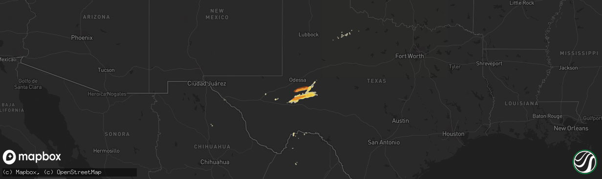
Hail Map on May 14, 2013
The weather event on May 14, 2013 includes Hail map. 3 states and 21 cities were impacted and suffered possible damage. The total estimated number of properties impacted is 2,912.
Want more than just the map?
Turn this storm into a full workflow.
- Owner + property data so you know who to knock
- OnDemand branded weather history reports to win the "did we even have hail?" argument
- RoofTrace estimate so reps stop guessing numbers at the door
Bought this map? Upgrade within 7 days and we'll credit the $230. (10-15 min setup call)
Hail
2,912
Estimated number of impacted properties by a 1.00" hail or larger0
Estimated number of impacted properties by a 1.75" hail or larger0
Estimated number of impacted properties by a 2.50" hail or largerStorm reports
Montana
| Date | Description |
|---|---|
| 05/14/201310:08 AM CDT | Winds were 49mph gusting to 61 mph from 908 pm to 912 pm at the sioux pass mesonet site. |
Minnesota
| Date | Description |
|---|---|
| 05/14/20137:13 AM CDT | Measured at minnesota dot site along highway 10 |
Texas
| Date | Description |
|---|---|
| 05/14/201312:00 AM CDT | Large pecan limbs down. Diameter of 6-12 inches by 8 feet long. |
Wisconsin
| Date | Description |
|---|---|
| 05/13/20139:57 PM CDT | Tree down. |
| 05/13/20139:41 PM CDT | At intersection of howell and morgan avenues...6 inch to 8 inch diameter tree across the road. |
| 05/13/20139:30 PM CDT | Large branches down near 71st and becher street. Social media report. |
| 05/13/20139:20 PM CDT | Milwaukee fire department reported several tree fires...live wires down and trees down. Time estimated. House fire due to live wires on house. Relayed by tv media via s |
| 05/13/20139:00 PM CDT | Wires and trees down in the delafield...merton...and hartland areas. |
| 05/13/20138:57 PM CDT | 60 foot pine tree down. Time estimated. Relayed via social media. |
| 05/13/20138:55 PM CDT | Waukesha county sheriff reported trees and power lines down in hartland...merton and delafield areas. Relayed by tv media via social media. |
| 05/13/20138:40 PM CDT | Time estimated. Social media report. |
| 05/13/20138:20 PM CDT | Large barn blown down and 4 x 4 posts ripped out of the ground at w7769 island road. Report relayed by jefferson county sheriff at 1040 pm. |
California
| Date | Description |
|---|---|
| 05/13/20137:08 PM CDT | Spotter in bishop ca reported strong winds knocked down a 5 inch tree limb. |
| 05/13/20137:00 PM CDT | Spotter in bishop reported trees knocked down from strong winds. |
Iowa
| Date | Description |
|---|---|
| 05/14/20135:00 PM CDT | A local report indicates 64 MPH wind near CARROLL |
| 05/14/20134:55 PM CDT | The automated weather observing equipment at the charles city airport measured a 58 miles per hour wind gust |
| 05/14/20134:50 PM CDT | Clarion awos measured a gust to 51 knots. |
| 05/14/20134:50 PM CDT | Cerro gordo county dispatch relayed a public report of strong winds blowing shingles off a roof between interstate 35 and swaledale. |
| 05/14/20134:43 PM CDT | Trained spotter reported wind gusts estimated between 60 and 75 mph along with a large dust cloud near a thunderstorm. |