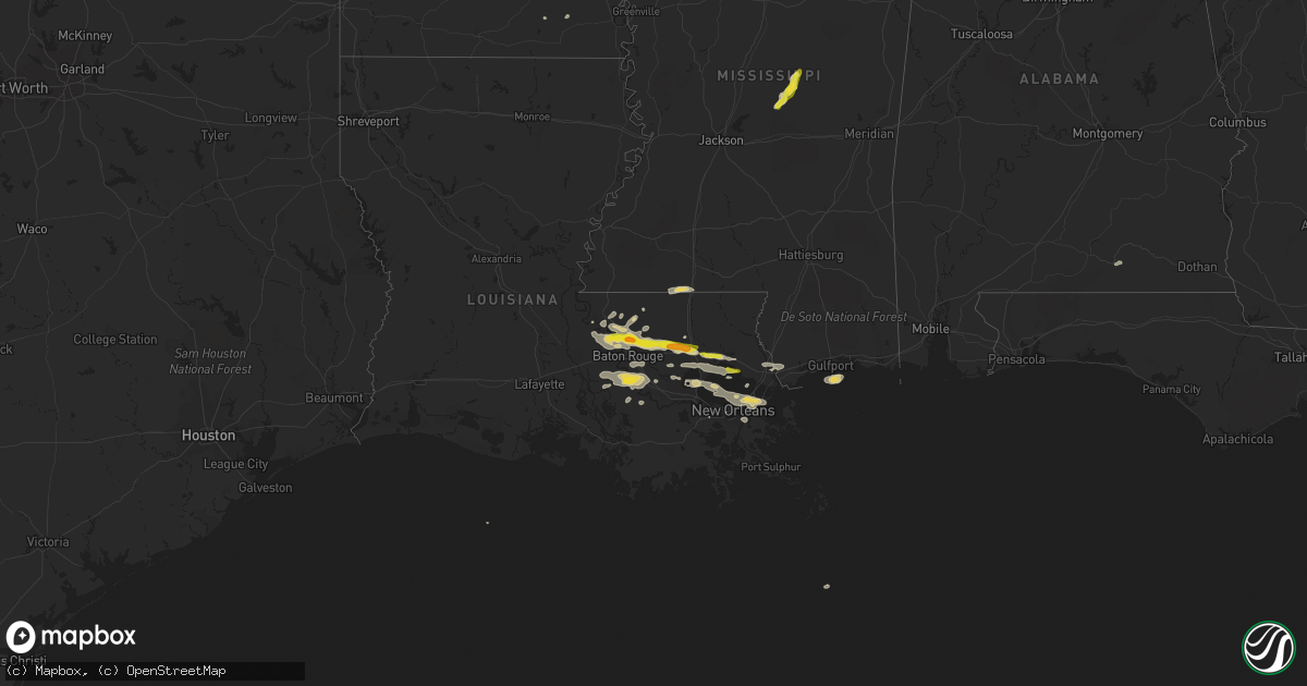
Hail Map on May 12, 2017
Get this storm
May 12 map
$229
one time, instant access
Download today. No call, no setup
Keep the $229
Bought the map and want the full workflow? Apply the entire $229 to a subscription within 7 days. None of it is wasted.
Every map, not just this one
This buys you this map. Subscription and you get every map we run, in the markets you choose from a few cities to whole states to nationwide. Plus real-time alerts the moment a storm fires.
Contact data
Name, contact info, occupancy, even credit band for addresses in the footprint. You go from where it hit to who to call.
Become the source they trust
Unlimited branding weather history reports on demand. You already have the documented answer ready for the property owner, and you are the one who showed up with it.
Property data and RoofTrace estimates
Pull up any address you have got, its value and the exact code rules for that jurisdiction, straight from One Click Code. Then RoofTrace estimates the squares, pitch, and roof value, priced the way you price.
States Impacted by Hail Map on May 12, 2017
Storm reports
South Carolina
| Date | Description |
|---|---|
| 05/11/20179:30 PM CDT | Spotter reports a few trees down near hwy 246. Time est from radar. |
Mississippi
| Date | Description |
|---|---|
| 05/12/20176:16 PM CDT | Enough quarter sized and smaller hailstones fell to cover the ground. |
| 05/12/20175:48 PM CDT | Hail to the size of quarters fell in carthage. |
| 05/12/20175:43 PM CDT | Numerous trees down. |
| 05/12/201711:36 AM CDT | Trees down reported in mchenry. Time estimated by radar. |
| 05/12/201710:54 AM CDT | Several trees and a few power lines were blown down in southwest laurel. |
| 05/12/201710:40 AM CDT | A few trees were reported blown down on the northeast side of ellisville. Reissued to correct event time. |
Florida
| Date | Description |
|---|---|
| 05/12/20175:35 PM CDT | Trees reported down on birtchwood rd |
| 05/12/20175:30 PM CDT | Trees reported down near baker creek in mariana |
| 05/12/20175:24 PM CDT | Report of power lines down on colins rd south of i-10 |
| 05/12/20173:55 PM CDT | 1 tree down on brown rd |
| 05/11/20177:24 PM CDT | Numerous trees and powerlines down across the county. |
| 05/11/20177:15 PM CDT | Report of tree down on s monroe st |
| 05/11/20177:07 PM CDT | Tree down near meridian road and ox bottom road. |
| 05/11/20177:06 PM CDT | Wind gust of 59 mph recorded at fsu |
| 05/11/20177:02 PM CDT | Report of tree down on west tn street |
Montana
| Date | Description |
|---|---|
| 05/12/20176:13 PM CDT | Sheriffs department estimated quarter size hail at the office. Time estimated based on radar. |
| 05/12/20176:04 PM CDT | 60 mph wind gust at the dot sensor just north of loma |
| 05/12/20176:03 PM CDT | Trained spotter reports several power poles blown down on hwy 223 south of chester. Fire department is on scene directing traffic. Spotter reported hail but size was un |
| 05/12/20175:31 PM CDT | Mesonet station e1937... 20 n rudyard. |
| 05/12/20175:29 PM CDT | 61 mph wind gust. |
| 05/12/20175:25 PM CDT | Estimated wind gusts in the upper 50 mph range. Penny size hail. Tree limbs down. Crop damage. Estimated time of event. |
| 05/12/20175:02 PM CDT | 70 mph wind gust at the dot sensor just east of inverness. |
| 05/12/20174:32 PM CDT | Two power poles blown down in thunderstorm winds. Highway 223 mm 42. Spotter reports poles just downed upon arrival arcing live power |
Louisiana
| Date | Description |
|---|---|
| 05/12/20175:28 PM CDT | Quarter size hail on the northern portion of the causeway bridge. |
| 05/12/20174:35 PM CDT | Tree damage in the vicinity of raiford oaks blvd. Large limbs down... Several trees snapped midway up... A large tree fell through a home. Tornado rated ef0... Max wind |
| 05/12/20174:30 PM CDT | Quarter size hail just outside the city limits of st. Gabriel. |
| 05/12/20174:02 PM CDT | *** 1 inj *** tree fell on car. Minor injury reported. |
| 05/12/20173:50 PM CDT | Inch in diameter hail between albany and hammond. |
| 05/12/20173:33 PM CDT | Also 45 to 55 mph wind gusts. |
| 05/12/20173:21 PM CDT | Damage reported near intersection of 449 and courtney. |
| 05/12/20173:19 PM CDT | First responders reporting to damage near arnold rd. |
| 05/12/20173:15 PM CDT | Large area of powerful straight line wind damage. More than 50 large hard and soft wood trees uprooted or snapped... Utility lines down... Light to moderate roof shingl |
| 05/12/20173:10 PM CDT | Ranged in size from quarter to ping pong ball. |
| 05/12/201711:36 AM CDT | Minor structural damage... Some damage to power poles and lines... And a few trees snapped/uprooted. |
| 05/12/201711:13 AM CDT | Minor property damage with two carports ripped off houses on mt. Revarb street. Rear car window blown out. Also tree and power line damage. Rated ef0 with max wind of 6 |
| 05/12/201711:13 AM CDT | Property damage with two carports ripped off houses on mt. Revarb street. Rear car window blown out. Possible tornado. |
| 05/12/201710:49 AM CDT | Confirmation of a delayed report... An outdoor shed was blown over damaging nearby cars. Down tree limbs were also in the area. Time estimated by radar. Asos reported a |
| 05/12/201710:38 AM CDT | Trees and power lines down on e. Harding st. |
| 05/12/201710:37 AM CDT | 3 power poles leaning with lines down on la. 627/prospect ave. Near main gate of valero. |
| 05/12/201710:26 AM CDT | Tree fell and brought down power lines on e. Hardy st. |
| 05/12/20179:04 AM CDT | Numerous trees down on four streets in city limits of white castle from possible tornado. |
| 05/12/20179:01 AM CDT | Damage consistent with 90 mph winds. Path length 0.50 miles. Path width 40 yards. |
| 05/12/20179:01 AM CDT | *** 1 inj *** reports and video from media of tornado in baton rouge in coursey and sherwood forest area. Emergency manager reported power lines down...and reports of v |
Georgia
| Date | Description |
|---|---|
| 05/12/20175:23 PM CDT | 1 inch hail was reported near murphy usa gas station in lilburn. |
Tennessee
| Date | Description |
|---|---|
| 05/12/20171:39 PM CDT | Tree down along county road 460. Time estimated by radar. |
| 05/12/20171:31 PM CDT | Reports of trees down...a storage shed blown from its foundation...and metal roof peeled off of a doublewide structure. Time estimated by radar. |
| 05/12/20171:30 PM CDT | A local report indicates 1.00 inch wind near 14 E BRISTOL TN |
| 05/12/20171:05 PM CDT | Large tree uprooted along bristol caverns hwy. Time estimated by radar. |
Alabama
| Date | Description |
|---|---|
| 05/12/20173:55 PM CDT | A few downed trees and power lines in town. |
| 05/12/20171:46 PM CDT | Multiple trees down and a few fences down. Minor roof damage to some mobile home porches and awnings. |
| 05/12/20171:40 PM CDT | Several reports of trees down and sporadic outbuilding and roof damage near bay minette. Time estimated via radar. |
| 05/12/20171:05 PM CDT | Trees down on hwy 45 in kushla near kushla rd. Time estimated by radar. |
| 05/12/201712:54 PM CDT | Trees down with damage to roof of home. |
| 05/12/201712:05 PM CDT | Trees down blocking the roadway in the pine mountain area of remlap. Relayed through social media and time based on radar. |
| 05/12/201712:04 PM CDT | Large tree down in palmerdale. Report relayed through social media and time based on radar. |
| 05/12/201711:33 AM CDT | Tree down onto power lines along mount olive road. Estimated 40 mph winds. |
| 05/12/201711:27 AM CDT | Large limbs down and small hail covering portions of the ground in morris. Time based on radar... And report relayed through social media. |
Cities Impacted by Hail Map on May 12, 2017
- Hingham, MT
- Fort Shaw, MT
- Jackson, LA
- Zachary, LA
- Gildford, MT
- Grayson, GA
- Lawrenceville, GA
- Rudyard, MT
- Inverness, MT
- Charleston, MS
- Carter, MT
- La Place, LA
- Chester, MT
- Holden, LA
- Greenwood, SC
- Saint Gabriel, LA
- Havre, MT
- Lakeland, LA
- Independence, LA
- Ponchatoula, LA
- Tickfaw, LA
- Baton Rouge, LA
- Baker, LA
- Port Allen, LA
- Livingston, LA
- Rougon, LA
- Erwinville, LA
- Denham Springs, LA
- Greenwell Springs, LA
- Albany, LA
- Hammond, LA
- Pride, LA
- Walker, LA
- Glynn, LA
- Lilburn, GA
- Stone Mountain, GA
- Norcross, GA
- Tucker, GA
- Prairieville, LA
- Gonzales, LA
- Geismar, LA
- White Castle, LA
- Sunshine, LA
- Plaquemine, LA
- Donaldsonville, LA
- Carville, LA
- Grenada, MS
- Anderson, SC
- Starr, SC
- Saint Francisville, LA
- Brady, MT
- Dutton, MT
- Carthage, MS
- Lena, MS
- Power, MT
- Madisonville, LA
- Gulfport, MS
- Ethel, LA
- Jarreau, LA
- Ventress, LA
- Slaughter, LA
- Oscar, LA
- Livonia, LA
- Abbeville, SC
- Kinston, AL
- Opp, AL
- Ledger, MT
- Pinson, AL
- Birmingham, AL
- Kimberly, AL
- Gardendale, AL
- Remlap, AL
- Mount Olive, AL
- Graysville, AL
- Morris, AL
- Snellville, GA
- Mandeville, LA
- Covington, LA
- Pearl River, LA
- Stennis Space Center, MS
- Bay Saint Louis, MS
- Fort Benton, MT
- Kosciusko, MS
- Maurepas, LA
- Belle Chasse, LA
- Braithwaite, LA
- New Orleans, LA
- Osyka, MS
- Iva, SC
- Saint Amant, LA
- Belle Rose, LA
- Belton, SC
- Clinton, LA
- Hamburg, AR
- Wellington, AL
- Jacksonville, AL
- Grosse Tete, LA
- Darrow, LA
- Ashville, AL
- Bradley, SC
- Magnolia, MS
- Kentwood, LA
- Liberty, MS
- Greensburg, LA
- Burnsville, MS
- Trussville, AL
- Springville, AL
- Pierre Part, LA
- Springfield, LA
- Walnut Grove, MS
- Bristol, TN