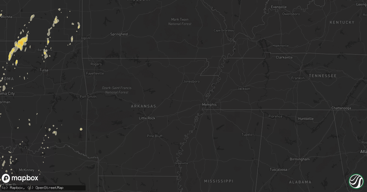
Hail Map on May 11, 2011
Get this storm
May 11 map
$229
one time, instant access
Download today. No call, no setup
Keep the $229
Bought the map and want the full workflow? Apply the entire $229 to a subscription within 7 days. None of it is wasted.
Every map, not just this one
This buys you this map. Subscription and you get every map we run, in the markets you choose from a few cities to whole states to nationwide. Plus real-time alerts the moment a storm fires.
Contact data
Name, contact info, occupancy, even credit band for addresses in the footprint. You go from where it hit to who to call.
Become the source they trust
Unlimited branding weather history reports on demand. You already have the documented answer ready for the property owner, and you are the one who showed up with it.
Property data and RoofTrace estimates
Pull up any address you have got, its value and the exact code rules for that jurisdiction, straight from One Click Code. Then RoofTrace estimates the squares, pitch, and roof value, priced the way you price.
States Impacted by Hail Map on May 11, 2011
Storm reports
Colorado
| Date | Description |
|---|---|
| 05/11/20116:21 PM CDT | Report received via espotter system. |
| 05/11/20116:03 PM CDT | A local report indicates 1.75 inch wind near 1 ESE BURLINGTON |
| 05/11/20116:00 PM CDT | Power poles reported down in burlington by sherif dispatch. |
| 05/11/20115:46 PM CDT | Reported from chaser in i-70. |
| 05/11/20115:46 PM CDT | A local report indicates 1.00 inch wind near 1 W BURLINGTON |
| 05/11/20115:15 PM CDT | Hail report relayed by law enforcement on interstate 70. |
South Dakota
| Date | Description |
|---|---|
| 05/11/20115:57 PM CDT | Shingles blown off roof. |
Ohio
| Date | Description |
|---|---|
| 05/11/20116:55 AM CDT | A local report indicates 1.00 inch wind near 1 S FARMERSTOWN |
| 05/11/20115:15 AM CDT | Dime to quarter size hail. |
| 05/11/20114:15 AM CDT | A local report indicates 1.25 inch wind near ASHLAND |
North Carolina
| Date | Description |
|---|---|
| 05/11/20116:28 PM CDT | A local report indicates 1.00 inch wind near 4 E COLUMBUS |
| 05/11/20116:00 PM CDT | On hwy 21 near nc/va state line. |
| 05/11/20114:30 PM CDT | Hail up to the size of quarters lasted for almost 30 minutes. |
| 05/10/20117:45 PM CDT | A local report indicates 1.00 inch wind near 4 NNE JEFFERSON |
| 05/10/20117:39 PM CDT | A local report indicates 1.00 inch wind near 4 E LANSING |
Iowa
| Date | Description |
|---|---|
| 05/11/20116:54 PM CDT | Observer measured 60mph wind gust... |
| 05/11/20116:40 PM CDT | Experienced between winterset and patterson. |
| 05/11/20116:36 PM CDT | Heavy rain blew horizontally under a 15 foot wide eave and into spotters house. |
| 05/11/20116:31 PM CDT | 60 to 70 mph winds near the town of winterset... |
| 05/11/20116:11 PM CDT | A local report indicates a tornado near 2 N HAWARDEN |
| 05/11/20116:08 PM CDT | Spotter reported at least 60 mph wind. Wind blowing rain horizontally and strongly shook their vehicle. |
| 05/11/20116:04 PM CDT | Observer reported wind gusts at least 60 mph heavy rain blowing horizontally. |
| 05/11/20115:55 PM CDT | Quarter hail and 40-50 mph winds at 160th and highway 25. |
| 05/11/20115:55 PM CDT | A local report indicates 1.00 inch wind near 4 NE HAWARDEN |
| 05/11/20115:55 PM CDT | A local report indicates 1.00 inch wind near 5 NNW IRETON |
| 05/11/20115:46 PM CDT | Quarter size hail |
| 05/11/20115:13 PM CDT | A local report indicates 1.75 inch wind near SALIX |
| 05/11/20114:59 PM CDT | Tornado was about 5-6 miles west of the intersection of h45 and p27. Intersection is south of creston. |
| 05/11/20114:50 PM CDT | Multiple tornadoes in and around lenox. Tornado damage on the west side of lenox. Homes and trailers damaged and power lines down. |
| 05/11/20114:40 PM CDT | Taylor county emergency manager reports 20 square blocks of damage in town...extent unknown at this time. |
| 05/11/20114:25 PM CDT | Brief twin tornadoes occurred. Location estimated. Trained spotter looking at storm from lenox. |
| 05/11/20114:22 PM CDT | Brief tornado near sharpsburg. From gravity fire department spotter. Wall cloud still rotating although currently no tornado. |
| 05/11/20113:08 PM CDT | Hail lasted five minutes. Time estimated. |
| 05/11/20112:55 PM CDT | A local report indicates 2.00 inch wind near 3 ENE NODAWAY |
| 05/11/20112:42 PM CDT | A local report indicates 1.00 inch wind near S NODAWAY |
| 05/11/20112:36 PM CDT | A local report indicates 1.25 inch wind near NODAWAY |
| 05/10/20117:07 PM CDT | A local report indicates a tornado near ASHTON |
| 05/10/20117:07 PM CDT | A local report indicates a tornado near SIBLEY |
Michigan
| Date | Description |
|---|---|
| 05/11/20114:15 PM CDT | Estimated time between 515 and 520 edt. |
| 05/11/20113:25 PM CDT | Ping pong sized hail reported. |
| 05/11/201112:29 PM CDT | A local report indicates 1.25 inch wind near 1 N WELLSTON |
| 05/10/20119:30 PM CDT | A local report indicates 1.00 inch wind near 3 N BORCULO |
| 05/10/20118:55 PM CDT | This is the peak wind gust at spyglass hill on the lakeshore. |
| 05/10/20117:27 PM CDT | 7-8 large pine trees...estimated 40 to 50 feet tall...uprooted and laying towards the north...time estimated from radar |
South Carolina
| Date | Description |
|---|---|
| 05/11/20115:36 PM CDT | Golf ball to baseball size hail at the intersection of highway 76 and academy rd. Windows broken out of vehicles. |
| 05/11/20115:00 PM CDT | A cocorahs observer reports hail up to 2 inches in diameter. |
| 05/11/20115:00 PM CDT | Oconee county relayed a public report of golf ball to baseball sized hail on whetstone road...sw of mountain rest. |
| 05/11/20114:36 PM CDT | Hail observed at the oconee state park. Time estimated from radar. |
| 05/11/20114:30 PM CDT | Hail up to the size of baseballs near hw-28. |
| 05/11/20114:24 PM CDT | Time estimated from radar. |
| 05/11/20114:20 PM CDT | Hail up to the size of quarters at the bad creek hydro station. |
| 05/11/20114:10 PM CDT | At devils fork state park. |
Oklahoma
| Date | Description |
|---|---|
| 05/11/20116:50 PM CDT | Windows blown out in bernice. Boats out of water at duck creek marina. |
| 05/11/20116:50 PM CDT | Large tree limbs were blown down. Estimated 60 to 65 mph gusts persisted for about 8 minutes. |
| 05/11/20116:46 PM CDT | 2 to 4 inch limbs down |
| 05/11/20116:46 PM CDT | Ef1 tornado with estimated maximum winds of 100 mph was found near bernice and tracked across grand lake. |
| 05/11/20116:23 PM CDT | Large limbs down along hwy 82 south of locust grove. Relayed by emergency management. |
| 05/11/20116:15 PM CDT | Thunderstorm wind gust measured at the claremore regional airport. |
| 05/11/20116:14 PM CDT | A local report indicates 60 MPH wind near 1 W SALLISAW |
| 05/11/20116:11 PM CDT | 50 yard wide ef0 with estimated maximum winds of 80 mph with a path length around one half mile. |
| 05/11/20116:10 PM CDT | Large limbs down along hwy 82 south of locust grove. Relayed by emergency management. |
| 05/11/20116:10 PM CDT | Several barns were damaged by strong thunderstorm wind |
| 05/11/20116:07 PM CDT | Several trees were uprooted...large tree limbs were snapped...and the roofs of several homes were damaged |
| 05/11/20116:07 PM CDT | Large tree limbs were snapped |
| 05/11/20116:05 PM CDT | Roof blown off barn...trees down |
| 05/11/20116:03 PM CDT | Power lines down on redbud road east of chouteau. Relayed by emergency management. |
| 05/11/20116:01 PM CDT | A local report indicates 60 MPH wind near CHOUTEAU |
| 05/11/20115:52 PM CDT | Several trees were snapped and large limbs were blown down |
| 05/11/20115:45 PM CDT | Numerous reports of large trees downed in the city. Time estimated via radar. |
| 05/11/20115:40 PM CDT | Estimated near 61st and garnett |
| 05/11/20115:30 PM CDT | Tree down across road in beavers bend state park. |
| 05/11/20115:30 PM CDT | Wind caused damage to the roof on the elementary school cafeteria. Time estimated via radar. |
| 05/11/20115:27 PM CDT | A local report indicates 76 MPH wind near 4 NW SKIATOOK |
| 05/11/20115:20 PM CDT | Large tree blown onto a trailer home near the osage casino. Time estimated via radar. |
| 05/11/20115:14 PM CDT | Trees down and damage to the porch of a house in yanush. Time estimated based on radar. |
| 05/11/20115:03 PM CDT | Three trees uprooted by the wind. Others damaged. |
| 05/11/20115:00 PM CDT | Large limbs down |
| 05/11/20115:00 PM CDT | Five trees blown over...many others damaged. Carport picked up and carried 50 yards. Mobile home had all skirting damaged/removed. |
| 05/11/20114:47 PM CDT | Trees downed by thunderstorm winds in henryetta. Report from volunteer fire department. |
| 05/11/20114:43 PM CDT | Considerable tree damage from wind. Large limbs broken. |
| 05/11/20114:43 PM CDT | A local report indicates 60 MPH wind near YALE |
| 05/11/20114:40 PM CDT | Trees blown down between snow and finley. Power went out in snow about 430...before storms arrived. |
| 05/11/20114:31 PM CDT | Several trees blown down around moyers...many more damaged by wind. Metal roofing blown off a shed. |
| 05/11/20114:30 PM CDT | A local report indicates 60 MPH wind near 2 NW GLENCOE |
| 05/11/20114:30 PM CDT | Trees down...powerlines down....estimated 70 mph winds |
| 05/11/20114:20 PM CDT | Shingles were blown off of rooftops. Carports were damaged. Several trees were blown down...along with numerous tree branches. Four power poles were blown down. The wor |
| 05/11/20114:20 PM CDT | Plastic guttering was blown off of a house. Large tree branches were also blown down. The winds were estimated at 60 mph. |
| 05/11/20113:59 PM CDT | A local report indicates 60 MPH wind near COALGATE |
| 05/11/20113:53 PM CDT | Power poles downed west side of town by thunderstorm winds. Report from city hall. Time estimated from radar. |
| 05/11/20113:40 PM CDT | A local report indicates 60 MPH wind near EDMOND |
| 05/11/20113:25 PM CDT | A local report indicates 60 MPH wind near 5 W GRAINOLA |
| 05/11/20113:25 PM CDT | A local report indicates 60 MPH wind near 3 E NICHOLS HILLS |
| 05/11/20113:15 PM CDT | A local report indicates 62 MPH wind near 8 E NEWKIRK |
| 05/11/20113:10 PM CDT | Also tree limbs down. Time estimated from radar. |
| 05/11/20113:10 PM CDT | A local report indicates 61 MPH wind near 8 E NEWKIRK |
| 05/11/20113:00 PM CDT | A local report indicates 64 MPH wind near 4 NNE SULPHUR |
| 05/11/20112:52 PM CDT | Roof taken off a large metal shop building with overhead doors on the east and west sides. The building was located near us highway 7 and state highway 110. No injuries |
| 05/11/20112:40 PM CDT | A local report indicates 58 MPH wind near 4 ENE ARDMORE |
| 05/11/20112:20 PM CDT | A local report indicates 60 MPH wind near 6 SE BRAY |
| 05/11/20111:30 PM CDT | A local report indicates 60 MPH wind near TERRAL |
| 05/10/20117:30 PM CDT | Trees were blown down on highway 60 |
| 05/10/20117:15 PM CDT | A local report indicates 65 MPH wind near 6 NE WYANDOTTE |
| 05/10/20117:15 PM CDT | Several large trees blown over. Power lines damaged resulting in power outages. |
Missouri
| Date | Description |
|---|---|
| 05/11/20114:11 PM CDT | Emergency management reported quarter size hailin town |
| 05/11/20112:45 PM CDT | 3 powerpoles reported blown down |
| 05/11/20112:44 PM CDT | A local report indicates 1.75 inch wind near HANNIBAL |
| 05/11/20112:37 PM CDT | Still hailing. |
| 05/11/20112:16 PM CDT | Along highway 79 |
| 05/11/20112:11 PM CDT | Lasted 5 minutes |
| 05/11/201112:10 PM CDT | Large tree branch down blocking part of highway f...around 2 miles west of highway 15 |
| 05/11/201112:00 PM CDT | Measured at a university of missouri ag weather site |
| 05/11/201111:55 AM CDT | Trees were reported uprooted with wind gusts estimated to 60 mph. |
| 05/11/201111:23 AM CDT | A local report indicates 62 MPH wind near 3 NE MACON |
| 05/10/20119:03 PM CDT | Tree uprooted downed power lines. |
| 05/10/20118:35 PM CDT | Tree down on power line and a few limbs down across 5th street |
| 05/10/20118:25 PM CDT | Barn roof blown off at papponsville and machinery inside moved several feet |
| 05/10/20117:23 PM CDT | Several trees and limbs down in the vicinity of cedar street and mud springs road. One barn damaged as well. |
| 05/10/20117:23 PM CDT | National weather service damage survey assessment team confirmed an ef-0 tornado east of anderson. Multiple limbs down...trees down...and roof damage to a barn along ce |
Texas
| Date | Description |
|---|---|
| 05/11/20116:55 PM CDT | Golf ball size hail reported 11 miles south of mason. Sheiffs office reports a vehicle lost control due to the hail but no injuries were reported. |
| 05/11/20116:45 PM CDT | Ping pong ball size hail and 1.90 inches of rainfall in 30 minutes. |
| 05/11/20115:55 PM CDT | A local report indicates 65 MPH wind near MOFFAT |
| 05/11/20115:30 PM CDT | Large hail near oatmeal along with an inch of rainfall in less than 30 miniutes. |
| 05/11/20115:20 PM CDT | W side of fort hood |
| 05/11/20115:20 PM CDT | W side of fort hood |
| 05/11/20114:58 PM CDT | Quarter size hail reported 3 miles nw of mason |
| 05/11/20114:35 PM CDT | Large tree branches blown down... Roof blown off a boat deck |
| 05/11/20114:31 PM CDT | Golf ball size hail reported 3 miles nw of mason. |
| 05/11/20114:17 PM CDT | Golf ball size hail reported in mason. |
| 05/11/20113:39 PM CDT | A local report indicates 1.00 inch wind near LLANO |
| 05/11/20113:12 PM CDT | A local report indicates 1.75 inch wind near QUEMADO |
| 05/11/20112:55 PM CDT | 62 mph gust measured at sherman/denison airport |
| 05/11/20112:50 PM CDT | Pea to 1 hail and heavy rain |
| 05/11/20112:45 PM CDT | Trailer home damaged and automobile overturned |
| 05/11/20112:41 PM CDT | A local report indicates 58 MPH wind near COLLINSVILLE |
| 05/11/20112:40 PM CDT | Partial roof off a residence. Suburban vehicle was flipped on its side and 8 outbuildings destroyed. Reports were on the 500 block of crow road. |
| 05/11/20112:37 PM CDT | Damage to barns and outbuildings 1 se of gainesville |
| 05/11/20112:35 PM CDT | 5 miles w of sherman |
| 05/11/20112:33 PM CDT | 65 mph wind gust measured in irving |
| 05/11/20112:15 PM CDT | Photos relayed through media |
| 05/11/20112:10 PM CDT | Intersection of roanoke and knox in north keller |
| 05/11/20112:04 PM CDT | Measured 50 kts at nws office in fort worth |
| 05/11/20111:55 PM CDT | A 30'x15' post barn was destroyed with the debris scattered approximately 1/4 mile to the northeast. The posts of the barn were ripped out of the ground. |
| 05/11/20111:55 PM CDT | Roof off home and power poles snapped on fm 2264 approx. 3 to 4 mi west of denton county line. |
| 05/11/20111:55 PM CDT | Some quarter size hail was reported in the mullin area |
| 05/11/20111:54 PM CDT | Tractor trailers blown off road at the intersection of hwy 287 and fm 407; estimated 65 mph winds. |
| 05/11/20111:45 PM CDT | Restaurant sign damage along 287 in decatur; time estimated by radar |
| 05/11/20111:42 PM CDT | Power lines down at fm 2123 and sh 114 in bridgeport |
| 05/11/20111:35 PM CDT | Few tree limbs down and damage to the roof of a barn. |
| 05/11/20111:35 PM CDT | Mobile home blown off foundation; out buildings blown into trees; intersection of cr 1655 and fm 1810 |
| 05/11/20111:33 PM CDT | A local report indicates 66 MPH wind near 1 N SPRINGTOWN |
| 05/11/20111:19 PM CDT | Bethel road and horseshoe bend road |
| 05/11/20111:18 PM CDT | Hail was at least the size of quarters |
| 05/11/20111:00 PM CDT | Report of cars blown off the road 10 mi n of stephenville on hwy 108 |
| 05/11/201112:20 PM CDT | Quarter size hail reported on the southwest side of possum kingdom lake |
| 05/11/201112:20 PM CDT | Wind gusts estimated between 60 and 70 mph on the southwest side of possum kingdom lake |
| 05/11/201112:04 PM CDT | A local report indicates 1.00 inch wind near 13 NW KERR WILDLIFE MGM |
| 05/11/201111:15 AM CDT | Report from ktxs employee |
| 05/11/201110:15 AM CDT | Hail just under the size of golf balls and winds of 50-60 mph 4 miles north of the concho and runnels county line on u.s. Highway 83. |
| 05/11/201110:05 AM CDT | Quarter size hail at krun studios in south ballinger. |
| 05/11/20116:45 AM CDT | A local report indicates 1.00 inch wind near 10 N ALAMO VILLAGE |
| 05/11/20115:50 AM CDT | A local report indicates 1.00 inch wind near CARTA VALLEY |
| 05/11/20115:25 AM CDT | A local report indicates 1.00 inch wind near 10 SW CARTA VALLEY |
| 05/11/20114:30 AM CDT | Devils river st pk |
| 05/10/201110:56 PM CDT | Golf ball size hail along with heavy rain. |
| 05/10/201110:42 PM CDT | A local report indicates 60 MPH wind near 1 N BARTLETT |
| 05/10/201110:42 PM CDT | A local report indicates 1.00 inch wind near 1 N BARTLETT |
| 05/10/201110:15 PM CDT | 10 inch diameter trees downed |
| 05/10/201110:15 PM CDT | Half inch to one inch size hail and strong winds. 1.20 inches of rainfall. |
| 05/10/201110:15 PM CDT | One inch hail and wind gusts to 40 mph. |
| 05/10/201110:09 PM CDT | Half inch to inch size hail in jarrell |
| 05/10/20119:41 PM CDT | Quarter size hail |
| 05/10/20119:10 PM CDT | A local report indicates 65 MPH wind near KILLEEN |
| 05/10/20119:00 PM CDT | 18-24 inch in diameter tree blown down on 18th street in killeen |
| 05/10/20118:40 PM CDT | Reported 1.6nm ene of kgrk |
| 05/10/20118:23 PM CDT | A local report indicates 1.00 inch wind near LORENA |
| 05/10/20118:15 PM CDT | A local report indicates 1.25 inch wind near MOODY |
| 05/10/20118:08 PM CDT | Quarter sized hail in moody |
| 05/10/20117:20 PM CDT | Half inch to golfball size hail and heavy rain. |
| 05/10/20117:20 PM CDT | Nickel to near quarter size hail. |
Georgia
| Date | Description |
|---|---|
| 05/11/20116:20 PM CDT | Spotter called back and after a quick survey of the yard found that many of the hail stones were 1 inch in diameter. |
| 05/11/20116:09 PM CDT | Rabun county comms reports one tree down and several powerlines down in lakemont. |
Virginia
| Date | Description |
|---|---|
| 05/11/20116:55 PM CDT | A local report indicates 1.00 inch wind near 5 WSW ELK CREEK |
| 05/11/20116:08 PM CDT | A local report indicates 1.00 inch wind near 3 NNE WHITETOP |
| 05/11/20116:00 PM CDT | On west main street |
| 05/11/20116:00 PM CDT | On west main street |
| 05/10/20117:20 PM CDT | A local report indicates 1.00 inch wind near NNW MOUTH OF WILSON |
| 05/10/20117:20 PM CDT | A local report indicates 1.00 inch wind near MOUTH OF WILSON |
| 05/10/20117:00 PM CDT | A local report indicates 1.00 inch wind near MOUTH OF WILSON |
Indiana
| Date | Description |
|---|---|
| 05/11/20116:41 PM CDT | A local report indicates 1.00 inch wind near CHESTERTON |
| 05/11/20116:38 PM CDT | Route 6 and route 49. |
| 05/11/20116:35 PM CDT | Hail ranging from 0.75 inch to 1.00 inch |
| 05/11/20116:30 PM CDT | Robin road and german drive. |
| 05/10/20117:07 PM CDT | Hail ranging from pea sized to 1.00 inch |
| 05/10/20117:00 PM CDT | A local report indicates 1.00 inch wind near 1 SSE TRACY |
Illinois
| Date | Description |
|---|---|
| 05/11/20116:54 PM CDT | A local report indicates 69 MPH wind near OSWEGO |
| 05/11/20116:40 PM CDT | Tree blocking road at route 47 and gardner road. |
| 05/11/20116:15 PM CDT | 8 power poles blown down at ashton road and i-80. |
| 05/11/20115:42 PM CDT | Nickel to quarter size hail at i-39 and route 251. |
| 05/11/20115:25 PM CDT | A local report indicates 1.75 inch wind near 5 SW HOPEDALE |
| 05/11/20115:04 PM CDT | Route 120 and route 31. |
| 05/11/20115:04 PM CDT | A local report indicates 1.00 inch wind near LAKE SUMMERSET |
| 05/11/20114:49 PM CDT | A local report indicates 1.50 inch wind near CRYSTAL LAKE |
| 05/11/20114:37 PM CDT | A local report indicates 58 MPH wind near 4 W YATES CITY |
| 05/11/20114:26 PM CDT | Route 120 and route 31. |
| 05/11/20114:24 PM CDT | A local report indicates 1.00 inch wind near LAKE IN THE HILLS |
| 05/11/20114:24 PM CDT | Trees down on route 97 blocking traffic. Time estimated. |
| 05/11/20114:20 PM CDT | Main street and route 14. Damage to cars. |
| 05/11/20114:17 PM CDT | Plank road and route 20. |
| 05/11/20114:10 PM CDT | Route 173 and wilmot road. |
| 05/11/20113:55 PM CDT | A local report indicates 1.00 inch wind near SPRING GROVE |
| 05/11/20113:52 PM CDT | Large tree limbs blown down and some siding blown off of a few houses. |
| 05/11/20113:39 PM CDT | 55 to 60 mph winds and heavy rain at okeson road 1/2 miles west of greenwood road. |
| 05/11/20113:30 PM CDT | Roof blown off an outbuilding near route 99 and county road 1300 e...three poles clipped off and power lines also down....time approximate. |
| 05/11/20113:14 PM CDT | Reported by illinois state police just south of pittsfield |
| 05/11/20113:06 PM CDT | A local report indicates 1.00 inch wind near MARTINSBURG |
| 05/11/20113:00 PM CDT | A local report indicates 59 MPH wind near MACOMB MUNICIPAL AIRPOR |
| 05/11/20112:52 PM CDT | Still hailing. |
| 05/11/20112:47 PM CDT | A local report indicates 1.25 inch wind near BARRY |
| 05/11/20112:12 PM CDT | A local report indicates 2.00 inch wind near PAYSON |
| 05/11/20111:58 PM CDT | Hail ranged in size from pea to quarter. Located along highway 72 near the adams and pike county line. |
| 05/10/20118:00 PM CDT | 95th and dan ryan expressway. |
| 05/10/20118:00 PM CDT | Trees down at 65th and oakley. |
| 05/10/20117:48 PM CDT | A local report indicates 1.00 inch wind near EVERGREEN PARK |
| 05/10/20117:40 PM CDT | A local report indicates 60 MPH wind near HOMETOWN |
| 05/10/20117:05 PM CDT | A local report indicates 1.00 inch wind near CREST HILL |
Kansas
| Date | Description |
|---|---|
| 05/11/20116:55 PM CDT | A local report indicates 1.00 inch wind near 14 N COLBY |
| 05/11/20116:45 PM CDT | Nickel to quarter size hail. |
| 05/11/20116:32 PM CDT | A local report indicates 58 MPH wind near 6 N EDNA |
| 05/11/20115:31 PM CDT | Fallen tree blocking the road just south of the greenhouse. |
| 05/11/20114:52 PM CDT | A local report indicates 65 MPH wind near EUREKA |
| 05/11/20113:40 PM CDT | 4.5 miles west of cedar vale on highway 166. |
| 05/11/20111:11 PM CDT | A local report indicates 1.00 inch wind near 1 E BREMEN |
| 05/11/20111:06 PM CDT | Also heavy rain with visibility of 150 ft. 35-40 mph wind gusts. |
| 05/11/201112:23 PM CDT | Nickel to quarter size hail |
| 05/11/201112:15 PM CDT | A local report indicates 60 MPH wind near 5 S BELOIT |
| 05/11/201111:54 AM CDT | A local report indicates 1.00 inch wind near 3 SW LINCOLN |
| 05/11/201110:30 AM CDT | A local report indicates 1.00 inch wind near 3 SW BLUFF CITY |
| 05/11/20119:17 AM CDT | A local report indicates 1.25 inch wind near 11 ENE DODGE CITY |
| 05/11/20119:16 AM CDT | A local report indicates 1.00 inch wind near 5 ENE FT. DODGE |
| 05/10/20118:30 PM CDT | Also reporting some street flooding in town. |
| 05/10/20117:35 PM CDT | Emergency management reports large tree down. |
| 05/10/20117:25 PM CDT | A local report indicates 1.00 inch wind near PITTSBURG |
| 05/10/20117:20 PM CDT | Emergency management reports large tree down. |
| 05/10/20117:05 PM CDT | A local report indicates 1.00 inch wind near 3 E SABETHA |
Arkansas
| Date | Description |
|---|---|
| 05/11/20116:50 PM CDT | Large limbs down |
| 05/11/20116:18 PM CDT | Several buildings sustained roof damage. |
| 05/11/20116:15 PM CDT | Trees down on polk county roads 47 and 125. |
| 05/10/20117:39 PM CDT | Measured at the rogers municipal airport. |
| 05/10/20117:37 PM CDT | A 69 knot gust was measured at rogers airport air traffic control tower. Relayed by knwa. |
| 05/10/20117:35 PM CDT | Privacy fences were damaged and large tree limbs were blown down |
| 05/10/20117:35 PM CDT | Trees and power lines were blown down |
| 05/10/20117:25 PM CDT | At 112th and marchem. Winds downing 4 inch diameter branches. |
| 05/10/20117:25 PM CDT | Trees were blown down |
| 05/10/20117:20 PM CDT | A local report indicates 70 MPH wind near 1 W SPRINGDALE |
| 05/10/20117:15 PM CDT | Trees were blown down |
Nebraska
| Date | Description |
|---|---|
| 05/11/20115:15 PM CDT | Light pole knocked over |
| 05/11/20115:09 PM CDT | A local report indicates 60 MPH wind near 1 S EMERSON |
| 05/11/20114:55 PM CDT | Corrected time of event. |
| 05/11/20114:55 PM CDT | Semi blown over |
| 05/11/20114:55 PM CDT | Semi blown over |
| 05/11/20114:22 PM CDT | Wind gust picked up and moved mini van. |
| 05/11/20114:10 PM CDT | A local report indicates 60 MPH wind near SCRIBNER |
| 05/11/20114:03 PM CDT | Grain bins blown in. |
| 05/11/20113:48 PM CDT | A local report indicates 70 MPH wind near PRIMROSE |
| 05/11/20113:47 PM CDT | Reported by emergency manager. Barn roof partly blown off. |
| 05/11/20113:45 PM CDT | Out buildings damaged or destroyed. Numerous center pivots overturned in the area. |
| 05/11/20113:44 PM CDT | 1 inch hail accompanied the gusts. |
| 05/11/20113:42 PM CDT | Pole building destroyed...other outbuildings and grain bins damaged. |
| 05/11/20113:40 PM CDT | A local report indicates 65 MPH wind near 2 E COLUMBUS |
| 05/11/20113:35 PM CDT | Power lines and trees down |
| 05/11/20113:33 PM CDT | Mainly tree damage |
| 05/11/20113:32 PM CDT | 70 mph winds estimated at the airport |
| 05/11/20113:15 PM CDT | A local report indicates 60 MPH wind near 3 S STROMSBURG |
| 05/11/20113:11 PM CDT | 1 inch hail accompanied gusts. |
| 05/11/20113:06 PM CDT | Tornado touched down 1 mile south of osceola...lifted just prior to reaching osceola...and then touched down again just north of osceola. |
| 05/11/20113:03 PM CDT | A local report indicates 63 MPH wind near OSCEOLA |
| 05/11/20113:00 PM CDT | 60 mph estimated wind gusts blew car off the road |
| 05/11/20112:50 PM CDT | Tornado reported by spotters and law enforcement |
| 05/11/20112:50 PM CDT | Evidence of touchdown approximately 6 n of hampton tracking northward to 5 s and 2 e of hordville. Estimated top wind speed of 95 mph...equivalent of a weak ef1...with |
| 05/11/20112:32 PM CDT | A local report indicates 60 MPH wind near MCCOOL JUNCTION |
| 05/11/20112:14 PM CDT | Estimated 55 to 60 mph winds. Also pea to dime size hail. |
| 05/11/20112:14 PM CDT | Pea to quarter size hail. |
| 05/11/20112:14 PM CDT | A few tree limbs down...estimated 2-3 inch diameter. |
| 05/11/20112:04 PM CDT | A local report indicates 70 MPH wind near WILBER |
| 05/11/20112:02 PM CDT | A local report indicates 60 MPH wind near 1 S FAIRFIELD |
| 05/11/20112:00 PM CDT | Approximately 20 cars have damaged windows apparently from thunderstorm winds picking up gravel from the parking lot. Wind speed likely near 60 mph |
| 05/11/20111:55 PM CDT | A local report indicates 60 MPH wind near FILLEY |
| 05/11/20111:46 PM CDT | Tornado reported by trained spotter |
| 05/11/20111:32 PM CDT | Branches breaking on trees. Also 1 inch hail. |
| 05/11/20111:21 PM CDT | Pea to quarter size hail. |
Wisconsin
| Date | Description |
|---|---|
| 05/11/20114:50 PM CDT | A local report indicates 1.00 inch wind near 2 SW COTTAGE GROVE |
| 05/11/20114:45 PM CDT | At intersection of broadway and highway 51. |
| 05/11/20114:44 PM CDT | A local report indicates 1.25 inch wind near HARTLAND |
| 05/11/20114:40 PM CDT | A local report indicates 1.00 inch wind near 1 S HARTLAND |
| 05/11/20114:37 PM CDT | A local report indicates 1.00 inch wind near 1 S MONONA |
| 05/11/20114:30 PM CDT | Delayed report. |
| 05/11/20114:28 PM CDT | A local report indicates 1.25 inch wind near 2 S MADISON |
| 05/11/20114:08 PM CDT | A local report indicates 1.25 inch wind near NE VERONA |
| 05/11/20112:56 PM CDT | A local report indicates 1.00 inch wind near 5 E SPARTA |
| 05/11/20112:43 PM CDT | A local report indicates 1.75 inch wind near S JEFFERSON |
| 05/11/20112:40 PM CDT | A local report indicates 2.00 inch wind near 1 N JEFFERSON |
| 05/11/20112:40 PM CDT | Delayed report of baseball sized hail and broken windows. |
| 05/11/20112:34 PM CDT | Softball size hail reported at intersection of highways 18 and 89. |
| 05/11/20112:30 PM CDT | A local report indicates 1.00 inch wind near 4 WNW LAKE MILLS |
| 05/11/20112:28 PM CDT | A local report indicates 1.00 inch wind near 1 W SUN PRAIRIE |
| 05/11/20112:26 PM CDT | Reported by sheriff deputy at intersection of highway 12 and highway j. |
| 05/11/20112:01 PM CDT | Hail damage to police cars on highway 16 se of tomah. |
| 05/11/20112:00 PM CDT | Delayed report. Video and images of ice cube sized hail in traffic on i-90. |
| 05/11/20111:47 PM CDT | A local report indicates 1.25 inch wind near 1 E MADISON TRUAX AIRPO |
| 05/11/20111:47 PM CDT | A local report indicates 1.50 inch wind near 2 E MADISON TRUAX AIRPO |
| 05/11/20111:45 PM CDT | A local report indicates 1.25 inch wind near 3 E MADISON |
| 05/11/20111:43 PM CDT | A local report indicates 1.00 inch wind near MCFARLAND |
| 05/11/20111:43 PM CDT | A local report indicates 1.00 inch wind near 2 E MADISON TRUAX AIRPO |
| 05/11/20111:41 PM CDT | A local report indicates 1.00 inch wind near MADISON TRUAX AIRPORT |
| 05/11/20111:36 PM CDT | A local report indicates 1.00 inch wind near 1 E MADISON |
| 05/11/201111:47 AM CDT | Minor branch damage |
| 05/11/201111:30 AM CDT | A local report indicates 1.00 inch wind near 2 SSW MENOMONIE |
| 05/11/20119:38 AM CDT | A local report indicates 1.00 inch wind near OCONTO FALLS |
| 05/11/20119:37 AM CDT | Delayed report |
| 05/11/20117:00 AM CDT | A local report indicates 1.00 inch wind near POUND |
Florida
| Date | Description |
|---|---|
| 05/11/20116:30 PM CDT | Large 10 to 14 inch diameter tree branches down and penny size hail near intersection of kelmscott place and rockbourne court. |
| 05/11/20115:10 PM CDT | 1 1/2 to 2 inch branches down |
| 05/11/20114:58 PM CDT | Dean road north |
| 05/11/20114:55 PM CDT | Quater size hail dean road and north university |
Cities Impacted by Hail Map on May 11, 2011
- Marble Falls, TX
- Johnson City, TX
- Llano, TX
- Horseshoe Bay, TX
- Round Mountain, TX
- Williamstown, MO
- Kahoka, MO
- Saint Patrick, MO
- Maple City, MI
- Chase, KS
- Raymond, KS
- Madison, WI
- Vona, CO
- Anabel, MO
- Atlanta, MO
- Macon, MO
- Macomb, IL
- Wellington, MO
- Bates City, MO
- Holden, MO
- Napoleon, MO
- Odessa, MO
- Northport, MI
- Plymouth, OH
- Shiloh, OH
- Audubon, IA
- Temple, TX
- Bellevue, TX
- Morrisonville, IL
- Burlington, CO
- Elgin, OK
- Mesick, MI
- Alva, OK
- Wahoo, NE
- Ithaca, NE
- Barnard, KS
- Kansas, OH
- Wayne, OH
- Fostoria, OH
- Risingsun, OH
- Egg Harbor, WI
- Peshtigo, WI
- Marinette, WI
- Sturgeon Bay, WI
- Elk Mound, WI
- Colfax, WI
- Falls City, NE
- Horton, KS
- Hiawatha, KS
- Fairview, KS
- Eldorado, TX
- Palmyra, WI
- Dousman, WI
- Burlington, WI
- Dexter, MI
- Chelsea, MI
- Ann Arbor, MI
- Krakow, WI
- Abrams, WI
- Oconto Falls, WI
- Little Suamico, WI
- Oconto, WI
- Lena, WI
- Gillett, WI
- Cecil, WI
- Calumet, OK
- Okarche, OK
- El Reno, OK
- Britton, MI
- Westmoreland, KS
- Rapid City, MI
- Alden, MI
- Macedonia, IA
- Ludington, MI
- Melvin, TX
- Old Monroe, MO
- Golden Eagle, IL
- Wentzville, MO
- Grafton, IL
- Brussels, IL
- O'Fallon, MO
- Winfield, MO
- Skiatook, OK
- Paw Paw, MI
- Mattawan, MI
- Kiel, WI
- Catawba, WI
- Prentice, WI
- Kennan, WI
- Eden, TX
- La Plata, MO
- Mount Sterling, IL
- New Salem, IL
- New London, MO
- Rockport, IL
- Baylis, IL
- Versailles, IL
- Chambersburg, IL
- Hull, IL
- Pittsfield, IL
- Nebo, IL
- Beardstown, IL
- Pleasant Hill, IL
- Perry, IL
- Barry, IL
- New Canton, IL
- Frankford, MO
- Kinderhook, IL
- Griggsville, IL
- Arenzville, IL
- Clarence, MO
- Olsburg, KS
- Manhattan, KS
- Goldthwaite, TX
- Pottsville, TX
- Hamilton, TX
- San Saba, TX
- Mullin, TX
- Winfield, KS
- Burden, KS
- Pound, WI
- Tomah, WI
- Wilton, WI
- Warrens, WI
- North Aurora, IL
- Aurora, IL
- Batavia, IL
- Tippecanoe, IN
- Mentone, IN
- Warsaw, IN
- Bourbon, IN
- Etna Green, IN
- Guthrie, OK
- Weldon, IA
- Garden Grove, IA
- Elk Creek, VA
- Independence, VA
- Joliet, IL
- Lockport, IL
- Prague, NE
- Del Rio, TX
- Comstock, TX
- Mchenry, IL
- Fox Lake, IL
- Spring Grove, IL
- Sterling, NE
- Tecumseh, NE
- Onondaga, MI
- Rives Junction, MI
- Holland, MI
- Fullerton, NE
- Sheridan, MO
- Clarinda, IA
- Morrill, KS
- Sabetha, KS
- Dryden, TX
- Salado, TX
- Killeen, TX
- Jarrell, TX
- Belton, TX
- Bartlett, TX
- Florence, TX
- Georgetown, TX
- Independence, KS
- Cainsville, MO
- Crystal Lake, IL
- Woodstock, IL
- Channahon, IL
- Mereta, TX
- Miles, TX
- San Angelo, TX
- Eola, TX
- Gilman City, MO
- Junction, TX
- Wimberley, TX
- Blanco, TX
- Ashland, OH
- Greenwich, OH
- Mansfield, OH
- Wymore, NE
- Lorena, TX
- Bruceville, TX
- Hewitt, TX
- McGregor, TX
- Moody, TX
- Waco, TX
- Voss, TX
- Ruthven, IA
- Terril, IA
- Dickens, IA
- Foster, OK
- Duncan, OK
- Marlow, OK
- Comanche, OK
- Loco, OK
- Rhinelander, WI
- Brackettville, TX
- Henrietta, TX
- Callao, MO
- Ulysses, NE
- Crivitz, WI
- Adrian, MI
- Palmyra, MI
- Jasper, MI
- Sauk City, WI
- Mazomanie, WI
- Russell, KS
- Great Bend, KS
- Hoisington, KS
- Olmitz, KS
- Lineville, IA
- Princeton, MO
- Mercer, MO
- Millbury, OH
- Walbridge, OH
- Oregon, OH
- Perrysburg, OH
- Harbor View, OH
- Toledo, OH
- Northwood, OH
- Yukon, OK
- Mustang, OK
- Maple City, KS
- Dexter, KS
- Cedar Vale, KS
- Kaw City, OK
- Burbank, OK
- Ponca City, OK
- Shidler, OK
- Newkirk, OK
- Bellwood, NE
- Chillicothe, TX
- Odell, TX
- Vernon, TX
- Christoval, TX
- Hartland, WI
- Fort Worth, TX
- Lakemont, GA
- Elsberry, MO
- Silex, MO
- Troy, MO
- Hawk Point, MO
- Foley, MO
- Springfield, NE
- Louisville, NE
- Murdock, NE
- Wheeler, TX
- Briscoe, TX
- Morris, IL
- Santa Anna, TX
- Knox, IN
- Northbrook, IL
- Highland Park, IL
- Glencoe, IL
- Kingfisher, OK
- Mason, TX
- Osceola, NE
- Stromsburg, NE
- Ridgeway, MO
- Bethany, MO
- Eagleville, MO
- Quemado, TX
- Coleman, WI
- Porterfield, WI
- La Valle, WI
- Lyndon Station, WI
- Dane, WI
- Deforest, WI
- Camp Douglas, WI
- Manistee, MI
- Chippewa Falls, WI
- Eau Claire, WI
- Dowling, MI
- Hastings, MI
- San Jose, IL
- Delavan, IL
- Mason City, IL
- Green Valley, IL
- Easton, IL
- Petersburg, IL
- Oakford, IL
- Quincy, IL
- Payson, IL
- Hayes Center, NE
- Palisade, NE
- Wauneta, NE
- Albany, WI
- Farragut, IA
- Buda, TX
- Driftwood, TX
- San Marcos, TX
- Kyle, TX
- Mountain Rest, SC
- Westminster, SC
- Long Creek, SC
- Walhalla, SC
- Brownwood, TX
- Early, TX
- Blanket, TX
- Zephyr, TX
- Polk, NE
- Bradshaw, NE
- Sparta, WI
- Duke, OK
- Kingsland, TX
- Fredericksburg, TX
- Willow City, TX
- Nelson, NE
- Weston, NE
- Ceresco, NE
- Harrietta, MI
- Welch, OK
- Sweetwater, OK
- Athelstane, WI
- Genoa, NE
- Silver Creek, NE
- Clarks, NE
- Weatherford, OK
- Thomas, OK
- Granite, OK
- Jeromesville, OH
- Imogene, IA
- Shenandoah, IA
- Essex, IA
- Bedford, IA
- Nodaway, IA
- New Market, IA
- Creston, IA
- Gravity, IA
- Sharpsburg, IA
- Prescott, IA
- Carbon, IA
- Villisca, IA
- Corning, IA
- Stanton, IA
- Red Oak, IA
- Lenox, IA
- Paint Rock, TX
- Rowena, TX
- Reydon, OK
- Crawford, OK
- Cedar Rapids, NE
- Cisco, TX
- Rising Star, TX
- Cheyenne, OK
- Sutton, NE
- Geneva, NE
- Fairmont, NE
- Grafton, NE
- Charlotte, MI
- Vermillion, SD
- Wilmington, IL
- Arcadia, OK
- Hopkins, MI
- Dorr, MI
- Tiffin, OH
- Bradner, OH
- West Millgrove, OH
- Red Rock, OK
- Marland, OK
- Tonkawa, OK
- Tampico, IL
- Murray, NE
- Weeping Water, NE
- Nehawka, NE
- Rocksprings, TX
- Barksdale, TX
- Plainville, IL
- Hannibal, MO
- Buckholts, TX
- Holland, TX
- Rogers, TX
- Marlin, TX
- Whiting, IA
- Salix, IA
- Sloan, IA
- Climbing Hill, IA
- Hornick, IA
- Bronson, IA
- Winnebago, NE
- Hartley, IA
- Schaumburg, IL
- Elk Grove Village, IL
- Sonora, TX
- New Hampton, MO
- Albany, MO
- Martinsville, MO
- Fort Hood, TX
- Spring Hill, KS
- Caddo, TX
- Breckenridge, TX
- Rock Port, MO
- Stanley, WI
- Springtown, TX
- Mead, NE
- Oneida, KS
- Sheffield, IL
- Saint Edward, NE
- Chico, TX
- Sunset, TX
- Mcfarland, WI
- Sun Prairie, WI
- Verona, WI
- Milford, NE
- Pleasant Dale, NE
- Seward, NE
- Waurika, OK
- Watertown, WI
- Alto, MI
- Fall Creek, WI
- Altoona, WI
- Castell, TX
- Buchanan Dam, TX
- Doss, TX
- Elgin, IL
- Maple Park, IL
- Hampshire, IL
- Gilberts, IL
- Huntley, IL
- Carpentersville, IL
- Algonquin, IL
- Lake In The Hills, IL
- Dundee, IL
- Crockett, TX
- Groveton, TX
- Pennington, TX
- Dodge City, KS
- Green Castle, MO
- Green City, MO
- Three Oaks, MI
- Rolling Prairie, IN
- New Carlisle, IN
- La Porte, IN
- Galien, MI
- Rush Center, KS
- Albert, KS
- Otis, KS
- Stoughton, WI
- Oregon, WI
- Jefferson, WI
- Cambridge, WI
- Lake Mills, WI
- Johnson Creek, WI
- Deerfield, WI
- Helenville, WI
- Cottage Grove, WI
- Waterloo, WI
- Fort Atkinson, WI
- Millersburg, OH
- Fresno, OH
- Kansas City, MO
- Ninnekah, OK
- Rush Springs, OK
- Walters, OK
- Temple, OK
- Oskaloosa, IA
- Benton, IA
- Campobello, SC
- Bremen, IN
- Smithville, OK
- Watson, OK
- Elmo, MO
- Burlington Junction, MO
- Ballinger, TX
- Talpa, TX
- Coleman, TX
- Hawarden, IA
- Stephenson, MI
- Randall, KS
- Jewell, KS
- Frankfort, KS
- Argos, IN
- Hardy, NE
- Byron, NE
- Deshler, NE
- Bartlesville, OK
- Ochelata, OK
- Ramona, OK
- Bridgeport, TX
- Nelson, WI
- York, NE
- Hampton, NE
- Barnes, KS
- Wellington, OH
- Carleton, NE
- Hebron, NE
- Shickley, NE
- Silver City, IA
- Malvern, IA
- Glenwood, IA
- Wellsville, KS
- Rantoul, KS
- Edgerton, KS
- Williamston, MI
- Crete, NE
- Scottville, MI
- Stockbridge, MI
- Hordville, NE
- La Harpe, IL
- Blandinsville, IL
- Bertram, TX
- Chesterton, IN
- Valparaiso, IN
- Mineral Wells, TX
- Alvord, TX
- Minooka, IL
- Shorewood, IL
- Plainfield, IL
- Craig, MO
- Forest City, MO
- Carlton, TX
- Olney, TX
- Richland Springs, TX
- Rochelle, TX
- Johnstown, NE
- Scotland, TX
- Edina, MO
- Novelty, MO
- Taylor, NE
- Columbus, NC
- Cashion, OK
- Tamassee, SC
- West Union, SC
- Frontenac, KS
- Pittsburg, KS
- Gould, OK
- Garland, NE
- Brady, TX
- Hamburg, IA
- Sidney, IA
- Emerson, IA
- Randolph, IA
- Westboro, MO
- Northboro, IA
- Tarkio, MO
- Delphos, KS
- Lawton, OK
- Jacksboro, TX
- Garden City, MO
- Pleasant Hill, MO
- Kingsville, MO
- Tremont, IL
- Neodesha, KS
- Elk City, KS
- Leonard, MO
- Wausaukee, WI
- Pembine, WI
- Amberg, WI
- Dunbar, WI
- Daggett, MI
- Lane, OK
- Spickard, MO
- King City, MO
- Luther, MI
- Justin, TX
- Ponder, TX
- Coldwater, MI
- Minco, OK
- Anadarko, OK
- Pocasset, OK
- Salem, SC
- Atwood, KS
- Denver, MO
- Gentry, MO
- Helena, OH
- Gibsonburg, OH
- Balko, OK
- Oak Lawn, IL
- Palos Hills, IL
- Burbank, IL
- Willow Springs, IL
- Justice, IL
- Bridgeview, IL
- Worth, IL
- Palos Park, IL
- Chicago Ridge, IL
- Hickory Hills, IL
- Lemont, IL
- Willowbrook, IL
- Robinson, KS
- Fairfax, MO
- White Cloud, KS
- Oregon, MO
- Mound City, MO
- Rulo, NE
- Maitland, MO
- Fillmore, MO
- Winters, TX
- Wolbach, NE
- Graford, TX
- Graham, TX
- Minneapolis, KS
- Lindsay, OK
- Quanah, TX
- Table Rock, NE
- Johnson, NE
- Elk Creek, NE
- Cook, NE
- Lawrence, MI
- Percival, IA
- Gregory, MI
- Fowlerville, MI
- Webberville, MI
- Mundelein, IL
- Vernon Hills, IL
- Unionville, MO
- Crowell, TX
- Pewaukee, WI
- Delafield, WI
- Nashotah, WI
- Landrum, SC
- Tryon, NC
- Franklin, TX
- Hearne, TX
- Plymouth, IN
- Culver, IN
- North Judson, IN
- Hamlet, IN
- Grovertown, IN
- Nekoma, KS
- Grandview, MO
- Crescent, OK
- Prospect Heights, IL
- Mount Prospect, IL
- Glenview, IL
- Wallace, NE
- Staplehurst, NE
- Surprise, NE
- Bangs, TX
- Brookesmith, TX
- Wautoma, WI
- Coloma, WI
- Westfield, WI
- Wright, KS
- Waunakee, WI
- Rosebud, TX
- Lott, TX
- Odell, NE
- Bremen, KS
- Marysville, KS
- Kirksville, MO
- Argonne, WI
- Stanberry, MO
- Plattsmouth, NE
- Marion, MI
- Nolanville, TX
- Harker Heights, TX
- Briggs, TX
- Benedict, KS
- Altoona, KS
- Thayer, KS
- Chanute, KS
- Belleville, WI
- Brooklyn, WI
- Dewey, OK
- Elliott, IA
- Pollock, MO
- Lucerne, MO
- Newtown, MO
- Shepherd, TX
- Livingston, TX
- Goodrich, TX
- Arkansas City, KS
- Wayland, MI
- Shelbyville, MI
- Medicine Park, OK
- Schuyler, NE
- Hext, TX
- Menard, TX
- Durand, WI
- Menomonie, WI
- Fontanelle, IA
- Tupelo, OK
- Stonewall, OK
- Friendship, WI
- Plainfield, WI
- Hancock, WI
- Lincoln, KS
- Almond, WI
- Wild Rose, WI
- Eagle, MI
- Portland, MI
- Pinckney, MI
- Howell, MI
- Clarkson, NE
- Leigh, NE
- Miltonvale, KS
- Union Star, MO
- Darlington, MO
- Wellston, MI
- Brethren, MI
- Free Soil, MI
- Oglesby, TX
- Gatesville, TX
- Kempner, TX
- Lampasas, TX
- Copperas Cove, TX
- Burnet, TX
- Caledonia, MI
- Middleville, MI
- Tescott, KS
- Leon, IA
- Mondovi, WI
- Skidmore, MO
- Kendall, WI
- Beaver, OK
- Decatur, TX
- Troutdale, VA
- Mouth Of Wilson, VA
- Powersville, MO
- Belleville, MI
- Ypsilanti, MI
- Mulliken, MI
- Frederick, OK
- Kellerton, IA
- Merrimac, WI
- Baraboo, WI
- Humeston, IA
- Liberty, IL
- Edmond, OK
- Ottawa Lake, MI
- Gleason, WI
- Glen Flora, WI
- Tony, WI
- Ogema, WI
- Brantwood, WI
- Delton, MI
- Toccoa, GA
- Brevard, NC
- Rosman, NC
- Lake Toxaway, NC
- Sunset, SC
- Tiger, GA
- Clarkesville, GA
- Harris, MO
- Milan, MO
- Michigan City, IN
- Westville, IN
- Hobart, IN
- Woodway, TX
- Washington, KS
- Idalia, CO
- Orlando, FL
- Phillips, WI
- Bostic, NC
- Ellenboro, NC
- Novice, TX
- Lawn, TX
- Goldsboro, TX
- Liberty, NE
- Oketo, KS
- Hamilton, IL
- Telephone, TX
- Allerton, IA
- Corydon, IA
- Jetmore, KS
- Amherst, WI
- Dewitt, MI
- Cherokee, TX
- Sterling City, TX
- Keller, TX
- Tomahawk, WI
- Gallatin, MO
- Jameson, MO
- Oconomowoc, WI
- Sussex, WI
- Colgate, WI
- Bridgewater, IA
- Liberty Hill, TX
- Lodi, WI
- Jamesport, MO
- Morse Bluff, NE
- Colon, NE
- Malmo, NE
- Madison, NE
- Indiahoma, OK
- Ranger, TX
- Strawn, TX
- Wann, OK
- Caney, KS
- Copan, OK
- Speedwell, VA
- Rural Retreat, VA
- Newcastle, TX
- Columbus, NE
- Hamlin, IA
- Exira, IA
- Hazelhurst, WI
- Tripoli, WI
- Sweetwater, TX
- Nocona, TX
- Mulhall, OK
- Chilton, TX
- Eddy, TX
- Durand, IL
- Brodhead, WI
- Davis, IL
- Mankato, KS
- Moulton, IA
- Unionville, IA
- Centerville, IA
- Udell, IA
- University Park, IA
- Eddyville, IA
- Spearville, KS
- Ford, KS
- Eastland, TX
- Greenville, TX
- Fountain, MI
- Branch, MI
- Rutherfordton, NC
- Oklahoma City, OK
- Lucas, KS
- Black River Falls, WI
- Shannon City, IA
- Gainesville, TX
- Bern, KS
- Byron Center, MI
- Hamilton, MI
- Allegan, MI
- Hudsonville, MI
- Zeeland, MI
- Perry, OK
- Orlando, OK
- Momence, IL
- Utica, NE
- Gresham, NE
- Waco, NE
- Syracuse, NE
- Unadilla, NE
- Nebraska City, NE
- Dunbar, NE
- Webber, KS
- Formoso, KS
- Bowie, TX
- Lac Du Flambeau, WI
- Finley, OK
- Moyers, OK
- Antlers, OK
- Richmond, IL
- Pacific Junction, IA
- Amity, MO
- Goff, KS
- Soldier, KS
- Concordia, KS
- Aurora, KS
- Clyde, KS
- Eaton Rapids, MI
- Glasco, KS
- Garnett, KS
- Adams, NE
- Cortland, NE
- Coin, IA
- Blanchard, IA
- Piedmont, KS
- Dorchester, NE
- Conway Springs, KS
- Viola, KS
- Hinckley, IL
- Avoca, NE
- Otoe, NE
- Yorkville, IL
- Rib Lake, WI
- Breckenridge, MO
- Hamilton, MO
- Suring, WI
- Palmer, NE
- Central City, NE
- Archer, NE
- Binger, OK
- Grand Ledge, MI
- Dillard, GA
- Cazenovia, WI
- Osceola, IA
- Murray, IA
- Homer, NE
- Luther, OK
- Blakesburg, IA
- Drakesville, IA
- Ottumwa, IA
- Valera, TX
- Beatrice, NE
- Fairbury, NE
- Alcester, SD
- Hudson, SD
- Stringtown, OK
- Creston, NE
- Spicewood, TX
- Clyde, TX
- Luray, KS
- New Glarus, WI
- Kennard, TX
- Forestburg, TX
- Saint Jo, TX
- Muenster, TX
- Albion, MI
- Homer, MI
- Monmouth, IL
- Addison, IL
- Itasca, IL
- Wood Dale, IL
- Royal, IA
- Everly, IA
- Spencer, IA
- Bryson, TX
- Bruno, NE
- Cache, OK
- Moville, IA
- Canute, OK
- Three Lakes, WI
- Harper, TX
- Comanche, TX
- Voca, TX
- Hennessey, OK
- Evansville, WI
- Janesville, WI
- Poolville, TX
- Weatherford, TX
- Whitt, TX
- Buckner, MO
- Baird, TX
- Edgar, NE
- Grand Island, NE
- Chapman, NE
- Pawnee, OK
- Irons, MI
- Parma, MI
- Ellsworth, KS
- Wilson, KS
- Sylvan Grove, KS
- Nashville, MI
- Vermontville, MI
- Greenleaf, KS
- La Belle, MO
- Benzonia, MI
- Frankfort, MI
- Grand Ridge, IL
- Marseilles, IL
- Ransom, IL
- Trenton, MO
- Saint Charles, IL
- Wayne, IL
- South Elgin, IL
- Coal City, IL
- Valparaiso, NE
- Concord, MI
- Carbon, TX
- Avon, IL
- Virginia, IL
- Waukegan, IL
- Zion, IL
- Helena, MO
- Beverly, KS
- Watonga, OK
- Sylva, NC
- Roff, OK
- Tustin, MI
- McBain, MI
- Leroy, MI
- Cadillac, MI
- Cornell, WI
- Whitewater, WI
- Lambertville, MI
- Temperance, MI
- Maitland, FL
- Winter Park, FL
- Wisner, NE
- Seneca, KS
- Smithland, IA
- Fort Pierce, FL
- Grassy Creek, NC
- Geary, OK
- Waterville, KS
- Hanover, KS
- Exline, IA
- Cincinnati, IA
- Blackstone, IL
- Kinsman, IL
- New Lisbon, WI
- Jansen, NE
- Stratton, CO
- Stanton, NE
- Lake, MI
- Harrison, MI
- Loudonville, OH
- Bluff City, KS
- Tow, TX
- Valley Spring, TX
- Lake Geneva, WI
- Elkhorn, WI
- Marthasville, MO
- Warrenton, MO
- Chattanooga, OK
- Loveland, OK
- Mangum, OK
- Olustee, OK
- Kanorado, KS
- Bellevue, NE
- Papillion, NE
- Erick, OK
- Ursa, IL
- Mendon, IL
- Fowler, IL
- Pender, NE
- Plymouth, NE
- De Witt, NE
- Palmer, KS
- Lindsay, NE
- Maxwell, NE
- Wonder Lake, IL
- Hebron, IL
- New Florence, MO
- Lakeville, OH
- Elkhart Lake, WI
- Custer, MI
- Wilber, NE
- Morrowville, KS
- Afton, IA
- Tennessee, IL
- Plymouth, IL
- Willow, OK
- Elkhart, TX
- Glencoe, OK
- Stillwater, OK
- Evart, MI
- Corrigan, TX
- Oberlin, KS
- Moscow Mills, MO
- Groesbeck, TX
- Gracemont, OK
- Clayton, IL
- Art, TX
- Clayton, GA
- Loraine, TX
- Roscoe, TX
- Onekama, MI
- Bear Lake, MI
- Union City, OK
- Seibert, CO
- Cameron, TX
- Gause, TX
- McCool Junction, NE
- Galesburg, MI
- Norfolk, NE
- Raymore, MO
- Belton, MO
- Hurdland, MO
- Elroy, WI
- Mauston, WI
- Linn, KS
- Waupaca, WI
- Dresden, KS
- Dawson, NE
- Du Bois, NE
- Humboldt, NE
- Salem, NE
- Wolfe City, TX
- Necedah, WI
- Eureka, KS
- Cushing, OK
- Braymer, MO
- Lock Springs, MO
- Crandon, WI
- Pawhuska, OK
- Stanfield, NC
- Midland, NC
- Monroe, NC
- Waterford, WI
- Union Grove, WI
- Berger, MO
- Beloit, KS
- Courtland, KS
- Lorimor, IA
- Manchester, OK
- Anthony, KS
- Athens, IL
- Decatur, IA
- Dublin, TX
- Shelbina, MO
- Grandville, MI
- Jenison, MI
- Grand Rapids, MI
- Wyoming, MI
- Paola, KS
- Eudora, KS
- Baldwin City, KS
- Bison, KS
- Marshall, WI
- Shawano, WI
- Ringwood, IL
- Colby, KS
- Hustler, WI
- Gorman, TX
- Shreve, OH
- Clearfield, IA
- Hatfield, MO
- Blythedale, MO
- Chillicothe, MO
- Agenda, KS
- Belleville, KS
- Independence, MO
- Genoa, OH
- Curtice, OH
- Grapeland, TX
- Douglas, NE
- Firth, NE
- Filley, NE
- Blue Springs, NE
- Hickman, NE
- Bennet, NE
- Pickrell, NE
- Crab Orchard, NE
- Rattan, OK
- Thayer, IA
- Ellston, IA
- Evant, TX
- Gouldbusk, TX
- Sergeant Bluff, IA
- Fort McKavett, TX
- Leslie, MI
- Galesburg, IL
- Davidson, OK
- Malcolm, NE
- Raymond, NE
- Monroe, WI
- Juda, WI
- Watson, MO
- Shamrock, TX
- Holcombe, WI
- Conrath, WI
- Ryan, OK
- Marquette, NE
- Henderson, NE
- Stroud, OK
- Normangee, TX
- Girard, KS
- Burr, NE
- Saint Cloud, FL
- Foristell, MO
- North Manchester, IN
- Seagoville, TX
- Forney, TX
- Tipton, KS
- Osborne, KS
- Elkhart, IL
- Windthorst, TX
- Greenfield, IA
- Denton, TX
- Stark, KS
- Cross Plains, TX
- Milligan, NE
- Kaleva, MI
- Copemish, MI
- Pelican Lake, WI
- Fredonia, TX
- Dallas City, IL
- Lawton, IA
- Sioux City, IA
- Pawnee City, NE
- Lewiston, NE
- Burchard, NE
- Steinauer, NE
- Poynette, WI
- Dodge, NE
- Beemer, NE
- Howells, NE
- West Point, NE
- Hayesville, OH
- Big Prairie, OH
- Perrysville, OH
- Shelby, OH
- Dwight, NE
- Baileyville, KS
- Axtell, KS
- Minneola, KS
- Chickasha, OK
- Pattonsburg, MO
- Dekalb, IL
- Ingleside, IL
- Elburn, IL
- Grant City, MO
- Worth, MO
- Harrold, TX
- Henderson, IA
- Durham, OK
- Thurman, IA
- Portage, IN
- Verdon, NE
- Centralia, KS
- Wichita, KS
- Colwich, KS
- Goddard, KS
- Maize, KS
- Bunker Hill, KS
- Bushton, KS
- Holyrood, KS
- Claflin, KS
- Burkett, TX
- Abingdon, IL
- Maquon, IL
- Riesel, TX
- New Virginia, IA
- Phillips, NE
- Garden City, TX
- Westbrook, TX
- Bucklin, KS
- Arlington, WI
- Rio, WI
- Culbertson, NE
- Diagonal, IA
- Argyle, TX
- Duncan, NE
- Monroe, NE
- Jackson, MI
- David City, NE
- Burdett, KS
- Olivet, MI
- Bellevue, MI
- Harshaw, WI
- Dwight, IL
- Diller, NE
- La Crosse, KS
- Larned, KS
- Moran, TX
- Kingston, OK
- Glen Ellyn, IL
- Glendale Heights, IL
- Lombard, IL
- Lamoni, IA
- Orrick, MO
- Excelsior Springs, MO
- Highlands, NC
- Cedar, MI
- Springfield, WI
- Sparta, MI
- London Mills, IL
- Morrison, OK
- Park Falls, WI
- Boyd, WI
- Humboldt, KS
- Colchester, IL
- Muir, MI
- Fenwick, MI
- Ionia, MI
- Ruskin, NE
- Republic, KS
- Norton, TX
- Barrington, IL
- Cary, IL
- Diboll, TX
- Lovelady, TX
- Trinity, TX
- Crockett, VA
- Crumpler, NC
- Piney Creek, NC
- Wytheville, VA
- Springport, MI
- Wright City, MO
- Ringgold, TX
- Hartington, NE
- Newcastle, NE
- Wynot, NE
- Argonia, KS
- Freeport, KS
- Knox City, MO
- Wonewoc, WI
- Florence, WI
- Manitowoc, WI
- Valders, WI
- Newton, WI
- Brainard, NE
- Riverton, IA
- Lansing, NC
- Libertyville, IL
- Grayslake, IL
- Gurnee, IL
- Berkey, OH
- Blissfield, MI
- Metamora, OH
- Thornton, TX
- Kosse, TX
- Elmer, OK
- Bellevue, OH
- Columbus, KS
- Chetopa, KS
- Danbury, NE
- Sidney, TX
- Milton, KS
- Garden Plain, KS
- Union, NE
- Humphreys, MO
- Plainwell, MI
- Hinton, OK
- Sheridan, MI
- Bruning, NE
- Strang, NE
- Davenport, NE
- Burkburnett, TX
- Randlett, OK
- Wichita Falls, TX
- Bassett, NE
- Bryan, TX
- Apache, OK
- Battle Creek, MI
- Sanger, TX
- Ringling, OK
- Wallace, MI
- Cedar Springs, MI
- Perrin, TX
- Home, KS
- Columbus, WI
- Jones, OK
- Hawkins, WI
- Hopedale, IL
- Green Springs, OH
- Clay Center, KS
- Jerseyville, IL
- Pentwater, MI
- Arkdale, WI
- Broaddus, TX
- Orient, IA
- Bethune, CO
- Mart, TX
- Stuart, IA
- Bee, NE
- Clatonia, NE
- Swanton, NE
- Endicott, NE
- Antioch, IL
- Emmetsburg, IA
- Graettinger, IA
- Fremont, OH
- Troy, TX
- Coshocton, OH
- Calvin, OK
- Stuart, OK
- Aurora, NE
- Granger, TX
- Leander, TX
- Priddy, TX
- Little River Academy, TX
- Pontotoc, TX
- Mountain Home, TX
- Bluffton, TX
- Kalamazoo, MI
- Brashear, MO
- Jasper, TX
- Orange City, IA
- Longford, KS
- Honor, MI
- Lake Tomahawk, WI
- Carnegie, OK
- Miami, OK
- Evanston, IL
- Wilmette, IL
- Skokie, IL
- May, TX
- Carter, OK
- Sentinel, OK
- Lone Wolf, OK
- Scammon, KS
- Iola, KS
- Middleton, WI
- Sullivan, WI
- Sheldon, WI
- Elmwood, NE
- Denton, NE
- Greeley, KS
- Wisconsin Dells, WI
- Grand Marsh, WI
- Irma, WI
- Omaha, NE
- Gretna, NE
- Cedar Creek, NE
- Manley, NE
- Aledo, TX
- Colmesneil, TX
- Woodville, TX
- Uniontown, KS
- Spring Arbor, MI
- Horton, MI
- Seneca, IL
- Axtell, TX
- Conklin, MI
- South Sioux City, NE
- Deerfield, IL
- Perryton, TX
- Blue Springs, MO
- Altus, OK
- Minocqua, WI
- Cyril, OK
- Medford, WI
- Talmage, NE
- Virginia, NE
- Panama, NE
- Brock, NE
- Dakota City, NE
- Rogers, NE
- Era, TX
- Orfordville, WI
- Mount Horeb, WI
- Humphrey, NE
- Valley View, TX
- Kimballton, IA
- Sioux Center, IA
- Atoka, OK
- Boswell, OK
- Vickery, OH
- Clyde, OH
- Cedar Bluffs, NE
- Martin, OH
- Laurel Springs, NC
- Sparta, NC
- Camden, MO
- Henrietta, MO
- Cleveland, WI
- Gardner, KS
- Olathe, KS
- Steele City, NE
- Hollenberg, KS
- Western, NE
- Friend, NE
- Azle, TX
- Fay, OK
- Bennington, OK
- North Bend, NE
- Mukwonago, WI
- Hubbardston, MI
- Saline, MI
- Terral, OK
- Clarksville, MO
- Delaware, OK
- Union Mills, IN
- Baroda, MI
- Buchanan, MI
- Mill Creek, IN
- Sawyer, MI
- Rochester, IN
- Drumright, OK
- Jennings, OK
- Childress, TX
- Seneca, SC
- Millerton, IA
- Russell, IA
- Eolia, MO
- Lansing, MI
- Sulphur, OK
- Dripping Springs, TX
- Grandfield, OK
- Atlanta, KS
- Clyde, MO
- Pierceton, IN
- Ellisville, IL
- Circleville, KS
- Davis City, IA
- Piedmont, OK
- Newark, IL
- Edgerton, WI
- Bethel, OK
- Collinsville, TX
- Great Lakes, IL
- North Chicago, IL
- Wakefield, NE
- Wayne, NE
- Hebron, IN
- Elmwood, WI
- Bronson, MI
- Pontiac, IL
- Moravia, IA
- Bloomfield, IA
- Swanton, OH
- West Jefferson, NC
- Cromwell, IA
- Macksburg, IA
- Hastings, IA
- Winterset, IA
- De Leon, TX
- Clifton, TX
- McFall, MO
- Coffey, MO
- Rising City, NE
- Sedgwick, KS
- Valley Center, KS
- Brussels, WI
- Mount Ayr, IA
- Gaylord, KS
- Gary, IN
- Lake Station, IN
- Quincy, MI
- Greenville, MI
- Romeoville, IL
- Beaver Crossing, NE
- Griffith, IN
- Palmyra, MO
- Grand River, IA
- Ireton, IA
- Reedsburg, WI
- Mazon, IL
- Flat Rock, NC
- Zirconia, NC
- Rock Valley, IA
- Colorado City, TX
- Crest Hill, IL
- Millersview, TX
- Monticello, WI
- East Troy, WI
- Lagrange, OH
- Madill, OK
- Fence, WI
- Round Lake, IL
- Wauconda, IL
- Arlington Heights, IL
- Des Plaines, IL
- Wheeling, IL
- Walnut, IL
- Tabor, IA
- Gowen, MI
- Shelby, NE
- Broken Bow, OK
- Redding, IA
- Goliad, TX
- Lake Zurich, IL
- Hoffman Estates, IL
- Texola, OK
- Cresson, TX
- Lucien, OK
- Covington, OK
- Cornell, IL
- Fort Cobb, OK
- Summerfield, KS
- Beattie, KS
- Bartlett, IL
- Streamwood, IL
- Hanover Park, IL
- Bath, MI
- Jim Falls, WI
- Walthill, NE
- Thompsonville, MI
- Elwood, IL
- New Lenox, IL
- Manhattan, IL
- Stratton, NE
- Arma, KS
- Franklin, KS
- Hinsdale, IL
- Oak Brook, IL
- Westmont, IL
- Clarendon Hills, IL
- Tyro, KS