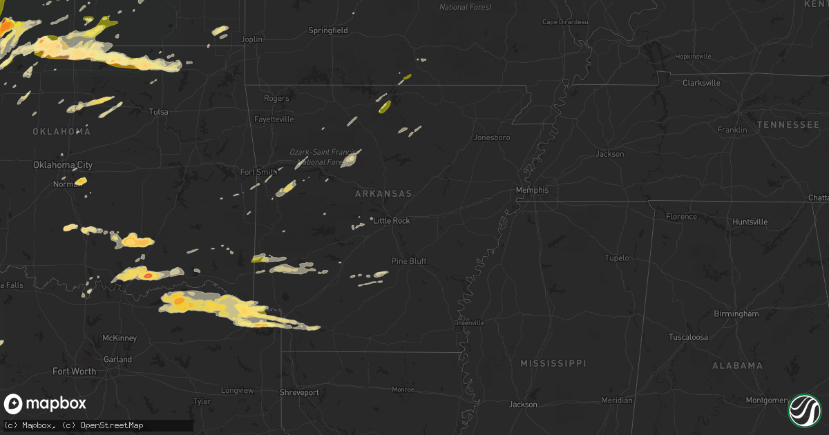
Hail Map in Arkansas on May 9, 2016
Get this storm
May 9 map
$229
one time, instant access
Download today. No call, no setup
Keep the $229
Bought the map and want the full workflow? Apply the entire $229 to a subscription within 7 days. None of it is wasted.
Every map, not just this one
This buys you this map. Subscription and you get every map we run, in the markets you choose from a few cities to whole states to nationwide. Plus real-time alerts the moment a storm fires.
Contact data
Name, contact info, occupancy, even credit band for addresses in the footprint. You go from where it hit to who to call.
Become the source they trust
Unlimited branding weather history reports on demand. You already have the documented answer ready for the property owner, and you are the one who showed up with it.
Property data and RoofTrace estimates
Pull up any address you have got, its value and the exact code rules for that jurisdiction, straight from One Click Code. Then RoofTrace estimates the squares, pitch, and roof value, priced the way you price.
Storm reports in Arkansas
Arkansas
| Date | Description |
|---|---|
| 05/09/20166:40 PM CDT | A local report indicates 1.00 inch wind near 5 E MOUNTAIN HOME |
| 05/09/20161:10 AM CDT | Large tree down across county road 320 in newcastle. Time is radar estimated. |
| 05/08/201611:12 PM CDT | Txk asos recorded 50 knot gust. |
| 05/08/201610:55 PM CDT | A few trees blown over. |
| 05/08/201610:50 PM CDT | Trees down on pinnacle valley road. |
| 05/08/201610:45 PM CDT | A few trees reported down. |
| 05/08/201610:42 PM CDT | Home damaged along sacred path road...possible tornado. |
| 05/08/201610:40 PM CDT | A few trees down and signs blown over near burlingame rd south of kanis. |
| 05/08/201610:36 PM CDT | Numerous trees uprooted and snapped...with some falling on a home. |
| 05/08/201610:34 PM CDT | Nws storm survey revealed an ef1 tornado...with track length of 2.7 miles...and max width of 200 yds. Numerous trees were uprooted or snapped...with a few trees on home |
| 05/08/20169:52 PM CDT | Trees down in new hope. |
| 05/08/20169:00 PM CDT | Several trees down along highway 71. |
| 05/08/20169:00 PM CDT | Relayed by polk county em. |
| 05/08/20168:45 PM CDT | Large tree down across grandview road. Time is radar estimated. |
| 05/08/20168:20 PM CDT | A few trees down. |
| 05/08/20167:43 PM CDT | Trees snapped and uprooted in salem. Large trees down with multiple power and telephone lines down. Spotter estimated windspeed at 75 mph. |
| 05/08/20167:41 PM CDT | Planes severely damaged along with structural damage to some airport buildings. |
| 05/08/20167:40 PM CDT | Trees were downed on houses...with some building damage reported. Straight-line winds estimated at 60 to 80 mph. |
| 05/08/20167:10 PM CDT | Several trees down near hector. |
| 05/08/20167:00 PM CDT | A few trees blown over and large tree limbs down. |
All States Impacted by Hail Map on May 9, 2016
Cities Impacted by Hail Map on May 9, 2016
- Covington, OK
- Stamps, AR
- Leonardville, KS
- Randolph, KS
- Clearwater, KS
- Goddard, KS
- Wichita, KS
- Viola, KS
- Munden, KS
- Belleville, KS
- Scandia, KS
- Medford, OK
- Bokchito, OK
- New Boston, TX
- Texarkana, TX
- Simms, TX
- De Kalb, TX
- Maud, TX
- Hooks, TX
- Mahaska, KS
- Flippin, AR
- Columbus, KS
- Weeping Water, NE
- Murray, NE
- Nehawka, NE
- Plattsmouth, NE
- Louisville, NE
- Meno, OK
- Fairfield, NE
- Edgar, NE
- Clay Center, NE
- Glenvil, NE
- Hector, AR
- Milford, NE
- Kirkman, IA
- Harlan, IA
- Minneapolis, KS
- Glasco, KS
- Delphos, KS
- Tescott, KS
- Waldron, KS
- Kiowa, KS
- Hazelton, KS
- Burlington, OK
- Bassett, NE
- Cherokee, OK
- Taylor, NE
- Westboro, MO
- Tarkio, MO
- Wapanucka, OK
- Coalgate, OK
- Stonewall, OK
- Centrahoma, OK
- Atoka, OK
- Tupelo, OK
- Mankato, KS
- Garland City, AR
- Buckner, AR
- Lewisville, AR
- Davis, OK
- Wynnewood, OK
- Falls City, NE
- Durant, OK
- Bennington, OK
- Caddo, OK
- Caney, OK
- Pawhuska, OK
- Bartlesville, OK
- Boswell, OK
- Soper, OK
- Hugo, OK
- Brownville, NE
- Nemaha, NE
- Auburn, NE
- Medicine Lodge, KS
- Pawnee, OK
- Wayne, NE
- Wakefield, NE
- Madison, NE
- Norfolk, NE
- Tryon, NE
- Shelby, IA
- Avoca, IA
- Turon, KS
- Paris, TX
- Harvard, NE
- Texarkana, AR
- Barnes, KS
- Palmer, KS
- Linn, KS
- Greenleaf, KS
- Morrowville, KS
- Green, KS
- Washington, KS
- South Haven, KS
- Farragut, IA
- Riverton, IA
- Hamburg, IA
- Roff, OK
- Stapleton, NE
- Mead, OK
- Correctionville, IA
- Oneill, NE
- Pilger, NE
- Wisner, NE
- Glenwood, IA
- Martell, NE
- Lincoln, NE
- Denton, NE
- Roca, NE
- Walton, NE
- Mount Pleasant, AR
- Fairfax, SD
- Spencer, NE
- Bristow, NE
- Wellington, KS
- Jewell, KS
- Nash, OK
- Jet, OK
- Wetmore, KS
- Holton, KS
- Edgar Springs, MO
- Salem, MO
- Rolla, MO
- Lenox, MO
- Cunningham, KS
- Plevna, KS
- Sylvia, KS
- Newport, NE
- Stuart, NE
- Blossom, TX
- Morrison, OK
- Stillwater, OK
- Perry, OK
- Glencoe, OK
- Magazine, AR
- Booneville, AR
- Holdrege, NE
- Pacific Junction, IA
- Pleasant Dale, NE
- Courtland, KS
- Formoso, KS
- Jamestown, KS
- Beloit, KS
- Fredonia, KS
- Elmore City, OK
- Thermopolis, WY
- Petty, TX
- Roxton, TX
- Sumner, TX
- Brookston, TX
- Attica, KS
- Sharon, KS
- Milburn, OK
- Guthrie Center, IA
- Ivan, AR
- Udall, KS
- Winfield, KS
- Oxford, KS
- Honey Grove, TX
- Crete, NE
- Wilber, NE
- De Witt, NE
- Swanton, NE
- Plymouth, NE
- Western, NE
- Clarksville, TX
- Sioux City, IA
- South Sioux City, NE
- North Sioux City, SD
- Avoca, NE
- Blackwell, OK
- Newkirk, OK
- Braman, OK
- Paris, AR
- Harper, KS
- Amorita, OK
- Anthony, KS
- Strang, NE
- Shickley, NE
- Geneva, NE
- Newcastle, NE
- Maramec, OK
- Yale, OK
- Ripley, OK
- Salt Lake City, UT
- Julian, NE
- Nebraska City, NE
- Brock, NE
- Peru, NE
- Percival, IA
- Dorchester, NE
- Little River, KS
- Lyons, KS
- Atkinson, NE
- Kimball, SD
- Platte, SD
- Niobrara, NE
- Abilene, KS
- Sulphur, OK
- Stratford, OK
- Newalla, OK
- Norman, OK
- Annona, TX
- Mena, AR
- Clay Center, KS
- Seward, NE
- Bruning, NE
- Lavaca, AR
- Carthage, AR
- Rison, AR
- Grapevine, AR
- Madill, OK
- Fairbury, NE
- Daykin, NE
- West Valley City, UT
- Carleton, NE
- Pattonville, TX
- Detroit, TX
- Arthur City, TX
- Shidler, OK
- Boss, MO
- Stockton, KS
- Bogue, KS
- Unadilla, NE
- Heavener, OK
- Sergeant Bluff, IA
- Newman Grove, NE
- Peace Valley, MO
- Pomona, MO
- West Plains, MO
- Fairmont, NE
- Alden, KS
- Sterling, KS
- Grenola, KS
- Moline, KS
- Howard, KS
- Wickes, AR
- Umpire, AR
- Kaw City, OK
- Mountain View, AR
- Melbourne, AR
- Verdigre, NE
- Fairview, OK
- Deweese, NE
- Ellsworth, KS
- Firth, NE
- Fall River, KS
- Severy, KS
- Avery, TX
- Bluff City, KS
- Dewey, OK
- Wann, OK
- Delaware, OK
- Mcloud, OK
- Tecumseh, OK
- Elmwood, NE
- Palmyra, NE
- Syracuse, NE
- Eagle, NE
- Summerfield, KS
- Beattie, KS
- Essex, IA
- Shenandoah, IA
- Coin, IA
- Northboro, IA
- Haworth, OK
- Ashdown, AR
- Nash, TX
- Foreman, AR
- Stanton, NE
- Stringtown, OK
- Bogata, TX
- Windom, TX
- Idabel, OK
- Fouke, AR
- Powderly, TX
- Waldo, AR
- Deport, TX
- Bagwell, TX
- Smithland, IA
- Hornick, IA
- Albion, NE
- Petersburg, NE
- Johnson, NE
- Elk Creek, NE
- Oswego, KS
- Caulfield, MO
- Guthrie, OK
- Coyle, OK
- Lamont, OK
- West Point, NE
- Sparkman, AR
- Waterville, KS
- Burbank, OK
- Arkansas City, KS
- Ponca City, OK
- Manchester, OK
- Nardin, OK
- Caldwell, KS
- Geneseo, KS
- Hanover, KS
- Hollenberg, KS
- Alexandria, NE
- Coon Rapids, IA
- Murdock, NE
- Calera, OK
- Kingston, OK
- Riley, KS
- Manhattan, KS
- Maskell, NE
- Hartington, NE
- Hoskins, NE
- Winside, NE
- Foster, OK
- Pauls Valley, OK
- Pretty Prairie, KS
- Dardanelle, AR
- Delaware, AR
- Shubert, NE
- Stella, NE
- Humboldt, NE
- Seneca, KS
- Meadow Grove, NE
- Danville, KS
- Olsburg, KS
- Clifton, KS
- Waterbury, NE
- Allen, NE
- Emerson, NE
- Jerusalem, AR
- Pelsor, AR
- Dover, AR
- Alvo, NE
- Akron, IA
- Mountain Home, AR
- Oto, IA
- Tecumseh, NE
- Endicott, NE
- Plainview, AR
- Carroll, NE
- Burrton, KS
- Cheney, KS
- Clatonia, NE
- Cortland, NE
- Perkins, OK
- Mayfield, KS
- Milan, KS
- Argonia, KS
- Wakita, OK
- Ochelata, OK
- Geuda Springs, KS
- Nowata, OK
- Aurora, KS
- Concordia, KS
- Lynch, NE
- Lake Andes, SD
- Chetopa, KS
- Irwin, IA
- Defiance, IA
- Watson, OK
- Grannis, AR
- Murfreesboro, AR
- Dierks, AR
- Nashville, AR
- Lockesburg, AR
- Delight, AR
- De Queen, AR
- Orlando, OK
- Toronto, KS
- Altus, AR
- Poteau, OK
- Hackett, AR
- Cameron, OK
- Graham, TX
- Douglass, KS
- Rose Hill, KS
- Hubbard, NE
- Charleston, AR
- Mulvane, KS
- Dawson, NE
- Ames, OK
- Lahoma, OK
- Ringwood, OK
- Cook, NE
- Cleveland, OK
- Moville, IA
- Lawton, IA
- Bronson, IA
- Red Oak, IA
- North Platte, NE
- Hallam, NE
- Jansen, NE
- Galva, KS
- Mcpherson, KS
- Marietta, OK
- Colwich, KS
- Thackerville, OK
- Jennings, OK
- Anthon, IA
- Okolona, AR
- Milligan, NE
- Exeter, NE
- Sidney, IA
- Hennessey, OK
- Cambridge, KS
- Latham, KS
- Bennet, NE
- Narka, KS
- Haddam, KS
- Milton, KS
- Burden, KS
- Oklahoma City, OK
- Bixby, MO
- Mullen, NE
- Tishomingo, OK
- Broken Bow, OK
- Valley Center, KS
- Maize, KS
- Winnebago, NE
- Thurston, NE
- Burbank, SD
- Dacoma, OK
- Redfield, SD
- Hot Springs Village, AR
- Lonsdale, AR
- Choctaw, OK
- Barnsdall, OK
- Watson, MO
- Rodney, IA
- Onawa, IA
- Whiting, IA
- Climbing Hill, IA
- Benton, AR
- Paron, AR
- Wood Lake, NE
- Saint Joe, AR
- Western Grove, AR
- Everton, AR
- Pindall, AR
- Subiaco, AR
- Rock Port, MO
- Enid, OK
- Funk, NE
- Gassville, AR
- Cotter, AR
- Ong, NE
- Bertrand, NE
- Beresford, SD
- Norwich, KS
- Wanette, OK
- Fort Smith, AR
- Atchison, KS
- Sawyer, OK
- Spencerville, OK
- Fort Towson, OK
- Shady Point, OK
- Cecil, AR
- Kenefic, OK
- Henderson, NE
- Copan, OK
- Friend, NE
- Beaver Crossing, NE
- Magna, UT
- Gainesville, TX
- Helena, OK
- Greenwood, AR
- Pickrell, NE
- Le Mars, IA
- Tabor, SD
- Ponca, AR
- Parthenon, AR
- Grafton, NE
- Sutton, NE
- Whitesboro, TX
- Treynor, IA
- Edmond, OK
- Marysville, KS
- Bremen, KS
- Mansfield, AR
- Dexter, KS
- Tulare, SD
- Loomis, NE
- Verdon, NE
- Bedford, IA
- New Market, IA
- Westfield, IA
- Alva, OK
- Arkadelphia, AR
- Blanchard, IA
- Little Rock, AR
- Red Oak, OK
- Rattan, OK
- Snow, OK
- Finley, OK
- Elk Point, SD
- Jefferson, SD
- Hebron, NE
- Hubbell, NE
- Gillham, AR
- Newhope, AR
- Hinton, IA
- Dakota City, NE
- Marshfield, MO
- Niangua, MO
- Richland, MO
- Laquey, MO
- Fordyce, AR
- Clarksville, AR
- Merrill, IA
- Maple City, KS
- Aline, OK
- McCracken, KS
- Wynot, NE
- Lexington, OK
- Bartlett, KS
- Bakersfield, MO
- Ozark, AR
- Hartman, AR
- Phillipsburg, KS
- Manley, NE
- Maxwell, NE
- Whitman, NE
- Cleo Springs, OK
- Carrier, OK
- Drummond, OK
- Deer Creek, OK
- Fittstown, OK
- Ada, OK
- Fitzhugh, OK
- Noble, OK
- Shawnee, OK
- Pittsburg, OK
- Hickman, NE
- Union, NE
- Mcconnell Afb, KS
- Belle Plaine, KS
- Nashville, KS
- Isabel, KS
- Norfork, AR
- Moody, MO
- York, NE
- Logan, KS
- Webber, KS


