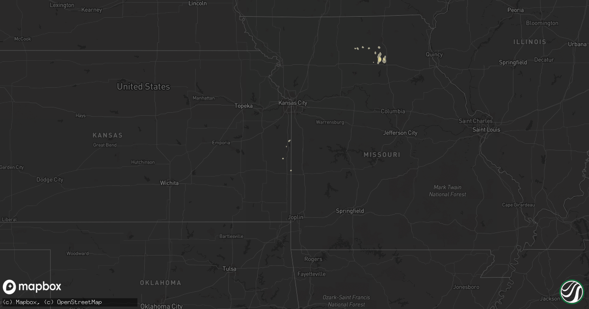
Hail Map in South Dakota on May 8, 2011
Get this storm
May 8 map
$229
one time, instant access
Download today. No call, no setup
Keep the $229
Bought the map and want the full workflow? Apply the entire $229 to a subscription within 7 days. None of it is wasted.
Every map, not just this one
This buys you this map. Subscription and you get every map we run, in the markets you choose from a few cities to whole states to nationwide. Plus real-time alerts the moment a storm fires.
Contact data
Name, contact info, occupancy, even credit band for addresses in the footprint. You go from where it hit to who to call.
Become the source they trust
Unlimited branding weather history reports on demand. You already have the documented answer ready for the property owner, and you are the one who showed up with it.
Property data and RoofTrace estimates
Pull up any address you have got, its value and the exact code rules for that jurisdiction, straight from One Click Code. Then RoofTrace estimates the squares, pitch, and roof value, priced the way you price.
Storm reports in South Dakota
South Dakota
| Date | Description |
|---|---|
| 05/08/20115:37 PM CDT | A local report indicates 1.00 inch wind near 5 NNW SISSETON |
| 05/08/20118:21 AM CDT | A local report indicates 1.00 inch wind near OLDHAM |
| 05/08/20117:40 AM CDT | A few windows broken out |
| 05/08/20113:15 AM CDT | A local report indicates 1.00 inch wind near 8 SW ORIENT |
| 05/08/20111:06 AM CDT | A local report indicates 1.00 inch wind near 6 S SUMMIT |
| 05/08/201112:40 AM CDT | A local report indicates 1.50 inch wind near ORTLEY |
| 05/08/201112:05 AM CDT | Quarter to half dollar sized hail. Some minor dents to pickup truck. |
| 05/07/201110:18 PM CDT | Marble to golf ball hail |
| 05/07/20119:51 PM CDT | Measured at the south dakota state university mesonet site. |
| 05/07/20119:45 PM CDT | Wind damage reported at cedar shore resort. 2 campers overturned. Part of a house addition taken off with debris scattered downwind. One report of a boat blown away fro |
| 05/07/20119:01 PM CDT | A local report indicates 1.75 inch wind near 8 S PRESHO |
| 05/07/20118:50 PM CDT | A local report indicates 1.50 inch wind near 10 S PRESHO |
| 05/07/20118:40 PM CDT | A local report indicates 1.00 inch wind near PRESHO |
| 05/07/20118:10 PM CDT | A local report indicates 1.00 inch wind near 7 S PRESHO |
All States Impacted by Hail Map on May 8, 2011
Cities Impacted by Hail Map on May 8, 2011
- River Falls, WI
- Norcross, MN
- Jamestown, ND
- Saint Michael, MN
- Linton, ND
- Appleton, MN
- Correll, MN
- Woonsocket, SD
- Alpena, SD
- Cannon Falls, MN
- Seymour, TX
- Steen, MN
- Rock Rapids, IA
- Volga, SD
- Brackettville, TX
- Cleveland, ND
- Devol, OK
- Randlett, OK
- Brewster, MN
- Shakopee, MN
- Jordan, MN
- Prior Lake, MN
- Worthington, MN
- Lonsdale, MN
- Faribault, MN
- Wallace, SD
- Bradley, SD
- Webster, SD
- Waubay, SD
- Leakey, TX
- Kirksville, MO
- La Plata, MO
- Bowie, TX
- Twin Brooks, SD
- Le Center, MN
- Montgomery, MN
- Windthorst, TX
- Electra, TX
- Iowa Park, TX
- Presho, SD
- Ringling, OK
- Mound City, KS
- Ramona, SD
- Iroquois, SD
- De Smet, SD
- Howard, SD
- Carthage, SD
- Oldham, SD
- Holliday, TX
- Starbuck, MN
- Marvin, SD
- Springfield, MN
- Leonard, ND
- Kennebec, SD
- Benson, MN
- Clontarf, MN
- Danvers, MN
- Highmore, SD
- Orient, SD
- Buffalo, WY
- Streeter, ND
- Gackle, ND
- Del Rio, TX
- Barrett, MN
- Herman, MN
- Dumont, MN
- Chokio, MN
- Edgeley, ND
- Morris, MN
- Montpelier, ND
- Kanaranzi, MN
- Northfield, MN
- Nerstrand, MN
- Bellingham, MN
- Moffit, ND
- Donnelly, MN
- Willmar, MN
- Spicer, MN
- Gaylord, MN
- Henrietta, TX
- Waseca, MN
- Janesville, MN
- Hazelton, ND
- Wheaton, MN
- Bigelow, MN
- Callao, MO
- Huron, SD
- Eden Prairie, MN
- Jacksboro, TX
- Jud, ND
- New Cambria, MO
- Wessington Springs, SD
- Hancock, MN
- Atlanta, MO
- Bevier, MO
- Olney, TX
- Newcastle, TX
- Ortley, SD
- Mooreton, ND
- Richards, MO
- Fort Scott, KS
- Plankinton, SD
- Gann Valley, SD
- Fredonia, ND
- Virgil, SD
- Beardsley, MN
- Reliance, SD
- Sleepy Eye, MN
- Kintyre, ND
- Rockford, MN
- Buffalo, MN
- Loretto, MN
- Granada, MN
- Fairmont, MN
- Milnor, ND
- Lafayette, MN
- Nicollet, MN
- New Ulm, MN
- Browning, MO
- Winigan, MO
- Summit, SD
- Jackson, MN
- Wells, MN
- Little Rock, IA
- Ellsworth, MN
- Minneapolis, MN
- Lindsay, OK
- Macon, MO
- Dundas, MN
- Clinton, MN
- Watertown, SD
- South Shore, SD
- Wichita Falls, TX
- Lake Crystal, MN
- Walters, OK
- Peever, SD
- Webster, MN
- Florence, SD
- Milbank, SD
- New Boston, MO
- Round Lake, MN
- Delano, MN
- Marion, ND
- Napoleon, ND
- Elmer, MO
- Ethel, MO
- Nunda, SD
- Corona, SD
- Dickey, ND
- New Prague, MN
- Truman, MN
- Horace, ND
- Moorhead, MN
- Rothsay, MN
- Sisseton, SD
- Kimball, SD
- Purcell, OK
- Madison, MN
- Petrolia, TX
- Comfrey, MN
- Saint Paul, MN
- Lake Elmo, MN
- Brooten, MN
- Wessington, SD
- Wilmont, MN
- Garden City, SD
- Edgerton, MN
- Chico, TX
- Clarkfield, MN
- Arlington, SD
- Kulm, ND
- Dawson, MN
- Throckmorton, TX
- Waterville, MN
- La Cygne, KS
- Louisburg, KS
- Slayton, MN
- Hills, MN
- Artesian, SD
- Adrian, MN
- Iona, MN
- Mount Vernon, SD
- Chandler, MN
- Lismore, MN
- Dawson, ND
- Lidgerwood, ND
- Murdock, MN
- Montevideo, MN
- Cavour, SD
- Holloway, MN
- Steele, ND
- Hanska, MN
- Saint James, MN
- Madelia, MN
- Foley, MN
- Cyrus, MN
- Morristown, MN
- Elko New Market, MN
- Warsaw, MN
- Spencer, SD
- Canova, SD
- Kindred, ND
- Fairmount, ND
- Purdin, MO
- Buchanan, ND
- Simpsonville, SC
- Chamberlain, SD
- Graceville, MN
- Renville, MN
- Lake Lillian, MN
- Clearmont, WY
- Tappen, ND
- Wilmot, SD


