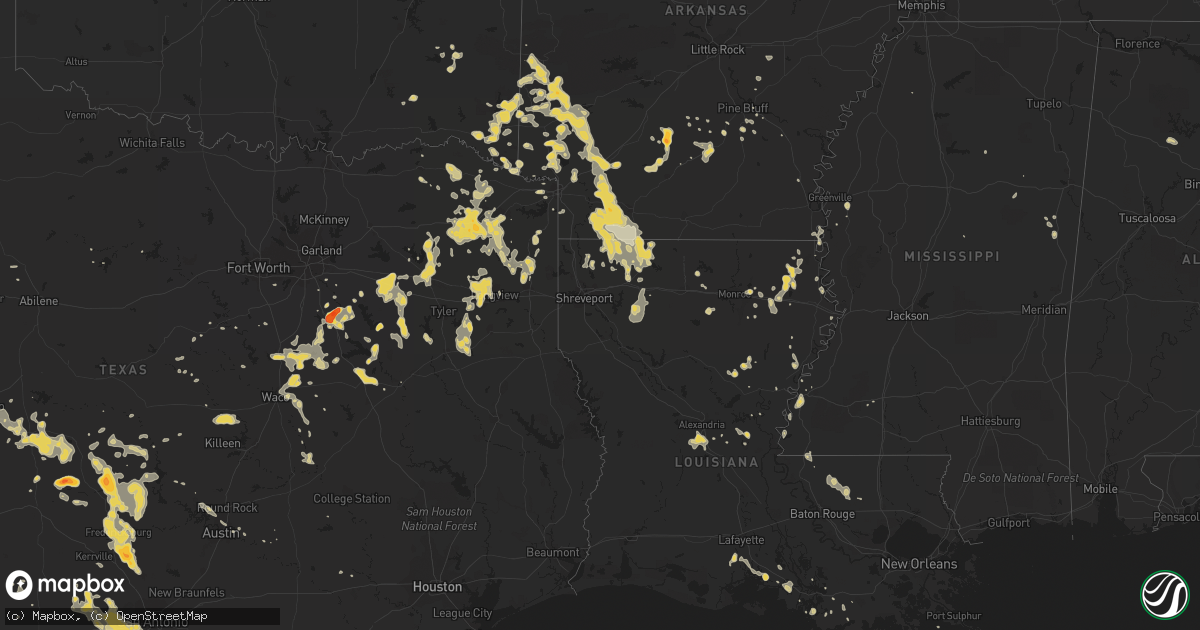
Hail Map on May 7, 2012
Get this storm
May 7 map
$229
one time, instant access
Download today. No call, no setup
Keep the $229
Bought the map and want the full workflow? Apply the entire $229 to a subscription within 7 days. None of it is wasted.
Every map, not just this one
This buys you this map. Subscription and you get every map we run, in the markets you choose from a few cities to whole states to nationwide. Plus real-time alerts the moment a storm fires.
Contact data
Name, contact info, occupancy, even credit band for addresses in the footprint. You go from where it hit to who to call.
Become the source they trust
Unlimited branding weather history reports on demand. You already have the documented answer ready for the property owner, and you are the one who showed up with it.
Property data and RoofTrace estimates
Pull up any address you have got, its value and the exact code rules for that jurisdiction, straight from One Click Code. Then RoofTrace estimates the squares, pitch, and roof value, priced the way you price.
States Impacted by Hail Map on May 7, 2012
Storm reports
Louisiana
| Date | Description |
|---|---|
| 05/07/20126:00 PM CDT | Public reported quarter sized hail. |
| 05/07/20126:00 PM CDT | Trees down on highway 955. |
| 05/07/20121:50 PM CDT | Multiple trees down near mayfield elementary on highway 190. |
| 05/07/201212:55 PM CDT | Trees down on duckworth road |
| 05/07/201212:36 PM CDT | Tree blown down along sand road |
| 05/06/20129:30 PM CDT | Tree down across the road near the town of bienville. |
| 05/06/20128:45 PM CDT | Trees reported down in minden. |
| 05/06/20128:00 PM CDT | Alot of trees down across northern parts of webster parish. |
Mississippi
| Date | Description |
|---|---|
| 05/07/20124:05 PM CDT | Trees were downed along springfield road...beau pre road...and artman road. |
| 05/07/20124:00 PM CDT | A tree was downed on morgantown road |
| 05/07/20124:00 PM CDT | Trees were downed on col john pitchford parkway and john r dunkin drive. A tree fell on a house on pinewood circle. |
| 05/07/20123:55 PM CDT | Large limbs were downed causing road blockage near marion ave...copiah lincoln community college...and pinewood cir. |
| 05/07/20123:40 PM CDT | A tree had fallen on a home on spears road...which had caused an injury. |
| 05/07/20123:39 PM CDT | Trees were blown down. The locations were as follows around yazoo city. Dark corner road...courts road...steed lane...fox road...rebecca road...eden midway...scotland r |
| 05/07/20121:40 PM CDT | Trees were blown down along jeff davis road |
| 05/07/20121:30 PM CDT | A shed was blown over on highway 481 near leesburg |
| 05/07/20121:10 PM CDT | 2 trees down in the county. One in the city of vicksburg and another one down in the county. |
| 05/07/20121:10 PM CDT | Power lines were blown down across i-55 near woodrow wilson drive. Three lanes of the interstate are closed. |
| 05/07/20121:00 PM CDT | A couple trees were downed along gluckstadt road |
| 05/07/201212:45 PM CDT | One tree down at junction of south montgomery and poorhouse roads |
| 05/07/201212:43 PM CDT | Trees down on powerlines on old highway 12 |
Alabama
| Date | Description |
|---|---|
| 05/07/20123:36 PM CDT | A local report indicates 1.00 inch wind near 1 SW ONEONTA |
| 05/07/20123:26 PM CDT | Trees down blocking the roadway on pineywoods sipsey road and claude banks road in the pineywoods community. A school bus was trapped due to the fallen trees. No injuri |
| 05/07/20123:25 PM CDT | Trees down at the intersection of capps road and pineywoods sipsey road. Time estimated from radar. |
| 05/07/20123:25 PM CDT | Trees down at the intersection of tidwell cemetery road and old pineywoods road. Time estimated from radar. |
| 05/07/20123:20 PM CDT | Trees down at the intersection of highway 69 and burrows crossing road. Time estimated from radar. |
| 05/07/20123:19 PM CDT | Trees down blocking the roadway at the intersection of empire road and little vine road northeast of empire. Time estimated from radar. |
| 05/07/20123:17 PM CDT | Trees and power lines down on highway 69 north near boldo at the intersection of clayton road. Time estimated from radar. |
Indiana
| Date | Description |
|---|---|
| 05/07/20123:24 PM CDT | A local report indicates 1.00 inch wind near 3 SSE RIDGEVILLE |
| 05/07/20123:08 PM CDT | Reported relayed via media. |
| 05/07/20122:45 PM CDT | On the west side of muncie. |
| 05/07/20122:42 PM CDT | Northern muncie...mcgalliard rd and barr st. |
Texas
| Date | Description |
|---|---|
| 05/07/20126:50 PM CDT | Several trees blown over near kingsland due to strong winds. |
| 05/07/20126:50 PM CDT | Two oak trees 75 apart blown down in opposite directions |
| 05/07/20126:50 PM CDT | Nickel to quarter sized hail in hooks |
| 05/07/20126:41 PM CDT | A local report indicates 1.00 inch wind near CRYER CREEK |
| 05/07/20126:28 PM CDT | Quarter size hail covering the ground. |
| 05/07/20126:26 PM CDT | One inch hail in fredericksburg. |
| 05/07/20126:25 PM CDT | Quarter size hail to half dollar size hail covering the ground. |
| 05/07/20126:20 PM CDT | Quarter hail lasted from 620 pm to 630 pm cdt. |
| 05/07/20126:20 PM CDT | Quarter size hail near fredericksburg |
| 05/07/20126:15 PM CDT | Estimated 60 mph winds knocked power out at the terrell gas plant. Hail was dime to nickel size. |
| 05/07/20126:06 PM CDT | Wind gusts to 60 mph. |
| 05/07/20125:30 PM CDT | Hail to penny size and wind gusts to near 60 mph. |
| 05/07/20125:25 PM CDT | Golfball size hail. |
| 05/07/20125:15 PM CDT | Pea to near quarter size hail near llano. |
| 05/07/20124:56 PM CDT | A local report indicates 1.00 inch wind near 1 S SAN SABA |
| 05/07/20124:37 PM CDT | Gust front moved through junction |
| 05/07/20124:35 PM CDT | A local report indicates 1.00 inch wind near PINE SPRINGS |
| 05/07/20124:30 PM CDT | Uprooted trees in fredonia |
| 05/07/20124:20 PM CDT | Time estimated from radar. Report from the mason county news. |
| 05/07/20123:50 PM CDT | Two inch diameter hail on hungry hollow road. Report via mason news. |
| 05/07/20123:38 PM CDT | A local report indicates 70 MPH wind near EDEN |
| 05/07/20123:30 PM CDT | Public report of golfball size hail in erna |
| 05/07/20122:21 PM CDT | A local report indicates 1.00 inch wind near 2 E WALL |
| 05/07/20122:06 PM CDT | A local report indicates 1.00 inch wind near 2 SE SAN ANGELO |
| 05/07/20121:45 PM CDT | A local report indicates 1.00 inch wind near 11 SW SAN ANGELO |
| 05/07/20121:45 PM CDT | A local report indicates 1.25 inch wind near 4 S SAN ANGELO |
| 05/07/20121:37 PM CDT | Quarter hail near the irion and tom green county line |
| 05/07/20121:30 PM CDT | Quarter hail lasted from 130 pm to 145 pm cdt. |
| 05/07/20127:26 AM CDT | Rainfall reported called with 24-hr rain and hail report. Hail started at approx 10pm and lasted approx 30 min. |
| 05/06/201210:30 PM CDT | Thunderstorm wind gusts downed trees in carthage. One of these trees fell across a mobile home. There were no report of injuries. |
| 05/06/201210:20 PM CDT | A few large trees reported down near fm 839. |
| 05/06/201210:15 PM CDT | Numerous large trees down in and around henderson. Em reports trees on a house in town...as well as numerous roadways being blocked by fallen trees. Blocked roadways in |
| 05/06/201210:05 PM CDT | Large trees reported down. |
| 05/06/201210:00 PM CDT | A large pine tree fell on a house on lincoln drive. |
| 05/06/20129:50 PM CDT | Tree reported down on house along fm 450 near hallsville. |
| 05/06/20129:48 PM CDT | Numerous trees and tree limb blown down and several power outages. |
| 05/06/20129:45 PM CDT | Quarter hail lasted from 945 pm to 1015 pm cdt. |
| 05/06/20129:40 PM CDT | Trees and powerlines down in downtown marshall...with one tree on a house. |
| 05/06/20129:38 PM CDT | A local report indicates 1.50 inch wind near 3 S CARRIZO SPRINGS |
| 05/06/20129:30 PM CDT | Estimated 60 mph winds in lone star. Large tree limbs greater than 2 inches in diameter and branches downed. |
| 05/06/20129:30 PM CDT | One inch size hail. |
| 05/06/20129:25 PM CDT | Ping pong ball size reported just east of big wells. |
| 05/06/20129:18 PM CDT | Quarter size hail |
| 05/06/20129:15 PM CDT | Quarter hail lasted from 915 pm to 945 pm cdt. |
| 05/06/20129:05 PM CDT | Trees reported down in southern cass county near avinger. |
| 05/06/20129:01 PM CDT | A local report indicates 1.00 inch wind near 12 SSW PAYNES CORNER |
| 05/06/20128:48 PM CDT | Hondo asos reported a gusts to 62 mph. Hdo pk wnd 36054 0148. |
| 05/06/20128:30 PM CDT | Large tree fell on a house in daingerfield and numerous trees down along hwy 259 |
| 05/06/20128:26 PM CDT | A local report indicates 1.75 inch wind near 10 SE HOBBS |
| 05/06/20128:20 PM CDT | A local report indicates 1.50 inch wind near 5 SE MOUNT PLEASANT |
| 05/06/20128:20 PM CDT | Powerlines reported down in the town of mount pleasant. |
| 05/06/20128:17 PM CDT | Strong winds damaged a roof and uprooted a 2 foot diameter tree. |
| 05/06/20128:00 PM CDT | Alot of trees reported down from mount pleasant to winfield. |
| 05/06/20127:50 PM CDT | Nickel size hail and wind gusts from 50 mph to 60 mph. |
| 05/06/20127:20 PM CDT | Nickel to quarter size hail and winds gusting over 50 mph. |
| 05/06/20127:11 PM CDT | Quarter sized hail reported in johntown |
| 05/06/20127:06 PM CDT | At the intersection of highway 287 and i-45 |
| 05/06/20127:00 PM CDT | A local report indicates 1.00 inch wind near 2 ESE SISTERDALE |
| 05/06/20127:00 PM CDT | A local report indicates 1.75 inch wind near 6 N SISTERDALE |
New Mexico
| Date | Description |
|---|---|
| 05/07/20125:48 PM CDT | Golfball hail in cottonwood. |
| 05/07/20125:45 PM CDT | A local report indicates 1.00 inch wind near 2 E LAKE ARTHUR |
| 05/07/20125:43 PM CDT | A local report indicates 1.25 inch wind near 6 NNE ARTESIA |
| 05/07/20125:30 PM CDT | Baseball hail lasted from 430 pm to 445 pm mdt. |
| 05/07/20125:27 PM CDT | A local report indicates 1.00 inch wind near 7 NW ARTESIA |
| 05/07/20124:48 PM CDT | Golfball hail in cottonwood. |
| 05/07/20124:30 PM CDT | Baseball hail lasted from 430 pm to 445 pm mdt. |
| 05/07/20124:30 PM CDT | A local report indicates 1.75 inch wind near 18 NE DUNKEN |
| 05/07/20124:00 PM CDT | A local report indicates 1.00 inch wind near 6 NNW DUNKEN |
| 05/06/20127:58 PM CDT | A local report indicates 1.75 inch wind near 1 S HOBBS |
| 05/06/20127:54 PM CDT | A local report indicates 1.50 inch wind near HOBBS |
| 05/06/20127:52 PM CDT | A local report indicates 1.00 inch wind near 5 N NADINE |
| 05/06/20127:51 PM CDT | A local report indicates 1.75 inch wind near 1 W HOBBS |
| 05/06/20127:48 PM CDT | A local report indicates 1.00 inch wind near 1 W HOBBS |
| 05/06/20127:10 PM CDT | A local report indicates 1.75 inch wind near 5 S HOBBS |
Pennsylvania
| Date | Description |
|---|---|
| 05/07/20125:10 PM CDT | A local report indicates 1.00 inch wind near SARVER |
| 05/07/20121:02 PM CDT | Large tree downed by thunderstorm winds on sr2866 in boggs township |
| 05/06/20127:53 PM CDT | A local report indicates 1.75 inch wind near HERMITAGE |
| 05/06/20127:50 PM CDT | A local report indicates 1.00 inch wind near FARRELL |
| 05/06/20127:47 PM CDT | A local report indicates 1.00 inch wind near HERMITAGE |
| 05/06/20127:45 PM CDT | A local report indicates 1.00 inch wind near WHEATLAND |
| 05/06/20127:40 PM CDT | Roof blown off large industrial building |
| 05/06/20127:20 PM CDT | A local report indicates 1.00 inch wind near TRANSFER |
Arkansas
| Date | Description |
|---|---|
| 05/07/20126:45 PM CDT | Trees and power lines down in hope and throughout the county along hwy 278 and hwy 29 |
| 05/07/20126:25 PM CDT | Trees reported down near the ogden area...and powerlines down. |
| 05/07/20126:00 PM CDT | Powerlines were downed. Trees were uprooted. A barn was damaged. |
| 05/07/20126:00 PM CDT | Trees down along hwy 27 west of mineral springs |
| 05/07/20126:00 PM CDT | Trees down in downtown mineral springs |
| 05/07/20125:50 PM CDT | Many loose items destroyed. A trampoline flew 1500ft. A shed was heavily damaged. |
| 05/07/20125:45 PM CDT | Trees and powerlines reported down. |
| 05/07/20125:42 PM CDT | A local report indicates 1.75 inch wind near SPARKMAN |
| 05/07/20125:36 PM CDT | Numerous trees and powerlines down in the areas of highland...sweet home...and roy. Approximately 25 homes without power. |
| 05/07/20125:30 PM CDT | Quarter sized hail reported near center point at the intersection of hwy 369 and hwy 26 |
| 05/07/20125:30 PM CDT | Trees down near center point at intersection of hwy 369 and hwy 26 |
| 05/07/20124:45 PM CDT | Quarter sized hail in umpire |
| 05/07/20124:45 PM CDT | Trees down on hwy 278 in umpire |
| 05/07/20124:02 PM CDT | Quarter sized hail reported in mena. |
| 05/06/20128:45 PM CDT | Trees reported blown down around the fordyce area. |
| 05/06/20127:05 PM CDT | Power lines down in stamps |
Colorado
| Date | Description |
|---|---|
| 05/07/201212:42 PM CDT | Hail covering the ground. Just ended. |
| 05/07/201212:31 PM CDT | A local report indicates 1.00 inch wind near PAGOSA JUNCTION |
California
| Date | Description |
|---|---|
| 05/07/20122:30 AM CDT | Gusty winds from a dry thunderstorm knocked out power to amboy for about 3 hours and dropped visibility to about 100 yards for two hours. |
Florida
| Date | Description |
|---|---|
| 05/07/20126:15 PM CDT | One tree down on highway 221 just north of interstate 10. Multiple traffic accidents reported in the county due to heavy rain. |
| 05/07/20125:00 PM CDT | Power lines and a transformer also down near luraville. |
| 05/07/20124:25 PM CDT | Two trees down on louvinia drive between apalachee pkwy and old st. Augustine road. |
| 05/07/20122:30 PM CDT | 911 call center reported trees and powerlines down on aladdin terrace. |
| 05/07/20122:30 PM CDT | 911 call center reported trees and powerlines down on brady road. |
Ohio
| Date | Description |
|---|---|
| 05/07/20126:40 PM CDT | Quarter size to dollar size hail in austinburg. |
| 05/07/20126:21 PM CDT | A local report indicates 1.00 inch wind near CORTLAND |
| 05/07/20125:35 PM CDT | A local report indicates 1.00 inch wind near SHELBY |
| 05/07/20125:25 PM CDT | Downed power lines and trees. |
| 05/07/20124:23 PM CDT | A light pole was reported down. |
| 05/07/20124:07 PM CDT | A local report indicates 1.00 inch wind near MEDINA |
| 05/07/20123:28 PM CDT | A local report indicates 1.00 inch wind near 3 WNW NEW BREMEN |
| 05/07/201212:50 PM CDT | A local report indicates 1.00 inch wind near NAVARRE |
| 05/06/20127:38 PM CDT | A local report indicates 1.00 inch wind near 4 N YOUNGSTOWN |
| 05/06/20127:29 PM CDT | A local report indicates 1.00 inch wind near VIENNA |
| 05/06/20127:27 PM CDT | A local report indicates 1.00 inch wind near HUBBARD |
| 05/06/20127:23 PM CDT | A local report indicates 1.25 inch wind near HUBBARD |
Cities Impacted by Hail Map on May 7, 2012
- Greenville, FL
- Madison, FL
- Fredericksburg, TX
- Epps, LA
- Pioneer, LA
- Boerne, TX
- Melvin, TX
- Brady, TX
- Ennis, TX
- Pearsall, TX
- Pineville, LA
- Thornton, TX
- Harleton, TX
- Marshall, TX
- Jefferson, TX
- Choudrant, LA
- Farmerville, LA
- Dryden, TX
- Theriot, LA
- Doss, TX
- Jacksonville, FL
- Lamesa, TX
- Welch, TX
- Lockesburg, AR
- Winchester, IN
- Parker City, IN
- Selma, IN
- Ridgeville, IN
- Muncie, IN
- Albany, IN
- Farmland, IN
- Malakoff, TX
- Eustace, TX
- Mabank, TX
- Pecos, TX
- Texarkana, AR
- Yorktown, IN
- Green Cove Springs, FL
- Garden City, TX
- Big Lake, TX
- Artesia, NM
- Lake Arthur, NM
- Detroit, TX
- Clarksville, TX
- Hope, AR
- Morral, OH
- Harpster, OH
- Paint Rock, TX
- Eden, TX
- Rice, TX
- Marion, OH
- Nevada, OH
- Monroe, LA
- Jasper, AL
- Eagletown, OK
- Broken Bow, OK
- Watson, OK
- Laredo, TX
- Malone, TX
- Vienna, OH
- Girard, OH
- Youngstown, OH
- Hubbard, OH
- Dierks, AR
- Chidester, AR
- Lowellville, OH
- Campbell, OH
- Eagle Pass, TX
- Quemado, TX
- Kemp, TX
- Kaufman, TX
- Rushville, OH
- Crystal City, TX
- Haworth, OK
- De Queen, AR
- Gillham, AR
- Lovington, NM
- Maljamar, NM
- Glen Rose, TX
- Franklin, LA
- Jeanerette, LA
- Sondheimer, LA
- Seminole, TX
- Hobbs, NM
- Mason, TX
- Menard, TX
- London, TX
- Springport, IN
- Mount Pleasant, TX
- Winfield, TX
- Pittsburg, TX
- Denham Springs, LA
- Sterling City, TX
- Leander, TX
- Austin, TX
- Cedar Park, TX
- Hondo, TX
- Mico, TX
- Castroville, TX
- Rio Medina, TX
- Homer, LA
- Yantis, TX
- Como, TX
- Umpire, AR
- Mena, AR
- Sparkman, AR
- Eldorado, TX
- Geneva, OH
- Austinburg, OH
- Batesville, TX
- La Pryor, TX
- Big Wells, TX
- Junction, TX
- Athens, TX
- Murchison, TX
- Mayhill, NM
- Weed, NM
- Hope, NM
- Macon, MS
- Hamilton, TX
- Jefferson, OH
- Ashtabula, OH
- Axtell, TX
- Linden, TX
- Emory, TX
- Shongaloo, LA
- Springhill, LA
- Sarepta, LA
- Andrews, TX
- Quitman, TX
- Fulton, AR
- Nashville, AR
- Rochelle, TX
- San Angelo, TX
- Hubbard, TX
- Hillsboro, TX
- Bynum, TX
- Emmet, AR
- Big Sandy, TX
- White Oak, TX
- Kilgore, TX
- Longview, TX
- Gladewater, TX
- Gilmer, TX
- Murfreesboro, AR
- Richland Springs, TX
- San Saba, TX
- Ozona, TX
- Gatesville, TX
- Abbott, TX
- Waskom, TX
- Saint Henry, OH
- Fort Recovery, OH
- Coldwater, OH
- North Salem, IN
- Lizton, IN
- Pittsboro, IN
- Brownsburg, IN
- Fairfield, TX
- Teague, TX
- Oakwood, TX
- Streetman, TX
- Alba, TX
- Wilton, AR
- Gould, AR
- Edinburg, PA
- Penelope, TX
- Clinton, LA
- Slaughter, LA
- Tyler, TX
- Overton, TX
- Winona, TX
- Buchanan Dam, TX
- Llano, TX
- Jbsa Lackland, TX
- Fort Stockton, TX
- Saint Johns, FL
- Ashdown, AR
- Mineral Springs, AR
- Vidalia, LA
- Barnhart, TX
- Mertzon, TX
- Castell, TX
- Valley Spring, TX
- Art, TX
- Pontotoc, TX
- Comfort, TX
- Taylor, AR
- Magnolia, AR
- Waldo, AR
- Stamps, AR
- Lancaster, OH
- Pyote, TX
- Barstow, TX
- Lampasas, TX
- Daytona Beach, FL
- New Smyrna Beach, FL
- Deland, FL
- Frankston, TX
- Horatio, AR
- Canton, TX
- Wills Point, TX
- Edgewood, TX
- Mount Calm, TX
- Adrian, PA
- New Bethlehem, PA
- Dayton, PA
- Templeton, PA
- Kittanning, PA
- Salt Flat, TX
- Pipe Creek, TX
- Grannis, AR
- Abbeville, LA
- Maurice, LA
- Eros, LA
- Live Oak, FL
- Lee, FL
- Pickton, TX
- Mineola, TX
- Asherton, TX
- Carrizo Springs, TX
- Camp Wood, TX
- Caledonia, OH
- Troup, TX
- Jacksonville, TX
- Bogata, TX
- Wortham, TX
- Ambrose, GA
- Douglas, GA
- Prairie Hill, TX
- Coolidge, TX
- Natchez, MS
- Saint Francisville, LA
- Ashland, KY
- Rush, KY
- Paris, TX
- Pattonville, TX
- Ravenna, OH
- Brooksville, MS
- Webster, FL
- Mart, TX
- Riesel, TX
- Rayville, LA
- Barksdale, TX
- Ringgold, LA
- Dubberly, LA
- Jamestown, LA
- Brackettville, TX
- Niles, OH
- Masury, OH
- Hermitage, PA
- Warren, OH
- Farrell, PA
- Sharon, PA
- Brookfield, OH
- New Wilmington, PA
- Wheatland, PA
- West Middlesex, PA
- Manor, TX
- Colorado City, TX
- Westbrook, TX
- Lewisville, AR
- Buckner, AR
- Groesbeck, TX
- McGuffey, OH
- Dola, OH
- Harrod, OH
- Ada, OH
- Alger, OH
- Forest, OH
- Kenton, OH
- Rison, AR
- Chatfield, TX
- Orange Park, FL
- Seagraves, TX
- Deltona, FL
- Thornton, AR
- Fordyce, AR
- Emerson, AR
- Haynesville, LA
- Medina, TX
- Bagwell, TX
- Milford, TX
- Corsicana, TX
- Breckenridge, TX
- Graham, TX
- Ocala, FL
- Batesville, MS
- Devine, TX
- Woodworth, LA
- Lecompte, LA
- Alexandria, LA
- Forest Hill, LA
- Dawson, TX
- Marksville, LA
- Effie, LA
- Newhope, AR
- Washington, AR
- McCaskill, AR
- Trafalgar, IN
- Morgantown, IN
- Oak Grove, LA
- Blacklick, OH
- New Albany, OH
- Hughes Springs, TX
- Texarkana, TX
- Hooks, TX
- Comstock, TX
- New Plymouth, OH
- La Coste, TX
- Fowler, OH
- Transfer, PA
- Sharpsville, PA
- Burghill, OH
- Atlanta, TX
- Medina, OH
- Lodi, OH
- Larue, TX
- Greens Fork, IN
- Talihina, OK
- Nashoba, OK
- Upper Sandusky, OH
- Bandera, TX
- Rocksprings, TX
- Selman City, TX
- Arp, TX
- Mcconnelsville, OH
- Blue Rock, OH
- Alamo, GA
- Arkadelphia, AR
- Fredonia, TX
- Voca, TX
- Big Spring, TX
- Lancaster, TX
- Ferris, TX
- Rushsylvania, OH
- Ridgeway, OH
- Huntsville, OH
- Bellefontaine, OH
- Belle Center, OH
- Idabel, OK
- Harrisonburg, LA
- Marlin, TX
- Elm Mott, TX
- Waco, TX
- Cookville, TX
- Lone Star, TX
- Naples, TX
- Omaha, TX
- Daingerfield, TX
- Leland, MS
- Greenville, MS
- Lindale, TX
- Grand Saline, TX
- Winnsboro, TX
- Cotton Valley, LA
- Plain Dealing, LA
- San Antonio, TX
- Benton, LA
- Olla, LA
- Pulaski, PA
- Mercer, PA
- Boston, GA
- Antlers, OK
- Hastings, FL
- Minden, LA
- Willow City, TX
- Liberty Hill, TX
- Ozan, AR
- Thomasville, GA
- Houma, LA
- Bucyrus, OH
- Coyanosa, TX
- Imperial, TX
- Saint Marys, OH
- New Knoxville, OH
- Montezuma, OH
- Wapakoneta, OH
- Botkins, OH
- Maria Stein, OH
- Celina, OH
- New Bremen, OH
- Cortland, OH
- Atascosa, TX
- Powell, TX
- Kingsville, OH
- Roswell, NM
- Aimwell, LA
- Columbia, LA
- Enterprise, LA
- Cove, AR
- Hatfield, AR
- Garvin, OK
- Mount Vernon, TX
- Starkville, MS
- Sturgis, MS
- Bradley, AR
- Cameron, TX
- Rock Creek, OH
- Fruitvale, TX
- Clayton, LA
- Loraine, TX
- McCall Creek, MS
- Zachary, LA
- Ethel, LA
- Walker, LA
- Greenwell Springs, LA
- Pride, LA
- Monticello, FL
- Annona, TX
- Chrisman, IL
- Avinger, TX
- Jonesville, LA
- Moore, TX
- Yoakum, TX
- Kosciusko, MS
- Sanford, FL
- Winthrop, AR
- Millersview, TX
- Miles, TX
- Mereta, TX
- Wall, TX
- Hext, TX
- Vancourt, TX
- Eola, TX
- Goodfellow Afb, TX
- Bristolville, OH
- Donalsonville, GA
- Iron City, GA
- Bigfoot, TX
- Richland, TX
- Bunnell, FL
- Center Point, TX
- Kerrville, TX
- Frost, TX
- Shelby, OH
- Galion, OH
- Crestline, OH
- Star City, AR
- Carlisle, AR
- Finley, OK
- Moyers, OK
- Mayo, FL
- Gurdon, AR
- Scroggins, TX
- Midkiff, TX
- Athens, LA
- Dilley, TX
- Heflin, LA
- Avery, TX
- Wildwood, FL
- Oxford, FL
- Paige, TX
- Ben Wheeler, TX
- La Rue, OH
- Mount Victory, OH
- Ivan, AR
- Kingsland, AR
- Pine Bluff, AR
- Albany, TX
- Portland, IN
- Anderson, IN
- Union City, IN
- Alexandria, IN
- Daleville, IN
- Altamonte Springs, FL
- Navarre, OH
- Beach City, OH
- Tow, TX
- Guilford, IN
- Barry, TX
- Blooming Grove, TX
- Sarver, PA
- Woodville, MS
- Inverness, FL
- Wickes, AR
- Gibsland, LA
- Castor, LA
- Sugar Grove, OH
- Bremen, OH
- Bluffton, TX
- Burnet, TX
- Bertram, TX
- Freeport, PA
- Leechburg, PA
- Langley, AR
- Smithville, OK
- Prescott, AR
- Rosston, AR
- Vandervoort, AR
- Blevins, AR
- Columbus, AR
- Lumber City, GA
- Ford City, PA
- Cadogan, PA
- Foreman, AR
- Sealy, TX
- Cat Spring, TX
- Orlando, FL
- Tuskahoma, OK
- Mansfield, OH
- Ashland, OH
- Ocilla, GA
- McDonald, OH
- Mansfield, TX
- Purdon, TX
- Mertens, TX
- Clayton, OK
- Lawrenceburg, IN
- Christmas, FL
- Oviedo, FL
- Leesburg, TX
- Cherokee, TX
- Alpine, TX
- Columbus, OH
- Eudora, AR
- Oak Ridge, LA
- Volant, PA
- Carlton, TX
- Hico, TX
- Glenwood, GA
- Ansonia, OH
- Hollandale, MS
- Lakeland, FL
- Dade City, FL
- Bainbridge, GA
- Brinson, GA
- New Ulm, TX
- New Bloomington, OH
- Fort Hood, TX
- Van, TX
- Calhoun City, MS
- Lytle, TX
- D Hanis, TX
- Powderly, TX
- Haughton, LA
- Carthage, AR
- Elgin, TX
- Mentone, TX
- Baskin, LA
- Delhi, LA
- Youngsville, LA
- Hazen, AR
- Ferriday, LA
- Reagan, TX
- Erath, LA
- New Iberia, LA
- Melbourne, FL
- Ore City, TX
- Kerens, TX
- Callahan, FL
- Hilliard, FL
- Sonora, TX
- De Kalb, TX
- Anson, TX
- Hamlin, TX
- Tallulah, LA
- Cabot, PA
- Shuqualak, MS
- Saratoga, AR
- New Castle, PA
- McCaulley, TX
- Sylvester, TX
- Sweetwater, TX
- Ojo Caliente, NM
- Mangham, LA
- Pataskala, OH
- Elkton, FL
- McRae Helena, GA
- Seagoville, TX
- Balmorhea, TX
- Calvert, TX
- Clifton, TX
- Bullard, TX
- Bivins, TX
- Palestine, TX
- Montalba, TX
- Poteet, TX
- Von Ormy, TX
- Del Rio, TX
- Deport, TX
- Lometa, TX
- Danville, IN
- England, AR
- Cowansville, PA
- Brookhaven, MS
- Cleburne, TX
- Spring Church, PA
- Apollo, PA
- Vandergrift, PA
- Talco, TX
- Bluff Dale, TX
- Fredericksburg, OH
- Dundee, OH
- Apopka, FL
- Saint Joseph, LA
- Waterproof, LA
- New Philadelphia, OH
- Stone Creek, OH
- Grandview, TX
- Moundsville, WV
- Powhatan Point, OH
- Wray, GA
- Saxonburg, PA
- Falmouth, IN
- Transylvania, LA
- Summerfield, FL
- Bastrop, TX
- Uvalde, TX
- Somerville, TX
- Floral City, FL