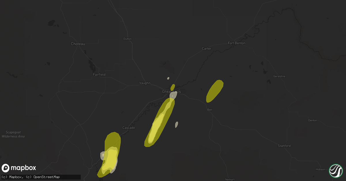
Hail Map in Great Falls, MT on May 6, 2017
Get this storm
May 6 map
$229
one time, instant access
Download today. No call, no setup
Keep the $229
Bought the map and want the full workflow? Apply the entire $229 to a subscription within 7 days. None of it is wasted.
Every map, not just this one
This buys you this map. Subscription and you get every map we run, in the markets you choose from a few cities to whole states to nationwide. Plus real-time alerts the moment a storm fires.
Contact data
Name, contact info, occupancy, even credit band for addresses in the footprint. You go from where it hit to who to call.
Become the source they trust
Unlimited branding weather history reports on demand. You already have the documented answer ready for the property owner, and you are the one who showed up with it.
Property data and RoofTrace estimates
Pull up any address you have got, its value and the exact code rules for that jurisdiction, straight from One Click Code. Then RoofTrace estimates the squares, pitch, and roof value, priced the way you price.
Storm reports in Great Falls, MT
Great Falls, MT
| Date | Description |
|---|---|
| 05/06/20176:58 PM CDT | Estimated 60 mph wind gust 5 miles south of great falls in fox far/big bend area. |
| 05/06/20176:55 PM CDT | Basketball hoop with metal pole snapped in half |
| 05/05/20177:18 PM CDT | Hail up to one inch in diameter and wind gusts estimated at 70 mph. |
| 05/05/20177:07 PM CDT | A local report indicates 63 MPH wind near BLACK EAGLE |
| 05/05/20177:01 PM CDT | Power went out at weather forecast office. Currently running on backup power. Wind and lightning in area at the time. |
| 05/05/20177:00 PM CDT | 1 inch diameter hail 8 mi ese of ulm around 6pm mdt. |


