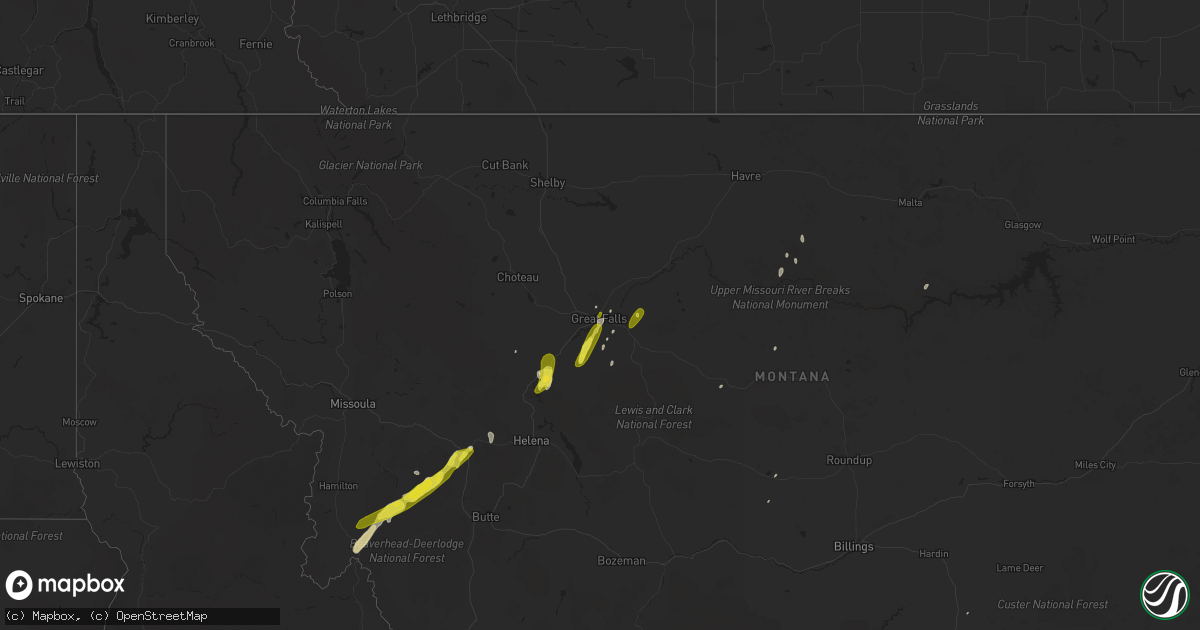
Hail Map on May 6, 2017
Get this storm
May 6 map
$229
one time, instant access
Download today. No call, no setup
Keep the $229
Bought the map and want the full workflow? Apply the entire $229 to a subscription within 7 days. None of it is wasted.
Every map, not just this one
This buys you this map. Subscription and you get every map we run, in the markets you choose from a few cities to whole states to nationwide. Plus real-time alerts the moment a storm fires.
Contact data
Name, contact info, occupancy, even credit band for addresses in the footprint. You go from where it hit to who to call.
Become the source they trust
Unlimited branding weather history reports on demand. You already have the documented answer ready for the property owner, and you are the one who showed up with it.
Property data and RoofTrace estimates
Pull up any address you have got, its value and the exact code rules for that jurisdiction, straight from One Click Code. Then RoofTrace estimates the squares, pitch, and roof value, priced the way you price.
Storm reports
New Mexico
| Date | Description |
|---|---|
| 05/05/20178:00 PM CDT | Krtn asos. |
| 05/05/20177:16 PM CDT | A local report indicates 63 MPH wind near JORNADA RANGE |
Idaho
| Date | Description |
|---|---|
| 05/06/20176:40 PM CDT | Measured at arl site rover 8 ssw mud lake. |
| 05/06/20175:30 PM CDT | Large tree toppled in a cemetery. Source of pictures from social media. Time is estimated based on time of wind gust. |
| 05/05/20177:00 PM CDT | Measured at bald mountain. |
Nevada
| Date | Description |
|---|---|
| 05/06/20175:40 PM CDT | Gust of 49 kt or 56 mph reported on rsois. |
| 05/06/20174:09 PM CDT | 51 kt or 59 mph gust reported on rsois. This was produced from a shower's microburst. |
| 05/06/201712:00 AM CDT | Tree branch down due to gusty winds near windmill and rainbow. Time estimated. |
Colorado
| Date | Description |
|---|---|
| 05/06/20174:43 PM CDT | Mesonet station co098... Douglas pass - 26 n mack. |
| 05/05/20177:00 PM CDT | Mesonet station caege... Eagle mountain. |
Montana
| Date | Description |
|---|---|
| 05/06/20176:58 PM CDT | Estimated 60 mph wind gust 5 miles south of great falls in fox far/big bend area. |
| 05/06/20176:55 PM CDT | Basketball hoop with metal pole snapped in half |
| 05/06/20175:43 PM CDT | A local report indicates 58 MPH wind near 8 SW WOLF CREEK |
| 05/06/20175:05 PM CDT | Also reports pea sized hail. |
| 05/06/20174:55 PM CDT | *** 1 fatal *** thunderstorm winds caused several lodge-pole pine trees to fall by a campsite south of elliston. One tree hit a 41 year old female... Who had been campi |
| 05/06/20174:49 PM CDT | A local report indicates 1.00 inch wind near GARRISON |
| 05/06/20173:55 PM CDT | *** 1 fatal *** thunderstorm winds caused several lodge-pole pine trees to fall by a campsite south of elliston. One tree hit a 41 year old female... Who had been campi |
| 05/06/20173:42 PM CDT | Trained spotters estimated quarter and half dollar sized hail stones. They were worried about vehicle damage. Did not go outside yet to check vehicles. |
| 05/06/20173:30 PM CDT | Resident reported ground covered white with quarter-sized hail. A few strikes of lightning accompanied the storm. |
| 05/06/20172:55 PM CDT | Raws sensor reported 66 mph gust as storm moved through. Sensor reports hourly... With the hour containing this report being 1:09pm - 2:09pm mdt. Estimated time of gust |
| 05/06/20172:42 PM CDT | Mostly nickel-sized hailstones... With a few getting to quarter-sized. Person looked outside afterward... But didn't find any significant damage. Winds were strong with |
| 05/05/201711:32 PM CDT | Blm raws reports 58 mph wind gust. |
| 05/05/201711:32 PM CDT | Blm raws reports 65 mph wind gust. |
| 05/05/20177:18 PM CDT | Hail up to one inch in diameter and wind gusts estimated at 70 mph. |
| 05/05/20177:17 PM CDT | A local report indicates 60 MPH wind near 6 E POWER |
| 05/05/20177:07 PM CDT | A local report indicates 63 MPH wind near BLACK EAGLE |
| 05/05/20177:01 PM CDT | Power went out at weather forecast office. Currently running on backup power. Wind and lightning in area at the time. |
| 05/05/20177:00 PM CDT | 1 inch diameter hail 8 mi ese of ulm around 6pm mdt. |
Utah
| Date | Description |
|---|---|
| 05/06/20175:10 PM CDT | I-15 at plymouth sensor... Ut29. |
| 05/06/20174:50 PM CDT | I-15 at tremonton... Ut28. |
| 05/06/20174:40 PM CDT | I-80 at grassey... Utgrs. |
| 05/06/20174:15 PM CDT | Great salt lake minerals sensor... Gslm. |
| 05/06/20173:55 PM CDT | Pleasant grove raws... Pgru1. |
| 05/06/20173:55 PM CDT | Windows broken and pavilions damaged by strong thunderstorm winds at antelope island state park. |
| 05/06/20173:50 PM CDT | Syracuse sensor... Uusyr. |
| 05/06/20173:50 PM CDT | Fremont island- miller hill... Freut. |
| 05/06/20173:20 PM CDT | Lake point i-80 sensor... Ut9. |
| 05/06/20173:20 PM CDT | I-15 at beer creek... Utbrc. |
Wyoming
| Date | Description |
|---|---|
| 05/06/20173:55 PM CDT | 1-2 aspen trees downed near star valley ranch |