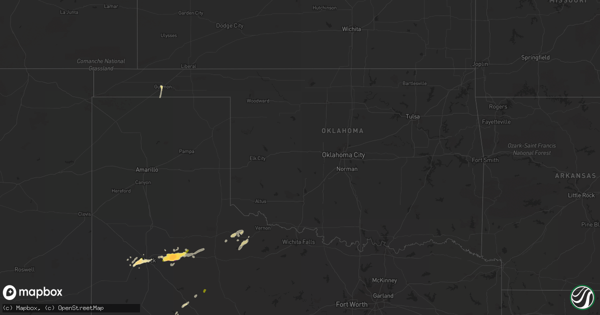
Hail Map in Oklahoma on May 5, 2015
Get this storm
May 5 map
$229
one time, instant access
Download today. No call, no setup
Keep the $229
Bought the map and want the full workflow? Apply the entire $229 to a subscription within 7 days. None of it is wasted.
Every map, not just this one
This buys you this map. Subscription and you get every map we run, in the markets you choose from a few cities to whole states to nationwide. Plus real-time alerts the moment a storm fires.
Contact data
Name, contact info, occupancy, even credit band for addresses in the footprint. You go from where it hit to who to call.
Become the source they trust
Unlimited branding weather history reports on demand. You already have the documented answer ready for the property owner, and you are the one who showed up with it.
Property data and RoofTrace estimates
Pull up any address you have got, its value and the exact code rules for that jurisdiction, straight from One Click Code. Then RoofTrace estimates the squares, pitch, and roof value, priced the way you price.
Storm reports in Oklahoma
Oklahoma
| Date | Description |
|---|---|
| 05/05/20153:33 AM CDT | Large tree limbs down near 51st street and yale. Time is radar estimated. |
| 05/05/20153:12 AM CDT | Tree limbs down on 141st street. Time is radar estimated. |
| 05/05/20153:08 AM CDT | Large tree limbs down on 171st street south. Time is radar estimated. |
| 05/05/20152:58 AM CDT | Ef0 tornado split a couple hardwood trees and snapped large limbs from other trees |
| 05/05/20152:50 AM CDT | Most of the top of an oak tree snapped off. Two additional tree uprooted. Broken limb downs power line on 281st. 4 south on hwy 48 and 1 mile east |
| 05/05/20152:50 AM CDT | A local report indicates 58 MPH wind near MANNFORD |
| 05/05/20152:00 AM CDT | Metal trailor and 2 storage sheds destroyed. Possible roof damage to a home. Reported at the intersection of hwy 19 and cty rd 1550 |
| 05/05/20151:00 AM CDT | Report of several trees damaged in an area generally along i-40 between se 15th st and sooner rd. |
| 05/05/201512:45 AM CDT | Power line downed... Damaging a utility meter at a home. Tree downed along with many tree limbs. Reported near intersections of ne36th and n. Martin luther king ave. |
| 05/05/201512:37 AM CDT | Tree limbs down at rockcreek rd and n porter ave. |
| 05/05/201512:37 AM CDT | A local report indicates 60 MPH wind near 2 N NORMAN |
| 05/05/201512:20 AM CDT | A local report indicates 66 MPH wind near 5 WNW EL RENO |
| 05/04/201511:05 PM CDT | A local report indicates 1.00 inch wind near 9 S MOUNTAIN VIEW |
| 05/04/20158:02 PM CDT | Large tree split and tin blown off barn |
| 05/04/20157:26 PM CDT | A local report indicates 1.00 inch wind near 2 SW GUYMON |
All States Impacted by Hail Map on May 5, 2015
Cities Impacted by Hail Map on May 5, 2015
- Downs, KS
- Gaylord, KS
- Osborne, KS
- Rensselaer, IN
- Brook, IN
- Morocco, IN
- Crosbyton, TX
- Ralls, TX
- Crowell, TX
- Lorenzo, TX
- Quanah, TX
- Giddings, TX
- Mcadoo, TX
- Dickens, TX
- Afton, TX
- Somerville, TX
- Lyons, TX
- Caldwell, TX
- Lubbock, TX
- Ropesville, TX
- Wolfforth, TX
- Levelland, TX
- Boyce, VA
- Guymon, OK
- Goodwell, OK
- Big Spring, TX
- Snyder, TX
- Paducah, TX
- Westbrook, TX
- Harbor Beach, MI
- Lexington, TX
- Lincoln, TX
- Lenorah, TX
- Knott, TX
- Coleman, TX
- Dime Box, TX
- Luray, KS
- Slaton, TX
- Ira, TX
- Roosevelt, OK
- Roscoe, TX
- Clyde, TX
- Tipton, KS
- East China, MI
- Apple Creek, OH
- Manzanola, CO
- Alton, KS
- Natoma, KS
- Colorado City, TX
- Ballinger, TX
- Brewster, OH
- Massillon, OH
- Navarre, OH
- Gruver, TX
- Seymour, TX
- Chillicothe, TX
- Vernon, TX
- Dalton, OH
- Crane, TX
- Coahoma, TX
- Albany, TX
- Brenham, TX
- Clearville, PA
- Rush, CO
- Talpa, TX
- The Plains, VA
- Portis, KS
- Port Huron, MI
- Millersburg, OH
- Esbon, KS
- Novice, TX
- Burwell, NE
- Shallowater, TX
- Roaring Spring, PA
- Anson, TX
- Stamford, TX
- Hamlin, TX
- Woodson, TX
- Throckmorton, TX
- Newcastle, TX
- Glen Elder, KS
- Rocky Ford, CO
- Eden, TX
- McCamey, TX
- Sterling City, TX
- Jayton, TX
- Sycamore, OH
- Upper Sandusky, OH
- Bucyrus, OH
- Tiro, OH
- Carey, OH
- San Jon, NM


