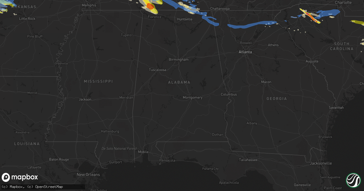
Hail Map in Alabama on May 4, 2020
Get this storm
May 4 map
$229
one time, instant access
Download today. No call, no setup
Keep the $229
Bought the map and want the full workflow? Apply the entire $229 to a subscription within 7 days. None of it is wasted.
Every map, not just this one
This buys you this map. Subscription and you get every map we run, in the markets you choose from a few cities to whole states to nationwide. Plus real-time alerts the moment a storm fires.
Contact data
Name, contact info, occupancy, even credit band for addresses in the footprint. You go from where it hit to who to call.
Become the source they trust
Unlimited branding weather history reports on demand. You already have the documented answer ready for the property owner, and you are the one who showed up with it.
Property data and RoofTrace estimates
Pull up any address you have got, its value and the exact code rules for that jurisdiction, straight from One Click Code. Then RoofTrace estimates the squares, pitch, and roof value, priced the way you price.
Storm reports in Alabama
Alabama
| Date | Description |
|---|---|
| 05/04/20205:03 AM CDT | At 1003 PM CDT, a severe thunderstorm was located near Cowan, or 10 miles southeast of Winchester, moving east at 40 mph. HAZARD...60 mph wind gusts. SOURCE...Radar indicated. IMPACT...Expect damage to roofs, siding, and trees. Locations impacted include... Jasper, South Pittsburg, Whitwell, Kimball, Monteagle, Powells Crossroads, Orme, Martin Springs, Fiery Gizzard State Park and Haletown (guild). |
| 05/04/20204:22 AM CDT | At 922 PM CDT, severe thunderstorms were located along a line extending from near Lynchburg to 9 miles southwest of Fayetteville, moving southeast at 50 mph. HAZARD...60 mph wind gusts and quarter size hail. SOURCE...Radar indicated. IMPACT...Hail damage to vehicles is expected. Expect wind damage to roofs, siding, and trees. Locations impacted include... Northern Huntsville, Winchester, Fayetteville, Lynchburg, Moores Mill, Meridianville, Hazel Green, Decherd, Cowan and Huntland. |
| 05/04/20203:43 AM CDT | At 843 PM CDT, a severe thunderstorm was located 8 miles southwest of Lewisburg, moving southeast at 40 mph. HAZARD...60 mph wind gusts and half dollar size hail. SOURCE...Radar indicated. IMPACT...Hail damage to vehicles is expected. Expect wind damage to roofs, siding, and trees. Locations impacted include... Fayetteville, Ardmore, Petersburg, Chestnut Ridge, Howell, Belleville, Dellrose, Mimosa, Booneville and Cash Point. |
| 05/04/20203:36 AM CDT | At 836 PM CDT, severe thunderstorms were located along a line extending from near Summertown to 10 miles northwest of Loretto, moving east at 60 mph. HAZARD...60 mph wind gusts and half dollar size hail. SOURCE...Radar indicated. IMPACT...Hail damage to vehicles is expected. Expect wind damage to roofs, siding, and trees. Locations impacted include... Lewisburg, Lawrenceburg, Pulaski, Ardmore, Cornersville, Elkton, Ethridge, Lynnville, Culleoka, Goodspring, Leoma, Frankewing and Prospect.This includes Interstate 65 between mile markers 1 and 32. |
| 05/03/202010:29 PM CDT | Tree down across cr 406. |
| 05/03/202010:20 PM CDT | A tree was down blocking both lanes of highway 117. |
| 05/03/202010:18 PM CDT | Tree down across tupelo pike. |
| 05/03/202010:06 PM CDT | A tree was report down over cr 42 just before cr 39. |
| 05/03/202010:03 PM CDT | Tree down across hwy 79. |
| 05/03/202010:01 PM CDT | A tree was reported down blocking both lanes of highway 117 in the bass area. |
| 05/03/202010:00 PM CDT | Large tree across roadway. |
| 05/03/20209:52 PM CDT | A tree was reported down across highway 146 near cr 9. |
| 05/03/20209:45 PM CDT | Large tree fell on vehicle on hwy 53. |
| 05/03/20209:03 PM CDT | Tree down on powerline hwy 17/gobble drive. And cr8/cr17. |
All States Impacted by Hail Map on May 4, 2020
Cities Impacted by Hail Map on May 4, 2020
- Piqua, KS
- Moran, KS
- Elsmore, KS
- Uniontown, KS
- La Harpe, KS
- Walker, MO
- Fulton, KS
- Fort Scott, KS
- Bronson, KS
- Nevada, MO
- Humboldt, KS
- Kincaid, KS
- Richards, MO
- Iola, KS
- Redfield, KS
- Hume, MO
- Springdale, AR
- Lowell, AR
- Prairie Grove, AR
- Fayetteville, AR
- Farmington, AR
- Elkins, AR
- Noble, OK
- Norman, OK
- Lexington, OK
- Macomb, OK
- Wanette, OK
- Henderson, TN
- Finger, TN
- Bethel Springs, TN
- Wilburton, OK
- Hartford, KS
- Burlington, KS
- Ada, OK
- Abilene, KS
- Salina, KS
- Solomon, KS
- New Cambria, KS
- Alpena, AR
- Harrison, AR
- Compton, AR
- Berryville, AR
- Huntsville, AR
- Jasper, AR
- Green Forest, AR
- Marble Falls, AR
- Pauls Valley, OK
- New Market, AL
- Lockwood, MO
- Grandin, MO
- Florence, AL
- Collinwood, TN
- Savannah, TN
- Waynesboro, TN
- Iron City, TN
- Cypress Inn, TN
- Olivehill, TN
- Lutts, TN
- Broken Bow, OK
- Decaturville, TN
- Darden, TN
- Parsons, TN
- Niangua, MO
- Bragg City, MO
- Stratford, OK
- Smithville, OK
- Riley, KS
- Fontana, KS
- Parker, KS
- La Cygne, KS
- Granby, MO
- Neosho, MO
- Carrollton, TX
- Okemah, OK
- Nocona, TX
- Saint Jo, TX
- South Greenfield, MO
- Waverly, KS
- Vanzant, MO
- Drury, MO
- Vinita, OK
- Swifton, AR
- Wilson, OK
- Siloam Springs, AR
- Medon, TN
- Union, SC
- Danville, AR
- Afton, OK
- Okmulgee, OK
- Morris, OK
- Timmonsville, SC
- Elliott, SC
- Lynchburg, SC
- Lamar, SC
- Bishopville, SC
- Osceola, MO
- Lowry City, MO
- Mansfield, AR
- Huntington, AR
- Columbus, KS
- Baxter Springs, KS
- Galena, KS
- Riverton, KS
- Jay, OK
- Red Oak, TX
- Waxahachie, TX
- Jonesboro, AR
- Everton, MO
- Greenfield, MO
- Burneyville, OK
- Overbrook, OK
- Ringling, OK
- Lake Dallas, TX
- Republic, MO
- Ozark, MO
- Nixa, MO
- Rogersville, MO
- Clever, MO
- Springfield, MO
- Brookline, MO
- Billings, MO
- Elmore City, OK
- Newalla, OK
- Paoli, OK
- Roff, OK
- Wayne, OK
- Byars, OK
- Maysville, OK
- Hennepin, OK
- Sulphur, OK
- Tecumseh, OK
- Davis, OK
- Wynnewood, OK
- Eucha, OK
- Butler, MO
- Oak Grove, AR
- Cleveland, GA
- Cornelia, GA
- Garvin, OK
- Catoosa, OK
- Inola, OK
- Claremore, OK
- Wickes, AR
- Honobia, OK
- Bethel, OK
- Watson, OK
- Nashoba, OK
- Grannis, AR
- Chester, SC
- Spavinaw, OK
- Strang, OK
- Picher, OK
- Quapaw, OK
- Miami, OK
- Commerce, OK
- North Miami, OK
- Hartville, MO
- Mansfield, MO
- Minneapolis, KS
- Delphos, KS
- Nowata, OK
- Sharon, TN
- Garland, KS
- Arcadia, KS
- Bronaugh, MO
- Reading, KS
- Madison, KS
- Oronogo, MO
- Webb City, MO
- Carthage, MO
- Joplin, MO
- Detroit, TX
- Clay Center, KS
- Miltonvale, KS
- Roland, AR
- Perryville, AR
- Lamar, MO
- Fort Gibson, OK
- Hulbert, OK
- Tahlequah, OK
- Williamsburg, KS
- Garnett, KS
- Carl Junction, MO
- Lebo, KS
- Emporia, KS
- Neosho Rapids, KS
- Diamond, MO
- Alicia, AR
- Batesville, AR
- Sulphur Rock, AR
- Cord, AR
- Harrisburg, AR
- Cave City, AR
- Trumann, AR
- Mount Pleasant, AR
- Sidney, AR
- Cash, AR
- Saffell, AR
- Tuckerman, AR
- Bay, AR
- Newark, AR
- Weiner, AR
- Manhattan, KS
- Pryor, OK
- Dyersburg, TN
- Milan, TN
- Humboldt, TN
- Lavinia, TN
- Medina, TN
- Gadsden, TN
- Wyandotte, OK
- Seneca, MO
- Lexington, TN
- Muskogee, OK
- Cedar Hill, TX
- Midlothian, TX
- Strong City, KS
- Sardis, TN
- Alton, MO
- Beech Bluff, TN
- Obion, TN
- Gideon, MO
- Westpoint, TN
- Kennett, MO
- Oakfield, TN
- Caruthersville, MO
- Trenton, TN
- Van Buren, MO
- Hayti, MO
- Linden, TN
- Harviell, MO
- Holcomb, MO
- Newbern, TN
- Lawrenceburg, TN
- Rector, AR
- Cedar Grove, TN
- Qulin, MO
- Ridgely, TN
- Jackson, TN
- Dyer, TN
- Halls, TN
- Steele, MO
- Saltillo, TN
- Fremont, MO
- Campbell, MO
- Saint Francis, AR
- Doniphan, MO
- Scotts Hill, TN
- Broseley, MO
- Alamo, TN
- Pollard, AR
- Fairdealing, MO
- Clarkton, MO
- Wardell, MO
- Winona, MO
- Corning, AR
- Finley, TN
- Piggott, AR
- Bath Springs, TN
- Neelyville, MO
- Reagan, TN
- Huron, TN
- Clifton, TN
- Oxly, MO
- Wildersville, TN
- Malden, MO
- Poplar Bluff, MO
- Friendship, TN
- Gibson, MO
- Birch Tree, MO
- Naylor, MO
- Portageville, MO
- Greenway, AR
- Asher, OK
- Bennington, KS
- Tescott, KS
- Rogers, AR
- Bentonville, AR
- Little Elm, TX
- Aubrey, TX
- Moundville, MO
- Sheldon, MO
- Milo, MO
- Junction City, KS
- Dwight, KS
- Honea Path, SC
- Belton, SC
- Arlington, TX
- Grand Prairie, TX
- Marionville, MO
- Aurora, MO
- Archie, MO
- Washburn, MO
- Seligman, MO
- La Russell, MO
- Duenweg, MO
- Sarcoxie, MO
- Rocky Comfort, MO
- Powell, MO
- Goodman, MO
- Stella, MO
- Chetopa, KS
- Cassville, MO
- Reeds, MO
- Treece, KS
- Anderson, MO
- Welch, OK
- Eagle Rock, MO
- Exeter, MO
- Fairland, OK
- Pineville, MO
- Pittsburg, KS
- Rich Hill, MO
- Bucyrus, MO
- Kansas, OK
- Rose, OK
- Oaks, OK
- Calico Rock, AR
- Big Cabin, OK
- Hugo, OK
- Boswell, OK
- Weaubleau, MO
- Bolivar, MO
- Half Way, MO
- Urbana, MO
- Wheatland, MO
- Tunas, MO
- Collins, MO
- Pittsburg, MO
- Buffalo, MO
- Long Lane, MO
- Humansville, MO
- Flemington, MO
- Polk, MO
- Louisburg, MO
- Hermitage, MO
- Ponca, AR
- Western Grove, AR
- Hasty, AR
- Woodruff, SC
- Pauline, SC
- Roebuck, SC
- Enoree, SC
- The Colony, TX
- Lewisville, TX
- Paradise, TX
- Howe, OK
- Poteau, OK
- Yukon, MO
- Cabool, MO
- Summersville, MO
- Willow Springs, MO
- Elk Creek, MO
- Chatfield, TX
- Kerens, TX
- Rice, TX
- Kemp, TX
- Decatur, TX
- Osage City, KS
- De Queen, AR
- Gillham, AR
- Umpire, AR
- Dierks, AR
- Saratoga, AR
- Fulton, AR
- Norwood, MO
- Hillsboro, TX
- Magazine, AR
- Blue Mountain, AR
- Havana, AR
- Lincoln, KS
- Beverly, KS
- Joiner, AR
- Dyess, AR
- Vian, OK
- Glasco, KS
- Concordia, KS
- Kershaw, SC
- Jefferson, SC
- Centerville, TN
- Hohenwald, TN
- Solo, MO
- West Plains, MO
- Lenox, TN
- Mountain View, MO
- Eminence, MO
- Gobler, MO
- Mountain Grove, MO
- Tiptonville, TN
- Enterprise, KS
- Blue Mound, KS
- Salina, OK
- Elkland, MO
- Fair Grove, MO
- Jasper, MO
- Neck City, MO
- Purcell, MO
- Alba, MO
- Edgerton, KS
- Gardner, KS
- Tonganoxie, KS
- Linwood, KS
- Covington, TN
- Brighton, TN
- Dallas, TX
- Adair, OK
- West, TX
- Abbott, TX
- Kansas City, MO
- Lebanon, MO
- Alta Vista, KS
- Wamego, KS
- Gypsum, KS
- Alma, KS
- Paxico, KS
- Chapman, KS
- Topeka, KS
- Silver Lake, KS
- Rossville, KS
- Fort Riley, KS
- McFarland, KS
- Maple Hill, KS
- Ogden, KS
- Falcon, MO
- Conway, MO
- Pleasant Hope, MO
- Willard, MO
- Aldrich, MO
- Lynchburg, MO
- Dadeville, MO
- Morrisville, MO
- Walnut Grove, MO
- Seymour, MO
- Plato, MO
- Marshfield, MO
- Brighton, MO
- Grovespring, MO
- Phillipsburg, MO
- Huggins, MO
- Ash Grove, MO
- Graff, MO
- Delaware, OK
- Lenapah, OK
- Charleston, AR
- Fort Smith, AR
- Sylvan Grove, KS
- Olanta, SC
- Greeley, KS
- Lane, KS
- Forestburg, TX
- Mount Pleasant, TN
- Locust Grove, OK
- Hartsville, SC
- Society Hill, SC
- Patrick, SC
- Muenster, TX
- Welling, OK
- Bunch, OK
- Stevenson, AL
- Hazel Green, AL
- Elora, TN
- Flintville, TN
- Melvern, KS
- Licking, MO
- Yellville, AR
- Hornersville, MO
- Ola, AR
- Richmond, KS
- Stockton, MO
- Jonesville, SC
- Grove, OK
- Pomona, KS
- Amoret, MO
- Amsterdam, MO
- Lavaca, AR
- Gans, OK
- Roland, OK
- Gore, OK
- Sallisaw, OK
- Barling, AR
- Alma, AR
- Oktaha, OK
- Arkoma, OK
- Muldrow, OK
- Braggs, OK
- Van Buren, AR
- Ratcliff, AR
- Branch, AR
- Greenwood, AR
- Park Hill, OK
- Paris, AR
- Booneville, AR
- Eureka Springs, AR
- Garfield, AR
- McKenzie, TN
- Huntingdon, TN
- Trezevant, TN
- Hartwell, GA
- Wellsville, KS
- Chouteau, OK
- Gravette, AR
- Centerton, AR
- Hiwasse, AR
- Montague, TX
- Barnard, KS
- Bella Vista, AR
- West Fork, AR
- Hindsville, AR
- Winthrop, AR
- Wright City, OK
- Horatio, AR
- Lockesburg, AR
- Eagletown, OK
- Haworth, OK
- Valliant, OK
- Mercer, TN
- Denmark, TN
- Chanute, KS
- Erie, KS
- Garden City, MO
- Preston, MO
- Princeton, KS
- Ottawa, KS
- Paola, KS
- Osawatomie, KS
- Rantoul, KS
- Duncan, SC
- Greer, SC
- Bluejacket, OK
- Vendor, AR
- Pomona, MO
- Mount Judea, AR
- Fairview, MO
- Purdy, MO
- Houston, MO
- Miller, MO
- Weir, KS
- Asbury, MO
- Ellsinore, MO
- Westville, OK
- Broken Arrow, OK
- Waterloo, AL
- Proctor, OK
- Tiff City, MO
- Pierce City, MO
- Talala, OK
- Scammon, KS
- Enville, TN
- Stark City, MO
- Wagoner, OK
- Stilwell, OK
- Kingston, AR
- Oologah, OK
- Golden City, MO
- Decatur, AR
- Ketchum, OK
- Summers, AR
- Morris Chapel, TN
- Colcord, OK
- Bernie, MO
- Liberal, MO
- Cave Springs, AR
- Maysville, AR
- Hornbeak, TN
- Gentry, AR
- Bartlett, KS
- Luray, TN
- Chelsea, OK
- Strafford, MO
- Bells, TN
- Saint Joe, AR
- Golden, MO
- Monett, MO
- Lincoln, AR
- Cheraw, SC
- Roanoke, TX
- Southlake, TX
- Verona, MO
- Mount Vernon, MO
- Freistatt, MO
- Haskell, OK
- Taft, OK
- Porter, OK
- Warsaw, MO
- Waldron, AR
- Toccoa, GA
- Greenville, SC
- Moore, SC
- Raymondville, MO
- Mounds, OK
- Bixby, OK
- Evening Shade, AR
- Poughkeepsie, AR
- Clarkson, KY
- Longford, KS
- Louisburg, KS
- Dardanelle, AR
- Healdton, OK
- Taylors, SC
- Hillsboro, KS
- Marion, KS
- Grapevine, TX
- Flower Mound, TX
- Stark, KS
- Simpsonville, SC
- Smithville, AR
- Horseshoe Bend, AR
- Celina, TX
- Herington, KS
- Hope, KS
- Tampa, KS
- Westport, TN
- Yuma, TN
- Rudy, AR
- Mountainburg, AR
- Cedarville, AR
- Chester, AR
- Fayetteville, TN
- Lynchburg, TN
- Shelbyville, TN
- Petersburg, TN
- Due West, SC
- Elizabeth, AR
- Cotter, AR
- Flippin, AR
- Tishomingo, OK
- Woodbine, KS
- Pleasanton, KS
- Paragould, AR
- Cardwell, MO
- Mission, KS
- Seminole, OK
- Weleetka, OK
- Bull Shoals, AR
- Collinsville, OK
- Owasso, OK
- Elsberry, MO
- Silex, MO
- Tyronza, AR
- Strawberry, AR
- Melbourne, AR
- Lake City, AR
- Drummonds, TN
- Guion, AR
- Lepanto, AR
- Marked Tree, AR
- Wilson, AR
- Belfast, TN
- Culleoka, TN
- Cornersville, TN
- Lynnville, TN
- Lewisburg, TN
- Lincolnville, KS
- Wilsey, KS
- Burdick, KS
- Denton, TX
- Scurry, TX
- Rosser, TX
- Fair Play, MO
- Azle, TX
- Springtown, TX
- Spartanburg, SC
- Fort Worth, TX
- Hurst, TX
- North Richland Hills, TX
- Kelso, TN
- Lone Grove, OK
- Cottonwood Falls, KS
- Columbia, TN
- Hampshire, TN
- Columbus, AR
- Washington, AR
- Leon, OK
- Springer, OK
- Argyle, TX
- Ratliff City, OK
- Valley View, TX
- Graham, OK
- Bowie, TX
- Gainesville, TX
- Sanger, TX
- Krum, TX
- Thackerville, OK
- Era, TX
- Rosston, TX
- Marietta, OK
- Alvord, TX
- Lindsay, TX
- Sunset, TX
- Ardmore, OK
- Beggs, OK
- Franklin, AR
- Winchester, TN
- Shawnee, KS
- Kansas City, KS
- Overbrook, KS
- Haltom City, TX
- Bonner Springs, KS
- Mound City, KS
- Prescott, KS
- Baldwin City, KS
- Adrian, MO
- Lyndon, KS
- Quenemo, KS
- Americus, KS
- Westphalia, KS
- Harrisonville, MO
- Admire, KS
- Olpe, KS
- Drexel, MO
- Violet Hill, AR
- Wiseman, AR
- Wideman, AR
- Oxford, AR
- White City, KS
- Lindsborg, KS
- Eskridge, KS
- Lecompton, KS
- Lyman, SC
- Inman, SC
- Travelers Rest, SC
- Buffalo, SC
- Mauldin, SC
- Hartshorn, MO
- Frankewing, TN
- Fordland, MO
- Whitesboro, TX
- Atwood, TN
- Canehill, AR
- Idabel, OK
- Henning, TN
- Brownsville, TN
- Ripley, TN
- Heath Springs, SC
- Myrtle Beach, SC
- Blytheville, AR
- Ringold, OK
- Clyde, KS
- Clifton, KS
- Jerico Springs, MO
- El Dorado Springs, MO
- Farlington, KS
- Arma, KS
- Hepler, KS
- Sugar Tree, TN
- Holladay, TN
- Prague, OK
- Paden, OK
- Hartford, AR
- Mcalester, OK
- Rattan, OK
- New Blaine, AR
- Delaware, AR
- Mckinney, TX
- Castle, OK
- Boley, OK
- Scranton, KS
- Carbondale, KS
- Mayesville, SC
- Lucas, KS
- Foster, MO
- Benedict, KS
- Walnut, KS
- Troy, TN
- Kenton, TN
- Rives, TN
- Nashville, AR
- Bedford, TX
- Euless, TX
- Windyville, MO
- Wakefield, KS
- Gleason, TN
- Dorrance, KS
- Harwood, MO
- Stroud, OK
- Plainview, AR
- Casa, AR
- Appleton City, MO
- Lancaster, TX
- Desoto, TX
- Freeman, MO
- Cleveland, MO
- Ferris, TX
- Bristow, OK
- Pottsville, AR
- Russellville, AR
- Cameron, OK
- Seagoville, TX
- Manila, AR
- Dresden, TN
- Henry, TN
- Vassar, KS
- Estillfork, AL
- Princeton, AL
- Taft, TN
- Belvidere, TN
- Huntland, TN
- Hodges, SC
- Paris, TX
- Atkins, AR
- Quincy, MO
- Arbyrd, MO
- Rockville, MO
- Boynton, OK
- Colleyville, TX
- Tulsa, OK
- Council Grove, KS
- Subiaco, AR
- Leitchfield, KY
- York, SC
- Sharon, SC
- McConnells, SC
- Ozark, AR
- Shawnee, OK
- Mcloud, OK
- Spring Hill, KS
- Centerville, KS
- Dell, AR
- Smith Center, KS
- Dunnegan, MO
- Anderson, SC
- Mount Airy, GA
- Creighton, MO
- Schell City, MO
- Clarkesville, GA
- Demorest, GA
- Burlison, TN
- Iva, SC
- Starr, SC
- Leachville, AR
- Hartshorne, OK
- Bennettsville, SC
- Ashdown, AR
- Morrilton, AR
- Mulberry, TN
- Haslet, TX
- Keller, TX
- Blum, TX
- Weatherford, TX
- Greenfield, TN
- Bradford, TN
- Whiteville, TN
- Fort Towson, OK
- Sawyer, OK
- Plano, TX
- Allen, TX
- Alcolu, SC
- Watts, OK
- Oklahoma City, OK
- Belleville, AR
- Fitzhugh, OK
- Stonewall, OK
- Lebanon, OK
- Madill, OK
- Mountain Home, AR
- Mulberry, AR
- London, AR
- Lamar, AR
- Altus, AR
- Coal Hill, AR
- Knoxville, AR
- Scranton, AR
- Hackett, AR
- Midland, AR
- Bennington, OK
- Ramona, KS
- Stotts City, MO
- Prosper, TX
- Prairie Village, KS
- Overland Park, KS
- Hartman, AR
- Milford, KS
- Nunnelly, TN
- Meeker, OK
- Sparks, OK
- Ennis, TX
- Dover, AR
- Clayton, OK
- Clarksville, AR
- Gassville, AR
- Dolph, AR
- Sage, AR
- Morgan, TX
- McEwen, TN
- Hurricane Mills, TN
- Adamsville, TN
- Crump, TN
- Pilot Point, TX
- Mill Creek, OK
- Coweta, OK
- Duncanville, TX
- China Spring, TX
- Omaha, AR
- Lead Hill, AR
- Rutherford, TN
- Beloit, KS
- Salem, MO
- Urich, MO
- Clinton, MO
- Macomb, MO
- Success, MO
- Fisk, MO
- Resaca, GA
- Dawsonville, GA
- Dahlonega, GA
- Ellijay, GA
- Long Creek, SC
- Calhoun, GA
- Fairmount, GA
- Westminster, SC
- Talking Rock, GA
- Sugar Valley, GA
- Sautee Nacoochee, GA
- Jasper, GA
- Ranger, GA
- Marble Hill, GA
- Scottsboro, AL
- Summertown, TN
- Dellrose, TN
- Goodspring, TN
- Ethridge, TN
- Ardmore, TN
- Pulaski, TN
- Prospect, TN
- Estill Springs, TN
- Tullahoma, TN
- Trion, GA
- Valley Head, AL
- Pisgah, AL
- La Fayette, GA
- Fackler, AL
- Hollywood, AL
- Henagar, AL
- Summerville, GA
- Mentone, AL
- Menlo, GA
- Ider, AL
- Higdon, AL
- Rising Fawn, GA
- Flat Rock, AL
- Keiser, AR
- Etowah, AR
- Luxora, AR
- Osceola, AR
- Hattieville, AR
- Frisco, TX
- Blenheim, SC
- Chesterfield, SC
- Ruby, SC
- McBee, SC
- Pageland, SC
- Mount Croghan, SC
- Lancaster, SC
- Seneca, SC
- Liberty, SC
- Easley, SC
- Piedmont, SC
- Gaffney, SC
- Rock Hill, SC
- Clover, SC
- Hickory Grove, SC
- Smyrna, SC
- Pacolet, SC
- Bunker Hill, KS
- Russell, KS
- Wilson, KS
- Mapleton, KS
- Konawa, OK
- Foster, OK
- Kellyville, OK
- Killen, AL
- Everton, AR
- Pindall, AR
- Sulphur Springs, AR
- Carterville, MO
- Avilla, MO
- Dora, MO
- Puxico, MO
- S Coffeyville, OK
- Rover, AR
- Grantville, KS
- De Soto, KS
- Lenexa, KS
- Tecumseh, KS
- Basehor, KS
- Lawrence, KS
- Perry, KS
- Harveyville, KS
- Lone Jack, MO
- Olathe, KS
- New Century, KS
- Bucyrus, KS
- Grain Valley, MO
- Stilwell, KS
- Eudora, KS
- Grandview, MO
- Lees Summit, MO
- Burlingame, KS
- Greenwood, MO
- Peculiar, MO
- Pleasant Hill, MO
- Belton, MO
- Leawood, KS
- Raymore, MO
- Elmdale, KS
- Glade, KS
- Stockton, KS
- Kirwin, KS
- Norton, KS
- Clayton, KS
- Jennings, KS
- Lenora, KS
- Hill City, KS
- Morland, KS
- Woodston, KS
- Alton, KS
- Gaylord, KS
- Mankato, KS
- Esbon, KS
- Lebanon, KS
- Walnut Ridge, AR
- Bono, AR


