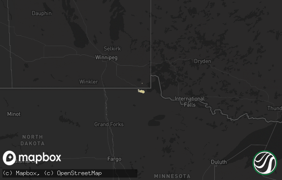
Hail Map in Georgia on May 4, 2017
The weather event in Georgia on May 4, 2017 includes Hail map. 6 states and 79 cities were impacted and suffered possible damage. The total estimated number of properties impacted is 4,554.

Hail
4,554
Estimated number of impacted properties by a 1.00" hail or larger0
Estimated number of impacted properties by a 1.75" hail or larger0
Estimated number of impacted properties by a 2.50" hail or largerStorm reports in Georgia
Georgia
| Date | Description |
|---|---|
| 05/04/20174:55 PM CDT | Severe damage to auto parts store in the 400 block of hwy 80 reported by emergency management. Likely tornado |
| 05/04/20174:50 PM CDT | *** 5 inj *** nws survey team confirmed an ef-1 tornado ocurred near garden city ga. Maximum sustained winds estimated to be 110 mph. Maximum path width 120 yards. Path |
| 05/04/20174:13 PM CDT | Media relayed report of large tree down on belfast pines drive. |
| 05/04/20174:04 PM CDT | Tree down on powerlines along clyo kildare rd. Time estimated from radar |
| 05/04/20172:47 PM CDT | Tree down on power lines near huddle house on us hwy 84 |
| 05/04/20172:30 PM CDT | Media shared social media post of quarter size hail. |
| 05/04/20172:30 PM CDT | Storm spotter reported quarter to half dollar size hail in the jesup vicinity. Time is estimated based on radar. |
| 05/04/20172:30 PM CDT | Power pole snapped with fences also heavily damaged near oak villa drive. |
| 05/04/20172:28 PM CDT | 911 reported part of a building fell onto a car near north brunswick road. Time estimated from radar. |
| 05/04/20171:28 PM CDT | 911 reported part of a building fell onto a car. Time estimated from radar. |
| 05/04/20171:20 PM CDT | A nws storm survey found that a tornado destroyed three older outbuildings and damaged several others. Snapped trunks and uprooted trees were also found along the path. |
| 05/04/20171:16 PM CDT | 911 reported 2 barns destroyed. Trees and powerlines down. Possible tornado. |
| 05/04/20171:10 PM CDT | A few trees down. Time based on radar. |
| 05/04/20171:05 PM CDT | Emergency management reported several different areas of tree damage. Tops of trees were snapped. Farm sheds damaged. Carport shelters damaged. One location of damage w |
| 05/04/20171:05 PM CDT | Emergency management reported several different areas of tree damage. Tops of trees were snapped. Farm sheds damaged. Carport shelters damaged. One location of damage w |
| 05/04/20171:04 PM CDT | A nws storm survey found a tornado resulted in damage to one home and one outbuilding. Trees with snapped trunks were also found along the path. |
| 05/04/201712:25 PM CDT | A nws storm survey concluded that a brief weak tornado caused severe roof damage to a barn before dissipating. |
| 05/04/201712:16 PM CDT | Several trees down along with large branches. Sheet metal on out building pulled back. Time estimated by radar. |
| 05/03/20179:55 PM CDT | Tree down on power lines on berkeley lake road. |
| 05/03/20179:44 PM CDT | Tree down on power line on friar tuck lane. |
| 05/03/20179:30 PM CDT | 80 foot oak tree reported down on house on chatuge drive... Several other trees damaged on street |
| 05/03/20178:40 PM CDT | Nws survey team determined an ef-0 tornado touched down northeast of avondale estates. The tornado downed and snapped multuple trees. The tornado path was 1.1 miles lon |
| 05/03/20178:14 PM CDT | Reports of mostly minor damage on north side of atlanta hartsfield airfield. Damage reports received thus far are to cargo buildings and cars on ramp. |
| 05/03/20178:12 PM CDT | Nws survey team determined that an ef-0 tornado briefly touched down at the north cargo bay area of hartsfield-jackson international airport. The tornado pickedup up 8 |
| 05/03/20178:12 PM CDT | Nws survey team determined that an ef-0 tornado briefly touched down at the north cargo bay area of hartsfield-jackson international airport. The tornado pickedup up 8 |
All States Impacted by Hail Map on May 4, 2017
Cities Impacted by Hail Map on May 4, 2017
- Butte Falls, OR
- Fort Jones, CA
- Jacksonville, FL
- Saint Johns, FL
- Jesup, GA
- Hortense, GA
- Eagle Point, OR
- Ashland, OR
- Mineral, WA
- Prosser, WA
- Prospect, OR
- Trail, OR
- Shady Cove, OR
- Bickleton, WA
- Callahan, CA
- Etna, CA
- Sunnyside, WA
- Clewiston, FL
- Screven, GA
- Ludowici, GA
- Mabton, WA
- Grandview, WA
- Mattawa, WA
- Royal City, WA
- Mossyrock, WA
- Moses Lake, WA
- Hartline, WA
- Coulee City, WA
- Marlin, WA
- Condon, OR
- Othello, WA
- Arlington, OR
- Roosevelt, WA
- Benton City, WA
- Myrtle Creek, OR
- Almira, WA
- Jacksonville, OR
- Eltopia, WA
- Pasco, WA
- Mesa, WA
- Walterboro, SC
- West Richland, WA
- Kennewick, WA
- Richland, WA
- Buckley, WA
- Enumclaw, WA
- Centralia, WA
- Tenino, WA
- Olympia, WA
- Rochester, WA
- Grand Coulee, WA
- Tiller, OR
- Richmond Hill, GA
- Medford, OR
- Morton, WA
- Stratford, WA
- Soap Lake, WA
- Warden, WA
- Skykomish, WA
- Yreka, CA
- Toutle, WA
- Stevenson, WA
- Vernonia, OR
- Buxton, OR
- Manning, OR
- Gales Creek, OR
- Gaston, OR
- Timber, OR
- Banks, OR
- Forest Grove, OR
- Culver, OR
- Camp Sherman, OR
- Redmond, OR
- Sisters, OR
- Bend, OR
- Madras, OR
- Terrebonne, OR
- Roseburg, OR
- Idleyld Park, OR


