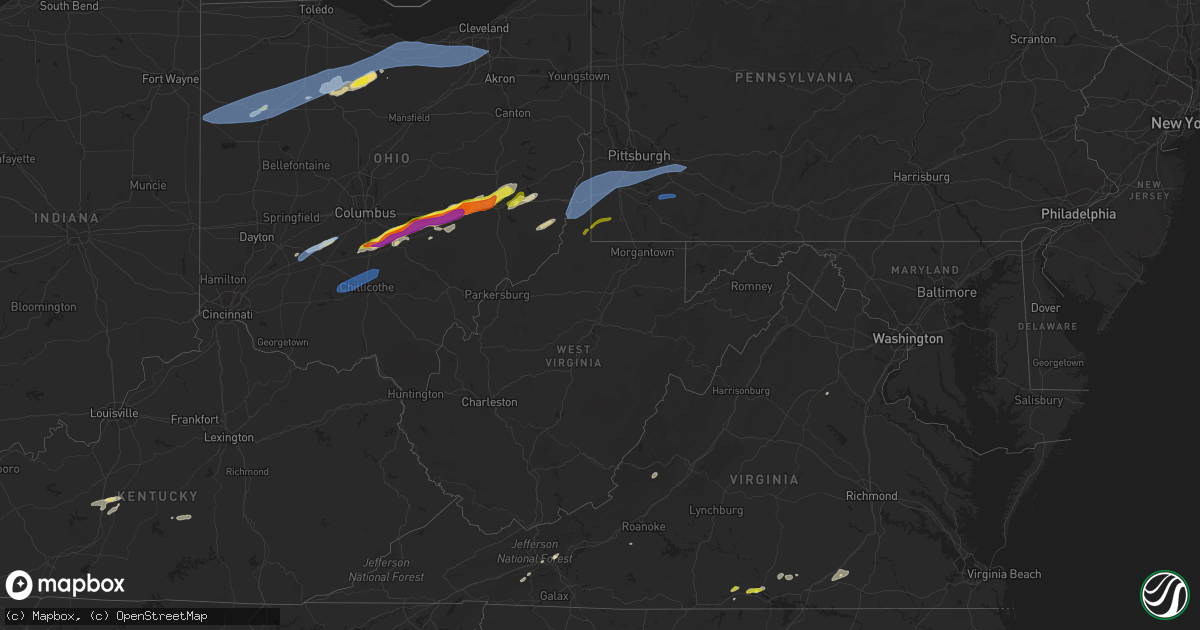
Hail Map in West Virginia on May 3, 2022
Get this storm
May 3 map
$229
one time, instant access
Download today. No call, no setup
Keep the $229
Bought the map and want the full workflow? Apply the entire $229 to a subscription within 7 days. None of it is wasted.
Every map, not just this one
This buys you this map. Subscription and you get every map we run, in the markets you choose from a few cities to whole states to nationwide. Plus real-time alerts the moment a storm fires.
Contact data
Name, contact info, occupancy, even credit band for addresses in the footprint. You go from where it hit to who to call.
Become the source they trust
Unlimited branding weather history reports on demand. You already have the documented answer ready for the property owner, and you are the one who showed up with it.
Property data and RoofTrace estimates
Pull up any address you have got, its value and the exact code rules for that jurisdiction, straight from One Click Code. Then RoofTrace estimates the squares, pitch, and roof value, priced the way you price.
Storm reports in West Virginia
West Virginia
| Date | Description |
|---|---|
| 05/03/20226:49 PM CDT | Tree reported down across a road in bridgeport at approximately 7:50 pm. |
| 05/03/20226:48 PM CDT | Tree reported down across adamsville rd. |
| 05/03/20225:20 PM CDT | Multiple reports of trees falling onto homes in williamstown at approximately 6:20 pm. |
| 05/03/20225:12 PM CDT | Report of a tree falling onto a home at approximately 6:10 pm. |
| 05/03/20224:50 PM CDT | Trees and power lines reported down along fraziers run road. |
| 05/03/20224:35 PM CDT | Multiple trees down near oglebay. |
| 05/03/20224:28 PM CDT | Measured wind gust at hlg airport. |
| 05/03/20222:56 AM CDT | At 756 PM EDT, a severe thunderstorm was located near Westover, moving east at 50 mph. HAZARD...60 mph wind gusts. SOURCE...Radar indicated. IMPACT...Expect damage to trees and power lines, resulting in some power outages. Locations impacted include... Morgantown, Fairmont, Westover, Kingwood, Star City, Winfield, Point Marion, Granville, Brookhaven, Cassville, Rivesville, and Reedsville. |
| 05/03/20222:15 AM CDT | At 715 PM EDT, severe thunderstorms were located along a line extending from 9 miles west of Wellsville to near Wintersville, moving northeast at 70 mph. HAZARD...60 mph wind gusts. SOURCE...Radar indicated. IMPACT...Expect damage to trees and power lines, resulting in some power outages. Locations impacted include... Weirton, Steubenville, East Liverpool, Wellsville, New Brighton, Toronto, Beaver, Calcutta, Wintersville, Ohioville, Midland, and Chester. |
| 05/03/202212:42 AM CDT | At 542 PM EDT, a severe thunderstorm was located near Triadelphia, moving northeast at 45 mph. HAZARD...60 mph wind gusts and penny size hail. SOURCE...Radar indicated. IMPACT...Expect damage to trees and power lines, resulting in some power outages. Locations impacted include... Wheeling, Moundsville, Bethlehem, Triadelphia, McMechen, Benwood, West Finley, Nineveh, Amity, Green Hills, Elm Grove, and Dallas. |
| 05/02/202211:11 PM CDT | At 411 PM EDT, a severe thunderstorm was located over Cameron, or 12 miles southeast of Moundsville, moving northeast at 45 mph. HAZARD...60 mph wind gusts and quarter size hail. SOURCE...Radar indicated. IMPACT...Minor hail damage to vehicles is possible. Expect wind damage to trees and power lines, resulting in some power outages. Locations impacted include... Waynesburg, Cameron, Rogersville, Aleppo, Nineveh, New Freeport, Rocklick, Lynn Camp, Glen Easton, Beelers Station, and Lone Oak. |
| 05/02/20229:00 PM CDT | Damage to windows on a house and to a barn roof on the 100 block of jordans way. |
| 05/02/20229:00 PM CDT | Damage to windows on a house and to a barn roof on the 100 block of jordans way. |
| 05/02/20228:55 PM CDT | There were reports of trees blown down in springfield. |
| 05/02/20228:50 PM CDT | There was a report of trees blown down on wv-10/1 frosty hollow road between rig and petersburg. |
| 05/02/20228:50 PM CDT | There were reports of trees blown down in romney. |
| 05/02/20228:35 PM CDT | There was a report of a few trees blown down near maysville along lunice creek highway near lazy star lane. Lightning also caused a transformer fire in this area. |
| 05/02/20227:06 PM CDT | Tree reported down across a road in flemington at approximately 8:05 pm. |
| 05/02/20227:05 PM CDT | Multiple different reports of trees down across roadways in grafton just after 8 pm. |
| 05/02/20227:05 PM CDT | Tree reported down across a road in lost creek at approximately 8:05 pm. Time was estimated from radar. |
| 05/02/20227:02 PM CDT | Tree down on l core road/state route 7 |
| 05/02/20227:02 PM CDT | Tree down on grafton road near the taylor county line |
| 05/02/20227:00 PM CDT | Tree down on the 900 block of willey street |
All States Impacted by Hail Map on May 3, 2022
Cities Impacted by Hail Map on May 3, 2022
- Aiken, SC
- Hartsville, SC
- Lynchburg, SC
- Timmonsville, SC
- Columbia, SC
- Concord, GA
- Hazlehurst, GA
- Baxley, GA
- Fort Meade, FL
- Punta Gorda, FL
- Quaker City, OH
- Salesville, OH
- Waycross, GA
- Maxton, NC
- Lumberton, NC
- Saint Pauls, NC
- Dolphin, VA
- Warfield, VA
- Tiffin, OH
- New Riegel, OH
- Florence, SC
- Swansea, SC
- Saint Matthews, SC
- Fayetteville, NC
- Tar Heel, NC
- White Oak, NC
- Manning, SC
- Alcolu, SC
- Mount Vernon, GA
- Uvalda, GA
- Ailey, GA
- Johnston, SC
- Marion, SC
- Mullins, SC
- Shannon, MS
- Lancaster, SC
- Heath Springs, SC
- Mount Sterling, OH
- Bloomingburg, OH
- Jamestown, OH
- South Solon, OH
- Jeffersonville, OH
- Washington Court House, OH
- Red Springs, NC
- Elizabethtown, NC
- Shannon, NC
- Newnan, GA
- Griffin, GA
- Williamson, GA
- Tifton, GA
- Douglas, GA
- Jennings, FL
- Pinetta, FL
- Millen, GA
- Portal, GA
- Buffalo, KY
- Sonora, KY
- Upton, KY
- Hodgenville, KY
- Hoboken, GA
- Lumber Bridge, NC
- Lamar, SC
- Stoutsville, OH
- Lore City, OH
- Port Washington, OH
- Thornville, OH
- Glenford, OH
- Pleasantville, OH
- Thurston, OH
- Lancaster, OH
- Heath, OH
- Canal Winchester, OH
- Adamsville, OH
- Zanesville, OH
- Millersport, OH
- Baltimore, OH
- Hopewell, OH
- Cambridge, OH
- Amanda, OH
- Roseville, OH
- Mount Perry, OH
- New Concord, OH
- Nashport, OH
- Carroll, OH
- Rushville, OH
- Freeport, OH
- Norwich, OH
- Circleville, OH
- Somerset, OH
- Kimbolton, OH
- Ashville, OH
- Willacoochee, GA
- Pearson, GA
- Saluda, SC
- Cameron, SC
- Reidsville, GA
- Glennville, GA
- Lyons, GA
- Alapaha, GA
- Nashville, GA
- Republic, OH
- Attica, OH
- Bloomville, OH
- Hopkins, SC
- Wytheville, VA
- Kenbridge, VA
- Summerton, SC
- Pinewood, SC
- Elloree, SC
- Santee, SC
- Sumter, SC
- Elk Horn, KY
- Liberty, KY
- Port Charlotte, FL
- Lineville, AL
- Talladega, AL
- Wedowee, AL
- Woodland, AL
- Ashland, AL
- Avon Park, FL
- Effingham, SC
- Ridge Spring, SC
- Sycamore, OH
- Tallahassee, FL
- Hampton, SC
- Varnville, SC
- Franklin, GA
- Bishopville, SC
- Fayetteville, GA
- Milan, GA
- Garfield, GA
- Scottsburg, VA
- Bear Creek, NC
- Mayo, FL
- Live Oak, FL
- Rocky Ford, GA
- Magnolia, KY
- Middlesex, NC
- South Boston, VA
- Halifax, VA
- Deridder, LA
- Patterson, GA
- Jesup, GA
- Hortense, GA
- Screven, GA
- Nahunta, GA
- Lenox, GA
- Omega, GA
- Lake Park, GA
- Valdosta, GA
- Rich Square, NC
- Jackson, NC
- Blair, SC
- Lake Wales, FL
- Frostproof, FL
- Beallsville, OH
- Sugar Grove, VA
- Speedwell, VA
- Rural Retreat, VA
- Bonnieville, KY
- Pembroke, NC
- Barnesville, OH
- Axson, GA
- Munford, AL
- Alma, GA
- Max Meadows, VA
- Dalzell, SC
- Rembert, SC
- Garnett, SC
- Estill, SC
- Pineland, SC
- Lecanto, FL
- Homosassa, FL
- Lillington, NC
- Bunnlevel, NC
- Erwin, NC
- Trion, GA
- Willard, OH
- Crooksville, OH
- McCutchenville, OH
- Upper Sandusky, OH
- Vanlue, OH
- Alvada, OH
- Mount Blanchard, OH
- Carey, OH
- Sylvania, GA
- Myakka City, FL
- Lake Placid, FL
- Mayesville, SC
- West Green, GA
- Broxton, GA
- Flushing, OH
- Alpine, AL
- Quincy, FL
- Zebulon, GA
- Milner, GA
- Longville, LA
- Dequincy, LA
- Brooks, GA
- Chase City, VA
- Bluffton, TX
- Tow, TX
- Monetta, SC
- Spruce Pine, NC
- Tecumseh, OK
- Shawnee, OK
- Findlay, OH
- Arlington, OH
- Twin City, GA
- Carrollton, GA
- Whitesburg, GA
- Newton, TX
- North Fort Myers, FL
- Newberry, SC
- Ona, FL
- Castalian Springs, TN
- Gallatin, TN
- Clinton, NC
- Lodge, SC
- Islandton, SC
- Brunson, SC
- Ehrhardt, SC
- Roopville, GA
- Bowdon, GA
- Ambrose, GA
- Alledonia, OH
- Jerusalem, OH
- Jacobsburg, OH
- Waxhaw, NC
- Greenville, NC
- Bethel, NC
- Hogansville, GA
- Glenwood, GA
- Alamo, GA
- Enigma, GA
- Lehigh Acres, FL
- Fairfax, SC
- Sebring, FL
- Wade, NC
- Freeman, VA
- Lawrenceville, VA
- Crockett, VA
- Bristol, GA
- Branchville, SC
- Mount Olive, NC
- Virgilina, VA
- Powhatan Point, OH
- Woodsfield, OH
- Dunn, NC
- Barnwell, SC
- Olar, SC
- Ludowici, GA
- Clarksville, VA
- Red Oak, VA
- Draper, VA
- Culpeper, VA
- Callaway, VA
- Peachtree City, GA
- Camden, SC
- Statesboro, GA
- Eagle Rock, VA
- Roseboro, NC
- Troy, NC
- Prosperity, SC
- West Columbia, SC
- Lee, FL
- Day, FL
- Buchanan Dam, TX
- Llano, TX
- Coal Center, PA
- New Lexington, OH
- Godwin, NC
- Acworth, GA
- Heflin, AL
- Delta, AL
- Cairo, OH
- Lima, OH
- Delphos, OH
- Columbus Grove, OH
- Darlington, SC
- Vidalia, GA
- Parkton, NC
- Lugoff, SC
- Elgin, SC
- Fort Myers, FL
- Jasper, FL
- Guyton, GA
- Sanderson, FL
- Trenton, SC
- Star, NC
- North Port, FL
- Senoia, GA
- Nicholls, GA
- Smoaks, SC
- Bellevue, OH
- Robbins, NC
- Bennett, NC
- Springfield, GA
- Clyo, GA
- Ellabell, GA
- Triadelphia, WV
- Eighty Four, PA
- Washington, PA
- New Eagle, PA
- Lawrence, PA
- Venetia, PA
- Rillton, PA
- Wellsburg, WV
- Westmoreland City, PA
- West Finley, PA
- West Alexander, PA
- Hickory, PA
- Muse, PA
- Meadow Lands, PA
- Elrama, PA
- Finleyville, PA
- Strabane, PA
- Manor, PA
- Valley Grove, WV
- Harrison City, PA
- Elizabeth, PA
- Claysville, PA
- Pittsburgh, PA
- Greensburg, PA
- Glen Dale, WV
- Forbes Road, PA
- Grapeville, PA
- Canonsburg, PA
- Bunola, PA
- Greenock, PA
- West Liberty, WV
- Wheeling, WV
- McDonald, PA
- Mckeesport, PA
- Claridge, PA
- Avella, PA
- Benwood, WV
- Loyalhanna, PA
- Hannastown, PA
- Moundsville, WV
- Adamsburg, PA
- Jeannette, PA
- Monongahela, PA
- Bradenville, PA
- Irwin, PA
- South Park, PA
- West Elizabeth, PA
- Bethany, WV
- Cameron, WV
- Westland, PA
- Buena Vista, PA
- Clairton, PA
- Penn, PA
- Bovard, PA
- Latrobe, PA
- Houston, PA
- Derry, PA
- Larimer, PA
- Bellaire, OH
- Mcmechen, WV
- Crabtree, PA
- Dallas, WV
- Shadyside, OH
- Luxor, PA
- Burgettstown, PA
- Bethel Park, PA
- Smithton, PA
- Star Junction, PA
- Scottdale, PA
- Dawson, PA
- Everson, PA
- Perryopolis, PA
- Patrick, SC
- Bascom, OH
- Kipton, OH
- Van Wert, OH
- Columbia Station, OH
- Fostoria, OH
- Amherst, OH
- Broadview Heights, OH
- Vaughnsville, OH
- Spencerville, OH
- Grafton, OH
- Harrod, OH
- Middle Point, OH
- Brunswick, OH
- Berlin Heights, OH
- Ohio City, OH
- Wakeman, OH
- Brecksville, OH
- Benton Ridge, OH
- Jenera, OH
- Green Springs, OH
- Sandusky, OH
- Independence, OH
- Rawson, OH
- Lagrange, OH
- Mount Cory, OH
- Fort Jennings, OH
- Mendon, OH
- Strongsville, OH
- Venedocia, OH
- Bluffton, OH
- Ottawa, OH
- Pandora, OH
- McComb, OH
- Milan, OH
- Willshire, OH
- Huron, OH
- Richfield, OH
- Litchfield, OH
- Clyde, OH
- Oberlin, OH
- Monroeville, OH
- Medina, OH
- Norwalk, OH
- Arcadia, OH
- Beaverdam, OH
- Collins, OH
- Elyria, OH
- Berea, OH
- Forest, OH
- Ada, OH
- Gomer, OH
- Wellington, OH
- Valley City, OH
- Vermilion, OH
- North Ridgeville, OH
- Rockford, OH
- North Royalton, OH
- Hinckley, OH
- Sabina, OH
- Chillicothe, OH
- South Salem, OH
- Frankfort, OH
- Kingston, OH
- Bainbridge, OH
- Sycamore, PA
- Waynesburg, PA
- Graysville, PA
- Wind Ridge, PA
- Holbrook, PA


