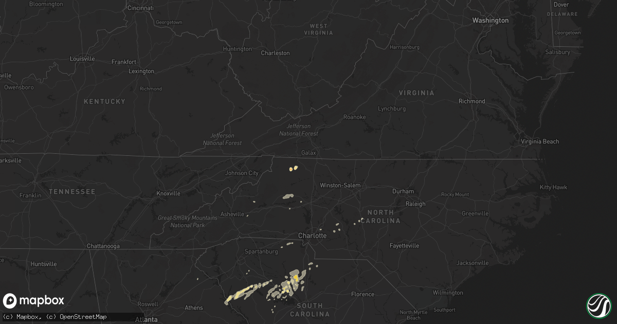
Hail Map in South Carolina on May 3, 2011
Get this storm
May 3 map
$229
one time, instant access
Download today. No call, no setup
Keep the $229
Bought the map and want the full workflow? Apply the entire $229 to a subscription within 7 days. None of it is wasted.
Every map, not just this one
This buys you this map. Subscription and you get every map we run, in the markets you choose from a few cities to whole states to nationwide. Plus real-time alerts the moment a storm fires.
Contact data
Name, contact info, occupancy, even credit band for addresses in the footprint. You go from where it hit to who to call.
Become the source they trust
Unlimited branding weather history reports on demand. You already have the documented answer ready for the property owner, and you are the one who showed up with it.
Property data and RoofTrace estimates
Pull up any address you have got, its value and the exact code rules for that jurisdiction, straight from One Click Code. Then RoofTrace estimates the squares, pitch, and roof value, priced the way you price.
Storm reports in South Carolina
South Carolina
| Date | Description |
|---|---|
| 05/02/20119:54 PM CDT | Dot reported several trees down on riverside road just off hwy 9 west of lancaster. |
| 05/02/20119:42 PM CDT | Dot reported several trees down in the jenkinsville area of southwest fairfield county. |
| 05/02/20119:38 PM CDT | Dot reported several trees down in northwest fairfield county east to southeast of blair. |
| 05/02/20118:58 PM CDT | Sc highway patrol reports a tree in the roadway on hw-49 just before the intersection with hw-55. Time estimated from radar data. |
| 05/02/20118:52 PM CDT | Fire department reported one tree down on the northeast side of clover. |
| 05/02/20117:48 PM CDT | Large oak trees uprooted along hw-56 about 6 miles south of clinton. |
| 05/02/20117:47 PM CDT | County communications and joanna fire department report one tree down along old milton road. |
| 05/02/20117:24 PM CDT | A trained spotter...and also a cocorahs observer...had quarter sized hail that lasted about 5 minutes. |
| 05/02/20117:13 PM CDT | Quarter sized hail reported in cokesbury. Also had tree limbs down of unknown size in this report. |
All States Impacted by Hail Map on May 3, 2011
Cities Impacted by Hail Map on May 3, 2011
- Gibson, GA
- Warthen, GA
- Mitchell, GA
- Millers Creek, NC
- Laurel Springs, NC
- Dudley, GA
- Dexter, GA
- Concord, NC
- Harrisburg, NC
- McGrady, NC
- Sparta, NC
- Blair, SC
- Saluda, SC
- Lancaster, SC
- Little Mountain, SC
- Pomaria, SC
- Shickshinny, PA
- Rochelle, GA
- Arabi, GA
- Vienna, GA
- Cordele, GA
- Pitts, GA
- Wapwallopen, PA
- Nanticoke, PA
- Clover, SC
- Mount Pleasant Mills, PA
- Beavertown, PA
- Middleburg, PA
- Richfield, PA
- Waterloo, SC
- Hodges, SC
- Abbeville, SC
- Clinton, SC
- Kinards, SC
- Newberry, SC
- Ridge Spring, SC
- Ward, SC
- Greenwood, SC
- Cross Hill, SC
- Bradley, SC
- Mountville, SC
- Wetumpka, AL
- Taylorsville, NC
- Port Royal, PA
- Honey Grove, PA
- East Dublin, GA
- Chester, GA
- Gaffney, SC
- Hudson, NC
- Lenoir, NC
- Granite Falls, NC
- Honea Path, SC
- Fountain Inn, SC
- Gray Court, SC
- Dublin, GA
- Blackstock, SC
- Winnsboro, SC
- Eastman, GA
- Berwick, PA
- Danville, PA
- Prosperity, SC
- Pineview, GA
- Atlanta, GA
- Chapin, SC
- Star, NC
- Silverstreet, SC
- Old Fort, NC
- Louisville, GA
- Midville, GA
- Toccoa, GA
- Eastanollee, GA
- Muncy, PA
- Bloomsburg, PA
- Abbeville, GA
- Marion, NC
- Orangeville, PA
- Millville, PA
- Cadwell, GA
- Calhoun Falls, SC
- New London, NC
- Richfield, NC
- Albemarle, NC
- McClure, PA
- Jackson, SC
- Augusta, GA
- Mifflinburg, PA
- Lewisburg, PA
- Newton, NC
- Hickory, NC
- White Haven, PA
- Blacksburg, SC
- York, SC
- Smyrna, SC
- Chester, SC
- Carlisle, SC
- Whitmire, SC
- Richburg, SC
- Jenkinsville, SC
- Joanna, SC
- Mountain Top, PA
- Wilkes Barre, PA
- Mill Creek, PA
- Stillwater, PA
- Keysville, GA
- Waynesboro, GA
- Seagrove, NC
- Ridgeway, SC
- Great Falls, SC
- Fort Lawn, SC
- Hawkinsville, GA
- Cochran, GA
- Rentz, GA
- Locust, NC
- Oakboro, NC
- Sunbury, PA
- Paxinos, PA
- Stony Point, NC
- Elberton, GA
- Batesburg, SC
- New Columbia, PA
- Union City, GA
- Warwick, GA
- Milton, PA
- Watsontown, PA
- Turbotville, PA
- Troy, NC
- Huntingdon, PA
- Millerstown, PA
- Hays, NC


