Hail Map in North Carolina on April 28, 2023
Get this storm
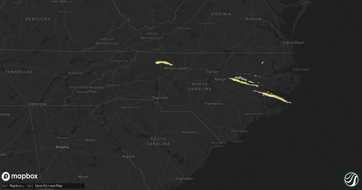
April 28 map
$229
one time, instant access
Download today. No call, no setup
Keep the $229
Bought the map and want the full workflow? Apply the entire $229 to a subscription within 7 days. None of it is wasted.
Every map, not just this one
This buys you this map. Subscription and you get every map we run, in the markets you choose from a few cities to whole states to nationwide. Plus real-time alerts the moment a storm fires.
Contact data
Name, contact info, occupancy, even credit band for addresses in the footprint. You go from where it hit to who to call.
Become the source they trust
Unlimited branding weather history reports on demand. You already have the documented answer ready for the property owner, and you are the one who showed up with it.
Property data and RoofTrace estimates
Pull up any address you have got, its value and the exact code rules for that jurisdiction, straight from One Click Code. Then RoofTrace estimates the squares, pitch, and roof value, priced the way you price.
Storm reports in North Carolina
North Carolina
| Date | Description |
|---|---|
| 04/28/20234:25 PM CDT | A local report indicates 1.00 inch wind near EAST BEND |
| 04/28/20234:24 PM CDT | Tree down. |
| 04/28/20234:00 PM CDT | Multiple trees down and hail at least quarter size. |
| 04/28/20233:47 PM CDT | Thunderstorm winds blew down several trees in jonesville. |
| 04/28/20233:45 PM CDT | Part of tree down as well. |
| 04/28/20233:45 PM CDT | Multiple trees down and power outage. |
| 04/28/20233:39 PM CDT | Trees fell on power lines. Time estimated from radar. |
| 04/28/20233:35 PM CDT | A local report indicates 62 MPH wind near 2 WSW PLEASANT HILL |
| 04/28/20233:31 PM CDT | Thunderstorm winds blew down several trees and the roof of a shed along the 400 block of luffman road. Hail up to the size of quarters also fell. |
| 04/27/20239:30 PM CDT | Public reported quarter size hail near hobucken at 10:30 pm. |
| 04/27/20238:35 PM CDT | Delayed report. Hail up to quarter size fell in the brook valley neighborhood in greenville. Report and picture via facebook. |
| 04/27/20238:18 PM CDT | Corrects previous hail report from 2 nw pitt-greenville airport. Public reported quarter size hail in greenville at 9:40 pm. |
| 04/27/20237:14 PM CDT | Em relayed report of at least quarter sized hail near forest hills rd and alt 264. Time estimated by radar. |
| 04/27/20237:05 PM CDT | Public estimated quarter size hail. |
All States Impacted by Hail Map on April 28, 2023
Cities Impacted by Hail Map on April 28, 2023
- Hamilton, TX
- Priddy, TX
- Mullin, TX
- Comanche, TX
- Pottsville, TX
- Gustine, TX
- Evant, TX
- Purmela, TX
- Gatesville, TX
- Jonesboro, TX
- Fort Hood, TX
- Copperas Cove, TX
- Lampasas, TX
- Oglesby, TX
- Hico, TX
- Iredell, TX
- Brackettville, TX
- Kempner, TX
- Briggs, TX
- Glen Rose, TX
- Nemo, TX
- Cleburne, TX
- Rainbow, TX
- Quemado, TX
- Dublin, TX
- Carlton, TX
- Eastland, TX
- Desdemona, TX
- Roaring River, NC
- Ronda, NC
- Elkin, NC
- Burnet, TX
- Bertram, TX
- Godley, TX
- Moody, TX
- Killeen, TX
- Harker Heights, TX
- Nolanville, TX
- Jonesville, NC
- Dobson, NC
- Boonville, NC
- Joshua, TX
- Belton, TX
- Salado, TX
- Llano, TX
- East Bend, NC
- Siloam, NC
- Kingsland, TX
- Marble Falls, TX
- Horseshoe Bay, TX
- Grand Prairie, TX
- Alvarado, TX
- Burleson, TX
- Mansfield, TX
- Lillian, TX
- Arlington, TX
- Dallas, TX
- Eagle Pass, TX
- Liberty Hill, TX
- Leander, TX
- Georgetown, TX
- Rosebud, TX
- Lott, TX
- Temple, TX
- Uvalde, TX
- Troy, TX
- Pfafftown, NC
- Tobaccoville, NC
- Hutto, TX
- Cedar Park, TX
- Austin, TX
- Round Rock, TX
- Aquilla, TX
- Abbott, TX
- Hillsboro, TX
- Crystal City, TX
- Pflugerville, TX
- Jarrell, TX
- Florence, TX
- Granger, TX
- Bartlett, TX
- Thrall, TX
- Thorndale, TX
- Taylor, TX
- Cameron, TX
- Davilla, TX
- Rockdale, TX
- Milano, TX
- Buckholts, TX
- Bandera, TX
- Medina, TX
- Comfort, TX
- Boerne, TX
- Manor, TX
- Pearsall, TX
- Carrizo Springs, TX
- West Palm Beach, FL
- Pipe Creek, TX
- Caldwell, TX
- Hearne, TX
- Bryan, TX
- Gause, TX
- West, TX
- Penelope, TX
- Mount Calm, TX
- Hubbard, TX
- Axtell, TX
- Coolidge, TX
- Helotes, TX
- Goldthwaite, TX
- Fellsmere, FL
- Fredericksburg, TX
- Johnson City, TX
- Lometa, TX
- Kerrville, TX
- Mason, TX
- Round Mountain, TX
- Ingram, TX
- State Road, NC
- San Saba, TX
- Holland, TX
- Malabar, FL
- Grant, FL
- Palm Bay, FL
- Vanderpool, TX
- Burlington, TX
- Tow, TX
- Bluffton, TX
- Rogers, TX
- Stonewall, TX
- Spicewood, TX
- Buchanan Dam, TX
- Willow City, TX
- Star, TX
- College Station, TX
- San Antonio, TX
- Mico, TX
- Dawson, TX
- Prairie Hill, TX
- Mexia, TX
- Laredo, TX
- Emory, TX
- Point, TX
- Bedias, TX
- Iola, TX
- Anderson, TX
- Richards, TX
- Huntsville, TX
- Groesbeck, TX
- Teague, TX
- Hortense, GA
- Patterson, GA
- Donie, TX
- Giddings, TX
- Lincoln, TX
- Brunswick, GA
- Jesup, GA
- Buffalo, TX
- La Vernia, TX
- Adkins, TX
- Floresville, TX
- Cotulla, TX
- Sutherland Springs, TX
- Stockdale, TX
- Kenly, NC
- Middlesex, NC
- Sims, NC
- Bailey, NC
- Zebulon, NC
- Wilson, NC
- Stantonsburg, NC
- Walstonburg, NC
- Fountain, NC
- Nixon, TX
- Gillett, TX
- Smiley, TX
- Schulenburg, TX
- Weimar, TX
- Hallettsville, TX
- Moulton, TX
- Oakland, TX
- Shiner, TX
- Westhoff, TX
- Cuero, TX
- Yoakum, TX
- Victoria, TX
- Inez, TX
- Sublime, TX
- Edna, TX
- Chocowinity, NC
- Blounts Creek, NC
- Ernul, NC
- Garwood, TX
- Louise, TX
- Ganado, TX
- Edward, NC
- Aurora, NC
- Hobucken, NC
- Bayboro, NC
- Zapata, TX
- Greenville, NC
- Grimesland, NC
- Roma, TX
- Alba, TX
- Wimberley, TX
- Blanco, TX
- Fischer, TX
- Gonzales, TX
- Macclesfield, NC
- Elm City, NC
- San Marcos, TX
- La Pryor, TX
- Manor, GA
- Wills Point, TX
- Edgewood, TX
- Goliad, TX
- Ayden, NC
- Big Wells, TX
- Converse, TX
- Universal City, TX
- Columbus, TX
- Kyle, TX
- Lockhart, TX
- Dale, TX
- Buda, TX
- Lexington, TX
- Yorktown, TX
- Rio Medina, TX
- Tilden, TX
- Elgin, TX
- Kendalia, TX
- Spring Branch, TX
- Encinal, TX
- Ledbetter, TX
- Round Top, TX
- La Grange, TX
- Townsend, GA
- Wellington, FL
- Lake Worth, FL
- Dilley, TX
- Moore, TX
- Canyon Lake, TX
- Dime Box, TX
- Bastrop, TX
- Pleasanton, TX
- Vanceboro, NC
- El Indio, TX
- Falls City, TX
- Blackshear, GA
- Waycross, GA
- Paige, TX
- McDade, TX
- Fayetteville, TX
- Robersonville, NC
- Tarboro, NC
- Franklin, TX
- Farmville, NC
- Stuart, FL
- Palm City, FL
- Hobe Sound, FL
- Cedar Creek, TX
- Smithville, TX
- Nordheim, TX
- Center Point, TX
- Somerville, TX
- Nahunta, GA
- Runge, TX
- Hobson, TX
- Karnes City, TX
- Maxwell, TX
- Martindale, TX
- Hoboken, GA
- Farmersville, TX
- Wendell, NC
- New Braunfels, TX
- Jbsa Ft Sam Houston, TX
- Brenham, TX
- Coupland, TX
- Burton, TX
- Yantis, TX
- Jourdanton, TX
- Christine, TX
- Port Saint Lucie, FL
- Jensen Beach, FL
- Baltimore, OH
- Rio Grande City, TX
- Garciasville, TX
- Grulla, TX
- Sullivan City, TX
- Mission, TX
- La Joya, TX
- Penitas, TX
- Mcallen, TX
- Pharr, TX
- Hidalgo, TX
- San Juan, TX
- Alamo, TX
- Edinburg, TX
- Donna, TX
- Mercedes, TX
- Edcouch, TX
- Weslaco, TX
- Elsa, TX
- Raymondville, TX
- Armstrong, TX
- Lyford, TX
- La Villa, TX
- Hargill, TX
- Linn, TX
- Progreso, TX
- San Benito, TX
- La Feria, TX
- Harlingen, TX
- San Perlita, TX
- Port Mansfield, TX
- Santa Rosa, TX
- Sebastian, TX
- Combes, TX
- Brownsville, TX
- Los Fresnos, TX
- Rio Hondo, TX
- Olmito, TX
- Port Isabel, TX
- Encino, TX
- Kingsville, TX
- Atlantic Beach, NC
- Salter Path, NC
- Aulander, NC
- Stokes, NC
- Sarita, TX
- Port Lavaca, TX
- Bloomington, TX
- Port O'Connor, TX
- Riviera, TX
- Cedar Island, NC
- Asherton, TX
- Freer, TX
- Alice, TX
- Yadkinville, NC
- Bethel, NC


