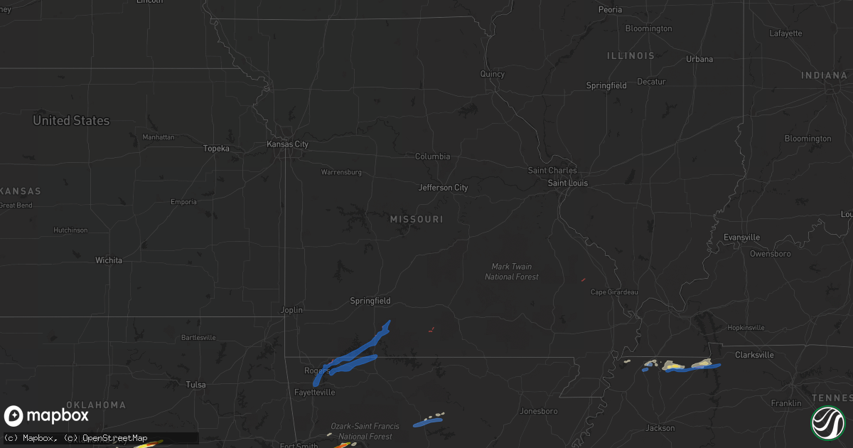
Hail Map in Missouri on April 28, 2021
Get this storm
April 28 map
$229
one time, instant access
Download today. No call, no setup
Keep the $229
Bought the map and want the full workflow? Apply the entire $229 to a subscription within 7 days. None of it is wasted.
Every map, not just this one
This buys you this map. Subscription and you get every map we run, in the markets you choose from a few cities to whole states to nationwide. Plus real-time alerts the moment a storm fires.
Contact data
Name, contact info, occupancy, even credit band for addresses in the footprint. You go from where it hit to who to call.
Become the source they trust
Unlimited branding weather history reports on demand. You already have the documented answer ready for the property owner, and you are the one who showed up with it.
Property data and RoofTrace estimates
Pull up any address you have got, its value and the exact code rules for that jurisdiction, straight from One Click Code. Then RoofTrace estimates the squares, pitch, and roof value, priced the way you price.
Storm reports in Missouri
Missouri
| Date | Description |
|---|---|
| 04/28/20213:55 PM CDT | Tree fell and caused damage to 3 cars and lawn mower. Time estimated by radar. |
| 04/28/20213:00 PM CDT | Shop roof blown off |
| 04/28/202111:14 AM CDT | Nws storm survey determined an ef0 tornado with maximum winds estimated at 85 mph touched down at this location. The most significant damage was the destruction of a th |
| 04/28/202111:12 AM CDT | Barn and residence damaged vicinity of highway 14 and county road 352 east of gentryville. |
| 04/28/202110:30 AM CDT | The roof was torn off a home east of oldfield. |
| 04/28/202110:27 AM CDT | Three large outbuildings damaged to destroyed. Debris blown northerly. Delayed report from previous nws survey. |
| 04/28/20219:56 AM CDT | Nws storm survey determined an ef0 tornado with winds estimated at 76 mph briefly touched down at this location. Trees were uprooted and a shed was destroyed. Path widt |
| 04/28/20219:37 AM CDT | Corrects previous tornado report from 2 n walnut shade. Nws storm survey determined an ef0 tornado with winds estimated at 76 mph briefly touched down at this location. |
| 04/28/20219:30 AM CDT | Nws storm survey determined an ef0 tornado with winds estimated at 70 mph briefly touched down at this location. Minor residential damage and snapped trees were observe |
| 04/28/20219:25 AM CDT | Large trees down on highway 76 near the highroad and shepherd of the hills outdoor theater. |
| 04/28/20219:20 AM CDT | Multiple trees down and light towers blown over indian point road. |
| 04/28/20217:35 AM CDT | At 1234 PM CDT, severe thunderstorms were located along a line extending from 7 miles northwest of Eminence to 10 miles south of Winona to 8 miles east of Alton to 10 miles northwest of Gatewood to near Dalton, moving northeast at 50 mph. HAZARD...60 mph wind gusts and penny size hail. SOURCE...Radar indicated. IMPACT...Expect damage to roofs, siding, and trees. Locations impacted include... Doniphan, Van Buren, Ellsinore, Budapest, Hunter, Gatewood, Handy, Fremont, Grandin and Briar. |
| 04/28/20217:30 AM CDT | At 1229 PM CDT, severe thunderstorms were located along a line extending from near Birch Tree to near Alton to near Thayer, moving northeast at 45 mph. HAZARD...60 mph wind gusts and penny size hail. SOURCE...Radar indicated. IMPACT...Expect damage to roofs, siding, and trees. Locations impacted include... Ozark National Scenic Riverways... Grand Gulf State Park... Thayer... Winona... Alton... Birch Tree... Eminence... Koshkonong... Montier... Thomasville... Myrtle... Wilderness... Couch... Rover... Alley Spring... West Eminence... Greer... |
| 04/28/20216:49 AM CDT | At 1149 AM CDT, severe thunderstorms were located along a line extending from near West Plains to 17 miles northeast of Bakersfield to 7 miles northwest of Sturkie to 6 miles south of Ott, moving northeast at 45 mph. HAZARD...60 mph wind gusts and penny size hail. SOURCE...Radar indicated. IMPACT...Expect damage to roofs, siding, and trees. Locations impacted include... West Plains... Grand Gulf State Park... Ozark National Scenic Riverways... Mountain View... Thayer... Winona... Alton... Birch Tree... Pomona... South Fork... Koshkonong... Brandsville... Montier... Thomasville... Peace Valley... Lanton... Teresita... Myrtle... Wilderness... Couch... |
| 04/28/20216:29 AM CDT | At 1129 AM CDT, a severe thunderstorm was located 14 miles southwest of Willow Springs, moving northeast at 20 mph. HAZARD...60 mph wind gusts and penny size hail. SOURCE...Radar indicated. IMPACT...Expect damage to roofs, siding, and trees. Locations impacted include... Willow Springs... |
| 04/28/20216:27 AM CDT | At 1127 AM CDT, a severe thunderstorm was located near Hartville, or 16 miles northwest of Mountain Grove, moving northeast at 25 mph. HAZARD...60 mph wind gusts and penny size hail. SOURCE...Radar indicated. IMPACT...Expect damage to roofs, siding, and trees. Locations impacted include... Hartville... Manes... |
| 04/28/20215:21 AM CDT | At 1021 AM CDT, severe thunderstorms were located along a line extending from 6 miles south of Seymour to 9 miles south of Ava to 12 miles northwest of Price Place to 8 miles northwest of Ozark Isle, moving northeast at 45 mph. HAZARD...60 mph wind gusts and penny size hail. SOURCE...Radar indicated. IMPACT...Expect damage to roofs, siding, and trees. Locations impacted include... Bull Shoals Lake... Norfork Lake... Mountain Grove... Ava... Seymour... Mansfield... Gainesville... Norwood... Bakersfield... Theodosia... Pontiac... Wasola... Sundown... Brixey... Willhoit... Brushyknob... Tecumseh... Caulfield... Udall... Hardenville... |
| 04/28/20214:37 AM CDT | At 937 AM CDT, severe thunderstorms were located along a line extending from 7 miles southeast of Highlandville to near Forsyth to Omaha to Carrollton, moving east at 35 mph. HAZARD...60 mph wind gusts and penny size hail. SOURCE...Radar indicated. IMPACT...Expect damage to roofs, siding, and trees. Locations impacted include... Lake Taneycomo... Bull Shoals Lake... Hollister... Ava... Forsyth... Merriam Woods... Kissee Mills... Rockaway Beach... Bull Creek... Taneyville... Theodosia... Kirbyville... Sundown... Oldfield... Elkhead... Chestnutridge... Powersite... Protem... Thornfield... Rome... |
| 04/28/20214:18 AM CDT | At 918 AM CDT, a severe thunderstorm was located near Roberson Hollow, or 10 miles south of Kimberling City, moving east at 40 mph. HAZARD...60 mph wind gusts and penny size hail. SOURCE...Radar indicated. IMPACT...Expect damage to roofs, siding, and trees. Locations impacted include... Table Rock Lake... Blue Eye... Ridgedale... |
| 04/28/20214:17 AM CDT | At 917 AM CDT, severe thunderstorms were located along a line extending from near Indian Point to near Green Forest to near Marble, moving east at 45 mph. HAZARD...60 mph wind gusts. SOURCE...Radar indicated. IMPACT...Expect damage to roofs, siding, and trees. Locations impacted include... Harrison... Diamond City... Bergman... Lead Hill... Omaha... Myrtle... Roberson Hollow... Capps... Self... Willis... Red Bank... Winington... Alpena... Crumpler Subdivision... South Lead Hill... Batavia... Bear Creek Springs... New Hope in Boone County... Hopewell in Boone County... Ridgeway... |
| 04/28/20214:04 AM CDT | At 903 AM CDT, severe thunderstorms were located along a line extending from 5 miles northeast of Urbanette to 5 miles north of Marble, moving east at 35 mph. HAZARD...70 mph wind gusts. SOURCE...Radar indicated. IMPACT...Expect considerable tree damage. Damage is likely to mobile homes, roofs, and outbuildings. Locations in or near the path include... Green Forest... Carrollton... Osage... Rule... Coin... Delmar... Denver... Connor... |
| 04/28/20213:51 AM CDT | At 851 AM CDT, a severe thunderstorm was located 10 miles west of Kimberling City, moving northeast at 30 mph. HAZARD...60 mph wind gusts and penny size hail. SOURCE...Radar indicated. IMPACT...Expect damage to roofs, siding, and trees. Locations impacted include... Branson... Table Rock Lake... Table Rock State Park... Silver Dollar City... Kimberling City... Shell Knob... Reeds Spring... Indian Point... Branson West... Galena... Mccord Bend... Blue Eye... Coney Island... Cape Fair... Lampe... |
| 04/28/20213:40 AM CDT | At 839 AM CDT, severe thunderstorms were located along a line extending from 4 miles west of Beaver to 5 miles north of Clifty to 4 miles southwest of Hindsville, moving east at 25 mph. HAZARD...60 mph wind gusts. SOURCE...Radar indicated. IMPACT...Expect damage to roofs, siding, and trees. Locations in or near the path include... Berryville... Huntsville... Eureka Springs... Elkins... Gateway... Beaver... Hindsville... Wesley... Rudd... Kingston... Forum... Hobbs State Park... Clifty... Withrow Springs State Park... War Eagle... Marble... Urbanette... Grandview... Rule... Goshen... |
| 04/28/20213:27 AM CDT | At 826 AM CDT, a severe thunderstorm was located over Beaver, or near Eureka Springs, moving northeast at 30 mph. HAZARD...60 mph wind gusts and penny size hail. SOURCE...Radar indicated. IMPACT...Expect damage to roofs, siding, and trees. Locations impacted include... Table Rock Lake... Shell Knob... Golden... Emerald Beach... Eagle Rock... Chain-O-Lakes... Arrow Point... |
| 04/28/20213:01 AM CDT | At 801 AM CDT, a severe thunderstorm was located over Garfield, or 12 miles northeast of Rogers, moving northeast at 30 mph. HAZARD...60 mph wind gusts and penny size hail. SOURCE...Radar indicated. IMPACT...Expect damage to roofs, siding, and trees. Locations impacted include... Table Rock Lake... Roaring River State Park... Cassville... Shell Knob... Seligman... Exeter... Washburn... Emerald Beach... Eagle Rock... Chain-O-Lakes... Wayne... |
| 04/28/20212:47 AM CDT | At 747 AM CDT, a severe thunderstorm was located 4 miles east of Rogers, moving northeast at 25 mph. HAZARD...60 mph wind gusts. SOURCE...Radar indicated. IMPACT...Expect damage to roofs, siding, and trees. Locations in or near the path include... Springdale... Rogers... Bentonville... Eureka Springs... Lowell... Pea Ridge... Bethel Heights... Gateway... War Eagle... Hobbs State Park... Avoca... Hill Top... Beaver Lake... Walnut Hill... Monte Ne... Larue... Lookout... Busch... Best... This includes Interstate 49 between mile markers 77 and 91. |
| 04/27/202110:47 PM CDT | At 346 PM CDT, severe thunderstorms were located along a line extending from near Delta to near Morley to near Morehouse, moving northeast at 35 mph. HAZARD...60 mph wind gusts and penny size hail. SOURCE...Radar indicated. IMPACT...Expect damage to roofs, siding, and trees. Locations impacted include... Cape Girardeau, Sikeston, Scott City, Chaffee, Oran, Miner, Benton, Morley, Kelso, Delta, Dutchtown, Hay-Wood City, Vanduser, Blodgett, Commerce and Lambert.This includes Interstate 55 between Mile Markers 69 and 98. |
| 04/27/20219:15 PM CDT | At 214 PM CDT, severe thunderstorms were located along a line extending from Buckhorn to near Grassy to near Shook, moving northeast at 45 mph. HAZARD...60 mph wind gusts and penny size hail. SOURCE...Radar indicated. IMPACT...Expect damage to roofs, siding, and trees. Locations impacted include... Marble Hill, Leopold, Grassy, Sedgewickville and Glenallen. |
| 04/27/20218:32 PM CDT | At 132 PM CDT, severe thunderstorms were located along a line extending from near Piedmont to near Ellsinore, moving east at 45 mph. HAZARD...60 mph wind gusts and penny size hail. SOURCE...Radar indicated. IMPACT...Expect damage to roofs, siding, and trees. Locations impacted include... Piedmont, Greenville, Lake Wappapello State Park, Williamsville, Wappapello, Shook and Mill Spring. |
| 04/27/20218:14 PM CDT | At 113 PM CDT, severe thunderstorms were located along a line extending from near Ellington to 6 miles west of Hunter to near Handy to 8 miles northwest of Doniphan, moving east at 30 mph. HAZARD...60 mph wind gusts and penny size hail. SOURCE...Radar indicated. IMPACT...Expect damage to roofs, siding, and trees. Locations impacted include... Van Buren, Ellsinore, Budapest, Hunter and Grandin. |
Cities Impacted by Hail Map on April 28, 2021
- Brownwood, TX
- Lohn, TX
- Rochelle, TX
- Rockwood, TX
- Santa Anna, TX
- Brookesmith, TX
- Gouldbusk, TX
- Doole, TX
- Uvalde, TX
- Leakey, TX
- Utopia, TX
- Vanderpool, TX
- Barksdale, TX
- Hunt, TX
- Rocksprings, TX
- Mountain Home, TX
- Camp Wood, TX
- Gustine, TX
- Garden City, TX
- Haslet, TX
- Azle, TX
- Southlake, TX
- Keller, TX
- Fort Worth, TX
- Roanoke, TX
- Novice, TX
- San Angelo, TX
- Newcastle, OK
- Blanchard, OK
- Colorado City, TX
- Westbrook, TX
- Coahoma, TX
- San Antonio, TX
- Wingate, TX
- Robert Lee, TX
- Bronte, TX
- Brackettville, TX
- Ovalo, TX
- Baird, TX
- Coleman, TX
- Goldsboro, TX
- Winters, TX
- Cross Plains, TX
- Clyde, TX
- Amber, OK
- Norman, OK
- Tuttle, OK
- Newalla, OK
- Pocasset, OK
- Eden, TX
- Millersview, TX
- Concan, TX
- Medina, TX
- Rio Frio, TX
- Eola, TX
- Devine, TX
- Hondo, TX
- Castroville, TX
- D Hanis, TX
- Sabinal, TX
- Rio Medina, TX
- Melvin, TX
- Blanket, TX
- Comanche, TX
- Sidney, TX
- Dublin, TX
- Rising Star, TX
- May, TX
- Early, TX
- Bangs, TX
- Aspermont, TX
- Old Glory, TX
- Paint Rock, TX
- Knippa, TX
- Justin, TX
- Menard, TX
- Coal Hill, AR
- Altus, AR
- Ozark, AR
- Magazine, AR
- Paris, AR
- Branch, AR
- Ratcliff, AR
- Comstock, TX
- Del Rio, TX
- Rule, TX
- Weinert, TX
- Throckmorton, TX
- Haskell, TX
- Rochester, TX
- Hurst, TX
- North Richland Hills, TX
- Bedford, TX
- Euless, TX
- Haltom City, TX
- Colleyville, TX
- Hico, TX
- Rotan, TX
- Atascosa, TX
- Lytle, TX
- Natalia, TX
- La Coste, TX
- Quemado, TX
- Laughlin Afb, TX
- La Pryor, TX
- Batesville, TX
- Eagle Pass, TX
- Bulverde, TX
- Kerrville, TX
- Jbsa Lackland, TX
- Tarpley, TX
- Comfort, TX
- Mico, TX
- Von Ormy, TX
- Cibolo, TX
- Center Point, TX
- Yancey, TX
- Bandera, TX
- New Braunfels, TX
- Poteet, TX
- Schertz, TX
- Somerset, TX
- Kyle, TX
- Canyon Lake, TX
- Pearsall, TX
- San Marcos, TX
- Moore, TX
- Gracemont, OK
- Prague, OK
- Anadarko, OK
- Chickasha, OK
- Shawnee, OK
- Verden, OK
- Tecumseh, OK
- Mcloud, OK
- Oklahoma City, OK
- Earlsboro, OK
- Seminole, OK
- Paden, OK
- Stanton, TX
- Clinton, AR
- Prosper, TX
- Frisco, TX
- Flower Mound, TX
- Grapevine, TX
- Lewisville, TX
- Lake Dallas, TX
- Millsap, TX
- The Colony, TX
- Little Elm, TX
- Mckinney, TX
- Weatherford, TX
- Itasca, TX
- Clarksville, AR
- Hartman, AR
- Talpa, TX
- Union City, TN
- South Fulton, TN
- Spur, TX
- Snyder, TX
- Vancourt, TX
- Christoval, TX
- Eldorado, TX
- Martin, TN
- Mccurtain, OK
- Nocona, TX
- Saint Jo, TX
- Cameron, OK
- Pocola, OK
- Windom, TX
- Dodd City, TX
- Bonham, TX
- Honey Grove, TX
- Dresden, TN
- Fort Smith, AR
- Charleston, AR
- Subiaco, AR
- Huntington, AR
- Booneville, AR
- Greenwood, AR
- Big Spring, TX
- Sulphur Springs, TX
- Kopperl, TX
- Palmersville, TN
- Paris, TN
- Cottage Grove, TN
- Olney, TX
- Newcastle, TX
- Fluvanna, TX
- Dover, TN
- Puryear, TN
- Buchanan, TN
- Springville, TN
- Big Sandy, TN
- Mullin, TX
- Pottsville, TX
- Mountain View, AR
- Ozona, TX
- Jayton, TX
- Strawn, TX
- Gordon, TX
- Boyd, TX
- Hackett, AR
- Walnut Springs, TX
- Iredell, TX
- Springtown, TX
- Umpire, AR
- Dierks, AR
- Lampasas, TX
- Burnet, TX
- Grannis, AR
- Dickens, TX
- Lawn, TX
- Scranton, AR
- Breckenridge, TX
- Glen Rose, TX
- Grandview, TX
- Eagletown, OK
- Gillham, AR
- Bokoshe, OK
- Carlton, TX
- Poteau, OK
- Spiro, OK
- Hartford, AR
- Mansfield, AR
- Shady Point, OK
- Midland, AR
- Broken Bow, OK
- Pattonville, TX
- Mineral Wells, TX
- Aledo, TX
- Santo, TX
- Celina, TX
- Burkett, TX
- Choctaw, OK
- Argyle, TX
- Paris, TX
- Cooper, TX
- Lake Creek, TX
- Bowie, TX
- Montague, TX
- Justiceburg, TX
- Milburn, OK
- Tishomingo, OK
- Norton, TX
- Fox, AR
- Shirley, AR
- Wickes, AR
- Ralls, TX
- Crosbyton, TX
- Fort Cobb, OK
- Carnegie, OK
- Okemah, OK
- Boley, OK
- Loraine, TX
- Ingram, TX
- Rives, TN
- Stewart, TN
- Keota, OK
- Indianola, OK
- Mcalester, OK
- Lake Ariel, PA
- Dalton, PA
- Factoryville, PA
- Moscow, PA
- Clarks Summit, PA
- Scranton, PA
- Olyphant, PA
- Jessup, PA
- Caddo, TX
- Zephyr, TX
- Crystal City, TX
- Chadwick, MO
- Rockaway Beach, MO
- Eagle Rock, MO
- Shell Knob, MO
- Reeds Spring, MO
- Springdale, AR
- Branson, MO
- Garfield, AR
- Lampe, MO
- Blue Eye, MO
- Rogers, AR
- Fayetteville, AR
- Golden, MO
- Berryville, AR
- Eureka Springs, AR
- Garrison, MO
- Walnut Shade, MO
- Kimberling City, MO
- Forsyth, MO
- Taneyville, MO
- Lowell, AR
- Green Forest, AR
- Omaha, AR
- Oak Grove, AR
- Hollister, MO
- Ridgedale, MO
- Drury, MO
- Edgemont, AR
- Smithville, OK
- Mena, AR
- Hatfield, AR
- Marble Hill, MO


