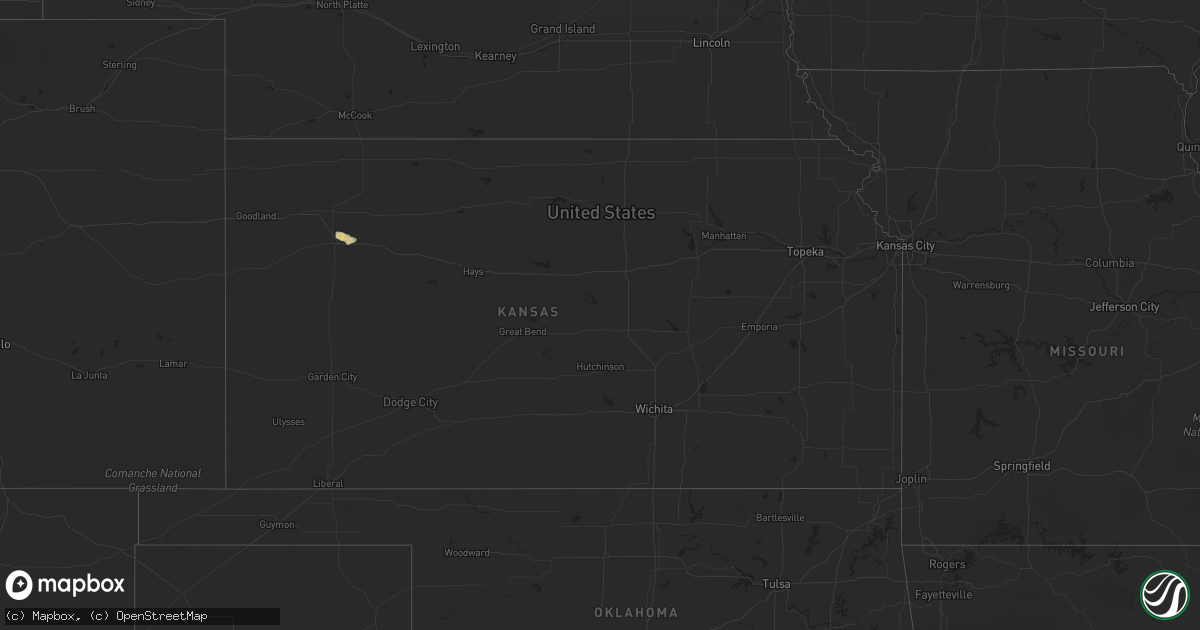
Hail Map in Kansas on April 27, 2023
Get this storm
April 27 map
$229
one time, instant access
Download today. No call, no setup
Keep the $229
Bought the map and want the full workflow? Apply the entire $229 to a subscription within 7 days. None of it is wasted.
Every map, not just this one
This buys you this map. Subscription and you get every map we run, in the markets you choose from a few cities to whole states to nationwide. Plus real-time alerts the moment a storm fires.
Contact data
Name, contact info, occupancy, even credit band for addresses in the footprint. You go from where it hit to who to call.
Become the source they trust
Unlimited branding weather history reports on demand. You already have the documented answer ready for the property owner, and you are the one who showed up with it.
Property data and RoofTrace estimates
Pull up any address you have got, its value and the exact code rules for that jurisdiction, straight from One Click Code. Then RoofTrace estimates the squares, pitch, and roof value, priced the way you price.
Storm reports in Kansas
Kansas
| Date | Description |
|---|---|
| 04/27/20236:58 PM CDT | A local report indicates 60 MPH wind near 2 NNE GOODLAND |
| 04/27/20236:50 PM CDT | A local report indicates 59 MPH wind near 1 NNE GOODLAND |
| 04/27/20236:43 PM CDT | Off duty nws employee reports 60 mph winds lasting 10-15 minutes and blowing dust resulting in reductions to visibility less than a mile. |
| 04/27/20236:40 PM CDT | A local report indicates 58 MPH wind near 2 NNE GOODLAND |
| 04/26/20238:35 PM CDT | Sustained at 47 mph. |
| 04/26/20237:49 PM CDT | A local report indicates 62 MPH wind near 9 WSW WINONA |
| 04/26/20237:31 PM CDT | A local report indicates 60 MPH wind near 10 NE WALLACE |
All States Impacted by Hail Map on April 27, 2023
Cities Impacted by Hail Map on April 27, 2023
- Waynesboro, MS
- Shubuta, MS
- Franklin, LA
- Patterson, LA
- Woodsboro, TX
- Refugio, TX
- Jay, FL
- Milton, FL
- Baker, FL
- Pensacola, FL
- Panama City Beach, FL
- Panama City, FL
- Lynn Haven, FL
- Youngstown, FL
- Satsuma, AL
- Daphne, AL
- Bay Minette, AL
- Port Sulphur, LA
- Braithwaite, LA
- Orange Beach, AL
- Saraland, AL
- Creola, AL
- State Line, MS
- Larose, LA
- Summerdale, AL
- Silverhill, AL
- Foley, AL
- Elberta, AL
- Dauphin Island, AL
- Picayune, MS
- Carriere, MS
- Stennis Space Center, MS
- Realitos, TX
- Golden Meadow, LA
- Gibson, LA
- Hebbronville, TX
- Lillian, AL
- Inlet Beach, FL
- Gulf Shores, AL
- Fairhope, AL
- Magnolia Springs, AL
- Aransas Pass, TX
- Houma, LA
- Berwick, LA
- Gulf Breeze, FL
- Wewahitchka, FL
- Blountstown, FL
- Jacksonville, FL
- Orange Park, FL
- Hosford, FL
- Bristol, FL
- Freeport, FL
- Ponce De Leon, FL
- Ebro, FL
- Vernon, FL
- Defuniak Springs, FL
- Hortense, GA
- Screven, GA
- Clarksville, FL
- Brunswick, GA
- Hastings, FL
- East Palatka, FL
- Elkton, FL
- Mayo, FL
- Branford, FL
- High Springs, FL
- Sopchoppy, FL
- Florahome, FL
- Fort White, FL
- Keystone Heights, FL
- Waldo, FL
- Gainesville, FL
- Alachua, FL
- Perry, FL
- Palatka, FL
- Melrose, FL
- Saint Augustine, FL
- Jesup, GA
- Starkville, MS
- Havana, FL
- Thomasville, GA
- Cocoa, FL
- Quincy, FL
- Gretna, FL
- Midway, FL
- Tallahassee, FL
- Greenville, FL
- West Point, MS
- Columbus, MS
- England, AR
- Uvalda, GA
- Lumber City, GA
- Blackshear, GA
- Tryon, NE
- Live Oak, FL
- Jasper, FL
- Alamo, GA
- Fargo, GA
- Homerville, GA
- Chipley, FL
- Christmas, FL
- Maben, MS
- Pheba, MS
- Saint Cloud, FL
- Jacksonville, GA
- Titusville, FL
- Glennville, GA
- Ludowici, GA
- Palm Coast, FL
- Oviedo, FL
- Geneva, FL
- Patterson, GA
- Ingleside, TX
- Eglin Afb, FL
- Orlando, FL
- Ponte Vedra Beach, FL
- Santa Rosa Beach, FL
- Mary Esther, FL
- Fort Walton Beach, FL
- Shalimar, FL
- Humnoke, AR
- Ulm, AR
- Carlisle, AR
- Stuttgart, AR
- Okeechobee, FL
- Cape Canaveral, FL
- Steens, MS
- Wabbaseka, AR
- Humphrey, AR
- Kenansville, FL
- Almyra, AR
- Roe, AR
- Casscoe, AR
- Collierville, TN
- Eads, TN
- Clarendon, AR
- Holly Grove, AR
- Monticello, FL
- Boston, GA
- Dixie, GA
- Quitman, GA
- Valdosta, GA
- Marvell, AR
- Reform, AL
- Millport, AL
- Ethelsville, AL
- Dunedin, FL
- Safety Harbor, FL
- Pinellas Park, FL
- Seminole, FL
- Clearwater, FL
- Saint Petersburg, FL
- Largo, FL
- Helena, AR
- Dundee, MS
- Spring Hill, FL
- Brooksville, FL
- Dade City, FL
- Webster, FL
- Sledge, MS
- Crenshaw, MS
- Sarah, MS
- Como, MS
- Sardis, MS
- Melbourne, FL
- Merritt Island, FL
- Satellite Beach, FL
- Indialantic, FL
- Palm Bay, FL
- Melbourne Beach, FL
- De Witt, AR
- Altheimer, AR
- Hazen, AR
- Gordo, AL
- Brinkley, AR
- De Valls Bluff, AR
- Aubrey, AR
- Little Rock, AR
- Hensley, AR
- Mabelvale, AR
- Malabar, FL
- Saint Charles, AR
- Elaine, AR
- Hoxie, KS
- Grinnell, KS
- Oakley, KS
- Crocketts Bluff, AR
- Scooba, MS
- West Helena, AR
- Lexa, AR
- Poplar Grove, AR
- Memphis, TN
- Aliceville, AL
- Emelle, AL
- Rockledge, FL
- Mims, FL
- Cedarbluff, MS
- Mantee, MS
- Mathiston, MS
- Canal Point, FL
- Indiantown, FL
- Tichnor, AR
- Cocoa Beach, FL
- Patrick Afb, FL
- Germantown, TN
- Cullman, AL
- Brookwood, AL
- Tuscaloosa, AL
- Livingston, AL
- Columbia, TN
- Walnut, MS
- Corinth, MS
- Rienzi, MS
- Ripley, MS
- Minter City, MS
- Philipp, MS
- Macon, MS
- Tiplersville, MS
- Lexington, TN
- Hohenwald, TN
- Oxford, MS
- Logan, AL
- Addison, AL
- Houston, AL
- Double Springs, AL
- Arley, AL
- Crane Hill, AL
- Holcomb, MS
- Northport, AL
- Elrod, AL
- University, MS
- Thaxton, MS
- Coker, AL
- Mount Pleasant, TN
- Holly Pond, AL
- Culleoka, TN
- Lewisburg, TN
- Hampshire, TN
- Blountsville, AL


