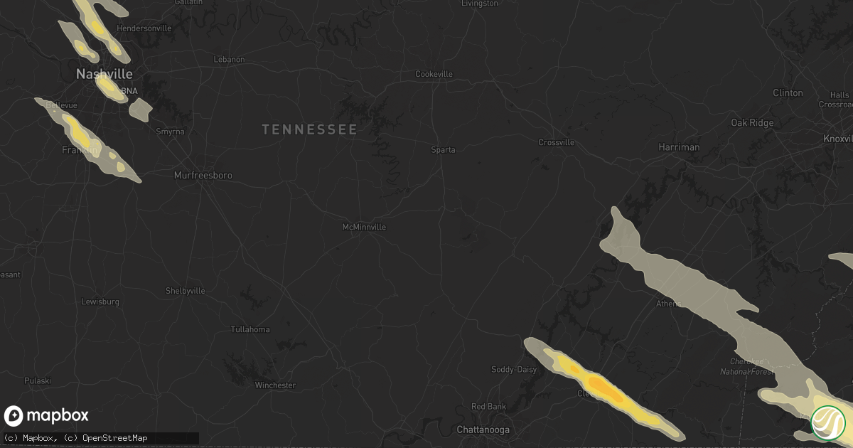
Hail Map in Asheville, NC on April 26, 2012
Get this storm
April 26 map
$229
one time, instant access
Download today. No call, no setup
Keep the $229
Bought the map and want the full workflow? Apply the entire $229 to a subscription within 7 days. None of it is wasted.
Every map, not just this one
This buys you this map. Subscription and you get every map we run, in the markets you choose from a few cities to whole states to nationwide. Plus real-time alerts the moment a storm fires.
Contact data
Name, contact info, occupancy, even credit band for addresses in the footprint. You go from where it hit to who to call.
Become the source they trust
Unlimited branding weather history reports on demand. You already have the documented answer ready for the property owner, and you are the one who showed up with it.
Property data and RoofTrace estimates
Pull up any address you have got, its value and the exact code rules for that jurisdiction, straight from One Click Code. Then RoofTrace estimates the squares, pitch, and roof value, priced the way you price.
Storm reports in Asheville, NC
Asheville, NC
| Date | Description |
|---|---|
| 04/26/20126:12 PM CDT | Dime to quarter sized hail. No wind. |
| 04/26/20126:12 PM CDT | Ping pong ball sized hail reported by cocorahs observer. |
| 04/26/20126:10 PM CDT | Public report of half dollar size hail. |
| 04/26/20126:10 PM CDT | Spotter reported hail increased from pea to golf ball size on rose hill rd. |
| 04/26/20126:05 PM CDT | Quarter sized hail and very gusty wind along patton avenue on the southwest side of asheville. |
| 04/26/20128:07 AM CDT | Tree blown down on pearson bridge road blocking traffic |
| 04/26/20127:47 AM CDT | Large branches blown down by high winds |
All States Impacted by Hail Map on April 26, 2012
All Cities Impacted by Hail Map on April 26, 2012
- Sharon, OK
- Mutual, OK
- Mount Juliet, TN
- Canyon, TX
- Amarillo, TX
- Stearns, KY
- Monticello, KY
- Pine Knot, KY
- Nancy, KY
- Russell Springs, KY
- Whitley City, KY
- Bronston, KY
- Columbia, KY
- Knifley, KY
- Sevierville, TN
- Greenville, WV
- Lindside, WV
- Cheraw, SC
- Tulia, TX
- Happy, TX
- Man, WV
- Cosby, TN
- Gatlinburg, TN
- Pigeon Forge, TN
- Utica, KS
- Wildersville, TN
- Rowland, NC
- Hamer, SC
- Fairmont, NC
- Dalhart, TX
- Conrad, MT
- Wyoming, WV
- Brenton, WV
- Pineville, WV
- Ballard, WV
- Spring City, TN
- Decatur, TN
- Ten Mile, TN
- Campo, CO
- Walsh, CO
- Nashville, TN
- Fourmile, KY
- London, KY
- Gray, KY
- Keavy, KY
- Barbourville, KY
- Artemus, KY
- Flat Lick, KY
- Eubank, KY
- Somerset, KY
- Science Hill, KY
- Trosper, KY
- Pineville, KY
- Corbin, KY
- Jackson, TN
- Goodwell, OK
- Elkhart, KS
- Richfield, KS
- Lancaster, KY
- Easley, SC
- Hayesville, NC
- Hiawassee, GA
- Brasstown, NC
- Warne, NC
- Young Harris, GA
- Murphy, NC
- Marble, NC
- Lamar, CO
- Manchester, KY
- Madisonville, TN
- Tellico Plains, TN
- Athens, TN
- Englewood, TN
- Niota, TN
- Bowling Green, KY
- Martha, KY
- Vanceburg, KY
- Manchester, OH
- Hendersonville, TN
- Adolphus, KY
- Hardesty, OK
- Leicester, NC
- Marshall, NC
- Alexander, NC
- Weaverville, NC
- Asheville, NC
- Tribune, KS
- West Portsmouth, OH
- Scottsville, KY
- Westmoreland, TN
- Franklin, KY
- Oneida, KY
- Thousandsticks, KY
- Hyden, KY
- Buckhorn, KY
- Portsmouth, OH
- South Shore, KY
- South Portsmouth, KY
- Parsons, TN
- Decaturville, TN
- Welch, WV
- Wooton, KY
- Smilax, KY
- Sizerock, KY
- Mountain Rest, SC
- Clayton, GA
- Hazard, KY
- Franklin, TN
- Brentwood, TN
- Murfreesboro, TN
- Las Animas, CO
- Kim, CO
- Mount Vernon, KY
- Whites Creek, TN
- Ashland City, TN
- Joelton, TN
- Dillon, SC
- Latta, SC
- Bryson City, NC
- Olton, TX
- Hale Center, TX
- Fieldton, TX
- Chapmanville, WV
- McCarr, KY
- Matewan, WV
- Wharncliffe, WV
- Livingston, KY
- Texhoma, OK
- Liberty, SC
- Ocoee, TN
- Old Fort, TN
- Birchwood, TN
- Ooltewah, TN
- Cleveland, TN
- Georgetown, TN
- Pritchett, CO
- Perryton, TX
- Greenbrier, TN
- Greenville, SC
- Travelers Rest, SC
- Berea, KY
- Sandgap, KY
- McKee, KY
- Franklin, NC
- Abingdon, VA
- Big Creek, KY
- Raysal, WV
- Iaeger, WV
- Cerro Gordo, NC
- Chadbourn, NC
- Alliance, NE
- West Union, OH
- Lascassas, TN
- Farner, TN
- Albany, KY
- Alpha, KY
- Oneida, TN
- Sheridan Lake, CO
- Warbranch, KY
- Mozelle, KY
- Mills River, NC
- Hot Springs, NC
- Clyde, NC
- Lost Creek, KY
- Ulysses, KS
- Johnson, KS
- Smyrna, TN
- Panhandle, TX
- Groom, TX
- Claude, TX
- Fairview, NC
- Jackson, OH
- Hamptonville, NC
- Kit Carson, CO
- Blairsville, GA
- Chappell, KY
- Richmond, KY
- Bear Branch, KY
- Big Laurel, KY
- Annville, KY
- Vincent, KY
- Waco, KY
- Tyner, KY
- Booneville, KY
- Bledsoe, KY
- Helton, KY
- Sextons Creek, KY
- Wendover, KY
- Paint Lick, KY
- Stinnett, KY
- Yeaddiss, KY
- Essie, KY
- York, SC
- Piedmont, SC
- Oceana, WV
- Cyclone, WV
- Only, TN
- Centerville, TN
- Lobelville, TN
- Hurricane Mills, TN
- Henderson, TN
- Medon, TN
- Beech Bluff, TN
- Pinson, TN
- Saint Ignatius, MT
- Debord, KY
- Van Lear, KY
- Panther, WV
- Stopover, KY
- Hurley, VA
- Mohawk, WV
- Krypton, KY
- Busy, KY
- Davy, WV
- Ikes Fork, WV
- Elkton, KY
- Chesterfield, SC
- Minatare, NE
- Scottsbluff, NE
- Flat Rock, NC
- Ransom, KS
- Hendersonville, NC
- Morland, KS
- Hill City, KS
- Wakeeney, KS
- Masterson, TX
- Bluefield, VA
- Bandy, VA
- Squire, WV
- Lancaster, SC
- Waxhaw, NC
- Sweetwater, TN
- Blue River, KY
- Vonore, TN
- Mallie, KY
- Pine Top, KY
- Littcarr, KY
- Granada, CO
- Morganton, NC
- Harrison, TN
- Arrington, TN
- Nolensville, TN
- Cherokee, NC
- West Liberty, KY
- Beattyville, KY
- Jackson, KY
- Townville, SC
- Seneca, SC
- Anderson, SC
- Walhalla, SC
- Medina, TN
- Oakfield, TN
- Rolla, KS
- Swannanoa, NC
- Camden, TN
- Valier, MT
- Andrews, NC
- Topton, NC
- Robbinsville, NC
- Holly, CO
- Big Sandy, TN
- Old Hickory, TN
- Cashiers, NC
- Cullowhee, NC
- Glenville, NC
- Wharton, WV
- Twilight, WV
- Charlotte, TN
- White Bluff, TN
- Dickson, TN
- Amherstdale, WV
- Pikeville, TN
- Dunlap, TN
- Danville, WV
- Riceville, TN
- Woodburn, KY
- Lafayette, TN
- Maryville, TN
- Knoxville, TN
- Seymour, TN
- Rockford, TN
- Two Buttes, CO
- Springfield, CO
- Waverly, TN
- Bluefield, WV
- Rock, WV
- Matoaka, WV
- Princeton, WV
- Bayard, NE
- Philadelphia, TN
- Soddy Daisy, TN
- McDonald, TN
- Burns, TN
- Vanleer, TN
- Cumberland Furnace, TN
- Vici, OK
- Pickens, SC
- Sunset, SC
- Fletcher, NC
- Westminster, SC
- Breeding, KY
- Edmonton, KY
- Ripplemead, VA
- Narrows, VA
- Pearisburg, VA
- Pikeville, KY
- Varney, KY
- Prestonsburg, KY
- Charleston, TN
- Pendleton, SC
- Hermitage, TN
- Lebanon, TN
- La Vergne, TN
- Belt, MT
- Madison, TN
- Hoxie, KS
- Park, KS
- Quinter, KS
- Arapahoe, CO
- Black Mountain, NC
- Monroe, NC
- Minford, OH
- Waverly, OH
- Brush, CO
- Paynesville, WV
- War, WV
- Walker, KY
- Arjay, KY
- Guthrie, KY
- Hartwell, GA
- Lavonia, GA
- Finger, TN
- Bethel Springs, TN
- Humboldt, TN
- Bells, TN
- Gadsden, TN
- Tuckasegee, NC
- Plainview, TX
- Herndon, WV
- Stinnett, TX
- Borger, TX
- Old Fort, NC
- Canton, NC
- Marion, NC
- Candler, NC
- Union Mills, NC
- Lake Lure, NC
- Rush, CO
- Shady Point, OK
- Bokoshe, OK
- Trenton, KY
- Goodlettsville, TN
- Allensville, KY
- Springfield, TN
- Cedar Hill, TN
- Adams, TN
- Hardy, KY
- Pegram, TN
- College Grove, TN
- Rockvale, TN
- Saint Francis, KS
- Sapphire, NC
- Whittier, NC
- Fountain Inn, SC
- Pelzer, SC
- Townsend, TN
- Almond, NC
- Simpsonville, SC
- Highlands, NC
- Salem, SC
- Horse Shoe, NC
- Yuma, CO
- Eckley, CO
- Pisgah Forest, NC
- Paintsville, KY
- Meally, KY
- Thelma, KY
- Peterstown, WV
- Waynesville, NC
- Fanrock, WV
- Simon, WV
- New Richmond, WV
- Clear Fork, WV
- Alvaton, KY
- New Johnsonville, TN
- Power, MT
- Jamestown, KY
- Pall Mall, TN
- Burkesville, KY
- Bastian, VA
- Harts, WV
- Logan, WV
- Russellville, KY
- Olmstead, KY
- Antioch, TN
- Lewisburg, KY
- Lily, KY
- Hinkle, KY
- Green Road, KY
- Scalf, KY
- Sterling, CO
- Merino, CO
- Collyer, KS
- Rock Hill, SC
- Edgemoor, SC
- Dunnville, KY
- McArthur, OH
- Arlington, CO
- Central, SC
- Norris, SC
- Sidney, KY
- Pilgrim, KY
- Canada, KY
- Belfry, KY
- Marshville, NC
- Brevard, NC
- Etowah, NC
- Rowdy, KY
- Carrie, KY
- Hindman, KY
- Emmalena, KY
- Bulan, KY
- Ary, KY
- Clio, SC
- Bennettsville, SC
- Benton, TN
- Mocksville, NC
- Harmony, NC
- Manter, KS
- Mullins, SC
- Nichols, SC
- Marion, SC
- Ness City, KS
- La Crosse, KS
- Sellers, SC
- Pageland, SC
- Glendo, WY
- Elizabethtown, NC
- Partridge, KY
- Cumberland, KY
- East Bernstadt, KY
- Burlington, CO
- Snyder, CO
- Padroni, CO
- Nunnelly, TN
- Williamsport, KY
- Boons Camp, KY
- Staffordsville, KY
- Oil Springs, KY
- Fairfield, MT
- Belton, SC
- Williamston, SC
- Pembroke, KY
- Hopkinsville, KY
- Cowpens, SC
- Pennington Gap, VA
- River, KY
- Ulysses, KY
- Lowmansville, KY
- Louisa, KY
- Blue Creek, OH
- Stout, OH
- Turtle Creek, WV
- Spearman, TX
- Patrick, SC
- Helenwood, TN
- Evergreen, NC
- Majestic, KY
- Dingess, WV
- Hemingford, NE
- Clarkesville, GA
- Williamson, WV
- Sugar Tree, TN
- Mitchell, NE
- Yolyn, WV
- Linefork, KY
- Whitesburg, KY
- Amherst, TX
- Rockfield, KY
- Dixon Springs, TN
- Hartsville, TN
- Blenheim, SC
- Vicco, KY
- Ruby, SC
- Mount Croghan, SC
- Wadesboro, NC
- Morven, NC
- Etowah, TN
- Royalton, KY
- Salyersville, KY
- Ray, OH
- Harrison, NE
- Arnett, OK
- Stollings, WV
- Sylva, NC
- Gaffney, SC
- Keyes, OK
- Fort Mill, SC
- Brady, MT
- Calvin, KY
- Wingate, NC
- Smyrna, SC
- Sharon, SC
- McConnells, SC
- Catawba, SC
- Clover, SC
- Stone, KY
- Freeburn, KY
- Berwind, WV
- Pinsonfork, KY
- Jolo, WV
- Huddy, KY
- North Tazewell, VA
- Phelps, KY
- Baisden, WV
- Ransom, KY
- McAndrews, KY
- Forest Hills, KY
- Long Creek, SC
- Hasty, CO
- McClave, CO
- Tomahawk, KY
- Eva, TN
- Davin, WV
- Lyburn, WV
- Switzer, WV
- Skellytown, TX
- Auburn, KY
- Dayton, TN
- Madison, WV
- Foster, WV
- Beaver, OH
- Camargo, OK
- Maggie Valley, NC
- Fair Bluff, NC
- Orrum, NC
- Lake View, SC
- Falls Mills, VA
- Anawalt, WV
- Mooreland, OK
- Clemson, SC
- Six Mile, SC
- West Union, SC
- Idalia, CO
- Fairdale, WV
- Glen Daniel, WV
- Slab Fork, WV
- Bolt, WV
- Lester, WV
- Loudon, TN


