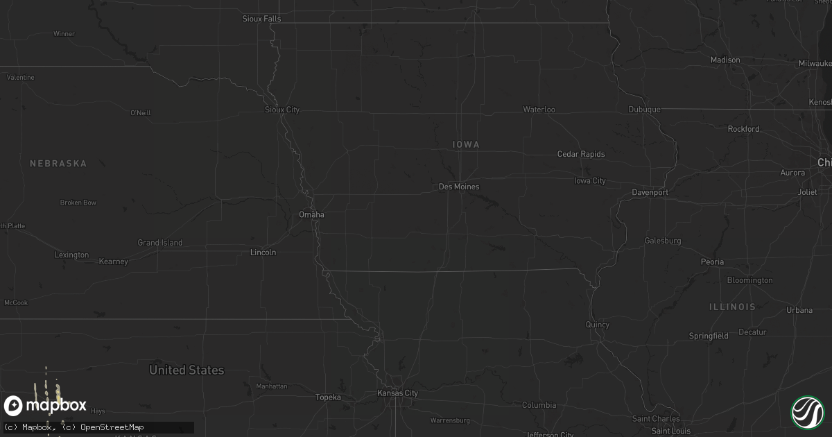
Hail Map on April 26, 2012
Get this storm
April 26 map
$229
one time, instant access
Download today. No call, no setup
Keep the $229
Bought the map and want the full workflow? Apply the entire $229 to a subscription within 7 days. None of it is wasted.
Every map, not just this one
This buys you this map. Subscription and you get every map we run, in the markets you choose from a few cities to whole states to nationwide. Plus real-time alerts the moment a storm fires.
Contact data
Name, contact info, occupancy, even credit band for addresses in the footprint. You go from where it hit to who to call.
Become the source they trust
Unlimited branding weather history reports on demand. You already have the documented answer ready for the property owner, and you are the one who showed up with it.
Property data and RoofTrace estimates
Pull up any address you have got, its value and the exact code rules for that jurisdiction, straight from One Click Code. Then RoofTrace estimates the squares, pitch, and roof value, priced the way you price.
States Impacted by Hail Map on April 26, 2012
Storm reports
North Carolina
| Date | Description |
|---|---|
| 04/26/20126:48 PM CDT | Dime to quarter sized hail with very little wind. |
| 04/26/20126:30 PM CDT | Public report of half dollar size hail. |
| 04/26/20126:30 PM CDT | Hail produced leaf damage and accumulated on ground. |
| 04/26/20126:25 PM CDT | Golf ball hail damaged vehicles near echo lake. |
| 04/26/20126:24 PM CDT | Quarter to ping pong ball sized hail in southeast buncombe county. |
| 04/26/20126:19 PM CDT | Public report of golf ball size hail. |
| 04/26/20126:12 PM CDT | Dime to quarter sized hail. No wind. |
| 04/26/20126:12 PM CDT | Ping pong ball sized hail reported by cocorahs observer. |
| 04/26/20126:10 PM CDT | Spotter reported hail increased from pea to golf ball size on rose hill rd. |
| 04/26/20126:10 PM CDT | Public report of half dollar size hail. |
| 04/26/20126:05 PM CDT | Quarter sized hail and very gusty wind along patton avenue on the southwest side of asheville. |
| 04/26/20125:54 PM CDT | A local report indicates 1.75 inch wind near HAYESVILLE |
| 04/26/20125:20 PM CDT | Quarter sized hail with the second storm to cross the cashiers-glenville volunteer fire department. Some wind gusts but not very significant. |
| 04/26/20125:12 PM CDT | Ping pong ball sized hail. |
| 04/26/20125:01 PM CDT | Dime to quarter sized hail at the same location where another storm dropped quarter sized hail at 543 pm. This report sent by cocorahs observer. |
| 04/26/20125:00 PM CDT | Half dollar sized hail fell at the cashiers-glenville volunteer fire department. |
| 04/26/20124:50 PM CDT | A local report indicates 1.75 inch wind near 6 WNW CASHIERS |
| 04/26/20124:43 PM CDT | Hail up to quarter sized reported through cocorahs. |
| 04/26/20124:25 PM CDT | A local report indicates 1.00 inch wind near 4 NNW FRANKLIN |
| 04/26/20123:55 PM CDT | A local report indicates 1.25 inch wind near 10 NW BRYSON CITY |
| 04/26/20123:55 PM CDT | Quarter size hail |
| 04/26/20123:20 PM CDT | 1.0 inch hail fell at the intersection of highway 130 and yukon ln. |
| 04/26/20122:55 PM CDT | Ham radio reports of quarter size hail at little river road and highway 25 south. |
| 04/26/20122:12 PM CDT | Hail nickel to quarter sized with enough wind to blow down small limbs. |
| 04/26/20121:54 PM CDT | Waxhaw volunteer fire department had hail up to the size of a quarter. |
| 04/26/20128:15 AM CDT | Tree down on power lines along east little horse creek rd |
| 04/26/20128:15 AM CDT | Tree down on power lines along east little horse creek rd |
| 04/26/20128:07 AM CDT | Tree blown down on pearson bridge road blocking traffic |
| 04/26/20127:54 AM CDT | Power pole down ssw of old fort |
| 04/26/20127:54 AM CDT | One tree down on highway 80 |
| 04/26/20127:47 AM CDT | Large branches blown down by high winds |
| 04/26/20127:45 AM CDT | County reports trees and power lines down around county...western yancey hardest hit. |
| 04/26/20127:40 AM CDT | Trees down in nantahala gorge area also hail no size |
| 04/26/20127:40 AM CDT | Trees and power lines down fifth street. |
| 04/26/20127:30 AM CDT | Trees and power lines down around town. |
| 04/26/20127:30 AM CDT | Trees and power lines down around town. |
| 04/25/20127:40 PM CDT | Public reports quarter to half dollar size hail. |
| 04/25/20127:35 PM CDT | A local report indicates 1.00 inch wind near MURPHY |
| 04/25/20127:35 PM CDT | Public reported golf ball size hail in the fletcher area. |
South Carolina
| Date | Description |
|---|---|
| 04/26/20126:30 PM CDT | Quarter sized hail in simpsonville. |
| 04/26/20126:20 PM CDT | Pea to quarter sized hail reported by retired nws employee in the moonville area. |
| 04/26/20126:05 PM CDT | Golf ball size hail reported in liberty along highway 178. |
| 04/26/20126:00 PM CDT | Nickel to quarter sized hail at the walmart in easley. Not much wind. |
| 04/26/20125:50 PM CDT | Trees and powerlines down near intersection of highways 11 and 178. |
| 04/26/20123:40 PM CDT | Quarter size hail |
| 04/26/20122:55 PM CDT | Quarter size hail |
| 04/26/20122:55 PM CDT | Quarter size hail downtown |
| 04/26/20122:52 PM CDT | Public reported nickel to quarter size hail south of cheraw. |
| 04/26/20121:00 PM CDT | Pea to quarter size hail |
| 04/25/20129:05 PM CDT | Hail reported near post office 1 1/4 |
| 04/25/20128:55 PM CDT | Hail reported near post office 1 1/4 |
| 04/25/20127:56 PM CDT | Golf ball sized hail in townville. No wind. |
| 04/25/20127:45 PM CDT | Public report of quarter size hail and several branches down in yard. |
| 04/25/20127:40 PM CDT | Marble to quarter sized hail with not much wind on the seneca side of westminister. |
West Virginia
| Date | Description |
|---|---|
| 04/26/20126:56 PM CDT | A local report indicates 1.50 inch wind near LINDSIDE |
| 04/26/20126:15 PM CDT | A local report indicates 1.00 inch wind near COALWOOD |
| 04/26/20125:35 PM CDT | Quarter to half dollar size hail from 635pm to 645pm |
| 04/26/20125:28 PM CDT | Quarter size hail from 628 to 638 pm |
| 04/26/20124:45 PM CDT | Located in marianna |
| 04/26/20124:45 PM CDT | A local report indicates 1.75 inch wind near 1 W PINEVILLE |
| 04/26/20124:12 PM CDT | A local report indicates 1.00 inch wind near ACCOVILLE |
| 04/26/20124:00 PM CDT | A local report indicates 1.25 inch wind near 1 S LOGAN |
Tennessee
| Date | Description |
|---|---|
| 04/26/20126:59 PM CDT | A local report indicates 1.25 inch wind near 2 SW BRENTWOOD |
| 04/26/20126:45 PM CDT | Spotter reported multiple trees down and large tree limbs on roofs near jacksboro. |
| 04/26/20126:44 PM CDT | *** 1 inj *** a national weather service storm survey team determined that an ef2 tornado occurred near montezuma in chester county tennessee. Peak wind speeds were est |
| 04/26/20126:25 PM CDT | Quarter size hail in gladeville. |
| 04/26/20126:24 PM CDT | A local report indicates 2.75 inch wind near 5 NW HENDERSON |
| 04/26/20126:20 PM CDT | One inch hail reported between mt juliet and gladeville. |
| 04/26/20126:15 PM CDT | A local report indicates 1.75 inch wind near 5 SE BEMIS |
| 04/26/20126:12 PM CDT | A local report indicates 1.00 inch wind near MOUNT JULIET |
| 04/26/20126:12 PM CDT | A local report indicates 1.25 inch wind near 5 SW BENTON |
| 04/26/20126:10 PM CDT | A local report indicates 2.00 inch wind near CLEVELAND |
| 04/26/20126:04 PM CDT | A local report indicates 1.75 inch wind near 2 N CLEVELAND |
| 04/26/20126:03 PM CDT | A local report indicates 1.50 inch wind near 5 NW HENDERSON |
| 04/26/20125:56 PM CDT | A local report indicates 1.25 inch wind near BEMIS |
| 04/26/20125:50 PM CDT | Quarter size hail in hendersonville. |
| 04/26/20125:45 PM CDT | A local report indicates 1.00 inch wind near BEMIS |
| 04/26/20124:58 PM CDT | A local report indicates 1.00 inch wind near SPRINGFIELD |
| 04/26/20124:55 PM CDT | A local report indicates 1.00 inch wind near TELLICO PLAINS |
| 04/26/20124:53 PM CDT | Lasted about 7 mins. |
| 04/26/20124:51 PM CDT | Golfball hail and 5 inch tree branches blown down. |
| 04/26/20124:22 PM CDT | A local report indicates 1.75 inch wind near WESTMORELAND |
| 04/26/20124:21 PM CDT | A local report indicates 1.25 inch wind near ADAMS |
| 04/26/20124:12 PM CDT | A local report indicates 1.00 inch wind near MADISONVILLE |
| 04/26/20124:11 PM CDT | Quarter size hail in westmoreland. |
| 04/26/201212:30 PM CDT | A local report indicates 2.75 inch wind near GATLINBURG |
| 04/26/20127:40 AM CDT | A local report indicates 1.00 inch wind near MADISONVILLE |
| 04/26/20127:35 AM CDT | A local report indicates 1.00 inch wind near 4 W NIOTA |
| 04/26/20127:20 AM CDT | A local report indicates 1.00 inch wind near PIKEVILLE |
| 04/26/20127:20 AM CDT | Few trees down. |
| 04/26/20127:05 AM CDT | Reported along highway 101. |
| 04/26/20127:00 AM CDT | Several trees down. |
| 04/26/20127:00 AM CDT | Several trees down. |
| 04/25/20127:39 PM CDT | At the intersection of nolensville road and rosedale road a mixture of quarter and smaller size hail was reported. |
| 04/25/20127:11 PM CDT | A local report indicates 1.00 inch wind near FRANKLIN |
| 04/25/20127:06 PM CDT | Trees blown down on top of 3 trailers at 1501 w main st. |
| 04/25/20127:06 PM CDT | *** 6 inj *** two vehicles overturned and four others damaged at jim warren park. Scorboard blown onto cars. 2 injuries in an overturned vehicle with 4 other minor inju |
| 04/25/20127:00 PM CDT | *** 6 inj *** ef0 tornado with max winds of 85 mph. 3.77 mile damage path and 100 yd max path width. Tornado began in franklin near hwy 96 and founders point blvd then |
Nevada
| Date | Description |
|---|---|
| 04/26/20126:09 PM CDT | Warm springs nv dot-5798 ft amsl |
| 04/26/20123:37 PM CDT | Morey creek raws site 5500 ft amsl |
| 04/25/20129:03 PM CDT | Ruby valley raws-6900 ft amsl |
| 04/25/20128:41 PM CDT | Spring gulch raws-5470 ft amsl |
| 04/25/20127:41 PM CDT | Pole creek raws site 8502 ft amsl |
Georgia
| Date | Description |
|---|---|
| 04/26/20126:06 PM CDT | The public reported quarter sized hail in the city of hiawassee. |
| 04/26/20129:30 AM CDT | Tallulah falls post office reported nickel to quarter sized hail. |
| 04/26/20128:37 AM CDT | The public reported quarter sized hail in hiawassee with duration unknown. |
Virginia
| Date | Description |
|---|---|
| 04/26/20126:45 PM CDT | Dispatcher at 911 center reported quarter size hail at her house in abbs valley |
| 04/26/20126:05 PM CDT | From 711 to 713pm |
Kentucky
| Date | Description |
|---|---|
| 04/26/20125:50 PM CDT | Hail at bird branch. |
| 04/26/20125:44 PM CDT | Quarter size hail fell at breastwork hill in pineville. |
| 04/26/20125:30 PM CDT | A local report indicates 1.00 inch wind near WHITLEY CITY |
| 04/26/20125:16 PM CDT | A local report indicates 1.25 inch wind near 1 E BARBOURVILLE |
| 04/26/20125:15 PM CDT | A local report indicates 1.00 inch wind near BIG ROCK |
| 04/26/20125:09 PM CDT | A local report indicates 1.25 inch wind near 1 E BARBOURVILLE |
| 04/26/20125:00 PM CDT | A local report indicates 1.00 inch wind near HYDEN |
| 04/26/20124:52 PM CDT | Several trees down along hwy 1546 near the murl community. |
| 04/26/20124:40 PM CDT | Large limbs blown down onto hwy 192. |
| 04/26/20124:40 PM CDT | A couple trees down. |
| 04/26/20124:39 PM CDT | 10693 hwy 192 |
| 04/26/20124:32 PM CDT | Hail was reported along swafford hollow road near the town of adolphus |
| 04/26/20124:25 PM CDT | Sheriff reports golf ball size hail in mill springs. Relayed by 911 dispatch. |
| 04/26/20124:20 PM CDT | A local report indicates 1.00 inch wind near 9 NE MONTICELLO |
| 04/26/20124:15 PM CDT | A local report indicates 1.75 inch wind near ONEIDA |
| 04/26/20124:01 PM CDT | Quarter to half dollar size hail falling. |
| 04/26/20123:55 PM CDT | A local report indicates 1.50 inch wind near 8 E FRANKLIN |
| 04/26/20123:50 PM CDT | A local report indicates 1.75 inch wind near 5 E RUSSELL SPRINGS |
| 04/26/20123:49 PM CDT | A local report indicates 1.00 inch wind near ISLAND CITY |
| 04/26/20123:47 PM CDT | A local report indicates 1.25 inch wind near SCOTTSVILLE |
| 04/26/20123:15 PM CDT | A local report indicates 1.75 inch wind near TURKEY FOOT |
| 04/26/20123:05 PM CDT | A local report indicates 1.75 inch wind near SANDGAP |
| 04/26/20123:05 PM CDT | A local report indicates 1.75 inch wind near SAND HILL |
| 04/26/20123:03 PM CDT | A local report indicates 2.50 inch wind near SANDGAP |
| 04/26/20123:03 PM CDT | Highways 3447 and 2004 at kerby knob has hail 1.5 inches deep. |
| 04/26/20123:01 PM CDT | Hail covering the ground. |
| 04/26/20122:53 PM CDT | A local report indicates 1.00 inch wind near 3 WSW COMBS |
Texas
| Date | Description |
|---|---|
| 04/26/20126:23 PM CDT | A local report indicates 1.50 inch wind near LAKE TANGLEWOOD |
| 04/26/20126:15 PM CDT | A local report indicates 60 MPH wind near FRITCH |
| 04/26/20125:50 PM CDT | Golf ball size hail accompanied by estimated 70 mph winds |
| 04/26/20125:47 PM CDT | A local report indicates 1.00 inch wind near 1 S HAPPY |
| 04/26/20125:35 PM CDT | Fence blown over. Empty semi truck trailer blown over. |
| 04/26/20125:26 PM CDT | A local report indicates 60 MPH wind near 4 N CANYON |
| 04/26/20125:20 PM CDT | A local report indicates 60 MPH wind near 7 SW AMARILLO |
| 04/26/20125:17 PM CDT | A local report indicates 69 MPH wind near 3 NNW CANYON |
| 04/26/20125:15 PM CDT | One inch tree limbs down at palo duro creek golf course. Time estimated based on radar data. Wind gust measured at 54 mph using anemometer at nws employee home in hunsl |
| 04/26/20125:05 PM CDT | Storage unit destroyed by thunderstorm wind gust just south of rockwell road and interstate 27 on joy avenue. |
| 04/26/20124:40 PM CDT | Discovery center school net site. |
| 04/26/20124:39 PM CDT | Near amarillo high school. |
| 04/26/20124:35 PM CDT | A local report indicates 1.25 inch wind near 4 N CANYON |
| 04/26/20124:32 PM CDT | Reported pea to quarter size hail around interstate 27 and rockwell and mccormick roads. |
| 04/26/20124:32 PM CDT | Reported pea to quarter size hail around interstate 27 and rockwell and mccormick roads. |
| 04/25/20127:19 PM CDT | Quarter size hail |
| 04/25/20127:01 PM CDT | Ping pong ball size hail |
Pennsylvania
| Date | Description |
|---|---|
| 04/25/20127:40 PM CDT | Several trees down...and partial roof off animal barn. |
| 04/25/20127:30 PM CDT | At five forks |
| 04/25/20127:20 PM CDT | A local report indicates 1.00 inch wind near FAYETTEVILLE |
Oklahoma
| Date | Description |
|---|---|
| 04/26/20126:55 PM CDT | Quarter size hail |
| 04/26/20126:15 PM CDT | A local report indicates 60 MPH wind near TYRONE |
| 04/25/20129:50 PM CDT | A local report indicates 1.00 inch wind near 4 W MUTUAL |
Montana
| Date | Description |
|---|---|
| 04/26/20124:19 PM CDT | A large spruce tree blown over. |
| 04/26/20124:15 PM CDT | Orchard homes development received wind damage when a tree limb fell and crushed an outbuilding. |
Colorado
| Date | Description |
|---|---|
| 04/26/20126:17 PM CDT | A local report indicates 1.75 inch wind near 10 NE TWO BUTTES |
| 04/26/20126:15 PM CDT | Some broken tree limbs |
| 04/26/20125:51 PM CDT | A local report indicates 1.00 inch wind near 1 W TWO BUTTES |
| 04/26/20125:44 PM CDT | A local report indicates 66 MPH wind near DOUGLAS PASS |
| 04/26/20125:30 PM CDT | Thunderstorm outflow wind gust and brief heavy rain |
| 04/26/20125:29 PM CDT | A local report indicates 1.00 inch wind near 10 N SPRINGFIELD |
| 04/26/20123:40 AM CDT | Public report via prowers county comms...time approximate |
| 04/26/20122:58 AM CDT | Damage to an electrical substation along county road ee. Time approximate. |
| 04/25/20128:31 PM CDT | A local report indicates 1.00 inch wind near 3 W HARTMAN |
| 04/25/20127:55 PM CDT | A local report indicates 1.00 inch wind near 1 NE TWO BUTTES |
| 04/25/20127:05 PM CDT | A local report indicates 1.50 inch wind near CAMPO |
Nebraska
| Date | Description |
|---|---|
| 04/26/20125:37 PM CDT | Estmated rainfall of 4 inches at lake minatare. |
Kansas
| Date | Description |
|---|---|
| 04/26/20126:55 PM CDT | A local report indicates 1.00 inch wind near ELKHART |
| 04/26/20126:40 AM CDT | A local report indicates 1.00 inch wind near 3 S VODA |
| 04/25/20127:47 PM CDT | A local report indicates 2.75 inch wind near BIG BOW |
| 04/25/20127:45 PM CDT | A local report indicates 1.00 inch wind near 2 ESE BIG BOW |
| 04/25/20127:24 PM CDT | A local report indicates 1.00 inch wind near 11 NW JOHNSON CITY |
| 04/25/20127:20 PM CDT | A local report indicates 1.75 inch wind near RICHFIELD |
| 04/25/20127:00 PM CDT | A local report indicates 1.75 inch wind near 3 N ELKHART |
Cities Impacted by Hail Map on April 26, 2012
- Sharon, OK
- Mutual, OK
- Mount Juliet, TN
- Canyon, TX
- Amarillo, TX
- Stearns, KY
- Monticello, KY
- Pine Knot, KY
- Nancy, KY
- Russell Springs, KY
- Whitley City, KY
- Bronston, KY
- Columbia, KY
- Knifley, KY
- Sevierville, TN
- Greenville, WV
- Lindside, WV
- Cheraw, SC
- Tulia, TX
- Happy, TX
- Man, WV
- Cosby, TN
- Gatlinburg, TN
- Pigeon Forge, TN
- Utica, KS
- Wildersville, TN
- Rowland, NC
- Hamer, SC
- Fairmont, NC
- Dalhart, TX
- Conrad, MT
- Wyoming, WV
- Brenton, WV
- Pineville, WV
- Ballard, WV
- Spring City, TN
- Decatur, TN
- Ten Mile, TN
- Campo, CO
- Walsh, CO
- Nashville, TN
- Fourmile, KY
- London, KY
- Gray, KY
- Keavy, KY
- Barbourville, KY
- Artemus, KY
- Flat Lick, KY
- Eubank, KY
- Somerset, KY
- Science Hill, KY
- Trosper, KY
- Pineville, KY
- Corbin, KY
- Jackson, TN
- Goodwell, OK
- Elkhart, KS
- Richfield, KS
- Lancaster, KY
- Easley, SC
- Hayesville, NC
- Hiawassee, GA
- Brasstown, NC
- Warne, NC
- Young Harris, GA
- Murphy, NC
- Marble, NC
- Lamar, CO
- Manchester, KY
- Madisonville, TN
- Tellico Plains, TN
- Athens, TN
- Englewood, TN
- Niota, TN
- Bowling Green, KY
- Martha, KY
- Vanceburg, KY
- Manchester, OH
- Hendersonville, TN
- Adolphus, KY
- Hardesty, OK
- Leicester, NC
- Marshall, NC
- Alexander, NC
- Weaverville, NC
- Asheville, NC
- Tribune, KS
- West Portsmouth, OH
- Scottsville, KY
- Westmoreland, TN
- Franklin, KY
- Oneida, KY
- Thousandsticks, KY
- Hyden, KY
- Buckhorn, KY
- Portsmouth, OH
- South Shore, KY
- South Portsmouth, KY
- Parsons, TN
- Decaturville, TN
- Welch, WV
- Wooton, KY
- Smilax, KY
- Sizerock, KY
- Mountain Rest, SC
- Clayton, GA
- Hazard, KY
- Franklin, TN
- Brentwood, TN
- Murfreesboro, TN
- Las Animas, CO
- Kim, CO
- Mount Vernon, KY
- Whites Creek, TN
- Ashland City, TN
- Joelton, TN
- Dillon, SC
- Latta, SC
- Bryson City, NC
- Olton, TX
- Hale Center, TX
- Fieldton, TX
- Chapmanville, WV
- McCarr, KY
- Matewan, WV
- Wharncliffe, WV
- Livingston, KY
- Texhoma, OK
- Liberty, SC
- Ocoee, TN
- Old Fort, TN
- Birchwood, TN
- Ooltewah, TN
- Cleveland, TN
- Georgetown, TN
- Pritchett, CO
- Perryton, TX
- Greenbrier, TN
- Greenville, SC
- Travelers Rest, SC
- Berea, KY
- Sandgap, KY
- McKee, KY
- Franklin, NC
- Abingdon, VA
- Big Creek, KY
- Raysal, WV
- Iaeger, WV
- Cerro Gordo, NC
- Chadbourn, NC
- Alliance, NE
- West Union, OH
- Lascassas, TN
- Farner, TN
- Albany, KY
- Alpha, KY
- Oneida, TN
- Sheridan Lake, CO
- Warbranch, KY
- Mozelle, KY
- Mills River, NC
- Hot Springs, NC
- Clyde, NC
- Lost Creek, KY
- Ulysses, KS
- Johnson, KS
- Smyrna, TN
- Panhandle, TX
- Groom, TX
- Claude, TX
- Fairview, NC
- Jackson, OH
- Hamptonville, NC
- Kit Carson, CO
- Blairsville, GA
- Chappell, KY
- Richmond, KY
- Bear Branch, KY
- Big Laurel, KY
- Annville, KY
- Vincent, KY
- Waco, KY
- Tyner, KY
- Booneville, KY
- Bledsoe, KY
- Helton, KY
- Sextons Creek, KY
- Wendover, KY
- Paint Lick, KY
- Stinnett, KY
- Yeaddiss, KY
- Essie, KY
- York, SC
- Piedmont, SC
- Oceana, WV
- Cyclone, WV
- Only, TN
- Centerville, TN
- Lobelville, TN
- Hurricane Mills, TN
- Henderson, TN
- Medon, TN
- Beech Bluff, TN
- Pinson, TN
- Saint Ignatius, MT
- Debord, KY
- Van Lear, KY
- Panther, WV
- Stopover, KY
- Hurley, VA
- Mohawk, WV
- Krypton, KY
- Busy, KY
- Davy, WV
- Ikes Fork, WV
- Elkton, KY
- Chesterfield, SC
- Minatare, NE
- Scottsbluff, NE
- Flat Rock, NC
- Ransom, KS
- Hendersonville, NC
- Morland, KS
- Hill City, KS
- Wakeeney, KS
- Masterson, TX
- Bluefield, VA
- Bandy, VA
- Squire, WV
- Lancaster, SC
- Waxhaw, NC
- Sweetwater, TN
- Blue River, KY
- Vonore, TN
- Mallie, KY
- Pine Top, KY
- Littcarr, KY
- Granada, CO
- Morganton, NC
- Harrison, TN
- Arrington, TN
- Nolensville, TN
- Cherokee, NC
- West Liberty, KY
- Beattyville, KY
- Jackson, KY
- Townville, SC
- Seneca, SC
- Anderson, SC
- Walhalla, SC
- Medina, TN
- Oakfield, TN
- Rolla, KS
- Swannanoa, NC
- Camden, TN
- Valier, MT
- Andrews, NC
- Topton, NC
- Robbinsville, NC
- Holly, CO
- Big Sandy, TN
- Old Hickory, TN
- Cashiers, NC
- Cullowhee, NC
- Glenville, NC
- Wharton, WV
- Twilight, WV
- Charlotte, TN
- White Bluff, TN
- Dickson, TN
- Amherstdale, WV
- Pikeville, TN
- Dunlap, TN
- Danville, WV
- Riceville, TN
- Woodburn, KY
- Lafayette, TN
- Maryville, TN
- Knoxville, TN
- Seymour, TN
- Rockford, TN
- Two Buttes, CO
- Springfield, CO
- Waverly, TN
- Bluefield, WV
- Rock, WV
- Matoaka, WV
- Princeton, WV
- Bayard, NE
- Philadelphia, TN
- Soddy Daisy, TN
- McDonald, TN
- Burns, TN
- Vanleer, TN
- Cumberland Furnace, TN
- Vici, OK
- Pickens, SC
- Sunset, SC
- Fletcher, NC
- Westminster, SC
- Breeding, KY
- Edmonton, KY
- Ripplemead, VA
- Narrows, VA
- Pearisburg, VA
- Pikeville, KY
- Varney, KY
- Prestonsburg, KY
- Charleston, TN
- Pendleton, SC
- Hermitage, TN
- Lebanon, TN
- La Vergne, TN
- Belt, MT
- Madison, TN
- Hoxie, KS
- Park, KS
- Quinter, KS
- Arapahoe, CO
- Black Mountain, NC
- Monroe, NC
- Minford, OH
- Waverly, OH
- Brush, CO
- Paynesville, WV
- War, WV
- Walker, KY
- Arjay, KY
- Guthrie, KY
- Hartwell, GA
- Lavonia, GA
- Finger, TN
- Bethel Springs, TN
- Humboldt, TN
- Bells, TN
- Gadsden, TN
- Tuckasegee, NC
- Plainview, TX
- Herndon, WV
- Stinnett, TX
- Borger, TX
- Old Fort, NC
- Canton, NC
- Marion, NC
- Candler, NC
- Union Mills, NC
- Lake Lure, NC
- Rush, CO
- Shady Point, OK
- Bokoshe, OK
- Trenton, KY
- Goodlettsville, TN
- Allensville, KY
- Springfield, TN
- Cedar Hill, TN
- Adams, TN
- Hardy, KY
- Pegram, TN
- College Grove, TN
- Rockvale, TN
- Saint Francis, KS
- Sapphire, NC
- Whittier, NC
- Fountain Inn, SC
- Pelzer, SC
- Townsend, TN
- Almond, NC
- Simpsonville, SC
- Highlands, NC
- Salem, SC
- Horse Shoe, NC
- Yuma, CO
- Eckley, CO
- Pisgah Forest, NC
- Paintsville, KY
- Meally, KY
- Thelma, KY
- Peterstown, WV
- Waynesville, NC
- Fanrock, WV
- Simon, WV
- New Richmond, WV
- Clear Fork, WV
- Alvaton, KY
- New Johnsonville, TN
- Power, MT
- Jamestown, KY
- Pall Mall, TN
- Burkesville, KY
- Bastian, VA
- Harts, WV
- Logan, WV
- Russellville, KY
- Olmstead, KY
- Antioch, TN
- Lewisburg, KY
- Lily, KY
- Hinkle, KY
- Green Road, KY
- Scalf, KY
- Sterling, CO
- Merino, CO
- Collyer, KS
- Rock Hill, SC
- Edgemoor, SC
- Dunnville, KY
- McArthur, OH
- Arlington, CO
- Central, SC
- Norris, SC
- Sidney, KY
- Pilgrim, KY
- Canada, KY
- Belfry, KY
- Marshville, NC
- Brevard, NC
- Etowah, NC
- Rowdy, KY
- Carrie, KY
- Hindman, KY
- Emmalena, KY
- Bulan, KY
- Ary, KY
- Clio, SC
- Bennettsville, SC
- Benton, TN
- Mocksville, NC
- Harmony, NC
- Manter, KS
- Mullins, SC
- Nichols, SC
- Marion, SC
- Ness City, KS
- La Crosse, KS
- Sellers, SC
- Pageland, SC
- Glendo, WY
- Elizabethtown, NC
- Partridge, KY
- Cumberland, KY
- East Bernstadt, KY
- Burlington, CO
- Snyder, CO
- Padroni, CO
- Nunnelly, TN
- Williamsport, KY
- Boons Camp, KY
- Staffordsville, KY
- Oil Springs, KY
- Fairfield, MT
- Belton, SC
- Williamston, SC
- Pembroke, KY
- Hopkinsville, KY
- Cowpens, SC
- Pennington Gap, VA
- River, KY
- Ulysses, KY
- Lowmansville, KY
- Louisa, KY
- Blue Creek, OH
- Stout, OH
- Turtle Creek, WV
- Spearman, TX
- Patrick, SC
- Helenwood, TN
- Evergreen, NC
- Majestic, KY
- Dingess, WV
- Hemingford, NE
- Clarkesville, GA
- Williamson, WV
- Sugar Tree, TN
- Mitchell, NE
- Yolyn, WV
- Linefork, KY
- Whitesburg, KY
- Amherst, TX
- Rockfield, KY
- Dixon Springs, TN
- Hartsville, TN
- Blenheim, SC
- Vicco, KY
- Ruby, SC
- Mount Croghan, SC
- Wadesboro, NC
- Morven, NC
- Etowah, TN
- Royalton, KY
- Salyersville, KY
- Ray, OH
- Harrison, NE
- Arnett, OK
- Stollings, WV
- Sylva, NC
- Gaffney, SC
- Keyes, OK
- Fort Mill, SC
- Brady, MT
- Calvin, KY
- Wingate, NC
- Smyrna, SC
- Sharon, SC
- McConnells, SC
- Catawba, SC
- Clover, SC
- Stone, KY
- Freeburn, KY
- Berwind, WV
- Pinsonfork, KY
- Jolo, WV
- Huddy, KY
- North Tazewell, VA
- Phelps, KY
- Baisden, WV
- Ransom, KY
- McAndrews, KY
- Forest Hills, KY
- Long Creek, SC
- Hasty, CO
- McClave, CO
- Tomahawk, KY
- Eva, TN
- Davin, WV
- Lyburn, WV
- Switzer, WV
- Skellytown, TX
- Auburn, KY
- Dayton, TN
- Madison, WV
- Foster, WV
- Beaver, OH
- Camargo, OK
- Maggie Valley, NC
- Fair Bluff, NC
- Orrum, NC
- Lake View, SC
- Falls Mills, VA
- Anawalt, WV
- Mooreland, OK
- Clemson, SC
- Six Mile, SC
- West Union, SC
- Idalia, CO
- Fairdale, WV
- Glen Daniel, WV
- Slab Fork, WV
- Bolt, WV
- Lester, WV
- Loudon, TN