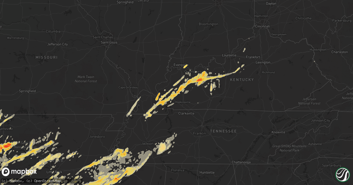
Hail Map in Texas on April 26, 2011
Get this storm
April 26 map
$229
one time, instant access
Download today. No call, no setup
Keep the $229
Bought the map and want the full workflow? Apply the entire $229 to a subscription within 7 days. None of it is wasted.
Every map, not just this one
This buys you this map. Subscription and you get every map we run, in the markets you choose from a few cities to whole states to nationwide. Plus real-time alerts the moment a storm fires.
Contact data
Name, contact info, occupancy, even credit band for addresses in the footprint. You go from where it hit to who to call.
Become the source they trust
Unlimited branding weather history reports on demand. You already have the documented answer ready for the property owner, and you are the one who showed up with it.
Property data and RoofTrace estimates
Pull up any address you have got, its value and the exact code rules for that jurisdiction, straight from One Click Code. Then RoofTrace estimates the squares, pitch, and roof value, priced the way you price.
Storm reports in Texas
Texas
| Date | Description |
|---|---|
| 04/26/20116:57 PM CDT | Reported in eastern mclennan county |
| 04/26/20116:55 PM CDT | A local report indicates 1.25 inch wind near MART |
| 04/26/20116:55 PM CDT | Half dollar size hail reported in the city of paris. |
| 04/26/20116:52 PM CDT | Golfball size hail reported in blossom |
| 04/26/20116:50 PM CDT | Golfball size hail west side of paris |
| 04/26/20116:46 PM CDT | A local report indicates 1.75 inch wind near ROXTON |
| 04/26/20116:44 PM CDT | Trees snapped...damage to a home...barn destroyed. On 149 and cr 2187 west of tatum |
| 04/26/20116:42 PM CDT | Half dollar size hail reported in cumby |
| 04/26/20116:36 PM CDT | Baseball hail reported in lacy-lakeview by the public. |
| 04/26/20116:35 PM CDT | An ef1 tornado touched down along cr 2138 and moved ne...where it destroyed an outbuilding and snapped and uprooted several trees. It continued ne where it uprooted and |
| 04/26/20116:33 PM CDT | Mile marker 342 on interstate 35w north of waco. |
| 04/26/20116:28 PM CDT | 3.25 inch hail relayed from nws fwd |
| 04/26/20116:20 PM CDT | Quarter size hail reported in tool by public. |
| 04/26/20116:18 PM CDT | Trees & power lines on buildings and on ground on 314 between edom and van |
| 04/26/20116:10 PM CDT | A local report indicates 1.25 inch wind near CUMBY |
| 04/26/20116:07 PM CDT | Crossing market street in mabank |
| 04/26/20116:04 PM CDT | Ef0 tornado along a 7 mile long track in extreme northwest smith county. This tornado was a continuation of the tornado that moved out of van zandt county. Multiple tre |
| 04/26/20116:03 PM CDT | Multi vortex tornado |
| 04/26/20116:01 PM CDT | Tornado south of kemp |
| 04/26/20115:56 PM CDT | Damage to roofs and trees |
| 04/26/20115:48 PM CDT | Golfball size hail 1 north of blooming grove |
| 04/26/20115:46 PM CDT | Golfball size hail reported in frost |
| 04/26/20115:41 PM CDT | Golfball size hail reported at concord-robbins 39 & hwy 7 |
| 04/26/20115:35 PM CDT | Windshield damaged in wylie |
| 04/26/20115:28 PM CDT | A local report indicates 1.00 inch wind near AVALON |
| 04/26/20115:26 PM CDT | A local report indicates 1.00 inch wind near SACHSE |
| 04/26/20115:17 PM CDT | Tornado on the ground east of the city of garrett. |
| 04/26/20115:16 PM CDT | Quarter size hail north hillsboro |
| 04/26/20115:16 PM CDT | Quarter size hail falling in wheelock. |
| 04/26/20115:11 PM CDT | Quarter size hail north of waxahachie. |
| 04/26/20115:11 PM CDT | Tornado spotted nnw of the city of mabank. |
| 04/26/20115:07 PM CDT | Quarter size hail in lone elm west of waxahachie. |
| 04/26/20115:05 PM CDT | A local report indicates 1.00 inch wind near GALLATIN |
| 04/26/20114:59 PM CDT | Quarter size hail 4 ne waxahachie |
| 04/26/20114:57 PM CDT | Tornado on cedar creek lake. Near seven points. |
| 04/26/20114:56 PM CDT | Tornado reported on ground near mabank. |
| 04/26/20114:55 PM CDT | Ham radio reporting golfball hail falling for 10 minutes south of jacksonville on fm 2138 |
| 04/26/20114:51 PM CDT | Hail covering the ground in hearne. Biggest diameter quarter size. |
| 04/26/20114:47 PM CDT | Golfball size hail just west of lone elm. |
| 04/26/20114:43 PM CDT | Quarter size hail at fm84 and acr 385 se of palestine. |
| 04/26/20114:43 PM CDT | A local report indicates 1.00 inch wind near MIDLOTHIAN |
| 04/26/20114:39 PM CDT | Quarter size hail south of venus. |
| 04/26/20114:35 PM CDT | Quarter hail reported southwest of the city of buffalo. |
| 04/26/20114:27 PM CDT | Quarter size hail south of alvarado. |
| 04/26/20114:20 PM CDT | Golfball size hail just se of cleburne. |
| 04/26/20114:05 PM CDT | Wind gusts to 53 mph. |
| 04/26/20114:03 PM CDT | Storm damage to light shed structure with debris scattered over 100 yds. |
| 04/26/20114:01 PM CDT | Quarter size hail northeast of cameron. |
| 04/26/20113:57 PM CDT | Golfball size hail in the city of ennis. |
| 04/26/20113:55 PM CDT | A local report indicates 1.75 inch wind near GARRETT |
| 04/26/20113:51 PM CDT | Quarter size hail at hwy 287 bypass and hwy 878 in waxahachie. |
| 04/26/20113:40 PM CDT | A local report indicates 60 MPH wind near BARDWELL |
| 04/26/20113:40 PM CDT | A local report indicates 1.00 inch wind near BARDWELL |
| 04/26/20113:39 PM CDT | Law enforcement reports 60 to 70 mph winds and quarter hail in waxahachie/forreston area. |
| 04/26/20113:10 PM CDT | Quarter size hail in grandview. |
| 04/26/20113:06 PM CDT | A local report indicates 1.00 inch wind near NORTHFIELD |
| 04/26/20115:00 AM CDT | A local report indicates 1.75 inch wind near 2 NE DAINGERFIELD |
| 04/26/201112:25 AM CDT | Numerous trees down along highway 21 near highway 103...as well as fm 330 and fm 1751 |
| 04/26/201112:15 AM CDT | Hail fell in groveton reported by the public to dispatch. |
| 04/26/201112:13 AM CDT | Tree down on a house on mt. Carmel road off of hwy 94 west. |
| 04/25/201111:46 PM CDT | Brief period of golf ball hail in lovelady. Public report to sheriffs office. |
| 04/25/201111:45 PM CDT | Golfball hail 6 miles west of centerville |
| 04/25/201111:45 PM CDT | Golfball hail 5 miles west of centerville |
| 04/25/201111:44 PM CDT | A local report indicates 1.25 inch wind near CENTERVILLE |
| 04/25/201111:35 PM CDT | Trees down in latexo on 1535. |
| 04/25/201110:05 PM CDT | Multiple trees down and on the road. |
| 04/25/201110:02 PM CDT | Spotter observed tornado becoming rain-wrapped...3 sse of thornton |
| 04/25/201110:01 PM CDT | Quarter hail 1 mile south of riesel on highway 6 |
| 04/25/20119:18 PM CDT | Large tree down across 1 lane of hwy 84. Tree diameter 2.5-3 ft |
| 04/25/20118:58 PM CDT | A local report indicates 1.75 inch wind near WACO |
| 04/25/20118:55 PM CDT | Small rope tornado just north of mart at mclennan/limestone county line |
| 04/25/20118:45 PM CDT | Multiple trees down along west bound lanes of hwy 84 between lake mexia and fm 1245. |
| 04/25/20118:42 PM CDT | A local report indicates 1.00 inch wind near RED OAK |
| 04/25/20118:36 PM CDT | A local report indicates 1.75 inch wind near LEROY |
| 04/25/20118:31 PM CDT | A local report indicates 1.00 inch wind near LEROY |
| 04/25/20118:31 PM CDT | Reported near chalk bluff community |
| 04/25/20118:30 PM CDT | A local report indicates 1.75 inch wind near 1 N ELM MOTT |
| 04/25/20118:30 PM CDT | On ground |
| 04/25/20117:53 PM CDT | Large tornado on ground |
| 04/25/20117:50 PM CDT | Several trees and power lines down on cr 3123 and morningside near ne loop 323. Tree down on a house at the 2600 block of cecil. |
| 04/25/20117:49 PM CDT | An ef0 tornado snapped and uprooted multiple trees along a 3 mile track just inside the northwest loop 323 and north of m.l.k. Blvd. The tornado touched down 2 miles no |
| 04/25/20117:46 PM CDT | *** 2 inj *** ef-2 tornado path length 42 miles...maximum width one half mile. Most of damage was ef-o and ef-1. The tornado began in eastern panola county texas and mo |
| 04/25/20117:40 PM CDT | Part of a roof blown off hwy 165 and hwy 14 |
| 04/25/20117:24 PM CDT | An ef0 tornado touched down snapping a few trees just north of i-20 near the hwy 80 exit w of waskom. The tornado continued ne causing sporadic tree damage along bellvi |
| 04/25/20117:09 PM CDT | Damage to a home along fm 2625 and taylor road |
| 04/25/20117:08 PM CDT | Home destroyed on blocker road |
| 04/25/20117:05 PM CDT | Power lines down eastern mclennan & western limestone county |
| 04/25/20117:04 PM CDT | Cars off hwy...trees snapped along us 59 |
| 04/25/20117:04 PM CDT | A tornado touched down and snapped trees along fm 2625 just w of hwy 59. The tornado paralleled fm 2625 causing sporadic tree damage until it reached the intersection o |
| 04/25/20117:00 PM CDT | An ef0 tornado snapped multiple trees along a 3 mile track just north of hwy. 80. The tornado touched down 7 miles west of hawkins and continued east northeast ending o |
| 04/25/20117:00 PM CDT | Tornado briefly dropped down northeast of hawkins and quickly went back up |
All States Impacted by Hail Map on April 26, 2011
Cities Impacted by Hail Map on April 26, 2011
- Clay, KY
- Dixon, KY
- Sebree, KY
- Nebo, KY
- Providence, KY
- Calhoun, KY
- Slaughters, KY
- Princeton, KY
- Moro, AR
- Atoka, OK
- Port Matilda, PA
- Julian, PA
- Nortonville, KY
- Madisonville, KY
- Frenchville, PA
- Havana, AR
- Converse, LA
- Millersburg, PA
- Hegins, PA
- Halifax, PA
- Herndon, PA
- Dornsife, PA
- Gratz, PA
- Spring Glen, PA
- Sacramento, PA
- Dalmatia, PA
- Elizabethville, PA
- Lykens, PA
- Klingerstown, PA
- Berrysburg, PA
- Mccurtain, OK
- Bokoshe, OK
- Pinconning, MI
- Bentonville, AR
- Gentry, AR
- Hiwasse, AR
- Siloam Springs, AR
- Bella Vista, AR
- Gravette, AR
- Decatur, AR
- Centerton, AR
- Garfield, AR
- Lowell, AR
- Rogers, AR
- Valliant, OK
- Gladys, VA
- Long Island, VA
- Scotland Neck, NC
- Rolling Prairie, IN
- La Porte, IN
- Sheridan, AR
- England, AR
- Redfield, AR
- Keo, AR
- Little Rock, AR
- Hensley, AR
- Scott, AR
- New Iberia, LA
- Abbeville, LA
- Erath, LA
- Franklin, LA
- Hamilton, MI
- Wyoming, MI
- Byron Center, MI
- Holland, MI
- Hudsonville, MI
- Zeeland, MI
- Grandville, MI
- Dorr, MI
- Marianna, AR
- Rattan, OK
- Nashoba, OK
- Almyra, AR
- Ethel, AR
- Chidester, AR
- Clarksdale, MS
- Pine Bluff, AR
- Queen City, TX
- Bluff City, AR
- Gurdon, AR
- Garland City, AR
- Fulton, AR
- Carthage, AR
- Lyon, MS
- Warren, AR
- West Helena, AR
- Willisville, AR
- Saint Charles, AR
- Waldo, AR
- De Witt, AR
- Sledge, MS
- Stuttgart, AR
- Lewisville, AR
- Hope, AR
- Bloomburg, TX
- Yorktown, AR
- Altheimer, AR
- Holly Grove, AR
- Hampton, AR
- Star City, AR
- Arkadelphia, AR
- Lexa, AR
- Rison, AR
- Grapevine, AR
- Texarkana, TX
- Dumas, AR
- Helena, AR
- Kingsland, AR
- Tichnor, AR
- Leola, AR
- Friars Point, MS
- Fouke, AR
- Buckner, AR
- Mellwood, AR
- Texarkana, AR
- Fordyce, AR
- Rosston, AR
- Stamps, AR
- Prescott, AR
- Sparkman, AR
- Gillett, AR
- Grady, AR
- Tunica, MS
- Dundee, MS
- Marvell, AR
- Crumrod, AR
- White Hall, AR
- Alligator, MS
- Ivan, AR
- Emmet, AR
- New Edinburg, AR
- Coahoma, MS
- Doddridge, AR
- Gould, AR
- Elaine, AR
- Stephens, AR
- Thornton, AR
- Camden, AR
- Atlanta, TX
- Bearden, AR
- Wilmar, AR
- Ruston, LA
- Holland Patent, NY
- Rome, NY
- Barneveld, NY
- Prospect, NY
- Cold Brook, NY
- Stittville, NY
- Remsen, NY
- Brooksville, MS
- Benton, KY
- Mer Rouge, LA
- Collinston, LA
- Oak Ridge, LA
- Ozark, AR
- Ashland, MS
- Judsonia, AR
- Kensett, AR
- Gladstone, VA
- White Oak, GA
- Kaplan, LA
- Caneyville, KY
- Roundhill, KY
- Brownsville, KY
- Tyrone, PA
- Grand Rapids, MI
- Lisbon, LA
- Lamar, IN
- Grandview, IN
- Gordo, AL
- Cushing, TX
- Mount Enterprise, TX
- Belding, MI
- Bakers Mills, NY
- Sheridan, IN
- Poteau, OK
- Cameron, OK
- Greenville, TX
- White Plains, KY
- Hughes, AR
- Franklin, TX
- Van Buren, AR
- Almond, NY
- Bolivar, NY
- Scio, NY
- Alfred Station, NY
- Wellsville, NY
- Belmont, NY
- Shinglehouse, PA
- Alma, NY
- Andover, NY
- Bolivar, TN
- Center, TX
- Ralston, PA
- Roaring Branch, PA
- Trout Run, PA
- Lowell, MI
- Oologah, OK
- Hulbert, OK
- Fort Gibson, OK
- Tahlequah, OK
- Waldron, AR
- Mansfield, AR
- Winnsboro, LA
- Goldonna, LA
- Linden, TN
- Decaturville, TN
- Arthur City, TX
- Boswell, OK
- Sumner, TX
- Hugo, OK
- Memphis, TN
- Tatum, TX
- Henderson, TX
- Overton, TX
- Kilgore, TX
- Hallsville, TX
- Beckville, TX
- Longview, TX
- Groesbeck, TX
- Marks, MS
- Maud, TX
- Waterford, MS
- Falkner, MS
- Byhalia, MS
- Potts Camp, MS
- Crenshaw, MS
- Sardis, MS
- Naples, TX
- Selmer, TN
- Wabbaseka, AR
- Walnut, MS
- Humphrey, AR
- Snow Lake, AR
- Red Banks, MS
- Douglassville, TX
- Marietta, TX
- Linden, TX
- Omaha, TX
- Hughes Springs, TX
- Michigan City, MS
- Batesville, MS
- Hornsby, TN
- Daingerfield, TX
- Senatobia, MS
- Sarah, MS
- Coldwater, MS
- Como, MS
- Holly Springs, MS
- Lamar, MS
- Middleton, TN
- Sherrill, AR
- Elgin, SC
- Alexander, NY
- Corfu, NY
- Borger, TX
- Panhandle, TX
- Sulphur Springs, TX
- Mountainburg, AR
- Barling, AR
- Alma, AR
- Mulberry, AR
- Keota, OK
- Arkoma, OK
- Cedarville, AR
- Gans, OK
- Charleston, AR
- Cecil, AR
- Uniontown, AR
- Fort Smith, AR
- Rudy, AR
- Spiro, OK
- Pocola, OK
- Muldrow, OK
- Lavaca, AR
- Roland, OK
- Dyer, AR
- Hosston, LA
- Ida, LA
- Crockett, TX
- Sylvan Beach, NY
- Blossvale, NY
- Durhamville, NY
- Canastota, NY
- Verona Beach, NY
- Verona, NY
- Midlothian, TX
- Venus, TX
- Hartford, KY
- Grandview, TX
- Covington, TX
- Rio Vista, TX
- Louisville, MS
- Macon, MS
- Bellwood, PA
- Cresson, PA
- Loretto, PA
- South Fork, PA
- Gallitzin, PA
- Wilmore, PA
- Sidman, PA
- Ashville, PA
- Tipton, PA
- Lilly, PA
- Mineral Point, PA
- Johnstown, PA
- Duncansville, PA
- Dysart, PA
- Portage, PA
- Summerhill, PA
- Altoona, PA
- Elkins, WV
- Glady, WV
- Bowden, WV
- Plainview, AR
- Sterlington, LA
- Monroe, LA
- Stigler, OK
- Moscow, TN
- Williston, TN
- Rossville, TN
- Bolivar, PA
- New Florence, PA
- Portland, MI
- Ionia, MI
- Lake Odessa, MI
- De Queen, AR
- Bradley, AR
- Fairland, OK
- Grove, OK
- Afton, OK
- Booneville, AR
- London, AR
- Cleveland, AR
- Atkins, AR
- Delaware, AR
- Blue Mountain, AR
- Paris, AR
- New Blaine, AR
- Dover, AR
- Hector, AR
- Jerusalem, AR
- Magazine, AR
- Dardanelle, AR
- Belleville, AR
- Scotland, AR
- Russellville, AR
- Clarksville, PA
- Rices Landing, PA
- Apple Springs, TX
- Groveton, TX
- Lovelady, TX
- Pennington, TX
- Kennard, TX
- Corrigan, TX
- Trinity, TX
- North Garden, VA
- Charlottesville, VA
- Goodwell, OK
- Keyes, OK
- Reagan, TN
- Bath Springs, TN
- Lexington, TN
- Saltillo, TN
- Scotts Hill, TN
- Sardis, TN
- Livermore, KY
- Island, KY
- Rumsey, KY
- Sacramento, KY
- Bigelow, AR
- Conway, AR
- Houston, AR
- Plumerville, AR
- Cameron, TX
- Rockdale, TX
- Milano, TX
- Gause, TX
- Hearne, TX
- Lindale, TX
- Widener, AR
- Cordova, TN
- Wheatley, AR
- Proctor, AR
- Forrest City, AR
- West Memphis, AR
- Drummonds, TN
- Heth, AR
- Brighton, TN
- Crawfordsville, AR
- Goodwin, AR
- Atoka, TN
- Millington, TN
- Arlington, TN
- Palestine, AR
- Mason, TN
- Covington, TN
- Colt, AR
- Eads, TN
- Clarendon, AR
- Munford, TN
- Madison, AR
- Earle, AR
- Brinkley, AR
- Marion, AR
- Dukedom, TN
- Dresden, TN
- Water Valley, KY
- Martin, TN
- Sedalia, KY
- Wingo, KY
- South Fulton, TN
- Fulton, KY
- Mayfield, KY
- Cooper, TX
- Donaldson, AR
- Malvern, AR
- Mount Vernon, AR
- Greenbrier, AR
- Vilonia, AR
- Enola, AR
- Romance, AR
- Oak Grove, LA
- Pioneer, LA
- Addison, NY
- Cave Springs, AR
- Summers, AR
- Springdale, AR
- Eureka Springs, AR
- Fayetteville, AR
- Lincoln, AR
- Humnoke, AR
- Rohwer, AR
- Dermott, AR
- McGehee, AR
- Ferdinand, IN
- Huntingburg, IN
- Saint Anthony, IN
- Plain Dealing, LA
- Karnack, TX
- Tennyson, IN
- Dale, IN
- Stendal, IN
- Holland, IN
- Beech Creek, PA
- Pottersdale, PA
- Renovo, PA
- Karthaus, PA
- Westport, PA
- Delhi, LA
- Rayville, LA
- Epps, LA
- Shreveport, LA
- Cameron, WV
- Hindsville, AR
- Ferris, TX
- Lancaster, TX
- Caledonia, MI
- Cayuga, NY
- Auburn, NY
- Union Springs, NY
- Philpot, KY
- Eastview, KY
- Big Clifty, KY
- Dundee, KY
- Mortons Gap, KY
- Glendale, KY
- Calvert City, KY
- Reynolds Station, KY
- Utica, KY
- Manitou, KY
- Crofton, KY
- Hawesville, KY
- Leitchfield, KY
- McHenry, KY
- Gilbertsville, KY
- Eddyville, KY
- Fordsville, KY
- Cloverport, KY
- Falls Of Rough, KY
- Dawson Springs, KY
- Cadiz, KY
- Kirksey, KY
- Centertown, KY
- Union City, TN
- Elizabethtown, KY
- Beaver Dam, KY
- Saint Charles, KY
- Cecilia, KY
- Palmersville, TN
- McDaniels, KY
- Earlington, KY
- Hudson, KY
- Hardin, KY
- Whitesville, KY
- Olaton, KY
- Horse Branch, KY
- Kuttawa, KY
- Adair, OK
- Spavinaw, OK
- Salina, OK
- Pryor, OK
- Strang, OK
- Hillsboro, TX
- Itasca, TX
- New Albany, PA
- Forksville, PA
- Dushore, PA
- Oakwood, TX
- Roxton, TX
- Schuyler, VA
- Faber, VA
- Shipman, VA
- Esmont, VA
- Rusk, TX
- Jacksonville, TX
- Henderson, TN
- Saulsbury, TN
- Tucker, AR
- Finger, TN
- Jefferson, AR
- Duncan, MS
- Monticello, AR
- Hernando, MS
- Bethel Springs, TN
- Fleming, PA
- Warriors Mark, PA
- Bellefonte, PA
- Milesburg, PA
- Ebensburg, PA
- Lock Haven, PA
- Jersey Shore, PA
- Philipsburg, PA
- Mill Hall, PA
- Saint Michael, PA
- Blanchard, PA
- Avis, PA
- Howard, PA
- Guymon, OK
- Hurricane Mills, TN
- Lobelville, TN
- Parkin, AR
- Cumby, TX
- Commerce, TX
- Lake Creek, TX
- Campbell, TX
- Lone Oak, TX
- Paris, TX
- Klondike, TX
- Tuscaloosa, AL
- Timpson, TX
- Henderson, KY
- Reed, KY
- Newburgh, IN
- Spottsville, KY
- Haileyville, OK
- Mcalester, OK
- Hartshorne, OK
- Rolling Fork, MS
- Mayersville, MS
- Buffalo, TX
- Teague, TX
- Fairfield, TX
- Spearsville, LA
- Stonewall, LA
- Gouldsboro, PA
- Moscow, PA
- Hagarville, AR
- Pattonville, TX
- Wolfe City, TX
- Ladonia, TX
- Powderly, TX
- Bagwell, TX
- Honey Grove, TX
- Enloe, TX
- Blossom, TX
- Petty, TX
- Ben Franklin, TX
- Detroit, TX
- Pecan Gap, TX
- Brookston, TX
- Homer, LA
- Italy, TX
- Doddsville, MS
- Clarkton, MO
- Holcomb, MO
- Blackville, SC
- Barnwell, SC
- Aliceville, AL
- Swansea, SC
- Ridgeway, SC
- Camden, SC
- Mineola, TX
- Van, TX
- Tyler, TX
- Memphis, NY
- Elbridge, NY
- Carthage, TX
- Joaquin, TX
- Gary, TX
- Logansport, LA
- Tenaha, TX
- Rockford, MI
- Ada, MI
- Clearfield, PA
- Woodland, PA
- Sinnamahoning, PA
- Morrisdale, PA
- Laceyville, PA
- Meshoppen, PA
- Idabel, OK
- Stanton, MI
- Sidney, MI
- Sheridan, MI
- Fenwick, MI
- Calvert, TX
- Vivian, LA
- Jefferson, TX
- Cleburne, TX
- Melrose, LA
- Natchez, LA
- Natchitoches, LA
- Montgomery, LA
- Tawas City, MI
- Au Gres, MI
- Port Saint Lucie, FL
- Smithland, KY
- Ledbetter, KY
- Symsonia, KY
- Paducah, KY
- Winona, TX
- Elm Grove, LA
- Choudrant, LA
- Coushatta, LA
- Frierson, LA
- Keatchie, LA
- Grand Cane, LA
- Hall Summit, LA
- Columbia, LA
- Chatham, LA
- Bienville, LA
- Eros, LA
- Calhoun, LA
- Simsboro, LA
- Ringgold, LA
- Quitman, LA
- Gloster, LA
- Castor, LA
- Jamestown, LA
- Jonesboro, LA
- Doyline, LA
- Gibsland, LA
- Heflin, LA
- Minden, LA
- Bossier City, LA
- Haughton, LA
- De Berry, TX
- West Monroe, LA
- Keithville, LA
- Mansfield, LA
- French Lick, IN
- Lilesville, NC
- Vestal, NY
- Apalachin, NY
- Endicott, NY
- White Haven, PA
- Hopkins, SC
- Columbia, SC
- Columbiana, AL
- Philadelphia, MS
- Flinton, PA
- Madera, PA
- Irvona, PA
- Glen Hope, PA
- Beccaria, PA
- Patton, PA
- Coalport, PA
- Nacogdoches, TX
- Fort Pierce, FL
- Bardstown, KY
- Prairie Hill, TX
- Ruleville, MS
- Shaw, MS
- Douglass, TX
- Skaneateles, NY
- Talihina, OK
- Wister, OK
- Red Oak, OK
- Caddo Mills, TX
- Farmersville, TX
- Lavon, TX
- Royse City, TX
- Rockwall, TX
- Wylie, TX
- Princeton, TX
- Nevada, TX
- Standish, MI
- Muncy Valley, PA
- Mildred, PA
- Catawissa, PA
- Houtzdale, PA
- Ramey, PA
- Fallentimber, PA
- Smithmill, PA
- Norman, AR
- Mount Ida, AR
- Antlers, OK
- Eutaw, AL
- Nedrow, NY
- Fayetteville, NY
- Marietta, NY
- Bridgeport, NY
- Ava, NY
- Lee Center, NY
- Cleveland, NY
- Syracuse, NY
- Poland, NY
- East Syracuse, NY
- Westernville, NY
- Liverpool, NY
- Manlius, NY
- La Fayette, NY
- Cicero, NY
- Minoa, NY
- Marcellus, NY
- Jamesville, NY
- Kirkville, NY
- Camillus, NY
- Taberg, NY
- Chittenango, NY
- Amherst, VA
- Wright City, OK
- Hooks, TX
- Ashdown, AR
- Blossburg, PA
- Cammal, PA
- North Bend, PA
- Valley Bend, WV
- Franklin, WV
- Seneca Rocks, WV
- Whitmer, WV
- Riverton, WV
- Bartow, WV
- Circleville, WV
- Upper Tract, WV
- Maumelle, AR
- Ringtown, PA
- Shenandoah, PA
- Boston, KY
- Clayton, OK
- New Boston, TX
- Greenville, MI
- Yazoo City, MS
- Mount Calm, TX
- Axtell, TX
- Mexia, TX
- Elm Mott, TX
- West, TX
- Woodway, TX
- Mart, TX
- Coolidge, TX
- Waco, TX
- Leesburg, TX
- Mount Pleasant, TX
- Pittsburg, TX
- Preston, MS
- Ennis, TX
- Waxahachie, TX
- Forreston, TX
- Rice, TX
- Chatfield, TX
- Perryville, AR
- Arrington, VA
- Clinton, AR
- Shirley, AR
- Mabelvale, AR
- Poyen, AR
- Prattsville, AR
- Alexander, AR
- Bauxite, AR
- Benton, AR
- Traskwood, AR
- North Little Rock, AR
- Shongaloo, LA
- Haynesville, LA
- Normangee, TX
- Victor, NY
- Farmington, NY
- Fort Towson, OK
- Spencerville, OK
- Bloomfield, KY
- Richland, MI
- Kalamazoo, MI
- Indian Lake, NY
- Decatur, MI
- Scurry, TX
- Kemp, TX
- Kaufman, TX
- Strongstown, PA
- Northern Cambria, PA
- Seward, PA
- Nanty Glo, PA
- Belsano, PA
- Colver, PA
- Mentcle, PA
- Nicktown, PA
- Heilwood, PA
- Homer City, PA
- Indiana, PA
- Clymer, PA
- Penn Run, PA
- Vintondale, PA
- Cherry Tree, PA
- Mabank, TX
- Crete, IL
- Huntington, AR
- Ralph, AL
- Fairfield Bay, AR
- West Decatur, PA
- New Millport, PA
- Glen Richey, PA
- Olanta, PA
- Ellenboro, WV
- Porters Falls, WV
- Middlebourne, WV
- Proctor, WV
- Waverly, WV
- Petroleum, WV
- Sistersville, WV
- Walker, WV
- Cairo, WV
- Reader, WV
- New Martinsville, WV
- Friendly, WV
- Saint Marys, WV
- Laneville, TX
- Zavalla, TX
- Huntington, TX
- Palmer, TX
- Enfield, IL
- Norris City, IL
- Sallisaw, OK
- Bunch, OK
- Blooming Grove, TX
- Frost, TX
- Barry, TX
- Milford, TX
- De Kalb, MS
- Ochopee, FL
- Corsicana, TX
- Roseland, VA
- Knoxville, AL
- Patrick, SC
- Davilla, TX
- Stilwell, OK
- Tulsa, OK
- Cedar Run, PA
- Texhoma, OK
- Carthage, NC
- Bernice, LA
- Chelsea, OK
- Quinlan, TX
- Plattsburgh, NY
- Derry, PA
- Blairsville, PA
- Quitman, AR
- Bee Branch, AR
- Damascus, AR
- Keene, VA
- Scottsville, VA
- Hazel, KY
- Murray, KY
- Farmington, KY
- Boyle, MS
- Cleveland, MS
- Forney, TX
- Terrell, TX
- Dodson, LA
- Pelsor, AR
- Mena, AR
- Mount Judea, AR
- Subiaco, AR
- Springfield, AR
- Vinita, OK
- Big Cabin, OK
- Owasso, OK
- Talala, OK
- Collinsville, OK
- Claremore, OK
- Donie, TX
- Jewett, TX
- Kosse, TX
- Constantia, NY
- West Monroe, NY
- Finley, OK
- Ringold, OK
- Snow, OK
- Forestport, NY
- Parsons, TN
- Adamsville, TN
- Milledgeville, TN
- Darden, TN
- Enville, TN
- Morris Chapel, TN
- Leslie, AR
- Sand Springs, OK
- East Prairie, MO
- Charleston, MO
- Crystal Springs, MS
- Utica, MS
- Canton, TX
- Ben Wheeler, TX
- Millsboro, PA
- Forbes Road, PA
- East Millsboro, PA
- Brownsville, PA
- Hiller, PA
- Ruffs Dale, PA
- Wickhaven, PA
- Greensburg, PA
- Stockdale, PA
- Dunlevy, PA
- Bovard, PA
- Dawson, PA
- California, PA
- New Stanton, PA
- Fayette City, PA
- Grindstone, PA
- Madison, PA
- Jefferson, PA
- Yukon, PA
- Perryopolis, PA
- Belle Vernon, PA
- Allenport, PA
- Coal Center, PA
- Newell, PA
- Elco, PA
- Daisytown, PA
- Smithton, PA
- Jeannette, PA
- La Belle, PA
- Crabtree, PA
- West Newton, PA
- Roscoe, PA
- Charleroi, PA
- Hunker, PA
- Denbo, PA
- Hannastown, PA
- Wyano, PA
- McRae, AR
- Searcy, AR
- Bald Knob, AR
- Blum, TX
- Whitney, TX
- Louise, MS
- Liberty, PA
- Mineral Springs, PA
- Driftwood, PA
- Cross Fork, PA
- Wellsboro, PA
- Gaines, PA
- Slate Run, PA
- Morris, PA
- Port Clinton, OH
- Lacarne, OH
- Long Lake, NY
- Colton, NY
- Mountain Top, PA
- Wapwallopen, PA
- Wilkes Barre, PA
- Nanticoke, PA
- Pleasant Hill, LA
- Marthaville, LA
- Belmont, LA
- Zwolle, LA
- Many, LA
- Cary, MS
- Lexington, MS
- Arp, TX
- Hawkins, TX
- Alvarado, TX
- Benton, MS
- Kopperl, TX
- Brownsboro, TX
- Mertens, TX
- Camden, MS
- Arcadia, LA
- Maypearl, TX
- Satartia, MS
- Sondheimer, LA
- Mangham, LA
- Kerens, TX
- Dubberly, LA
- Tallulah, LA
- Rosser, TX
- Gladewater, TX
- Bentonia, MS
- Pickens, MS
- Sibley, LA
- Seagoville, TX
- Red Oak, TX
- Transylvania, LA
- Holly Bluff, MS
- Vaughan, MS
- Valley Park, MS
- Eustace, TX
- Tinsley, MS
- Chandler, TX
- Lake Providence, LA
- Jones, LA
- Saline, LA
- Athens, TX
- Canton, MS
- Grand Saline, TX
- Grambling, LA
- Long Branch, TX
- Vicksburg, MS
- Barksdale Afb, LA
- Flora, MS
- Baldwinsville, NY
- Friendsville, PA
- Montrose, PA
- Miami, TX
- Hackett, AR
- Midland, AR
- Memphis, IN
- Borden, IN
- Sellersburg, IN
- West Fork, AR
- Moorefield, WV
- Camden, NY
- Lawton, PA
- San Augustine, TX
- Etoile, TX
- Chireno, TX
- Lufkin, TX
- Hermitage, AR
- Banks, AR
- Avery, TX
- Haworth, OK
- Palestine, TX
- Macedon, NY
- Shortsville, NY
- Boonville, IN
- Cheraw, SC
- Waynesburg, PA
- Holbrook, PA
- Shelbyville, TX
- Waymart, PA
- Lake Ariel, PA
- Owensboro, KY
- Hurt, VA
- Altavista, VA
- Piseco, NY
- Raquette Lake, NY
- Roe, AR
- Grand Rivers, KY
- Pittsburg, OK
- Kiowa, OK
- Jenison, MI
- Colcord, OK
- Glenwood, AR
- Amity, AR
- Caddo Gap, AR
- Kirby, AR
- Marquez, TX
- Centerville, TX
- Lake Village, AR
- Tunkhannock, PA
- Archbold, OH
- Dobson, NC
- Mount Airy, NC
- Locust Grove, OK
- Wynne, AR
- Vandervoort, AR
- Snow Shoe, PA
- Bogata, TX
- Annona, TX
- Clarksville, TX
- Talco, TX
- Osceola Mills, PA
- Cabins, WV
- Petersburg, WV
- Fisher, WV
- Waskom, TX
- Helena, OH
- Ashland, LA
- Cogan Station, PA
- Williamsport, PA
- Montoursville, PA
- Linden, PA
- Wilburton, OK
- Tuskahoma, OK
- Hickman, KY
- New Madrid, MO
- Tiptonville, TN
- Noxapater, MS
- Hartford, AR
- Crawford, MS
- Baker, WV
- Maysville, WV
- Dundee, NY
- Campbell, NY
- Watkins Glen, NY
- Bradford, NY
- Rock Stream, NY
- Painted Post, NY
- Beaver Dams, NY
- Woodbine, GA
- Kingsland, GA
- Blanco, OK
- Eudora, AR
- Benton, PA
- Stillwater, PA
- Shickshinny, PA
- Huntington Mills, PA
- Dowagiac, MI
- Lawton, MI
- Mattawan, MI
- Milton, PA
- Watsontown, PA
- Danville, PA
- Brashear, TX
- Rockingham, NC
- Allendale, SC
- Troup, TX
- Lake Pleasant, NY
- Speculator, NY
- Wells, NY
- Williamstown, PA
- Willisburg, KY
- Danville, VA
- Huron, TN
- Tillar, AR
- Greenwood, AR
- Moshannon, PA
- Wadesboro, NC
- Norwood, NC
- Abbott, TX
- Elkhart, TX
- Dawson, TX
- Malone, TX
- Reagan, TX
- Wortham, TX
- Grapeland, TX
- China Spring, TX
- Crawford, TX
- Valley Mills, TX
- Chilton, TX
- Aquilla, TX
- McGregor, TX
- Hubbard, TX
- Diboll, TX
- Lorena, TX
- Riesel, TX
- Alto, TX
- Hewitt, TX
- Thornton, TX
- Marlin, TX
- Penelope, TX
- Cloutierville, LA
- Robeline, LA
- Georgetown, LA
- Dry Prong, LA
- Winnfield, LA
- Atlanta, LA
- Colfax, LA
- Bullard, TX
- Hastings, PA
- Kingsley, PA
- New Milford, PA
- Rio, WV
- Wardensville, WV
- Mathias, WV
- Harman, WV
- Dryfork, WV
- Davis, WV
- Gretna, VA
- Fremont, OH
- Gibsonburg, OH
- Lindsey, OH
- Elwell, MI
- Riverdale, MI
- Ferriday, LA
- Pelican, LA
- Bynum, TX
- Wisner, LA
- Jena, LA
- Clayton, LA
- Bronson, TX
- Garrison, TX
- Saint Joseph, LA
- Noble, LA
- Bastrop, LA
- Trinidad, TX
- Bryan, TX
- Big Sandy, TX
- Milam, TX
- Pollok, TX
- Shuqualak, MS
- Enterprise, LA
- Marshall, TX
- Newellton, LA
- Whitehouse, TX
- Tullos, LA
- Malakoff, TX
- Kosciusko, MS
- Lorman, MS
- Grayson, LA
- Buckholts, TX
- Benton, LA
- Aimwell, LA
- Wells, TX
- Murchison, TX
- Kelly, LA
- Athens, LA
- Provencal, LA
- Baskin, LA
- Greenwood, LA
- Carthage, MS
- Waterproof, LA
- Chester, TX
- Mooringsport, LA
- Jasper, TX
- Campti, LA
- Powell, TX
- Sicily Island, LA
- Price, TX
- Purdon, TX
- Reklaw, TX
- Jonesville, LA
- Bremond, TX
- Desoto, TX
- Ethel, MS
- Downsville, LA
- Harrisonburg, LA
- Anguilla, MS
- Olla, LA
- Selman City, TX
- Gilbert, LA
- Fort Necessity, LA
- Belcher, LA
- McCool, MS
- Blanchard, LA
- Princeton, LA
- Moody, TX
- Flint, TX
- Redwood, MS
- Cottondale, AL
- Buchanan, MI
- Stinnett, TX
- Spearman, TX
- Hillsgrove, PA
- Poplar Grove, AR
- Grant, OK
- Tupper Lake, NY
- Morgantown, KY
- Mebane, NC
- Burlington, NC
- Solgohachia, AR
- Dennard, AR
- Somerville, TN
- Oakland, TN
- Bee Spring, KY
- Madisonburg, PA
- Hermanville, MS
- Raeford, NC
- Ligonier, PA
- Millwood, KY
- Sweeden, KY
- Arcanum, OH
- Shady Point, OK
- Scranton, AR
- Howe, OK
- Heavener, OK
- Daisy, OK
- Hattieville, AR
- Pottsville, AR
- Center Ridge, AR
- Lamar, AR
- Clarksville, AR
- Genesee, PA
- Ferrum, VA
- Boligee, AL
- Avinger, TX
- Brookeland, TX
- Gillham, AR
- Mahanoy City, PA
- Stratford, TX
- Carlisle, AR
- Troy, PA
- Canton, PA
- Covington, PA
- Mainesburg, PA
- Oakdale, LA
- Glenmora, LA
- Rebuck, PA
- Pillow, PA
- Wiconisco, PA
- Nowata, OK
- Emerson, AR
- New Carlisle, IN
- Galien, MI
- Drums, PA
- Hazleton, PA
- Galatia, IL
- Mountain View, AR
- Fifty Six, AR
- Hazlehurst, MS
- Chicago Heights, IL
- Cotton Valley, LA
- Inlet, NY
- Hanson, KY
- Stella, MO
- Granby, MO
- Lugoff, SC
- Duryea, PA
- Pittston, PA
- Old Forge, PA
- Spring Mills, PA
- Rebersburg, PA
- Crystal, MI
- Vestaburg, MI
- Niles, MI
- Perry, AR
- Adona, AR
- Olive Branch, MS
- Cromwell, KY
- Westview, KY
- Coxs Creek, KY
- New Haven, KY
- Hardinsburg, KY
- Rosine, KY
- Fredonia, KY
- Winthrop, AR
- Dierks, AR
- Horatio, AR
- Eagletown, OK
- Lockesburg, AR
- Broken Bow, OK
- Eucha, OK
- Omer, MI
- Thurmond, NC
- Buhl, AL
- Fosters, AL
- Liberty Hill, SC
- Heath Springs, SC
- Proctor, OK
- Rockport, IN
- Chrisney, IN
- Pineville, MO
- Washburn, MO
- Seligman, MO
- Gilberton, PA
- Bivins, TX
- Rodessa, LA
- Lena, MS
- Forest, MS
- Morton, MS
- Marshall, AR
- Hemphill, TX
- Concord, VA
- Watson, OK
- Alabaster, AL
- Helena, AL
- Pelham, AL
- Brackney, PA
- Scottsburg, VA
- Ulm, AR
- Fountain Hill, AR
- Jersey, AR
- Jordan, NY
- Weedsport, NY
- Wayland, NY
- Naples, NY
- Monroe, VA
- Sallis, MS
- Goodman, MS
- Rose Bud, AR
- Mountain Pine, AR
- Morrilton, AR
- Mayflower, AR
- Jessieville, AR
- Wooster, AR
- Mansfield, PA
- Columbia Cross Roads, PA
- Shunk, PA
- Noel, MO
- Smithfield, KY
- Eminence, KY
- New Castle, KY
- Madison Heights, VA
- Springfield, KY
- Yanceyville, NC
- Medon, TN
- Loganton, PA
- West Finley, PA
- Gruver, TX
- Watson, AR
- Arcadia, OH
- Findlay, OH
- Fostoria, OH
- Sycamore, PA
- Rogersville, PA
- New Freeport, PA
- Whiteville, TN
- Aubrey, AR
- Jacksonville, AR
- Benoit, MS
- Greenville, MS
- Beulah, MS
- Moundville, AL
- Winslow, AR
- Henryville, IN
- Cookville, TX
- Sanford, MI
- Binghamton, NY
- Bloomdale, OH
- Sylvania, GA
- Newington, GA
- Hortense, GA
- Gentryville, IN
- Russellville, KY
- Asheboro, NC
- Hornell, NY
- Watts, OK
- Pinehurst, NC
- Shavertown, PA
- Dallas, PA
- Luzerne, PA
- Wyoming, PA
- Carrolltown, PA
- Commodore, PA
- Twin Rocks, PA
- Armagh, PA
- Robinson, PA
- Alverda, PA
- Hunlock Creek, PA
- Santa Claus, IN
- Midland, MI
- Shepherd, MI
- Beebe, AR
- Port Gibson, MS
- Pattison, MS
- Edgemont, AR
- Higden, AR
- Wardville, OK
- North, SC
- Monroeton, PA
- Collierville, TN
- Honobia, OK
- Shawsville, VA
- Christiansburg, VA
- Elliston, VA
- Winnsboro, TX
- Scroggins, TX
- Montevallo, AL
- Jay, OK
- Avoca, NY
- Prattsburgh, NY
- Bath, NY
- Witts Springs, AR
- Tilly, AR
- Eagles Mere, PA
- Pitkin, LA
- Jesup, GA
- Sperry, OK
- Crandall, TX
- Brickeys, AR
- La Jose, PA
- Westover, PA
- Powell, MO
- Anderson, MO
- Robinsonville, MS
- Lake Cormorant, MS
- Wyalusing, PA
- Conehatta, MS
- Decatur, MS
- Union, MS
- Tobyhanna, PA
- Beverly, WV
- Carrollton, AL
- Springerton, IL
- McLeansboro, IL
- Clifton, TN
- Jacks Creek, TN
- Gowen, MI
- Birdseye, IN
- Darien Center, NY
- Central City, KY
- Rich Square, NC
- Mehoopany, PA
- Keeling, VA
- Blairs, VA
- Starkville, MS
- Celeste, TX
- Hardesty, OK
- Ulmer, SC
- Dubach, LA
- Berrien Springs, MI
- Berrien Center, MI
- Falls, PA
- Clarks Summit, PA
- Garfield, KY
- Harned, KY
- Blanchard, MI
- Edmore, MI
- Calico Rock, AR
- Waynesboro, TN
- Olivehill, TN
- Wickes, AR
- Powderly, KY
- Polkton, NC
- Aaronsburg, PA
- Almo, KY
- Williamstown, NY
- Floyds Knobs, IN
- New Albany, IN
- Paoli, IN
- Lyons, MI
- Bennington, OK
- Celestine, IN
- Jasper, IN
- Rineyville, KY
- Radcliff, KY
- Oark, AR
- Clarence, PA
- Timbo, AR
- Onia, AR
- Russell, AR
- Garvin, OK
- Leland, MS
- Wilburton, PA
- Ashland, PA
- Marion, KY
- Augusta, AR
- Olyphant, PA
- Scranton, PA
- Oswegatchie, NY
- Scipio Center, NY
- Romulus, NY
- Ovid, NY
- Aurora, NY
- Junction City, AR
- Broaddus, TX
- Ozone, AR
- Waxhaw, NC
- Monroe, NC
- Matthews, NC
- Ulster, PA
- East Smithfield, PA
- Milan, PA
- Carmi, IL
- Wayne, WV
- Mahanoy Plane, PA
- Girardville, PA
- Frackville, PA
- Taylorsville, KY
- Portageville, MO
- Warners, NY
- Skaneateles Falls, NY
- Hoffmeister, NY
- Boonville, NY
- Moravia, NY
- Jessup, PA
- Archbald, PA
- Higginson, AR
- Okeechobee, FL
- Evington, VA
- Melbourne, AR
- Hawk Run, PA
- Pennsylvania Furnace, PA
- Spruce Creek, PA
- Davidsville, PA
- Allport, PA
- Windber, PA
- Munson, PA
- Alexandria, PA
- Sherwood, AR
- Farmerville, LA
- Lillie, LA
- Summerfield, LA
- Hallstead, PA
- Waverly, TN
- Sugar Tree, TN
- Savannah, TN
- Sugar Run, PA
- West Baden Springs, IN
- Turbotville, PA
- Pickens, AR
- Toone, TN
- Crocketts Bluff, AR
- Casscoe, AR
- Southaven, MS
- De Valls Bluff, AR
- McNeil, AR
- Walls, MS
- Horn Lake, MS
- Nesbit, MS
- Germantown, TN
- Hickory Valley, TN
- Grand Junction, TN
- La Grange, TN
- Moosic, PA
- Titusville, FL
- Moore Haven, FL
- Laurinburg, NC
- Laurel Hill, NC
- Marston, NC
- Fisherville, KY
- Finchville, KY
- Cub Run, KY
- Clarkson, KY
- Louisa, KY
- Bernhards Bay, NY
- De Kalb, TX
- Thorndale, TX
- Skiatook, OK
- Luxor, PA
- Vestaburg, PA
- Darragh, PA
- Fredericktown, PA
- Latrobe, PA
- Arona, PA
- Herminie, PA
- Youngwood, PA
- New Alexandria, PA
- Greenville, KY
- Bowling Green, KY
- Elkins, AR
- Minter City, MS
- Waterville, PA
- Drumright, OK
- Jennings, OK
- Elizabeth, LA
- Harrison City, PA
- Irwin, PA
- Cohocton, NY
- Branchport, NY
- State College, PA
- Cassandra, PA
- Orviston, PA
- Muskogee, OK
- Dilltown, PA
- Spangler, PA
- Marsteller, PA
- Elmora, PA
- Emeigh, PA
- Saint Boniface, PA
- Saint Benedict, PA
- Grand Ledge, MI
- Lynchburg, VA
- Wickliffe, KY
- Barlow, KY
- Marston, MO
- Gilliam, LA
- Charlotte, MI
- Mulliken, MI
- Palm City, FL
- Indiantown, FL
- Coudersport, PA
- Ghent, KY
- Susquehanna, PA
- Starrucca, PA
- Underwood, IN
- Garland, TX
- Thompson, PA
- Jackson, PA
- Java, VA
- Halifax, NC
- Jackson, NC
- Cove, AR
- Grannis, AR
- Holgate, OH
- Kinta, OK
- West Leyden, NY
- Centre Hall, PA
- Pinebluff, NC
- Aberdeen, NC
- Broughton, IL
- Eldorado, IL
- Raleigh, IL
- Jetson, KY
- Harriet, AR
- Big Flat, AR
- Ratcliff, AR
- Branch, AR
- Pea Ridge, AR
- Duncanville, AL
- Brewerton, NY
- Clay, NY
- Harveys Lake, PA
- Stuart, VA


