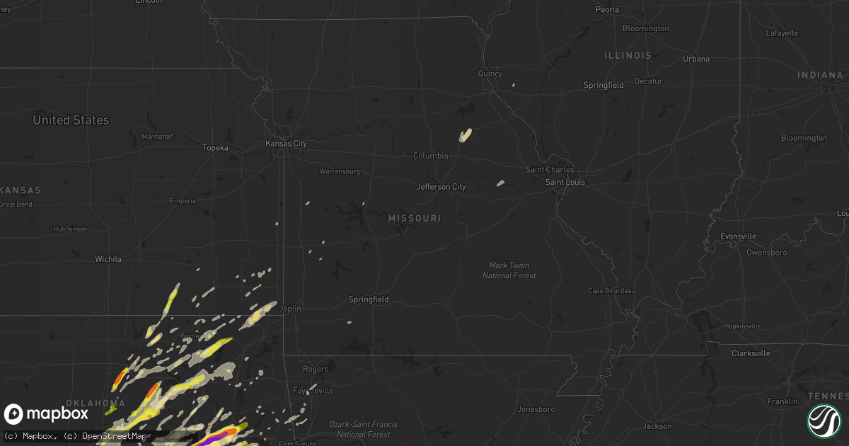
Hail Map in Missouri on April 25, 2017
Get this storm
April 25 map
$229
one time, instant access
Download today. No call, no setup
Keep the $229
Bought the map and want the full workflow? Apply the entire $229 to a subscription within 7 days. None of it is wasted.
Every map, not just this one
This buys you this map. Subscription and you get every map we run, in the markets you choose from a few cities to whole states to nationwide. Plus real-time alerts the moment a storm fires.
Contact data
Name, contact info, occupancy, even credit band for addresses in the footprint. You go from where it hit to who to call.
Become the source they trust
Unlimited branding weather history reports on demand. You already have the documented answer ready for the property owner, and you are the one who showed up with it.
Property data and RoofTrace estimates
Pull up any address you have got, its value and the exact code rules for that jurisdiction, straight from One Click Code. Then RoofTrace estimates the squares, pitch, and roof value, priced the way you price.
Storm reports in Missouri
Missouri
| Date | Description |
|---|---|
| 04/25/20174:17 AM CDT | Tree blocking hwy oo east of hwy m. |
| 04/25/20174:15 AM CDT | Tree blocking hwy m at hwy f. |
| 04/25/20174:12 AM CDT | Tree on fire and power lines down on hwy tt at hwy 94. |
| 04/25/20174:10 AM CDT | Tree blocking hwy ee at pendleton forest rd. |
| 04/25/20174:05 AM CDT | Tree and power lines down on mill st on mill rd. |
| 04/25/20173:27 AM CDT | 58mph gust asos station vih... Rolla national airport. |
| 04/25/20173:00 AM CDT | A few power poles blown down due to damaging winds. |
| 04/25/20172:35 AM CDT | Barn blown down on cr 840 from overnight thunderstorms. |
| 04/25/20172:05 AM CDT | Large oak tree uprooted... Several smaller limbs down. |
| 04/25/20171:55 AM CDT | Multiple power lines and several trees being reported down in the branson area. Some trees blocking roadways. |
| 04/25/20171:55 AM CDT | Reports of multiple trees down across springfield and greene county. A few blocking roadways. |
| 04/25/20171:52 AM CDT | Large tree down on back of house with 6 other trees down at the table rock state park. Power lines also down. Store dock and two other docks partially broke loose. |
| 04/25/20171:50 AM CDT | Several trees down in the northern part of stone county from overnight storms. |
| 04/25/20171:50 AM CDT | Several trees down in the southern part of stone county from overnight storms. |
| 04/25/20171:38 AM CDT | Tree into a house. No injuries. |
| 04/25/20171:31 AM CDT | A nws storm survey confirmed an ef-0 tornado briefly touched down near the missouri and arkansas border near st. John's wood lane in the area of golden... Missouri. Num |
| 04/25/20171:30 AM CDT | Multiple trees down. Some down on home. |
| 04/25/20171:29 AM CDT | Numerous trees down in the eagle rock area. |
| 04/25/20171:24 AM CDT | Multiple reports of trees and power lines down in the cassville area. Power outages. |
| 04/25/20171:20 AM CDT | Tree smashed a car and totaled it. No injuries. |
| 04/25/20171:19 AM CDT | A tree was blown down in monett at lincoln and dunn street. |
| 04/25/201712:40 AM CDT | Severe trees blown down around noel. |
| 04/25/201712:39 AM CDT | A tree fell on house and car. No injuries. |
Cities Impacted by Hail Map on April 25, 2017
- Perry, OK
- Ralston, OK
- Mulhall, OK
- Pawnee, OK
- Coyle, OK
- Morrison, OK
- Stillwater, OK
- Beggs, OK
- Mounds, OK
- Paden, OK
- Okemah, OK
- Boley, OK
- Burbank, OK
- Shidler, OK
- Stigler, OK
- Kinta, OK
- Delaware, OK
- Cushing, OK
- Yale, OK
- Bristow, OK
- Depew, OK
- Mansfield, TX
- West Fork, AR
- Claremore, OK
- Muskogee, OK
- Warner, OK
- Oktaha, OK
- Checotah, OK
- Lane, OK
- Tecumseh, OK
- Maud, OK
- Skiatook, OK
- Konawa, OK
- Wewoka, OK
- Council Hill, OK
- Eufaula, OK
- Henryetta, OK
- Mcalester, OK
- Porum, OK
- Quinton, OK
- Whitefield, OK
- Broken Arrow, OK
- Independence, KS
- Pleasanton, KS
- Prescott, KS
- Cedar Vale, KS
- Moline, KS
- Ramona, OK
- Pittsburg, OK
- Cedar Hill, TX
- Desoto, TX
- Dallas, TX
- Duncanville, TX
- Girard, KS
- Ada, OK
- Stratford, OK
- Seminole, OK
- Fairfax, OK
- McCune, KS
- Davenport, OK
- Norman, OK
- Oklahoma City, OK
- Jones, OK
- Meeker, OK
- Mannford, OK
- Owasso, OK
- Harrah, OK
- Stroud, OK
- Tuttle, OK
- Sapulpa, OK
- Drumright, OK
- Tulsa, OK
- Luther, OK
- Jennings, OK
- Spencer, OK
- Newcastle, OK
- Chandler, OK
- Blanchard, OK
- Choctaw, OK
- Catoosa, OK
- Sand Springs, OK
- Wellston, OK
- Lindsay, OK
- Stonewall, OK
- Fitzhugh, OK
- Prague, OK
- Byars, OK
- Rose, OK
- Rush Springs, OK
- Alex, OK
- Ninnekah, OK
- Bradley, OK
- Cement, OK
- Hominy, OK
- Glencoe, OK
- Wetumka, OK
- Sedan, KS
- Lincoln, MO
- Warsaw, MO
- Noble, OK
- Earlsboro, OK
- Purcell, OK
- Washington, OK
- Shawnee, OK
- Macomb, OK
- Lexington, OK
- Galena, KS
- Columbus, KS
- Bluejacket, OK
- Vinita, OK
- Welch, OK
- Baxter Springs, KS
- Miami, OK
- Chetopa, KS
- Boynton, OK
- Dewey, OK
- Nowata, OK
- Bartlesville, OK
- Lenapah, OK
- Bixby, OK
- Meridian, OK
- Holdenville, OK
- Calvin, OK
- Allen, OK
- El Dorado Springs, MO
- Barnsdall, OK
- Osage, OK
- Adair, OK
- Big Cabin, OK
- Morris, OK
- Haskell, OK
- Talala, OK
- Wayne, OK
- Maysville, OK
- Pauls Valley, OK
- Paoli, OK
- Muldrow, OK
- Venus, TX
- Alvarado, TX
- Midlothian, TX
- Okmulgee, OK
- Rush Hill, MO
- Pryor, OK
- Walnut Springs, TX
- Morgan, TX
- Iredell, TX
- Hartshorne, OK
- Wilburton, OK
- Grand Prairie, TX
- Lamar, OK
- Pawhuska, OK
- Chickasha, OK
- Locust Grove, OK
- Inola, OK
- Farmington, AR
- Fayetteville, AR
- Porter, OK
- Springdale, AR
- Bunch, OK
- Laddonia, MO
- Benton City, MO
- Mexico, MO
- Arlington, TX
- Wynnewood, OK
- Crowder, OK
- Salina, OK
- Chouteau, OK
- Red Oak, OK
- Collinsville, OK
- Keota, OK
- Taft, OK
- Wanette, OK
- Copan, OK
- Wynona, OK
- Vian, OK
- S Coffeyville, OK
- Wann, OK
- Marlow, OK
- Atwood, OK
- Asher, OK
- Caddo Mills, TX
- Castle, OK
- Barry, IL
- Oswego, KS
- Mccurtain, OK
- Vera, OK
- Ochelata, OK
- Guthrie, OK
- Cleburne, TX
- Itasca, TX
- Amber, OK
- Milo, MO
- Nevada, MO
- Rockwall, TX
- New Haven, MO
- Marthasville, MO
- Berger, MO
- Fort Worth, TX
- Tupelo, OK
- Sallisaw, OK
- Park Hill, OK
- Tahlequah, OK
- Keene, TX
- Godley, TX
- Walnut, KS
- Crane, MO
- Sparks, OK
- Burleson, TX
- Joshua, TX
- Dustin, OK
- Elk Falls, KS
- Stilwell, OK
- Havana, KS
- Parsons, KS
- Fredonia, KS
- Braggs, OK
- Sasakwa, OK
- Weleetka, OK
- Hanna, OK
- Elk City, KS
- Natural Dam, AR
- Grandview, TX
- Coffeyville, KS
- Galesburg, KS
- Erie, KS
- Greenville, TX
- Cedarville, AR
- Maramec, OK
- Cleveland, OK
- Foster, OK
- Mcloud, OK
- Fletcher, OK
- Webbers Falls, OK
- Kellyville, OK
- Stuart, OK
- Sperry, OK
- Chelsea, OK
- Canadian, OK
- Roff, OK
- Agra, OK
- Terlton, OK
- Elmore City, OK
- Gore, OK
- Savanna, OK
- Indianola, OK
- Tryon, OK
- Newalla, OK
- Lincoln, AR
- Stringtown, OK
- Daisy, OK
- Kennedale, TX
- Mesquite, TX
- Balch Springs, TX
- Lillian, TX
- Jenks, OK
- Sheldon, MO
- Jerico Springs, MO
- Butler, MO
- Glenpool, OK
- Chester, AR
- Rowlett, TX
- Garland, TX
- Orlando, OK
- Edmond, OK
- Carney, OK


