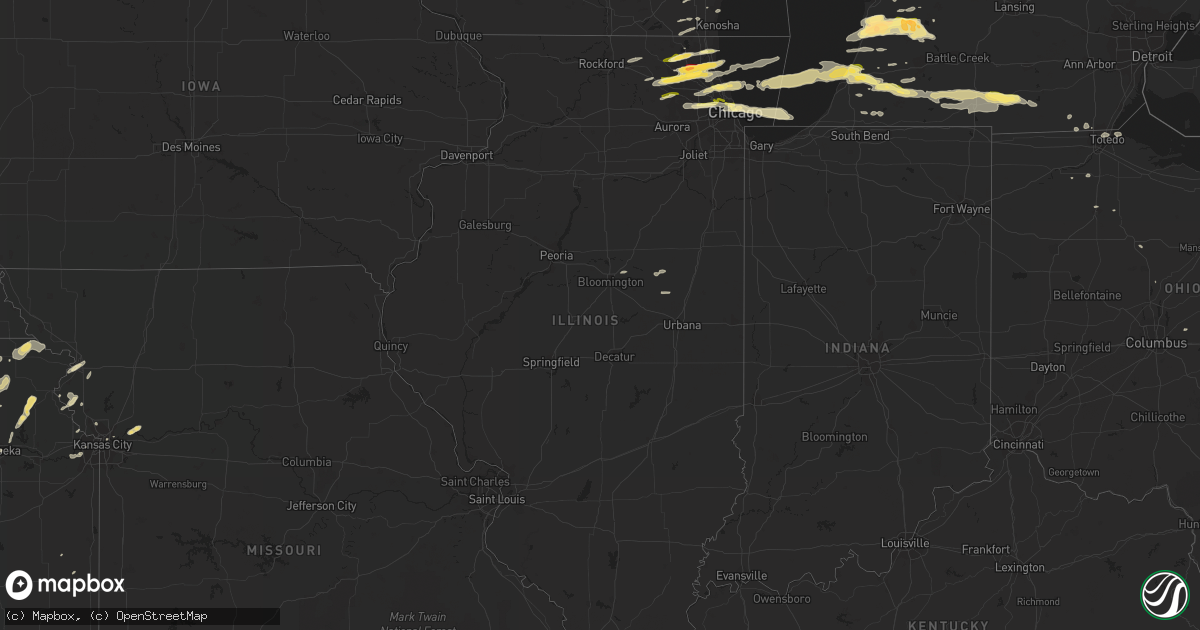
Hail Map in Illinois on April 25, 2016
Get this storm
April 25 map
$229
one time, instant access
Download today. No call, no setup
Keep the $229
Bought the map and want the full workflow? Apply the entire $229 to a subscription within 7 days. None of it is wasted.
Every map, not just this one
This buys you this map. Subscription and you get every map we run, in the markets you choose from a few cities to whole states to nationwide. Plus real-time alerts the moment a storm fires.
Contact data
Name, contact info, occupancy, even credit band for addresses in the footprint. You go from where it hit to who to call.
Become the source they trust
Unlimited branding weather history reports on demand. You already have the documented answer ready for the property owner, and you are the one who showed up with it.
Property data and RoofTrace estimates
Pull up any address you have got, its value and the exact code rules for that jurisdiction, straight from One Click Code. Then RoofTrace estimates the squares, pitch, and roof value, priced the way you price.
Storm reports in Illinois
Illinois
| Date | Description |
|---|---|
| 04/25/20166:25 PM CDT | A local report indicates 1.00 inch wind near GLENVIEW |
| 04/25/20165:40 PM CDT | Nearest intersection us-20 and mcclean boulevard. |
| 04/25/20165:15 PM CDT | Hail ranged in size from one quarter inch to one inch in diameter. Hail fell roughly from 510pm to 515pm. |
| 04/25/20164:40 PM CDT | Along highway 120. Report via twitter. Time estimated from radar. |
| 04/24/20169:45 PM CDT | In lincoln park. |
| 04/24/20169:40 PM CDT | Via facebook. Nearest intersection irving park and pulaski. |
| 04/24/20169:32 PM CDT | Nearest intersection montrose and ottawa. Via facebook. |
| 04/24/20169:31 PM CDT | Far northwest side of chicago. Relayed via facebook. |
| 04/24/20167:16 PM CDT | Hail from about 716 to 721 pm. Nearest intersection route 31 and algonquin road. |
| 04/24/20167:15 PM CDT | Estimated up to walnut size. Via twitter. |
| 04/24/20167:15 PM CDT | Butterfield and north huntington nearest intersections. Relayed via facebook. |
| 04/24/20167:15 PM CDT | Hail between quarter and half dollar size between 715pm and 721pm. New report from algonquin area. |
| 04/24/20167:10 PM CDT | At carmel high school. 176 and hawley. |
| 04/24/20167:09 PM CDT | Near chevy chase road. |
| 04/24/20167:06 PM CDT | Damage to multiple vehicles and a skylight in a home. Route 12 and 176. |
All States Impacted by Hail Map on April 25, 2016
Cities Impacted by Hail Map on April 25, 2016
- Fennville, MI
- Hamilton, MI
- Saint Joseph, MO
- Elwood, KS
- Wathena, KS
- Lebanon, KS
- Imperial, NE
- Madrid, NE
- Spring Branch, TX
- Canyon Lake, TX
- Oconomowoc, WI
- Germantown, WI
- Hartford, WI
- Richfield, WI
- Cedarburg, WI
- Grafton, WI
- Hartland, WI
- Hubertus, WI
- Mequon, WI
- Colgate, WI
- Jackson, WI
- Otsego, MI
- Pullman, MI
- Martin, MI
- Delton, MI
- Plainwell, MI
- South Haven, MI
- Shelbyville, MI
- Allegan, MI
- Hopkins, MI
- Greenleaf, KS
- Green, KS
- Wray, CO
- Holyoke, CO
- Casnovia, MI
- Bailey, MI
- Grant, MI
- Clyde, KS
- Bern, KS
- Seneca, KS
- Oneida, KS
- Wayland, MI
- Watervliet, MI
- Benton Harbor, MI
- Coloma, MI
- Hartford, MI
- Cotulla, TX
- Pearsall, TX
- Fowlerton, TX
- Centralia, KS
- Goff, KS
- Corning, KS
- Champion, NE
- Bremen, KS
- Summerfield, KS
- Oketo, KS
- Waterville, KS
- Washington, KS
- Axtell, KS
- Beattie, KS
- Frankfort, KS
- Burchard, NE
- Baileyville, KS
- Home, KS
- Morrowville, KS
- Hanover, KS
- Marysville, KS
- Clifton, KS
- Pawnee City, NE
- Linn, KS
- Palmer, KS
- Barnes, KS
- Egg Harbor City, NJ
- Bruning, NE
- Belvidere, NE
- Ohiowa, NE
- Tobias, NE
- Alexandria, NE
- Elkhart, IN
- Bridgeport, NE
- Endicott, NE
- Steele City, NE
- Hollenberg, KS
- Formoso, KS
- Jewell, KS
- Randall, KS
- Beloit, KS
- Mankato, KS
- Haddam, KS
- Agenda, KS
- Vermillion, KS
- Jamestown, KS
- Burnet, TX
- Hebron, NE
- Marne, MI
- Zeeland, MI
- Grand Rapids, MI
- Allendale, MI
- Lampasas, TX
- North Adams, MI
- Quincy, MI
- Allen, MI
- Litchfield, MI
- Jonesville, MI
- Hillsdale, MI
- Glenview, IL
- Golf, IL
- Morton Grove, IL
- Northbrook, IL
- Elk Grove Village, IL
- Schaumburg, IL
- Evanston, IL
- Skokie, IL
- Winnetka, IL
- Kenilworth, IL
- Niles, IL
- Des Plaines, IL
- Wilmette, IL
- Mount Prospect, IL
- Arlington Heights, IL
- Valley Falls, KS
- Nortonville, KS
- Ozawkie, KS
- Effingham, KS
- Meriden, KS
- Tilden, TX
- Charlotte, TX
- San Saba, TX
- Lake Zurich, IL
- Barrington, IL
- Cary, IL
- Saukville, WI
- Port Washington, WI
- Dickens, NE
- Bulverde, TX
- Von Ormy, TX
- Jbsa Lackland, TX
- San Antonio, TX
- Lytle, TX
- Atascosa, TX
- Somerset, TX
- Poteet, TX
- Castle Rock, CO
- Carleton, NE
- Davenport, NE
- Cedar Grove, WI
- Oostburg, WI
- Sibley, MO
- Tuckerton, NJ
- Kansas City, KS
- Courtland, KS
- Norway, KS
- Slinger, WI
- West Bend, WI
- Muskegon, MI
- Spring Lake, MI
- Nunica, MI
- Ravenna, MI
- Fruitport, MI
- Chester, NE
- Oak Creek, WI
- Grayslake, IL
- Gurnee, IL
- Chatsworth, NJ
- Vincentown, NJ
- Barnegat, NJ
- Orrick, MO
- Independence, MO
- Clayton, NJ
- Monroeville, NJ
- Franklinville, NJ
- Williamstown, NJ
- Glendale Heights, IL
- Bloomingdale, IL
- River Grove, IL
- Elmwood Park, IL
- Addison, IL
- Melrose Park, IL
- Bensenville, IL
- Chicago, IL
- Lombard, IL
- Carol Stream, IL
- Glen Ellyn, IL
- Elmhurst, IL
- Villa Park, IL
- Franklin Park, IL
- Dorr, MI
- Wauconda, IL
- Mundelein, IL
- White Cloud, KS
- Hiawatha, KS
- Robinson, KS
- Union City, MI
- Bronson, MI
- Tekonsha, MI
- Coldwater, MI
- Colon, MI
- Mendon, MI
- Leonidas, MI
- Sherwood, MI
- Rushville, MO
- Scandia, KS
- Belleville, KS
- Sedgwick, CO
- Ovid, CO
- Hardy, NE
- Elgin, IL
- Saint Charles, IL
- West Olive, MI
- Findlay, OH
- Mchenry, IL
- Penns Grove, NJ
- Wilmington, DE
- Newark, DE
- New Castle, DE
- Pedricktown, NJ
- Jerome, MI
- Leavenworth, KS
- Blanco, TX
- Nelson, NE
- Republic, KS
- Webber, KS
- Eckley, CO
- Yuma, CO
- Comfort, TX
- Boerne, TX
- Milwaukee, WI
- Forest City, MO
- Highland, KS
- Fox Lake, IL
- Lyons, MI
- Wetmore, KS
- Holton, KS
- Circleville, KS
- Narka, KS
- Munden, KS
- Metamora, OH
- Blissfield, MI
- Whiting, KS
- Netawaka, KS
- Hudsonville, MI
- Holland, MI
- Wyoming, MI
- Ada, MI
- Comstock Park, MI
- Coopersville, MI
- Jenison, MI
- Byron Center, MI
- Towanda, IL
- Marengo, IL
- Harvard, IL
- Garden Prairie, IL
- Belvidere, IL
- Fischer, TX
- Grand Haven, MI
- Sabetha, KS
- South Elgin, IL
- Shawnee, KS
- Toledo, OH
- Bennett, CO
- Reading, MI
- Decatur, MI
- Centreville, MI
- Lawton, MI
- Covert, MI
- Three Rivers, MI
- Dowagiac, MI
- Burr Oak, MI
- Marcellus, MI
- Inavale, NE
- Red Cloud, NE
- Franksville, WI
- Union Grove, WI
- Waterford, WI
- Waterford Works, NJ
- Sicklerville, NJ
- Waretown, NJ
- Hammonton, NJ
- Centerville, KS
- Blue Mound, KS
- Calliham, TX
- Elkton, MD
- Cheyenne, WY
- Sturtevant, WI
- Brigantine, NJ
- Caledonia, MI
- Weston, MO
- Addison, MI
- Pittsford, MI
- Hudson, MI
- Manitou Beach, MI
- De Kalb, MO
- Tow, TX
- Brookfield, WI
- Burlington, WI
- Chappell, NE
- Humboldt, NE
- Libertyville, IL
- Hampshire, IL
- Carpentersville, IL
- Lake Bluff, IL
- Buffalo Grove, IL
- Huntley, IL
- Palatine, IL
- Lincolnshire, IL
- Lake Forest, IL
- Fox River Grove, IL
- Vernon Hills, IL
- Deerfield, IL
- Gilberts, IL
- Dundee, IL
- Algonquin, IL
- Racine, WI
- Adell, WI
- Waldo, WI
- Random Lake, WI
- North Platte, NE
- Cuba, KS
- Mahaska, KS
- Fairbury, NE
- Middleville, MI
- Hastings, MI
- Du Bois, NE
- Crystal Lake, IL
- Ingleside, IL
- Round Lake, IL
- Onaga, KS
- Alexandria, OH
- Pataskala, OH
- Morganville, KS
- Kansas City, MO
- Wimberley, TX
- Jourdanton, TX
- Waukegan, IL
- Lake Villa, IL
- Woodstock, IL
- Island Lake, IL
- Belgium, WI
- Anchor, IL
- Sibley, IL
- Horton, KS
- Gilead, NE
- Deshler, NE
- Elmer, NJ
- Angora, NE
- Liberty, NE
- Westmoreland, KS
- Hubbell, NE
- Powhattan, KS
- Soldier, KS
- Blue Rapids, KS
- Grand Junction, MI
- Bloomingdale, MI
- Fairview, KS
- Vernon, CO
- Cummings, KS
- Paw Paw, MI
- Lawrence, MI
- Ruskin, NE
- Oak, NE
- Byron, NE
- Elizabeth, CO
- Prospect Heights, IL
- Highwood, IL
- Highland Park, IL
- Wheeling, IL
- Platte City, MO
- Wheatland, WY
- Topeka, KS
- Bowling Green, OH
- Weston, OH
- Hye, TX
- Palmyra, MI
- Park Ridge, IL
- Ashley, OH
- Waldo, OH
- Cardington, OH
- Saugatuck, MI
- Douglas, MI
- Jbsa Ft Sam Houston, TX
- South Milwaukee, WI
- Franklin, WI
- Belmont, MI
- Rubicon, WI
- McClure, OH
- Mishawaka, IN
- South Bend, IN
- Elm Grove, WI
- Llano, TX
- Haigler, NE
- Grandville, MI
- Mapleton, KS
- Parker, CO
- Menomonee Falls, WI
- Foosland, IL
- Harwood Heights, IL
- Hanover Park, IL
- Bartlett, IL
- West Chicago, IL
- Schiller Park, IL
- Easton, KS
- Newfield, NJ
- Berlin, NJ
- Lenexa, KS
- Bonner Springs, KS
- De Soto, KS
- Nevada, OH
- Harpster, OH
- Niles, MI
- Kenosha, WI
- Big Springs, NE
- Oregon, OH
- Harbor View, OH
- Ionia, MI
- Elsie, NE
- Kent City, MI
- Conklin, MI
- Enders, NE
- Benkelman, NE
- Agency, MO
- Maxwell, NE
- Kalamazoo, MI
- Ottawa Lake, MI
- Crook, CO
- Schoolcraft, MI
- Cassopolis, MI
- Edwardsburg, MI
- Meriden, WY
- Riga, MI
- Alvada, OH
- Wilmot, WI
- Salem, WI
- Bristol, WI
- Trevor, WI
- Twin Lakes, WI
- Superior, NE
- Eau Claire, MI
- Genoa, IL
- Kansasville, WI
- Bangor, MI
- Bigfoot, TX
- Natalia, TX
- Bosler, WY
- Claymont, DE
- Glassboro, NJ
- Forked River, NJ
- Wood Dale, IL
- Poplar Grove, IL


