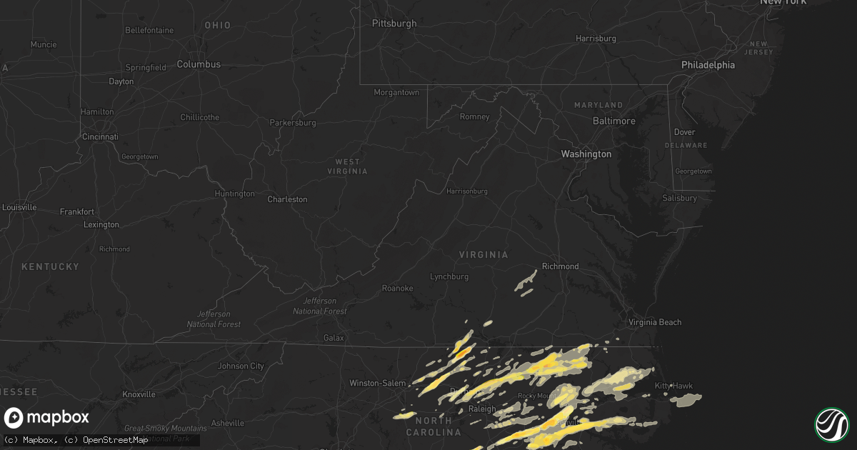
Hail Map in Virginia on April 25, 2014
Get this storm
April 25 map
$229
one time, instant access
Download today. No call, no setup
Keep the $229
Bought the map and want the full workflow? Apply the entire $229 to a subscription within 7 days. None of it is wasted.
Every map, not just this one
This buys you this map. Subscription and you get every map we run, in the markets you choose from a few cities to whole states to nationwide. Plus real-time alerts the moment a storm fires.
Contact data
Name, contact info, occupancy, even credit band for addresses in the footprint. You go from where it hit to who to call.
Become the source they trust
Unlimited branding weather history reports on demand. You already have the documented answer ready for the property owner, and you are the one who showed up with it.
Property data and RoofTrace estimates
Pull up any address you have got, its value and the exact code rules for that jurisdiction, straight from One Click Code. Then RoofTrace estimates the squares, pitch, and roof value, priced the way you price.
Storm reports in Virginia
Virginia
| Date | Description |
|---|---|
| 04/25/20143:35 PM CDT | Tree down in bon air blocking the road. |
| 04/25/20143:24 PM CDT | Multiple trees down and uprooted |
| 04/25/20143:15 PM CDT | Multiple trees down in the redfield neighborhood. |
| 04/25/20143:10 PM CDT | A local report indicates 1.00 inch wind near W SCOTTSBURG |
| 04/25/20143:07 PM CDT | A local report indicates 1.00 inch wind near 5 SE HALIFAX |
| 04/25/20142:30 PM CDT | Tree down just east of madisonville |
| 04/25/20142:29 PM CDT | Tree down on abilene rd |
| 04/25/20142:09 PM CDT | Tree down on patrick henry hwy |
| 04/25/20141:16 PM CDT | One tree down on henderson road. |
| 04/25/20141:11 PM CDT | One tree down on calvary road. |
All States Impacted by Hail Map on April 25, 2014
Cities Impacted by Hail Map on April 25, 2014
- Liberty, NC
- Graham, NC
- Haw River, NC
- Burlington, NC
- Cedar Grove, NC
- Efland, NC
- Mebane, NC
- Jamesville, NC
- Williamston, NC
- Drakes Branch, VA
- Wylliesburg, VA
- Red Oak, VA
- Chase City, VA
- Halifax, NC
- Hurdle Mills, NC
- Rougemont, NC
- Roxboro, NC
- Oxford, NC
- Timberlake, NC
- Julian, NC
- Weldon, NC
- Littleton, NC
- Hollister, NC
- Enfield, NC
- Garysburg, NC
- Jackson, NC
- Roanoke Rapids, NC
- Stem, NC
- Wanchese, NC
- Nags Head, NC
- Manteo, NC
- Carrboro, NC
- Chapel Hill, NC
- Scotland Neck, NC
- Woodland, NC
- Ahoskie, NC
- Aulander, NC
- Rich Square, NC
- Conway, NC
- Walstonburg, NC
- Greenville, NC
- Farmville, NC
- Raleigh, NC
- Murfreesboro, NC
- Erwin, NC
- South Boston, VA
- Clayton, NC
- Wendell, NC
- Windsor, NC
- Hertford, NC
- Edenton, NC
- Elizabeth City, NC
- Tyner, NC
- Merry Hill, NC
- Colerain, NC
- Princeton, NC
- Goldsboro, NC
- Bethel, NC
- Stokes, NC
- Robersonville, NC
- Warrenton, NC
- Norlina, NC
- Pendleton, NC
- Margarettsville, NC
- Tarboro, NC
- Smithfield, NC
- Franklinville, NC
- Asheboro, NC
- Ramseur, NC
- Denton, NC
- Pikeville, NC
- Winterville, NC
- Grimesland, NC
- Snow Hill, NC
- Fremont, NC
- Four Oaks, NC
- Benson, NC
- Fountain, NC
- Stantonsburg, NC
- Oak City, NC
- Apex, NC
- Youngsville, NC
- Wake Forest, NC
- Franklinton, NC
- Creedmoor, NC
- Rocky Mount, NC
- Wilson, NC
- Willow Spring, NC
- Black Creek, NC
- Garner, NC
- Lucama, NC
- Kenly, NC
- Selma, NC
- Engelhard, NC
- Fairfield, NC
- La Grange, NC
- Seven Springs, NC
- Hookerton, NC
- Kinston, NC
- Hobgood, NC
- Semora, NC
- Halifax, VA
- Leasburg, NC
- Scottsburg, VA
- Alton, VA
- Zebulon, NC
- Middlesex, NC
- Linden, NC
- Fayetteville, NC
- Spring Lake, NC
- Fort Bragg, NC
- Durham, NC
- Hamilton, NC
- Washington, NC
- Elm City, NC
- Bailey, NC
- Whitsett, NC
- Belhaven, NC
- Pinetown, NC
- Pantego, NC
- Grifton, NC
- Chocowinity, NC
- Plymouth, NC
- Ayden, NC
- Suffolk, VA
- Louisburg, NC
- Henderson, NC
- Kittrell, NC
- Newsoms, VA
- Como, NC
- Franklin, VA
- Boykins, VA
- Gibsonville, NC
- McLeansville, NC
- Elon, NC
- Nashville, NC
- Bullock, NC
- Fuquay Varina, NC
- Shiloh, NC
- Scranton, NC
- Columbia, NC
- Winton, NC
- Roxobel, NC
- Morrisville, NC
- Castalia, NC
- Battleboro, NC
- Seaboard, NC
- Macon, NC
- Cary, NC
- Whitakers, NC
- Kelford, NC
- Macclesfield, NC
- Reidsville, NC
- Yanceyville, NC
- Raeford, NC
- Dunn, NC
- Pope Army Airfield, NC
- Greensboro, NC
- Rolesville, NC
- Lewiston Woodville, NC
- Bath, NC
- Dudley, NC
- Pinetops, NC
- Vanceboro, NC
- Manns Harbor, NC
- Kitty Hawk, NC
- Milton, NC
- Skippers, VA
- Pleasant Hill, NC
- Gaston, NC
- Siler City, NC
- Pittsboro, NC
- Gates, NC
- Crystal Hill, VA
- Hillsborough, NC
- Amelia Court House, VA
- Blackstone, VA
- Crewe, VA
- Bahama, NC
- Randleman, NC
- Sophia, NC
- Sims, NC
- Creswell, NC
- Roper, NC
- Dover, NC
- Belvidere, NC
- Jetersville, VA
- Powhatan, VA
- Moseley, VA
- Shawboro, NC
- Camden, NC
- Virgilina, VA
- Climax, NC
- Prospect Hill, NC
- Snow Camp, NC
- Spring Hope, NC


