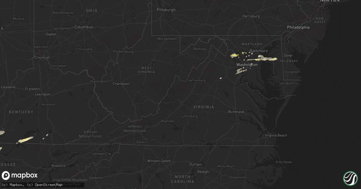
Hail Map in Virginia on April 24, 2011
Get this storm
April 24 map
$229
one time, instant access
Download today. No call, no setup
Keep the $229
Bought the map and want the full workflow? Apply the entire $229 to a subscription within 7 days. None of it is wasted.
Every map, not just this one
This buys you this map. Subscription and you get every map we run, in the markets you choose from a few cities to whole states to nationwide. Plus real-time alerts the moment a storm fires.
Contact data
Name, contact info, occupancy, even credit band for addresses in the footprint. You go from where it hit to who to call.
Become the source they trust
Unlimited branding weather history reports on demand. You already have the documented answer ready for the property owner, and you are the one who showed up with it.
Property data and RoofTrace estimates
Pull up any address you have got, its value and the exact code rules for that jurisdiction, straight from One Click Code. Then RoofTrace estimates the squares, pitch, and roof value, priced the way you price.
Storm reports in Virginia
Virginia
| Date | Description |
|---|---|
| 04/24/20116:02 PM CDT | A local report indicates 1.00 inch wind near 1 N CATALPA |
| 04/24/20113:01 PM CDT | Tree uprooted. Time estimated from radar |
| 04/24/20113:00 PM CDT | Softwood tree snapped along river creek parkway |
| 04/24/20113:00 PM CDT | Two trees snapped and one softwood tree uprooted along hillhead place |
| 04/24/20112:55 PM CDT | Shingle roof damage to cwsu center. Esitimated 50kt wind gust. |
| 04/24/20112:26 PM CDT | Tree down in the 4200 block of harry byrd highway rt 7. |
| 04/24/20112:24 PM CDT | Tree down at senseny road and janeville road. |
| 04/24/20112:12 PM CDT | A local report indicates 65 MPH wind near 1 WSW STRASBURG |
| 04/23/20117:30 PM CDT | A local report indicates 1.00 inch wind near 2 ESE BARCROFT |
| 04/23/20117:30 PM CDT | A local report indicates 58 MPH wind near 1 E ALEXANDRIA |
| 04/23/20117:30 PM CDT | 6 inch diameter tree down |
All States Impacted by Hail Map on April 24, 2011
Cities Impacted by Hail Map on April 24, 2011
- Newkirk, OK
- Holdenville, OK
- Sasakwa, OK
- Shawnee, OK
- Tioga, TX
- Dardanelle, AR
- Belleville, AR
- Danville, AR
- Coppell, TX
- Dallas, TX
- Irving, TX
- Red Oak, OK
- Wister, OK
- Graford, TX
- Rising Star, TX
- Carbon, TX
- Comanche, TX
- Nashville, AR
- Dierks, AR
- Dublin, TX
- Clarksville, AR
- Ozone, AR
- Cerulean, KY
- Crofton, KY
- Aledo, TX
- Weatherford, TX
- Marland, OK
- Talala, OK
- Princeton, TX
- Portland, TN
- Cottontown, TN
- Barnsdall, OK
- Watson, OK
- Eagletown, OK
- Albany, TX
- Gambrills, MD
- Crofton, MD
- Odenton, MD
- Arlington, TX
- Kennedale, TX
- Fort Worth, TX
- Mansfield, TX
- Coleman, TX
- Havana, AR
- Wingate, TX
- Calico Rock, AR
- Melbourne, AR
- Stilwell, OK
- Granbury, TX
- Cresson, TX
- Dalhart, TX
- Coyle, OK
- Stillwater, OK
- Hendersonville, TN
- Greenbrier, TN
- White House, TN
- Goodlettsville, TN
- Gallatin, TN
- Baird, TX
- Moran, TX
- Cisco, TX
- Cadiz, KY
- Princeton, KY
- Roanoke, TX
- Maynard, AR
- Biggers, AR
- Vera, OK
- Tulsa, OK
- Delaware, OK
- Ochelata, OK
- Nowata, OK
- Collinsville, OK
- Wann, OK
- Bartlesville, OK
- Lenapah, OK
- S Coffeyville, OK
- Liberty, KS
- Prue, OK
- Skiatook, OK
- Coffeyville, KS
- Sperry, OK
- Ramona, OK
- Copan, OK
- Sand Springs, OK
- Dewey, OK
- Crowley, TX
- Grapevine, TX
- Sikeston, MO
- Ravenden Springs, AR
- Poplar Bluff, MO
- Pocahontas, AR
- Fisk, MO
- Qulin, MO
- Naylor, MO
- Dexter, MO
- Warm Springs, AR
- Broseley, MO
- Bernie, MO
- Dudley, MO
- Neelyville, MO
- Success, AR
- Harviell, MO
- Oxly, MO
- Doniphan, MO
- Essex, MO
- Deer, AR
- Annona, TX
- Avery, TX
- Heavener, OK
- Howe, OK
- Horseshoe Bend, AR
- Wellington, KS
- Breckenridge, TX
- Ranger, TX
- Santo, TX
- Palo Pinto, TX
- Haslet, TX
- Poolville, TX
- Gordon, TX
- Azle, TX
- Strawn, TX
- Keller, TX
- Springtown, TX
- Mineral Wells, TX
- Millsap, TX
- Caddo, TX
- Hawley, TX
- Leesburg, VA
- Dickerson, MD
- Fort Smith, AR
- Stigler, OK
- Roland, OK
- Arkoma, OK
- Alma, AR
- Barling, AR
- Muldrow, OK
- Van Buren, AR
- Cecil, AR
- Porum, OK
- Keota, OK
- Ratcliff, AR
- Greenwood, AR
- Pocola, OK
- Charleston, AR
- Lavaca, AR
- Spiro, OK
- Sallisaw, OK
- Garland, TX
- Prosper, TX
- Sneads, FL
- Tuscola, TX
- Haltom City, TX
- Celina, TX
- Van Alstyne, TX
- Lavon, TX
- Paradise, TX
- Krum, TX
- Little Elm, TX
- Caddo Mills, TX
- Rockwall, TX
- Campbell, TX
- Trenton, TX
- Royse City, TX
- Nevada, TX
- Mingus, TX
- Euless, TX
- Tye, TX
- Rowlett, TX
- Mesquite, TX
- Bluff Dale, TX
- Denton, TX
- Perrin, TX
- Bedford, TX
- Burleson, TX
- Grand Prairie, TX
- Frisco, TX
- Lipan, TX
- Ponder, TX
- Bryson, TX
- Rhome, TX
- Joshua, TX
- Mckinney, TX
- Eastland, TX
- Buffalo Gap, TX
- Justin, TX
- Naval Air Station Jrb, TX
- Tolar, TX
- Bridgeport, TX
- North Richland Hills, TX
- Stephenville, TX
- Whitt, TX
- Abilene, TX
- Newark, TX
- Merkel, TX
- Boyd, TX
- Colleyville, TX
- Jacksboro, TX
- Argyle, TX
- Godley, TX
- Aubrey, TX
- Greenville, TX
- Decatur, TX
- Hurst, TX
- Graham, TX
- Whitewright, TX
- Dyess Afb, TX
- Clyde, TX
- Anna, TX
- Parsons, KS
- Dennis, KS
- Cherryvale, KS
- Mound Valley, KS
- Fort Gibson, OK
- Muskogee, OK
- Gustine, TX
- Carlton, TX
- Novice, TX
- Chipley, FL
- Ellicott City, MD
- Clarksville, MD
- Sterling City, TX
- Slocomb, AL
- Graceville, FL
- Bonifay, FL
- Hartford, AL
- Mcloud, OK
- Newalla, OK
- Noble, OK
- Washington, OK
- Farmersville, TX
- Booneville, AR
- Mansfield, AR
- Russellville, AR
- Hector, AR
- Dover, AR
- Addison, TX
- Carrollton, TX
- Purcell, OK
- Benton, MO
- Oran, MO
- Gainesville, TX
- Claremore, OK
- Catoosa, OK
- Owasso, OK
- Eufaula, OK
- Meeker, OK
- Bowling Green, KY
- Alvaton, KY
- Leon, KS
- El Dorado, KS
- Rosalia, KS
- Holliday, TX
- Wichita Falls, TX
- Bells, TX
- Sherman, TX
- Sharon Grove, KY
- Elkton, KY
- Springfield, TN
- Joelton, TN
- Jerusalem, AR
- Atkins, AR
- Indianola, OK
- Mcalester, OK
- Centreville, MD
- Lawton, OK
- Fletcher, OK
- Rush Springs, OK
- Marlow, OK
- Cross Plains, TX
- Hamilton, TX
- Burkett, TX
- Early, TX
- Blanket, TX
- Sidney, TX
- May, TX
- Hico, TX
- Brownwood, TX
- Cedar Hill, TN
- Hopkinsville, KY
- Oak Grove, KY
- Herndon, KY
- Mccurtain, OK
- Poteau, OK
- Shady Point, OK
- Kinta, OK
- Bokoshe, OK
- Culpeper, VA
- Fairfax, OK
- Pawhuska, OK
- Wynona, OK
- Geronimo, OK
- Throckmorton, TX
- Goldsboro, TX
- Poolesville, MD
- Beallsville, MD
- Waterford, VA
- Paeonian Springs, VA
- Hamilton, VA
- Rudy, AR
- Franklin, AR
- Evening Shade, AR
- Sage, AR
- Center Ridge, AR
- Bee Branch, AR
- Blue Ridge, TX
- Brockwell, AR
- Sapulpa, OK
- Hartford, AR
- Scotland, AR
- Hartshorne, OK
- Hattieville, AR
- Pelsor, AR
- Paris, AR
- Quinton, OK
- Ola, AR
- Hagarville, AR
- Solgohachia, AR
- Waldron, AR
- Wilburton, OK
- Pottsville, AR
- Cleveland, AR
- Midland, AR
- Scranton, AR
- Cameron, OK
- Delaware, AR
- Talihina, OK
- Huntington, AR
- Subiaco, AR
- Hackett, AR
- Magazine, AR
- Lamar, AR
- Blue Mountain, AR
- Kaw City, OK
- Farmington, KY
- Murray, KY
- Valley View, TX
- Olney, TX
- Ozark, AR
- Mountainburg, AR
- Mulberry, AR
- Tahlequah, OK
- Winters, TX
- Kuttawa, KY
- Eddyville, KY
- Woodson, TX
- Newcastle, TX
- Ivanhoe, TX
- Ravenna, TX
- Dexter, KS
- Cambridge, KS
- Albany, KY
- Cleveland, OK
- Hominy, OK
- Norman, OK
- Scott City, MO
- Vanduser, MO
- Charleston, MO
- Bloomfield, MO
- Bertrand, MO
- Gatewood, MO
- Bell City, MO
- Lafayette, TN
- Kaufman, TX
- Terrell, TX
- Oakland, KY
- Scottsville, KY
- Whitefield, OK
- Branch, AR
- Gans, OK
- De Leon, TX
- Sumner, TX
- Red Oak, TX
- Auburn, KY
- Woodburn, KY
- Hyattsville, MD
- Lanham, MD
- Upper Marlboro, MD
- Capitol Heights, MD
- Atlanta, KS
- Maryneal, TX
- Blackwell, TX
- Santa Anna, TX
- Robert Lee, TX
- Ovalo, TX
- Bronte, TX
- Lawn, TX
- Red Rock, OK
- Lorton, VA
- Gunter, TX
- Gracey, KY
- Okolona, AR
- Kirby, AR
- Delight, AR
- Tecumseh, OK
- Earlsboro, OK
- Blanchard, OK
- Amber, OK
- Tuttle, OK
- Clarksville, TN
- Loraine, TX
- The Colony, TX
- Parrish, FL
- Bradenton, FL
- Anadarko, OK
- Verden, OK
- Pembroke, KY
- Cumby, TX
- Wynnewood, OK
- Telephone, TX
- Honey Grove, TX
- Lewisburg, KY
- Trenton, KY
- Sparks, OK
- Prague, OK
- Konawa, OK
- Knoxville, AR
- London, AR
- Allen, TX
- Corning, AR
- Datto, AR
- Alexandria, VA
- Fort Belvoir, VA
- Dawson Springs, KY
- Saint Charles, KY
- Sadler, TX
- Whitesboro, TX
- Hartsville, TN
- Walnut Ridge, AR
- Guthrie, KY
- Chelsea, OK
- Washington, DC
- Oklahoma City, OK
- Newcastle, OK
- Kevil, KY
- Olmsted, IL
- Russellville, KY
- Boyds, MD
- Choctaw, OK
- Clarksville, TX
- Wellston, OK
- Harrah, OK
- Cyril, OK
- Apache, OK
- Gorman, TX
- Glasgow, KY
- Wetumka, OK
- Buncombe, IL
- Vienna, IL
- Dongola, IL
- Rose Bud, AR
- Heber Springs, AR
- Wilburn, AR
- Pangburn, AR
- Manassas, VA
- Franklin, KY
- Midlothian, TX
- Waxahachie, TX
- Smiths Grove, KY
- Westbrook, TX
- Bristow, OK
- Kellyville, OK
- Hanna, OK
- Era, TX
- Duncan, OK
- Gillham, AR
- De Queen, AR
- Checotah, OK
- Walters, OK
- Stratford, OK
- Hendrix, OK
- Paragould, AR
- Marmaduke, AR
- Adair, OK
- Dyer, AR
- Plainview, AR
- Hodgen, OK
- Haileyville, OK
- Krebs, OK
- New Blaine, AR
- Altus, AR
- Oark, AR
- Morrilton, AR
- Tuskahoma, OK
- Springfield, AR
- Crowder, OK
- Mount Judea, AR
- Coal Hill, AR
- Brookeville, MD
- Gaithersburg, MD
- Yantis, TX
- Quitman, TX
- Milan, TN
- Hardy, AR
- Ravenden, AR
- Miller City, IL
- Cairo, IL
- Williford, AR
- Murfreesboro, AR
- Pasadena, MD
- Glen Burnie, MD
- Millersville, MD
- Temple Hills, MD
- Clinton, MD
- Fort Washington, MD
- Mayfield, KY
- Depew, OK
- Sanger, TX
- Wylie, TX
- Stringtown, OK
- Pleasant View, TN
- Howe, TX
- Annapolis, MD
- Arnold, MD
- Gibson Island, MD
- Braggs, OK
- Emory, TX
- Douglas, OK
- Winslow, AR
- Potomac, MD
- Rockville, MD
- Bethesda, MD
- Chapmansboro, TN
- Ashland City, TN
- Castalian Springs, TN
- Bethpage, TN
- Plano, TX
- Murdock, KS
- Milton, KS
- Norwich, KS
- Kingman, KS
- Cheney, KS
- Bradley, OK
- Alex, OK
- Ninnekah, OK
- Gordonville, TX
- La Fayette, KY
- Big Rock, TN
- Bumpus Mills, TN
- Elgin, OK
- Umpire, AR
- Bogata, TX
- Burke, VA
- Springfield, VA
- Occoquan, VA
- Clifton, VA
- Fairfax Station, VA
- Woodbridge, VA
- Columbia, MD
- Weleetka, OK
- Crownsville, MD
- Highland, MD
- Silver Spring, MD
- Ashton, MD
- Spencerville, MD
- Fulton, MD
- Collinsville, TX
- Ponca City, OK
- Burbank, OK
- Dixon Springs, TN
- Ash Flat, AR
- Violet Hill, AR
- Pauls Valley, OK
- De Kalb, TX
- Haworth, OK
- Germantown, MD
- Olney, MD
- Sandy Spring, MD
- Grannis, AR
- Bagwell, TX
- Vinita, OK
- Brookston, TX
- Wills Point, TX
- Quinlan, TX
- Annandale, VA
- Clinton, AR
- Alpha, KY
- Monticello, KY
- Pleasant Plains, AR
- Lancaster, TX
- Ferris, TX
- Youngstown, FL
- Foreman, AR
- Loving, TX
- Hardin, KY
- Benton, KY
- Kirksey, KY
- Dexter, KY
- Almo, KY
- Chickasha, OK
- Powderly, TX
- Paris, TX
- Warner, OK
- Sweetwater, TX
- Stroud, OK
- Lexington, OK
- Broken Bow, OK
- Hugo, OK
- Grant, OK
- Roxton, TX
- Ladonia, TX
- Bonham, TX
- Winthrop, AR
- Ashdown, AR
- Cypress, IL
- Atwood, OK
- Burkesville, KY
- Garden Plain, KS
- Hartman, AR
- Lamar, OK
- Richardson, TX
- Gilbertsville, KY
- Fifty Six, AR
- Onia, AR
- Rio Vista, TX
- Cleburne, TX
- Elmore City, OK
- Wickes, AR
- Antlers, OK
- Hennessey, OK
- Lucas, KY
- Bison, OK
- Waukomis, OK
- Fairmont, OK
- Shidler, OK
- Whitley City, KY
- Queenstown, MD
- Detroit, TX
- Advance, MO
- Kingston, OK
- Cottondale, FL
- Glencoe, AR
- Mammoth Spring, AR
- Cherokee Village, AR
- Wimauma, FL
- Jennings, OK
- Bokchito, OK
- Parkers Lake, KY
- Corbin, KY
- Billings, OK
- Big Sandy, TN
- Valliant, OK
- Fort Towson, OK
- Judsonia, AR
- Viola, KS
- Mulhall, OK
- Stearns, KY
- Newark, AR
- Edna, KS
- Poughkeepsie, AR
- Damascus, MD
- Montgomery Village, MD
- Shirley, AR
- Ellenton, FL
- Ruskin, FL
- Palmetto, FL
- Sarasota, FL
- Alvarado, TX
- Venus, TX
- Macomb, OK
- Rover, AR
- Nolan, TX
- Chico, TX
- Duncanville, TX
- Randolph, TX
- Ector, TX
- Sulphur Springs, TX
- Klondike, TX
- Lueders, TX
- Commerce, TX
- Lewisville, TX
- Pilot Point, TX
- Lake Dallas, TX
- Southlake, TX
- Sachse, TX
- Allensville, KY
- Maud, OK
- Arthur City, TX
- Wewoka, OK
- Maple City, KS
- Covington, OK
- Garber, OK
- Meno, OK
- Ames, OK
- Perry, OK
- Nortonville, KY
- Laurel, MD
- Church Hill, MD
- Stevensville, MD
- Severna Park, MD
- Bowie, MD
- College Park, MD
- Curtis Bay, MD
- Rock Hall, MD
- Beltsville, MD
- Sunnyvale, TX
- Tompkinsville, KY
- Celina, TN
- Floral, AR
- Fort Campbell, KY
- Dover, TN
- Olmstead, KY
- Big Cabin, OK
- Independence, KS
- Roscoe, TX


