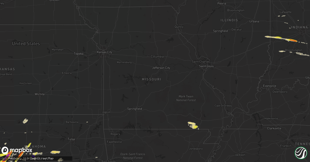
Hail Map in Missouri on April 20, 2017
Get this storm
April 20 map
$229
one time, instant access
Download today. No call, no setup
Keep the $229
Bought the map and want the full workflow? Apply the entire $229 to a subscription within 7 days. None of it is wasted.
Every map, not just this one
This buys you this map. Subscription and you get every map we run, in the markets you choose from a few cities to whole states to nationwide. Plus real-time alerts the moment a storm fires.
Contact data
Name, contact info, occupancy, even credit band for addresses in the footprint. You go from where it hit to who to call.
Become the source they trust
Unlimited branding weather history reports on demand. You already have the documented answer ready for the property owner, and you are the one who showed up with it.
Property data and RoofTrace estimates
Pull up any address you have got, its value and the exact code rules for that jurisdiction, straight from One Click Code. Then RoofTrace estimates the squares, pitch, and roof value, priced the way you price.
Storm reports in Missouri
Missouri
| Date | Description |
|---|---|
| 04/20/20175:43 PM CDT | Overturned semi-tractor trailer on highway 67 about one mile north of the arkansas-missouri state line. Driver removed from truck and appears ok at this time. Corrected |
| 04/20/20175:20 PM CDT | Moderate damage to 3 homes with trees falling through roofs. One home with minor damage with power line weatherhead pulled from structure by downed tree. Two homes were |
| 04/20/20174:55 PM CDT | Report of a tree was blocking route k near doniphan. Report relayed by kfvs-12 from doniphan police department. |
| 04/20/20174:40 PM CDT | Report of a tree was blocking route y near doniphan. Report relayed by kfvs-12 from doniphan police department. |
All States Impacted by Hail Map on April 20, 2017
Cities Impacted by Hail Map on April 20, 2017
- Okemah, OK
- Bloomington, IN
- Norman, IN
- Nashville, IN
- Seymour, IN
- Columbus, IN
- Freetown, IN
- Oklahoma City, OK
- East Brady, PA
- Vowinckel, PA
- Kersey, PA
- Butler, PA
- Templeton, PA
- Fenelton, PA
- Marienville, PA
- Clarington, PA
- Fairmount City, PA
- Strattanville, PA
- Ridgway, PA
- Mayport, PA
- James City, PA
- Corsica, PA
- Summerville, PA
- Sigel, PA
- Brockway, PA
- Worthington, PA
- Brookville, PA
- Chicora, PA
- Rimersburg, PA
- New Bethlehem, PA
- Cabot, PA
- Cowansville, PA
- Nocona, TX
- Lawton, OK
- Elgin, OK
- Apache, OK
- Centreville, MI
- Three Rivers, MI
- Jones, MI
- Weatherford, OK
- Geary, OK
- Wickliffe, KY
- La Center, KY
- Stinnett, TX
- Borger, TX
- Cheyenne, OK
- Cloverdale, IN
- Fort Cobb, OK
- Gracemont, OK
- Hammon, OK
- Butler, OK
- Sayre, OK
- Leedey, OK
- Decatur, MI
- Marcellus, MI
- Bowie, TX
- Spearman, TX
- Timberville, VA
- Broadway, VA
- Childress, TX
- Laverne, OK
- Crowell, TX
- Doniphan, MO
- Paris, IL
- Lebanon, IN
- Sheridan, IN
- Anadarko, OK
- Arapaho, OK
- Custer City, OK
- Corn, OK
- Hydro, OK
- Elk City, OK
- Clinton, OK
- Cordell, OK
- Gotebo, OK
- Thomas, OK
- Bessie, OK
- Edmond, OK
- Grandin, MO
- Nash, OK
- Saltsburg, PA
- Murrysville, PA
- Apollo, PA
- Export, PA
- Pittsburgh, PA
- New Kensington, PA
- Harwick, PA
- Verona, PA
- Creighton, PA
- Springdale, PA
- Tarentum, PA
- Cheswick, PA
- Raton, NM
- Jeannette, PA
- Greensburg, PA
- Grapeville, PA
- Okarche, OK
- Calumet, OK
- Prospect, VA
- Farmville, VA
- Appomattox, VA
- Masterson, TX
- Hartley, TX
- Panhandle, TX
- Dalhart, TX
- Fritch, TX
- Channing, TX
- Dumas, TX
- Stratford, TX
- Pamplin, VA
- Hobart, OK
- Blair, OK
- Fargo, OK
- Fort Supply, OK
- Woodward, OK
- Vian, OK
- Montague, TX
- Crawfordsville, IN
- Vernon, TX
- Electra, TX
- Boley, OK
- Grover Hill, OH
- Columbus Grove, OH
- Cloverdale, OH
- Ottawa, OH
- Leipsic, OH
- Middle Point, OH
- Fort Jennings, OH
- Kalida, OH
- Ladoga, IN
- North Salem, IN
- Lafayette, IN
- Romney, IN
- Westpoint, IN
- Vandalia, MI
- Constantine, MI
- Vermilion, IL
- Clinton, IN
- Brazil, IN
- New Goshen, IN
- Terre Haute, IN
- Carbon, IN
- Rosedale, IN
- Harmony, IN
- West Terre Haute, IN
- Paducah, TX
- Fletcher, OK
- Roosevelt, OK
- Pandora, OH
- Vinita, OK
- Corry, PA
- Shattuck, OK
- Mooreland, OK
- Booker, TX
- Canadian, TX
- Follett, TX
- Mountain View, OK
- Carnegie, OK
- Irwin, PA
- Mckeesport, PA
- East Leroy, MI
- Scotts, MI
- Vicksburg, MI
- Schoolcraft, MI
- Athens, MI
- Fulton, MI
- Worthington, IN
- Chillicothe, TX
- Seiling, OK
- Union City, PA
- Cashion, OK
- Hugoton, KS
- Mangum, OK
- Martinsville, IN
- Paragon, IN
- Quincy, IN
- Quanah, TX
- Eldorado, OK
- Camargo, OK
- Vici, OK
- Taloga, OK
- Temperance, MI
- Lambertville, MI
- Toledo, OH
- Wichita Falls, TX
- Henrietta, TX
- Switz City, IN
- Jasonville, IN
- Medford, OK
- Wakita, OK
- Sligo, PA
- Parker, PA
- Odell, TX
- Davidson, OK
- Bradford, PA
- Oxly, MO
- Van Wert, OH
- Perryton, TX
- Cambridge Springs, PA
- Waterford, PA
- Natrona Heights, PA
- Lookeba, OK
- Hinton, OK
- Morgantown, IN
- Reelsville, IN
- Monrovia, IN
- Bellevue, TX
- Morse, TX
- Luther, OK
- Kingfisher, OK
- Hennessey, OK
- Cee Vee, TX
- Seymour, TX
- Ringgold, TX
- Iowa Park, TX
- Holliday, TX
- College Park, MD
- Hyattsville, MD
- New Alexandria, PA
- Tekonsha, MI
- Ceresco, MI
- Homer, MI
- Marshall, MI
- Climax, MI
- Burlington, MI
- Enid, OK
- Fairmont, OK
- Hamlet, IN
- Walkerton, IN
- Naylor, MO
- Watonga, OK
- Sunray, TX
- Capulin, NM
- Des Moines, NM
- Grenville, NM
- Parma, MI
- Jackson, MI
- Delphos, OH
- Chandler, OK
- Stroud, OK
- Depew, OK
- Davenport, OK
- El Reno, OK
- Union City, OK
- Edinburgh, IN
- Franklin, IN
- Latrobe, PA
- Derry, PA
- Ligonier, PA
- Yukon, OK
- Neelyville, MO
- Belleville, MI
- Fairdealing, MO
- Binger, OK
- Folsom, NM
- Gibsonia, PA
- Flat Rock, IN
- Muenster, TX
- Piedmont, OK
- Castle, OK
- Sharon, OK
- Gosport, IN
- Colony, OK
- Matador, TX
- Flomot, TX
- Allison Park, PA
- Indianola, PA
- Glenshaw, PA
- Mason, MI
- Onondaga, MI
- Beaver, OK
- Balko, OK
- Royal Center, IN
- Attica, IN
- Allerton, IL
- Dansville, MI
- Chester, OK
- Battle Creek, MI
- Arcadia, OK
- Linton, IN
- Bloomfield, IN
- Pond Creek, OK
- Jones, OK
- Caldwell, KS
- Greenfield, OK
- Erick, OK
- Sentinel, OK
- Rocky, OK
- Sweetwater, OK
- Saint Jo, TX
- Forestburg, TX
- Oklaunion, TX
- Harrold, TX
- Memphis, TX
- Spartansburg, PA
- Blairsville, PA
- Solsberry, IN
- Spring Creek, PA
- Sewickley, PA
- Columbus, PA
- Bear Lake, PA
- Sturgis, MI
- Hardesty, OK
- Nineveh, IN
- Trafalgar, IN
- Putnam, OK
- Buffalo, OK
- Pittsfield, PA
- Gruver, TX
- Headrick, OK
- Altus, OK
- Mountain Park, OK
- Grandfield, OK
- Norman, OK
- Cement City, MI
- Brooklyn, MI
- Findlay, OH
- McComb, OH
- Avonmore, PA
- Slickville, PA
- Reynoldsville, PA
- Crown, PA
- Leeper, PA
- Tionesta, PA


