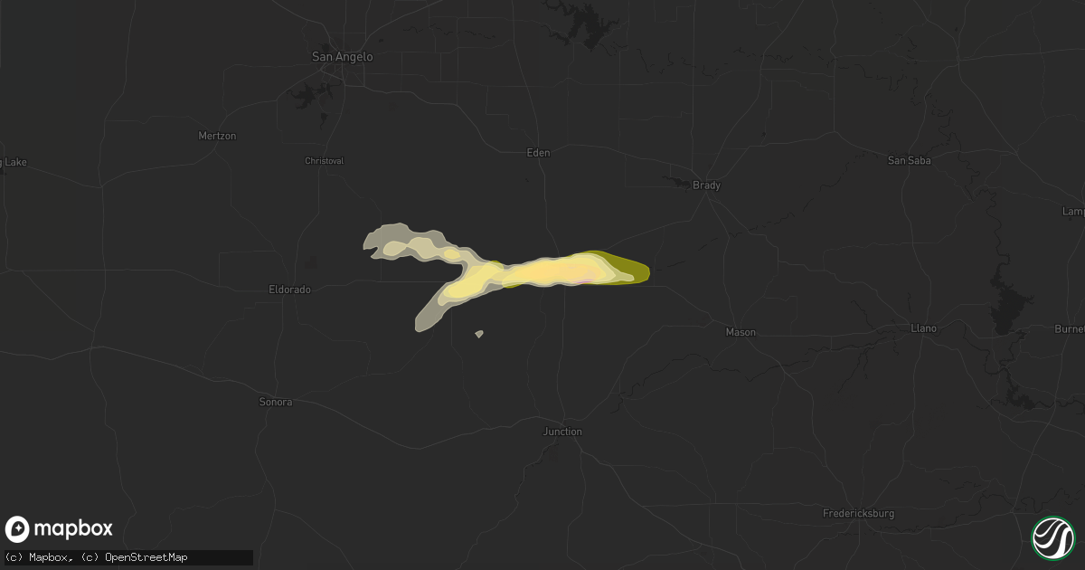
Hail Map in Menard, TX on April 19, 2016
Get this storm
April 19 map
$229
one time, instant access
Download today. No call, no setup
Keep the $229
Bought the map and want the full workflow? Apply the entire $229 to a subscription within 7 days. None of it is wasted.
Every map, not just this one
This buys you this map. Subscription and you get every map we run, in the markets you choose from a few cities to whole states to nationwide. Plus real-time alerts the moment a storm fires.
Contact data
Name, contact info, occupancy, even credit band for addresses in the footprint. You go from where it hit to who to call.
Become the source they trust
Unlimited branding weather history reports on demand. You already have the documented answer ready for the property owner, and you are the one who showed up with it.
Property data and RoofTrace estimates
Pull up any address you have got, its value and the exact code rules for that jurisdiction, straight from One Click Code. Then RoofTrace estimates the squares, pitch, and roof value, priced the way you price.
Storm reports in Menard, TX
Menard, TX
| Date | Description |
|---|---|
| 04/18/201610:25 PM CDT | Damaging thunderstorm winds uprooted a few large pecan and oak trees...broke off large tree branches and knocked over a fuel tank. A fuel pump was missing and the high |
| 04/18/20169:47 PM CDT | A local report indicates 2.00 inch wind near MENARD |
| 04/18/20169:28 PM CDT | Quarter to half dollar size hail along us 190. |
All Cities Impacted by Hail Map on April 19, 2016
- Justiceburg, TX
- Big Spring, TX
- Menard, TX
- Anson, TX
- Aspermont, TX
- Hamlin, TX
- Rotan, TX
- Stamford, TX
- Albany, TX
- Lockney, TX
- Crosbyton, TX
- Ralls, TX
- Lenorah, TX
- Petrolia, TX
- Kingston, OK
- Durant, OK
- Calera, OK
- Mead, OK
- Goree, TX
- Seymour, TX
- Throckmorton, TX
- Munday, TX
- Knox City, TX
- Dryden, TX
- Fort Stockton, TX
- Cumby, TX
- Sulphur Springs, TX
- Afton, TX
- Imperial, TX
- Gail, TX
- Moran, TX
- Post, TX
- Crowell, TX
- Haskell, TX
- Fluvanna, TX
- Fort McKavett, TX
- Levelland, TX
- Shallowater, TX
- Snyder, TX
- Idalou, TX
- Floydada, TX
- Dickens, TX
- Spur, TX
- Abilene, TX
- Jayton, TX
- Lueders, TX
- Paducah, TX
- Stanton, TX
- Eldorado, TX
- Marietta, OK
- Whitesboro, TX
- Roaring Springs, TX
- Mcadoo, TX
- Lamesa, TX
- Windthorst, TX
- Sunset, TX
- Ackerly, TX
- Springlake, TX
- Tahoka, TX
- Holliday, TX
- Brady, TX
- Christoval, TX
- Lubbock, TX
- Weatherford, TX
- Henrietta, TX
- Bellevue, TX
- Montague, TX
- Archer City, TX
- Bowie, TX
- Forestburg, TX
- Scotland, TX
- Rule, TX
- Girard, TX
- Old Glory, TX
- Hawley, TX
- Valley View, TX
- Era, TX
- Gainesville, TX
- Andrews, TX
- Mansfield, TX
- Grand Prairie, TX
- Cedar Hill, TX
- Cisco, TX
- Weinert, TX
- Avoca, TX
- Baird, TX
- Wichita Falls, TX
- Lorenzo, TX
- Saint Jo, TX
- Newcastle, TX
- Benjamin, TX
- Caddo, OK
- Knott, TX
- Dallas, TX
- Abernathy, TX
- Goldsmith, TX
- Clyde, TX
- Tarzan, TX
- Sylvester, TX
- Roby, TX
- McCaulley, TX
- Coahoma, TX
- Lebanon, OK
- Olney, TX
- Merkel, TX
- Ovalo, TX
- Brashear, TX
- Byers, TX
- Millsap, TX
- Blanket, TX
- Burleson, TX
- Fort Worth, TX
- Kennedale, TX
- May, TX
- Cross Plains, TX
- Brownwood, TX
- Rising Star, TX
- Ringgold, TX
- Nocona, TX
- Burkett, TX
- Lawn, TX
- Cooper, TX
- Ira, TX
- Plainview, TX
- Woodson, TX
- Moody, TX
- Hermleigh, TX
- Hext, TX
- Loving, TX
- Bokchito, OK
- Burneyville, OK
- Leon, OK


