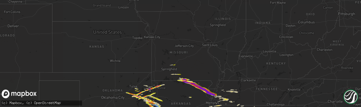
Hail Map in Missouri on April 15, 2022
The weather event in Missouri on April 15, 2022 includes Hail, Tornado, and Wind maps. 8 states and 323 cities were impacted and suffered possible damage. The total estimated number of properties impacted is 3,371.
Want more than just the map?
Turn this storm into a full workflow.
- Owner + property data so you know who to knock
- OnDemand branded weather history reports to win the "did we even have hail?" argument
- RoofTrace estimate so reps stop guessing numbers at the door
Bought this map? Upgrade within 7 days and we'll credit the $230. (10-15 min setup call)
Hail
Tornado
Wind
3,371
Estimated number of impacted properties by a 1.00" hail or larger1,189
Estimated number of impacted properties by a 1.75" hail or larger755
Estimated number of impacted properties by a 2.50" hail or largerStorm reports in Missouri
Missouri
| Date | Description |
|---|---|
| 04/15/20226:55 PM CDT | Corrects previous hail report from 4 se south fork. Report from mping: baseball |
| 04/15/20226:45 PM CDT | Quarter size hail on highway 101 between caufield and bakersfield. |
| 04/15/20225:58 PM CDT | Quarter size hail near highways p and 14. |
| 04/15/20225:30 PM CDT | Delayed report: picture showing hail sizes ranging from quarter to half dollar size. |
| 04/15/20225:03 PM CDT | Public reported quarter size hail by highway cc south of sampson via social media. |
| 04/15/20224:25 PM CDT | Public reported half-dollar size hail near highway ee in elkand. |
| 04/15/20224:23 PM CDT | Corrects previous hail report from 4 n niangua. Public reported quarter size hail by highway cc south of sampson via social media. |
| 04/15/20222:43 AM CDT | At 743 PM CDT, a severe thunderstorm was located 7 miles northwest of Price Place, or 13 miles northwest of Bull Shoals, moving east at 45 mph. HAZARD...60 mph wind gusts and quarter size hail. SOURCE...Radar indicated. IMPACT...Hail damage to vehicles is expected. Expect wind damage to roofs, siding, and trees. Locations impacted include... Bull Shoals Lake... Norfork Lake... Gainesville... Bakersfield... Theodosia... Pontiac... Sundown... Hardenville... Tecumseh... Isabella... Udall... |
| 04/15/20222:42 AM CDT | At 742 PM CDT, a severe thunderstorm was located near Dalton, or 19 miles east of Mammoth Spring, moving east at 55 mph. HAZARD...60 mph wind gusts and quarter size hail. SOURCE...Radar indicated. IMPACT...Hail damage to vehicles is expected. Expect wind damage to roofs, siding, and trees. This severe thunderstorm will be near... Gatewood around 750 PM CDT.Other locations in the path of this severe thunderstorm includeDoniphan. |
| 04/15/20222:23 AM CDT | At 722 PM CDT, a severe thunderstorm was located 8 miles southeast of Forsyth, moving east at 45 mph. HAZARD...60 mph wind gusts and quarter size hail. SOURCE...Radar indicated. IMPACT...Hail damage to vehicles is expected. Expect wind damage to roofs, siding, and trees. Locations impacted include... Lake Taneycomo... Bull Shoals Lake... Protem... Rueter... |
| 04/15/20221:28 AM CDT | At 628 PM CDT, a severe thunderstorm was located near Gainesville, or 12 miles northeast of Bull Shoals, moving east at 55 mph. HAZARD...60 mph wind gusts and quarter size hail. SOURCE...Radar indicated. IMPACT...Hail damage to vehicles is expected. Expect wind damage to roofs, siding, and trees. Locations impacted include... Norfork Lake... Gainesville... Bakersfield... South Fork... Brandsville... Lanton... Hardenville... Moody... Tecumseh... Caulfield... Zanoni... Udall... |
| 04/15/20221:25 AM CDT | At 624 PM CDT, a severe thunderstorm was located near Arkawana, or 9 miles north of Mountain Home, moving east at 60 mph. HAZARD...60 mph wind gusts and quarter size hail. SOURCE...Radar indicated. IMPACT...Hail damage to vehicles is expected. Expect wind damage to roofs, siding, and trees. Locations impacted include... Mountain Home... Cherokee Village... Bull Shoals... Salem in Fulton County... Ash Flat... Horseshoe Bend... Mammoth Spring... Lakeview in Baxter County... Oxford... Viola... Franklin... Ballard... Arkawana... Bexar... Flint Springs... Ott... Sturkie... Byron... Diamond Bay... Ozark Regional Airport... |
| 04/15/202212:36 AM CDT | At 535 PM CDT, a severe thunderstorm was located near Ava, moving east at 50 mph. HAZARD...Ping pong ball size hail and 60 mph wind gusts. SOURCE...Radar indicated. IMPACT...People and animals outdoors will be injured. Expect hail damage to roofs, siding, windows, and vehicles. Expect wind damage to roofs, siding, and trees. Locations impacted include... Ava... Rome... Vanzant... Squires... Brushyknob... Goodhope... Drury... Gentryville... |
| 04/14/202211:55 PM CDT | At 454 PM CDT, a severe thunderstorm was located near Highlandville, moving east at 60 mph. HAZARD...60 mph wind gusts and quarter size hail. SOURCE...Radar indicated. IMPACT...Hail damage to vehicles is expected. Expect wind damage to roofs, siding, and trees. Locations impacted include... Ozark... Ava... Seymour... Sparta... Highlandville... Spokane... Oldfield... Elkhead... Chestnutridge... Bruner... Selmore... Keltner... Christian Center... Ponce de Leon... Garrison... Rome... Chadwick... Goodhope... Dogwood... |
| 04/14/202211:21 PM CDT | At 420 PM CDT, a severe thunderstorm was located near Conway, or 8 miles north of Marshfield, moving east at 60 mph. HAZARD...60 mph wind gusts and quarter size hail. SOURCE...Radar indicated. IMPACT...Hail damage to vehicles is expected. Expect wind damage to roofs, siding, and trees. Locations impacted include... Morgan... Conway... Phillipsburg... Twin Bridges... Competition... Rader... Lynchburg... Dry Knob... Falcon... This includes Interstate 44 between mile markers 104 and 109, andbetween mile markers 112 and 121. |
| 04/14/20227:31 PM CDT | Report from mping: baseball |
All States Impacted by Hail Map on April 15, 2022
Cities Impacted by Hail Map on April 15, 2022
- Aliceville, AL
- Greensboro, AL
- Marion, AL
- Brent, AL
- Boligee, AL
- Akron, AL
- Newbern, AL
- Autaugaville, AL
- Moundville, AL
- Jones, AL
- Prattville, AL
- Knoxville, AL
- Eutaw, AL
- Selma, AL
- Osceola, AR
- Houlka, MS
- Pontotoc, MS
- Red Level, AL
- Evergreen, AL
- Andalusia, AL
- Sallisaw, OK
- Hernando, MS
- Cherokee Village, AR
- Ash Flat, AR
- Hardy, AR
- Mammoth Spring, AR
- Paragould, AR
- Brookland, AR
- Jonesboro, AR
- Philadelphia, MS
- Broken Arrow, OK
- Hamilton, MS
- Salem, AR
- Whiteville, TN
- Bolivar, TN
- Henderson, TN
- Stanton, TN
- Somerville, TN
- Toone, TN
- Mason, TN
- Medon, TN
- Hornsby, TN
- Selmer, TN
- Bethel Springs, TN
- Glencoe, AR
- Mansfield, AR
- Tahlequah, OK
- Welling, OK
- Southaven, MS
- Michigan City, MS
- Lamar, MS
- Olive Branch, MS
- Red Banks, MS
- Holly Springs, MS
- Moscow, TN
- Byhalia, MS
- Rossville, TN
- Tecumseh, MO
- Bakersfield, MO
- Lake City, AR
- Oakland, AR
- Caraway, AR
- Powhatan, AR
- Leachville, AR
- Manila, AR
- Burlison, TN
- West Plains, MO
- Caulfield, MO
- Clarkridge, AR
- Keiser, AR
- Poughkeepsie, AR
- Hardenville, MO
- Black Oak, AR
- Gamaliel, AR
- Etowah, AR
- Gainesville, MO
- Udall, MO
- Pocahontas, AR
- Walnut Ridge, AR
- Pontiac, MO
- Portia, AR
- Williford, AR
- Bay, AR
- Moody, MO
- Ravenden, AR
- Ravenden Springs, AR
- Henderson, AR
- Mountain Home, AR
- Monette, AR
- Dora, MO
- Sturkie, AR
- Black Rock, AR
- Gepp, AR
- Alicia, AR
- State University, AR
- Bono, AR
- Imboden, AR
- Camp, AR
- Henning, TN
- Smithville, AR
- Viola, AR
- Hoxie, AR
- Columbia, MS
- Lumberton, MS
- Forsyth, MO
- Chadwick, MO
- Garrison, MO
- Ava, MO
- Squires, MO
- Ozark, MO
- Oldfield, MO
- Fort Gibson, OK
- Hackett, AR
- Mccurtain, OK
- Haskell, OK
- Bokoshe, OK
- Henryetta, OK
- Depew, OK
- Cameron, OK
- Oktaha, OK
- Stigler, OK
- Poteau, OK
- Porum, OK
- Webbers Falls, OK
- Pocola, OK
- Vian, OK
- Warner, OK
- Council Hill, OK
- Morris, OK
- Keota, OK
- Okmulgee, OK
- Boynton, OK
- Spiro, OK
- Eufaula, OK
- Shady Point, OK
- Checotah, OK
- Huntington, AR
- Muskogee, OK
- Gore, OK
- Bristow, OK
- Beggs, OK
- Muldrow, OK
- Greenwood, AR
- Russellville, AL
- Town Creek, AL
- Bassfield, MS
- Sumrall, MS
- Hattiesburg, MS
- Rose, OK
- Amity, AR
- Bonnerdale, AR
- Pearcy, AR
- Arkadelphia, AR
- Bismarck, AR
- Athens, AL
- Hindsville, AR
- Fayetteville, AR
- Springdale, AR
- Watts, OK
- Kansas, OK
- Westville, OK
- Booneville, AR
- Stilwell, OK
- Thaxton, MS
- Oxford, MS
- Hulbert, OK
- Waldron, AR
- Florence, MS
- Harrisville, MS
- Natural Dam, AR
- Nesbit, MS
- Saulsbury, TN
- Middleton, TN
- Wister, OK
- Heavener, OK
- Howe, OK
- Ratcliff, AR
- Charleston, AR
- Paris, AR
- Branch, AR
- Proctor, OK
- Mount Ida, AR
- Story, AR
- Kokomo, MS
- Foxworth, MS
- Tylertown, MS
- Jackson, TN
- Lavinia, TN
- Cedar Grove, TN
- Rogers, AR
- Huntsville, AR
- Pencil Bluff, AR
- Sims, AR
- Oden, AR
- Judsonia, AR
- Bradford, AR
- Pangburn, AR
- Summers, AR
- Waterloo, AL
- Savannah, TN
- Montgomery, AL
- Hope Hull, AL
- Marion Junction, AL
- Purvis, MS
- Coweta, OK
- Ecru, MS
- Aberdeen, MS
- Lincoln, AR
- Van Buren, AR
- Norman, AR
- Moore Haven, FL
- Palmdale, FL
- Sandy Hook, MS
- Oakland, TN
- Abbeville, MS
- Waterford, MS
- Como, MS
- Okolona, MS
- Houston, MS
- Alma, AR
- Atwood, TN
- Huntingdon, TN
- Donaldson, AR
- Malvern, AR
- Shannon, MS
- New Albany, MS
- Senatobia, MS
- Belden, MS
- Etta, MS
- Lavaca, AR
- Hillsboro, AL
- Courtland, AL
- Fosters, AL
- Rayville, LA
- Noxapater, MS
- Carthage, MS
- Chelsea, AL
- Birmingham, AL
- Adamsville, TN
- Dyersburg, TN
- Friendship, TN
- Madison, AL
- Parks, AR
- Labelle, FL
- Westport, TN
- Yuma, TN
- Wildersville, TN
- Holladay, TN
- Lake Cormorant, MS
- Walls, MS
- Covington, TN
- Beech Grove, AR
- Collierville, TN
- Oak Ridge, LA
- Fort Smith, AR
- Harvey, AR
- Parsons, TN
- Orlando, FL
- Medina, TN
- Milan, TN
- Humboldt, TN
- Brighton, TN
- Brownsville, TN
- Atoka, TN
- Munford, TN
- Midland, AR
- Hartford, AR
- Bunch, OK
- Pottersville, MO
- Elizabeth, AR
- Koshkonong, MO
- Theodosia, MO
- Wasola, MO
- Wilson, AR
- Isabella, MO
- Siloam Springs, AR
- Fair Grove, MO
- Locust Grove, OK
- Oaks, OK
- Bixby, OK
- Lorida, FL
- Caledonia, MS
- Greenwood Springs, MS
- Braggs, OK
- Elkmont, AL
- Lowell, AR
- Berryville, AR
- Horn Lake, MS
- Naples, FL
- Eads, TN
- Monroe, LA
- Bald Knob, AR
- Alamo, TN
- Friendship, AR
- Prairie Grove, AR
- Royal, AR
- Roland, OK
- Glenwood, AR
- Mena, AR
- Elkland, MO
- Buffalo, MO
- Okeechobee, FL
- Porter, OK
- Oviedo, FL
- Buena Vista, TN
- Germantown, TN
- Boles, AR
- Carson, MS
- Florence, AL
- Niangua, MO
- Gentry, AR
- Jayess, MS
- Monticello, MS
- Marshfield, MO
- Conway, MO
- Norwood, MO
- Drury, MO
- Ripley, TN
- Farmington, AR
- Magazine, AR
- West Fork, AR
- Chester, AR
- Red Oak, OK


