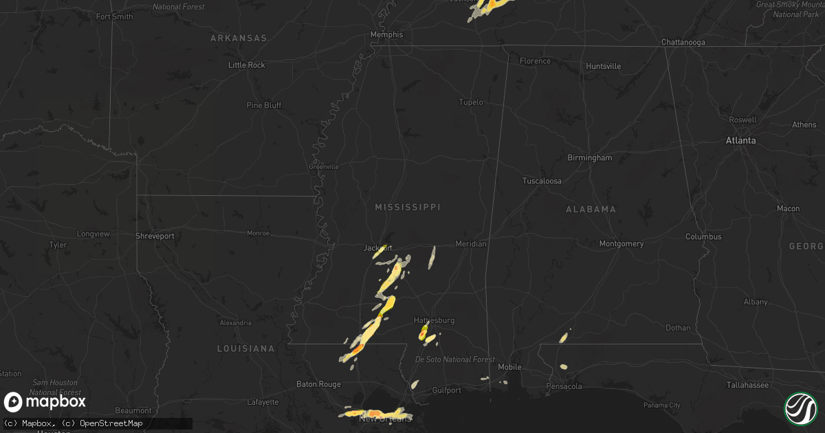
Hail Map in Mississippi on April 15, 2015
Get this storm
April 15 map
$229
one time, instant access
Download today. No call, no setup
Keep the $229
Bought the map and want the full workflow? Apply the entire $229 to a subscription within 7 days. None of it is wasted.
Every map, not just this one
This buys you this map. Subscription and you get every map we run, in the markets you choose from a few cities to whole states to nationwide. Plus real-time alerts the moment a storm fires.
Contact data
Name, contact info, occupancy, even credit band for addresses in the footprint. You go from where it hit to who to call.
Become the source they trust
Unlimited branding weather history reports on demand. You already have the documented answer ready for the property owner, and you are the one who showed up with it.
Property data and RoofTrace estimates
Pull up any address you have got, its value and the exact code rules for that jurisdiction, straight from One Click Code. Then RoofTrace estimates the squares, pitch, and roof value, priced the way you price.
Storm reports in Mississippi
Mississippi
| Date | Description |
|---|---|
| 04/15/20156:59 PM CDT | Multiple trees downed along pumping station rd and rockhill rd |
| 04/15/20156:59 PM CDT | Report of golfball size hail in rock hill. Relayed via social media. |
| 04/15/20156:57 PM CDT | Report of powerlines down in the rock hill area. |
| 04/15/20156:53 PM CDT | Powerlines downed and a barn roof blown off along deavers rd |
| 04/15/20156:52 PM CDT | Report of powerlines down on pistol ridge road at deavers road. Nickel size hail was also reported. |
| 04/15/20156:50 PM CDT | Report of ping pong size hail northeast of jayess. Report and picture relayed via social media. |
| 04/15/20156:17 PM CDT | Quarter sized hail along highway 98 |
| 04/15/20156:07 PM CDT | Reported pike county so |
| 04/15/20156:00 PM CDT | A barn damaged and trees down due to thunderstorm winds in osyka. |
| 04/15/20155:55 PM CDT | Large blown down reported pike county so |
| 04/15/20155:32 PM CDT | Report of quarter size hail on hwy 589 and purvis oloh road. |
| 04/15/20155:24 PM CDT | Golfball to hen egg size hail on purvis-columbia road. Report and picture relayed via social media. |
| 04/14/20158:10 PM CDT | Nickel to quarter size hail falling outside the nws jackson office. |
| 04/14/20158:09 PM CDT | Report of golfball size hail in cato. |
| 04/14/20158:01 PM CDT | Trees were defoliated a bit due to size of hail. |
| 04/14/20158:00 PM CDT | Numerous reports dime to quarter size hail in pearl |
| 04/14/20158:00 PM CDT | A local report indicates 1.00 inch wind near 2 SW D'LO |
| 04/14/20157:35 PM CDT | Trees were blown down on oak grove road... Divine church road...rodeoroad... Galilee and old hebron roads. A large tree had fallen on 4 vehicles on 706 divine church road. A |
| 04/14/20157:35 PM CDT | A local report indicates 1.00 inch wind near 2 SW D'LO |
| 04/14/20157:30 PM CDT | Report of quarter size hail in rockport area. |
| 04/14/20157:28 PM CDT | Trees down in sw simpson co. |
| 04/14/20157:25 PM CDT | Report of golfball size hail. Report relayed from lawrence county ema. |
| 04/14/20157:25 PM CDT | Report of quarter size hail in mclaurin. |
| 04/14/20157:25 PM CDT | Report of tree down on st. Stephens road near silver creek. |
| 04/14/20157:22 PM CDT | Report of dime to quarter size hail in monticello. |
All States Impacted by Hail Map on April 15, 2015
Cities Impacted by Hail Map on April 15, 2015
- Brandon, MS
- Hedley, TX
- Booker, TX
- Balko, OK
- Silver Creek, MS
- Prentiss, MS
- Oak Vale, MS
- Tylertown, MS
- Magnolia, MS
- Osyka, MS
- Kentwood, LA
- Jayess, MS
- Mccomb, MS
- Greensburg, LA
- Summit, MS
- Amite, LA
- Metairie, LA
- Kenner, LA
- Ponchatoula, LA
- Dryden, TX
- New Orleans, LA
- Purvis, MS
- Lumberton, MS
- Hattiesburg, MS
- Hopkinsville, KY
- Monticello, MS
- Vacherie, LA
- Mount Airy, LA
- Garyville, LA
- La Place, LA
- Edgard, LA
- Reserve, LA
- Moss Point, MS
- Brewster, KS
- Edson, KS
- Goodland, KS
- Jackson, MS
- Richland, MS
- Florence, MS
- Pearl, MS
- Flowood, MS
- Byram, MS
- Magee, MS
- Mendenhall, MS
- Morton, MS
- Perryton, TX
- Comstock, TX
- Marathon, TX
- Enville, TN
- Jacks Creek, TN
- Reagan, TN
- Henderson, TN
- Kanorado, KS
- Milton, FL
- Decaturville, TN
- Huron, TN
- Parsons, TN
- Lexington, TN
- Scotts Hill, TN
- Follett, TX
- Laverne, OK
- Linden, TN
- Pinson, TN
- Finger, TN
- Luray, TN
- Beech Bluff, TN
- Sardis, TN
- Picayune, MS
- Stennis Space Center, MS
- Brewton, AL
- Flomaton, AL
- Nashville, TN
- Saint Rose, LA
- Louin, MS
- Raleigh, MS
- Pinola, MS
- Newhebron, MS
- Wiggins, MS
- Brooklyn, MS
- Holden, LA
- Independence, LA
- Lebanon, NE
- Hart, TX
- Braxton, MS
- Brentwood, TN
- Gramercy, LA
- Paulina, LA
- Lutcher, LA
- Sidney, NE
- Georgetown, MS
- Hazel, KY
- Murray, KY
- Burlington, CO
- Trenton, TN
- Friendship, TN
- Dyer, TN
- Kenton, TN
- Newbern, TN
- Levant, KS
- Cambridge, NE
- Antioch, TN
- Franklin, TN
- Huntingdon, TN
- Westport, TN
- Wildersville, TN
- Darden, TN
- Ruth, MS
- Brookhaven, MS
- Tennessee Ridge, TN
- Stewart, TN
- Wesson, MS
- Hazlehurst, MS
- Sontag, MS
- Centerville, TN
- Lobelville, TN
- Norco, LA
- Convent, LA
- Arabi, LA
- Hahnville, LA
- Chalmette, LA
- Destrehan, LA
- Wallace, KS
- Clarendon, TX
- Holladay, TN
- Belle Chasse, LA
- Mount Juliet, TN
- Springville, TN
- Big Sandy, TN
- Irvington, AL
- Fluker, LA
- Roseland, LA
- Hermitage, TN
- Lyles, TN
- Lebanon, TN
- Liberty, MS
- Yuma, TN
- Bay Saint Louis, MS
- Rives, TN
- Union City, TN
- Foxworth, MS
- Nunnelly, TN
- Theodore, AL
- Gruver, TX
- Terry, MS
- Newton, MS
- Lawrence, MS
- Pampa, TX
- Pine Grove, LA
- Oshkosh, NE
- Miami, TX
- Bushnell, NE
- Windsor, CO
- Peetz, CO
- Colby, KS


