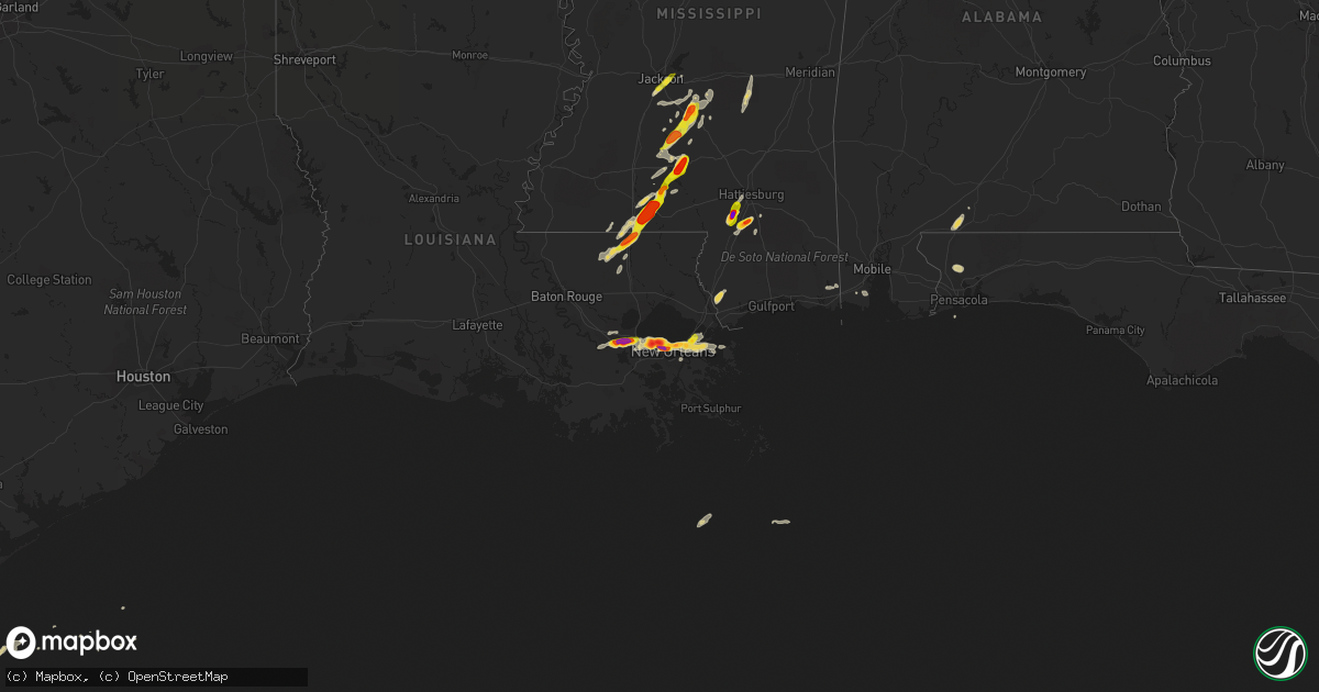
Hail Map on April 15, 2015
Get this storm
April 15 map
$229
one time, instant access
Download today. No call, no setup
Keep the $229
Bought the map and want the full workflow? Apply the entire $229 to a subscription within 7 days. None of it is wasted.
Every map, not just this one
This buys you this map. Subscription and you get every map we run, in the markets you choose from a few cities to whole states to nationwide. Plus real-time alerts the moment a storm fires.
Contact data
Name, contact info, occupancy, even credit band for addresses in the footprint. You go from where it hit to who to call.
Become the source they trust
Unlimited branding weather history reports on demand. You already have the documented answer ready for the property owner, and you are the one who showed up with it.
Property data and RoofTrace estimates
Pull up any address you have got, its value and the exact code rules for that jurisdiction, straight from One Click Code. Then RoofTrace estimates the squares, pitch, and roof value, priced the way you price.
States Impacted by Hail Map on April 15, 2015
Storm reports
Kansas
| Date | Description |
|---|---|
| 04/14/20159:39 PM CDT | A local report indicates 1.00 inch wind near 1 SSE BREWSTER |
| 04/14/20159:25 PM CDT | Mostly nickel sized hail. |
| 04/14/20158:43 PM CDT | A local report indicates 85 MPH wind near 8 E GOODLAND |
| 04/14/20158:35 PM CDT | A local report indicates 1.25 inch wind near 5 E GOODLAND |
| 04/14/20158:35 PM CDT | A local report indicates 1.00 inch wind near 5 WSW EDSON |
| 04/14/20157:29 PM CDT | Average stone size was 1/2 inch. |
Texas
| Date | Description |
|---|---|
| 04/15/20156:59 PM CDT | A local report indicates 59 MPH wind near 6 ENE AMARILLO |
| 04/14/20157:56 PM CDT | A local report indicates 61 MPH wind near 8 SSE MASTERSON |
| 04/14/20157:24 PM CDT | Nickel to quarter size hail |
| 04/14/20157:23 PM CDT | A local report indicates 1.50 inch wind near 1 E BOOKER |
| 04/14/20157:20 PM CDT | A local report indicates 1.00 inch wind near BOOKER |
Mississippi
| Date | Description |
|---|---|
| 04/15/20156:59 PM CDT | Multiple trees downed along pumping station rd and rockhill rd |
| 04/15/20156:59 PM CDT | Report of golfball size hail in rock hill. Relayed via social media. |
| 04/15/20156:57 PM CDT | Report of powerlines down in the rock hill area. |
| 04/15/20156:53 PM CDT | Powerlines downed and a barn roof blown off along deavers rd |
| 04/15/20156:52 PM CDT | Report of powerlines down on pistol ridge road at deavers road. Nickel size hail was also reported. |
| 04/15/20156:50 PM CDT | Report of ping pong size hail northeast of jayess. Report and picture relayed via social media. |
| 04/15/20156:17 PM CDT | Quarter sized hail along highway 98 |
| 04/15/20156:07 PM CDT | Reported pike county so |
| 04/15/20156:00 PM CDT | A barn damaged and trees down due to thunderstorm winds in osyka. |
| 04/15/20155:55 PM CDT | Large blown down reported pike county so |
| 04/15/20155:32 PM CDT | Report of quarter size hail on hwy 589 and purvis oloh road. |
| 04/15/20155:24 PM CDT | Golfball to hen egg size hail on purvis-columbia road. Report and picture relayed via social media. |
| 04/14/20158:10 PM CDT | Nickel to quarter size hail falling outside the nws jackson office. |
| 04/14/20158:09 PM CDT | Report of golfball size hail in cato. |
| 04/14/20158:01 PM CDT | Trees were defoliated a bit due to size of hail. |
| 04/14/20158:00 PM CDT | Numerous reports dime to quarter size hail in pearl |
| 04/14/20158:00 PM CDT | A local report indicates 1.00 inch wind near 2 SW D'LO |
| 04/14/20157:35 PM CDT | A local report indicates 1.00 inch wind near 2 SW D'LO |
| 04/14/20157:35 PM CDT | Trees were blown down on oak grove road... Divine church road...rodeoroad... Galilee and old hebron roads. A large tree had fallen on 4 vehicles on 706 divine church road. A |
| 04/14/20157:30 PM CDT | Report of quarter size hail in rockport area. |
| 04/14/20157:28 PM CDT | Trees down in sw simpson co. |
| 04/14/20157:25 PM CDT | Report of tree down on st. Stephens road near silver creek. |
| 04/14/20157:25 PM CDT | Report of quarter size hail in mclaurin. |
| 04/14/20157:25 PM CDT | Report of golfball size hail. Report relayed from lawrence county ema. |
| 04/14/20157:22 PM CDT | Report of dime to quarter size hail in monticello. |
Louisiana
| Date | Description |
|---|---|
| 04/15/20155:40 PM CDT | Golf ball size hail reported by fire department in kentwood. |
| 04/15/20155:32 PM CDT | Quarter sized hail reported by kentwood pd |
| 04/15/20155:10 PM CDT | Delayed report of ping pong to golf ball sized hail. Time estimated from radar. |
| 04/15/20155:03 PM CDT | Ham operator reported golf ball sized hail near i-610/i-10 split |
| 04/15/20154:50 PM CDT | Powerlines and trees down blocking roads. |
| 04/15/20154:42 PM CDT | Golf ball sized hail in kenner and metairie report by jpso |
| 04/15/20154:30 PM CDT | A local report indicates 60 MPH wind near NEW ORLEANS ARMSTRONG A |
| 04/15/20154:30 PM CDT | Photo of baseball size hail sent to tv station through social media in kenner. Event time based on radar. |
| 04/15/20154:00 PM CDT | Ceiling/roof damage as well as a car moved due to strong thunderstorm winds at st. Rose elementary school. |
| 04/15/20154:00 PM CDT | A local report indicates 1.00 inch wind near LAPLACE |
| 04/15/20153:50 PM CDT | A local report indicates 2.00 inch wind near RESERVE |
| 04/15/20153:50 PM CDT | Golf ball sized hail reported to broadcast tv met...estimated time by radar |
| 04/15/20153:46 PM CDT | Several reports of quarter to golf ball sized hail on social media |
| 04/15/20153:27 PM CDT | A local report indicates 1.00 inch wind near 2 SW GRAMERCY |
Nebraska
| Date | Description |
|---|---|
| 04/15/20156:35 PM CDT | A local report indicates 1.00 inch wind near 2 NE LISCO |
| 04/15/20156:25 PM CDT | Via facebook. |
| 04/15/20155:35 PM CDT | A local report indicates 60 MPH wind near 4 ENE SIDNEY |
| 04/15/20155:24 PM CDT | Hail was at least quarter sized. |
Colorado
| Date | Description |
|---|---|
| 04/15/20155:25 PM CDT | A local report indicates 58 MPH wind near BURLINGTON |
| 04/15/20154:55 PM CDT | Pea to quarter size hail |
| 04/15/20154:33 PM CDT | Power outage also reported. |
Tennessee
| Date | Description |
|---|---|
| 04/15/20151:42 AM CDT | Resident reported 2-3 minutes of at least quarter-sized hail |
| 04/15/201512:24 AM CDT | Delayed report. Hickman county ema reported a home was damaged on sulphur creek road in southwest hickman county. |
| 04/14/201510:53 PM CDT | A local report indicates 1.75 inch wind near REAGAN |
| 04/14/20159:44 PM CDT | Quarter sized hail in huron. |
| 04/14/20159:44 PM CDT | Quarter sized hail in lexington. |
| 04/14/20159:29 PM CDT | Quarter sized hail in huron. |
| 04/14/20157:28 PM CDT | Three trees down with up to 4000 people without power south of antioch. |
South Carolina
| Date | Description |
|---|---|
| 04/15/20152:43 PM CDT | Oak tree down across road half a mile north of appleton rd on concord church rd. One or two smaller hardwood trees also down in the area. Time estimated from radar |
| 04/15/20152:38 PM CDT | Tree down across pocotaligo rd. Time estimated from radar |
| 04/15/20152:33 PM CDT | Tree down along interstate 95 near point south. Tree took power lines down with it. Time estimated from radar. |
| 04/15/20152:04 PM CDT | Tree down across road at the corner of gillison branch rd and cypress branch rd. Time estimated from radar. |
| 04/15/20151:11 PM CDT | Tree down across steep bottom rd. Likely from outflow ahead of thunderstorm. |
Florida
| Date | Description |
|---|---|
| 04/15/20154:55 PM CDT | County 911 reports trees down from winds estimated at 60mph. Intense hail also reported but no information on size at this time. |
Cities Impacted by Hail Map on April 15, 2015
- Brandon, MS
- Hedley, TX
- Booker, TX
- Balko, OK
- Silver Creek, MS
- Prentiss, MS
- Oak Vale, MS
- Tylertown, MS
- Magnolia, MS
- Osyka, MS
- Kentwood, LA
- Jayess, MS
- Mccomb, MS
- Greensburg, LA
- Summit, MS
- Amite, LA
- Metairie, LA
- Kenner, LA
- Ponchatoula, LA
- Dryden, TX
- New Orleans, LA
- Purvis, MS
- Lumberton, MS
- Hattiesburg, MS
- Hopkinsville, KY
- Monticello, MS
- Vacherie, LA
- Mount Airy, LA
- Garyville, LA
- La Place, LA
- Edgard, LA
- Reserve, LA
- Moss Point, MS
- Brewster, KS
- Edson, KS
- Goodland, KS
- Jackson, MS
- Richland, MS
- Florence, MS
- Pearl, MS
- Flowood, MS
- Byram, MS
- Magee, MS
- Mendenhall, MS
- Morton, MS
- Perryton, TX
- Comstock, TX
- Marathon, TX
- Enville, TN
- Jacks Creek, TN
- Reagan, TN
- Henderson, TN
- Kanorado, KS
- Milton, FL
- Decaturville, TN
- Huron, TN
- Parsons, TN
- Lexington, TN
- Scotts Hill, TN
- Follett, TX
- Laverne, OK
- Linden, TN
- Pinson, TN
- Finger, TN
- Luray, TN
- Beech Bluff, TN
- Sardis, TN
- Picayune, MS
- Stennis Space Center, MS
- Brewton, AL
- Flomaton, AL
- Nashville, TN
- Saint Rose, LA
- Louin, MS
- Raleigh, MS
- Pinola, MS
- Newhebron, MS
- Wiggins, MS
- Brooklyn, MS
- Holden, LA
- Independence, LA
- Lebanon, NE
- Hart, TX
- Braxton, MS
- Brentwood, TN
- Gramercy, LA
- Paulina, LA
- Lutcher, LA
- Sidney, NE
- Georgetown, MS
- Hazel, KY
- Murray, KY
- Burlington, CO
- Trenton, TN
- Friendship, TN
- Dyer, TN
- Kenton, TN
- Newbern, TN
- Levant, KS
- Cambridge, NE
- Antioch, TN
- Franklin, TN
- Huntingdon, TN
- Westport, TN
- Wildersville, TN
- Darden, TN
- Ruth, MS
- Brookhaven, MS
- Tennessee Ridge, TN
- Stewart, TN
- Wesson, MS
- Hazlehurst, MS
- Sontag, MS
- Centerville, TN
- Lobelville, TN
- Norco, LA
- Convent, LA
- Arabi, LA
- Hahnville, LA
- Chalmette, LA
- Destrehan, LA
- Wallace, KS
- Clarendon, TX
- Holladay, TN
- Belle Chasse, LA
- Mount Juliet, TN
- Springville, TN
- Big Sandy, TN
- Irvington, AL
- Fluker, LA
- Roseland, LA
- Hermitage, TN
- Lyles, TN
- Lebanon, TN
- Liberty, MS
- Yuma, TN
- Bay Saint Louis, MS
- Rives, TN
- Union City, TN
- Foxworth, MS
- Nunnelly, TN
- Theodore, AL
- Gruver, TX
- Terry, MS
- Newton, MS
- Lawrence, MS
- Pampa, TX
- Pine Grove, LA
- Oshkosh, NE
- Miami, TX
- Bushnell, NE
- Windsor, CO
- Peetz, CO
- Colby, KS