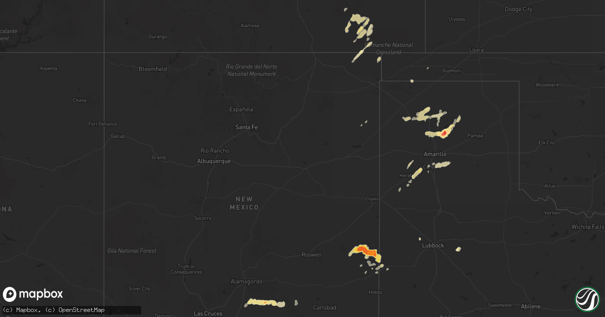
Hail Map in California on April 11, 2012
Get this storm
April 11 map
$229
one time, instant access
Download today. No call, no setup
Keep the $229
Bought the map and want the full workflow? Apply the entire $229 to a subscription within 7 days. None of it is wasted.
Every map, not just this one
This buys you this map. Subscription and you get every map we run, in the markets you choose from a few cities to whole states to nationwide. Plus real-time alerts the moment a storm fires.
Contact data
Name, contact info, occupancy, even credit band for addresses in the footprint. You go from where it hit to who to call.
Become the source they trust
Unlimited branding weather history reports on demand. You already have the documented answer ready for the property owner, and you are the one who showed up with it.
Property data and RoofTrace estimates
Pull up any address you have got, its value and the exact code rules for that jurisdiction, straight from One Click Code. Then RoofTrace estimates the squares, pitch, and roof value, priced the way you price.
Storm reports in California
California
| Date | Description |
|---|---|
| 04/11/20125:24 PM CDT | Around 1/2 inch to 1 inch diameter hail. Also about 7 mi east of traver and 99 |
| 04/11/20124:22 PM CDT | Some accumulation on the roads |
| 04/11/20124:20 PM CDT | A local report indicates 1.00 inch wind near 5 SE KINGSBURG |
| 04/11/20124:15 PM CDT | Winds from a thunderstorm ripped off a 30 foot section of a mobile home carport awning and damaged part of the roof near the intersection of gilbert and chambers street |
| 04/11/20124:10 PM CDT | A local report indicates 1.00 inch wind near 5 N HANFORD |
| 04/11/20124:03 PM CDT | A local report indicates 1.00 inch wind near HANFORD |
| 04/11/20123:40 PM CDT | Winds from a thunderstorm ripped off a 30 foot section of a mobile home carport awning and damaged part of the roof near the intersection of gilbert and chambers street |
| 04/11/20123:32 PM CDT | Relayed report from the public of wind damage to a roof at mcsweeny elementary school in hemet. Extent of damage is unknown. Time of the event is estimated based on ano |
| 04/11/20123:31 PM CDT | On highway 41 hail covering the ground. |
All States Impacted by Hail Map on April 11, 2012
Cities Impacted by Hail Map on April 11, 2012
- Mosquero, NM
- Grenville, NM
- Masterson, TX
- Amarillo, TX
- Fritch, TX
- Panhandle, TX
- Cloudcroft, NM
- Fort Stockton, TX
- Balmorhea, TX
- Coyanosa, TX
- Borger, TX
- Tatum, NM
- Kim, CO
- Folsom, NM
- Plains, TX
- Holden, LA
- Hereford, TX
- Pecos, TX
- Trinidad, CO
- Loranger, LA
- Robert, LA
- Van Horn, TX
- Hammond, LA
- Dumas, TX
- Friona, TX
- Crossroads, NM
- Sunray, TX
- Jal, NM
- Henderson, TX
- Littleton, CO
- Englewood, CO
- Denver, CO
- Hanford, CA
- Loving, NM
- Mentone, TX
- Channing, TX
- Hartley, TX
- Canyon, TX
- Bay Saint Louis, MS
- Commerce City, CO
- Grandfalls, TX
- Pride, LA
- Zachary, LA
- Kermit, TX
- Carlsbad, NM
- Erath, LA
- Abbeville, LA
- Fort Lupton, CO
- Kingsburg, CA
- Dinuba, CA
- Traver, CA
- Greenwell Springs, LA
- Fowler, CO
- Visalia, CA
- Ponchatoula, LA
- Springfield, LA
- Goldsmith, TX
- Laneville, TX
- Price, TX
- Ralls, TX
- Claude, TX
- Laton, CA
- Riverdale, CA
- Lemoore, CA
- Levelland, TX
- Branson, CO
- Tickfaw, LA
- Salt Flat, TX
- Ama, LA
- Stinnett, TX
- Imperial, TX
- Lovington, NM
- Covington, LA
- Dimmitt, TX
- Dalhart, TX
- Cactus, TX
- Windsor, CO
- Fort Collins, CO
- Maurepas, LA
- Livingston, LA
- Midkiff, TX
- Saint Bernard, LA
- Aurora, CO
- Delcambre, LA
- Amistad, NM
- Denham Springs, LA
- Milnesand, NM
- Model, CO
- Pearlington, MS
- Goodwell, OK
- Eunice, LA
- Folsom, LA
- Albany, LA
- Independence, LA
- Canon City, CO
- Walker, LA
- Odessa, TX
- Baton Rouge, LA


