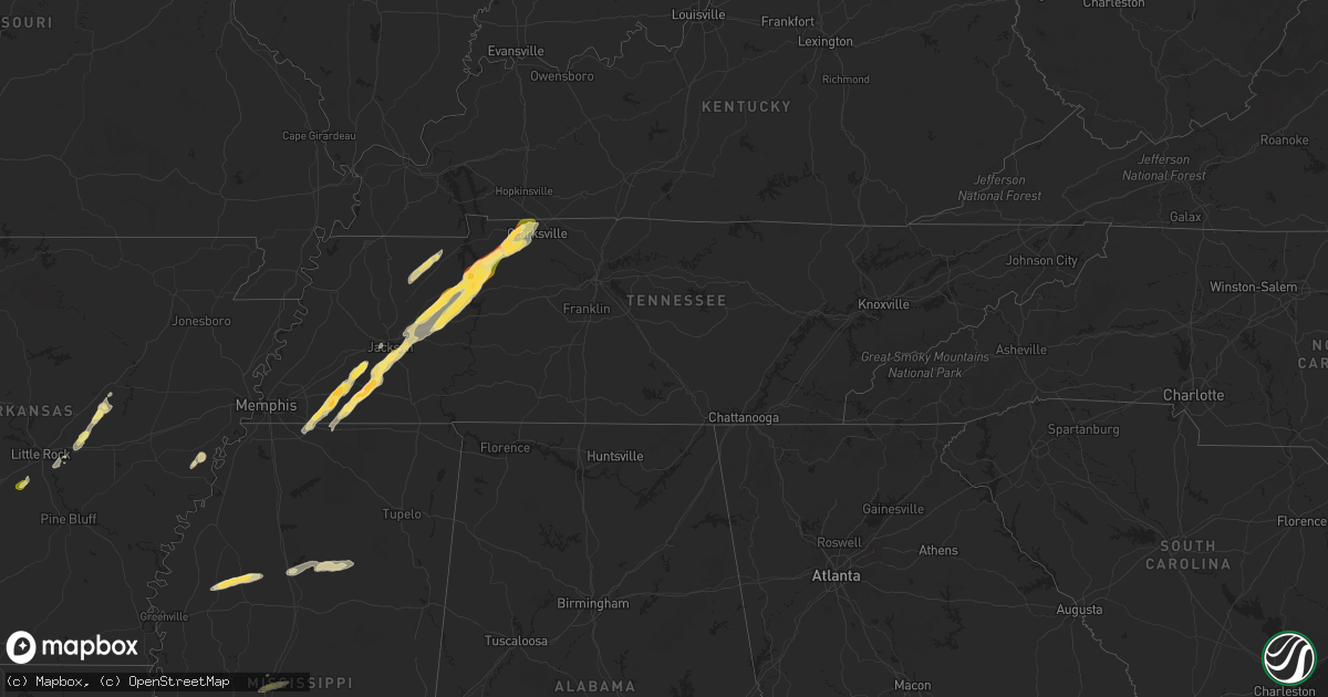
Hail Map in Tennessee on April 8, 2024
Get this storm
April 8 map
$229
one time, instant access
Download today. No call, no setup
Keep the $229
Bought the map and want the full workflow? Apply the entire $229 to a subscription within 7 days. None of it is wasted.
Every map, not just this one
This buys you this map. Subscription and you get every map we run, in the markets you choose from a few cities to whole states to nationwide. Plus real-time alerts the moment a storm fires.
Contact data
Name, contact info, occupancy, even credit band for addresses in the footprint. You go from where it hit to who to call.
Become the source they trust
Unlimited branding weather history reports on demand. You already have the documented answer ready for the property owner, and you are the one who showed up with it.
Property data and RoofTrace estimates
Pull up any address you have got, its value and the exact code rules for that jurisdiction, straight from One Click Code. Then RoofTrace estimates the squares, pitch, and roof value, priced the way you price.
Storm reports in Tennessee
Tennessee
| Date | Description |
|---|---|
| 04/08/20246:51 PM CDT | Facebook report of a tree down blocking moore hollow road in tennessee ridge. |
| 04/08/20246:51 PM CDT | Facebook report of part of roof blown off house on hurricane loop near moore hollow rd. |
| 04/08/20246:50 PM CDT | Twitter photo shows small barn roof blown off in tennessee ridge. |
| 04/08/20246:50 PM CDT | Received a phone call of marble size hail... That was not quite ping pong size. Strong winds as well. |
| 04/08/20246:24 PM CDT | A local report indicates 1.75 inch wind near 6 E Camden |
| 04/08/20246:23 PM CDT | A local report indicates 1.00 inch wind near 2 NE Camden |
| 04/08/20246:11 PM CDT | A local report indicates 1.00 inch wind near 8 S Camden |
| 04/08/20246:08 PM CDT | A local report indicates 1.00 inch wind near Bruceton |
| 04/08/20246:07 PM CDT | A local report indicates 1.00 inch wind near Hollow Rock |
| 04/08/20246:04 PM CDT | A local report indicates 1.25 inch wind near 5 S Camden |
| 04/08/20245:10 PM CDT | Hail fell at ferge dr and old jackson rd. Time is radar estimated. |
| 04/08/20245:03 PM CDT | A local report indicates 1.00 inch wind near 6 E Bemis |
| 04/08/20245:01 PM CDT | A local report indicates 1.00 inch wind near 4 ESE Bemis |
| 04/08/20245:00 PM CDT | A local report indicates 1.75 inch wind near Somerville |
| 04/08/20244:57 PM CDT | A local report indicates 1.00 inch wind near 3 SE Bemis |
| 04/08/20244:56 PM CDT | Damage to the roof of lendnation off hwy 45 / 18 south of jackson. |
| 04/08/20244:49 PM CDT | A local report indicates 1.25 inch wind near Medon |
| 04/08/20244:46 PM CDT | A local report indicates 1.50 inch wind near 2 WSW Williston |
| 04/08/20244:36 PM CDT | Powerlines down along hwy 57 in rossville. |
| 04/08/20244:33 PM CDT | A local report indicates 1.75 inch wind near 1 WNW Toone |
| 04/08/20244:23 PM CDT | A local report indicates 1.75 inch wind near 2 NNW Bolivar |
| 04/07/20247:36 PM CDT | A local report indicates 1.25 inch wind near 2 S Puryear |
| 04/07/20247:22 PM CDT | A local report indicates 1.00 inch wind near 5 NNW Routon |
| 04/07/20247:20 PM CDT | Facebook video of approximately ping pong size hail falling in indian mound. |
| 04/07/20247:14 PM CDT | Facebook report of approximately quarter sized hail in cumberland city. |
| 04/07/20247:10 PM CDT | Facebook photos showed ping pong ball size hail fell in cumberland city. |
| 04/07/20247:03 PM CDT | Report of power lines down on east richview road in cumberland city. Time estimated via radar. |
All States Impacted by Hail Map on April 8, 2024
Cities Impacted by Hail Map on April 8, 2024
- Doddsville, MS
- Ruleville, MS
- Schlater, MS
- Minter City, MS
- Philipp, MS
- Vaughan, MS
- Greenwood, MS
- Pickens, MS
- Holcomb, MS
- Goodman, MS
- Camden, MS
- Grenada, MS
- Coffeeville, MS
- Big Creek, MS
- Gore Springs, MS
- Calhoun City, MS
- Conroe, TX
- Vardaman, MS
- Derma, MS
- Hempstead, TX
- Willis, TX
- Chappell Hill, TX
- Bellville, TX
- Houston, MS
- Cleveland, TX
- Coldspring, TX
- New Waverly, TX
- Zavalla, TX
- Huntington, TX
- Waller, TX
- Navasota, TX
- Plantersville, TX
- Pointblank, TX
- San Augustine, TX
- Saint Joseph, LA
- Center, TX
- Montgomery, TX
- Grand Junction, TN
- Moscow, TN
- La Grange, TN
- Somerville, TN
- Hickory Valley, TN
- Whiteville, TN
- Bolivar, TN
- Nacogdoches, TX
- Toone, TN
- Rossville, TN
- Collierville, TN
- Marianna, AR
- Lexa, AR
- Byhalia, MS
- Medon, TN
- Jackson, TN
- Williston, TN
- Bremond, TX
- Pinson, TN
- Buffalo, TX
- Lamar, MS
- Elkhart, TX
- Oakwood, TX
- Oakland, TN
- Beech Bluff, TN
- Cameron, LA
- Mercer, TN
- Jacksonville, TX
- Fairfield, TX
- Kosse, TX
- Rusk, TX
- Palestine, TX
- Huron, TN
- Groesbeck, TX
- Thornton, TX
- Tennessee Colony, TX
- Hackberry, LA
- Teague, TX
- Lexington, TN
- Vivian, LA
- Plain Dealing, LA
- Hosston, LA
- Ida, LA
- Cedar Grove, TN
- Wildersville, TN
- Yuma, TN
- Bartlett, TX
- Bullard, TX
- Marshall, TX
- Brownsville, TN
- Westport, TN
- Buena Vista, TN
- Holladay, TN
- Huntingdon, TN
- Bruceton, TN
- Camden, TN
- Whitehouse, TX
- Athens, TX
- Flint, TX
- Montalba, TX
- Granger, TX
- Jefferson, TX
- Arp, TX
- Tyler, TX
- Bradley, AR
- Hollow Rock, TN
- Tahoka, TX
- Kerens, TX
- Eva, TN
- New Johnsonville, TN
- Waverly, TN
- Big Sandy, TN
- Post, TX
- Justiceburg, TX
- Coahoma, TX
- Hubbard, TX
- Lewisville, AR
- Dawson, TX
- Frost, TX
- Blooming Grove, TX
- Stewart, TN
- Atlanta, TX
- Tennessee Ridge, TN
- Queen City, TX
- Ira, TX
- Fluvanna, TX
- Trenton, TN
- Milan, TN
- Malone, TX
- Purdon, TX
- Humboldt, TN
- Texarkana, TX
- Texarkana, AR
- Eustace, TX
- Snyder, TX
- Barry, TX
- Italy, TX
- Ben Wheeler, TX
- Corsicana, TX
- Ennis, TX
- Bradford, TN
- Atwood, TN
- Erin, TN
- Cumberland City, TN
- Indian Mound, TN
- Palmyra, TN
- Dover, TN
- Woodlawn, TN
- Clarksville, TN
- Fulton, AR
- McKenzie, TN
- Gleason, TN
- Greenfield, TN
- Palmer, TX
- Rice, TX
- Prescott, AR
- Kaufman, TX
- Washington, AR
- Columbus, AR
- Ozan, AR
- Paris, TN
- Henry, TN
- Waxahachie, TX
- Ferris, TX
- Seagoville, TX
- Dallas, TX
- Okolona, AR
- Mesquite, TX
- Balch Springs, TX
- Forney, TX
- Amity, AR
- McCaskill, AR
- Gurdon, AR
- Lonoke, AR
- Hermleigh, TX
- Terrell, TX
- Cottage Grove, TN
- Lancaster, TX
- Sunnyvale, TX
- Jayton, TX
- Aspermont, TX
- Garland, TX
- Nashville, AR
- Murfreesboro, AR
- Rotan, TX
- Chandler, TX
- Rowlett, TX
- Rockwall, TX
- Benton, AR
- Bauxite, AR
- Carlisle, AR
- Puryear, TN
- Mexia, TX
- Caddo Mills, TX
- Quinlan, TX
- Greenville, TX
- Royse City, TX
- Bonnerdale, AR
- Bismarck, AR
- Pearcy, AR
- Ward, AR
- Austin, AR
- Searcy, AR
- Des Arc, AR
- Wylie, TX
- Sachse, TX
- Hamlin, TX
- Griffithville, AR
- Ralls, TX
- Lorenzo, TX
- Roby, TX
- Scott, AR
- McCaulley, TX
- Mabelvale, AR
- Sweetwater, TX
- Malvern, AR
- Wolfe City, TX
- Old Glory, TX
- Higginson, AR
- Celeste, TX
- Crosbyton, TX
- Rule, TX
- Stamford, TX
- Bedford, TX
- North Richland Hills, TX
- Hurst, TX
- Colleyville, TX
- Haskell, TX
- Southlake, TX
- Roanoke, TX
- Flower Mound, TX
- Argyle, TX
- Lewisville, TX
- Slaton, TX
- Keller, TX
- Bailey, TX
- Bonham, TX
- Leonard, TX
- Fort Worth, TX
- Ector, TX
- Denton, TX
- Mckinney, TX
- Celina, TX
- Dodd City, TX
- Ladonia, TX
- Haltom City, TX
- Grapevine, TX
- Batchelor, LA
- Saint Francisville, LA
- Ravenna, TX
- Ivanhoe, TX
- Telephone, TX
- Ponder, TX
- Justin, TX
- Decatur, TX
- Krum, TX
- Avoca, TX
- Weinert, TX
- Gunter, TX
- Haslet, TX
- Sanger, TX
- Valley View, TX
- Bennington, OK
- Frisco, TX
- Little Elm, TX
- Aubrey, TX
- Pilot Point, TX
- Hendrix, OK
- Laneville, TX
- Throckmorton, TX
- Rhome, TX
- Bokchito, OK
- Collinsville, TX
- Gainesville, TX
- Tioga, TX
- Boswell, OK
- Henderson, TX
- Denison, TX
- Moran, TX
- Breckenridge, TX
- Prosper, TX
- Hedley, TX
- Lelia Lake, TX
- Millsap, TX
- Weatherford, TX
- Newcastle, TX
- Liberty, MS
- Era, TX
- Whitesboro, TX
- Poolville, TX
- Quail, TX
- Graham, TX
- Olney, TX
- Loving, TX
- Caddo, TX
- Perrin, TX
- Mineral Wells, TX
- Lueders, TX
- Tatum, TX
- Muenster, TX
- Rosston, TX
- Van Alstyne, TX
- Whitt, TX
- Bryson, TX
- Atoka, OK
- Magnolia, MS
- Osyka, MS
- Caddo, OK
- Albany, TX
- Bridgeport, TX
- Jacksboro, TX
- Springtown, TX
- Marietta, OK
- Lane, OK
- Whitewright, TX
- Sherman, TX
- Tom Bean, TX
- Windthorst, TX
- Sunflower, MS
- Jermyn, TX
- Henrietta, TX
- Azle, TX
- Newark, TX
- Bells, TX
- Savoy, TX
- Boyd, TX
- Thackerville, OK
- Bowie, TX
- Strawn, TX
- Graford, TX
- Ardmore, OK
- Madill, OK
- Stringtown, OK
- Bellevue, TX
- Paradise, TX
- Chico, TX
- Woodson, TX
- Palo Pinto, TX
- Stonewall, OK
- Roff, OK
- Fitzhugh, OK
- Rochester, TX
- Kiowa, OK
- Pittsburg, OK
- Tishomingo, OK
- Nocona, TX
- Gordon, TX
- Ada, OK
- Sunset, TX
- Mill Creek, OK
- Wardville, OK
- Stuart, OK
- Mcalester, OK
- O'Brien, TX
- Sulphur, OK
- Lovington, NM
- Alvord, TX
- Tatum, NM
- Howe, TX
- Plains, TX
- Anna, TX
- Maljamar, NM
- Lake Dallas, TX
- Euless, TX
- Coppell, TX
- Carrollton, TX
- Whiteface, TX
- Andrews, TX
- Kemp, TX
- Fort Campbell, KY
- Seminole, TX
- Lufkin, TX
- Mabank, TX
- Canton, TX
- Wills Point, TX
- Hobbs, NM
- Eunice, NM
- Lamesa, TX
- Welch, TX
- Silverton, TX
- Bivins, TX
- Mineola, TX
- Winona, TX
- Lindale, TX
- Big Sandy, TX
- George West, TX
- Beeville, TX
- Gail, TX
- Odonnell, TX
- Frankston, TX
- Larue, TX
- Brownsboro, TX
- Wilson, TX
- Longview, TX
- Diana, TX
- Alto, TX
- Cushing, TX
- Gause, TX
- Cameron, TX
- Hearne, TX
- Jewett, TX
- Long Branch, TX
- Trenton, TX
- Randolph, TX
- Colbert, OK
- Cartwright, OK


