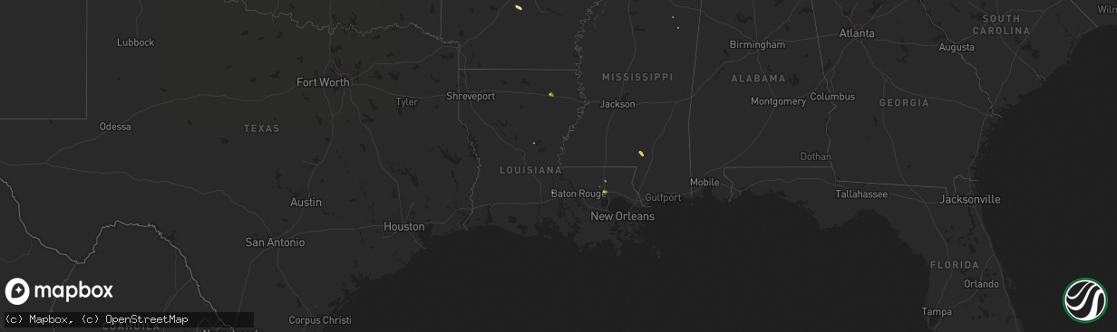
Hail Map in Louisiana on April 8, 2014
The weather event in Louisiana on April 8, 2014 includes Hail map. 3 states and 18 cities were impacted and suffered possible damage. The total estimated number of properties impacted is 4,470.
Want more than just the map?
Turn this storm into a full workflow.
- Owner + property data so you know who to knock
- OnDemand branded weather history reports to win the "did we even have hail?" argument
- RoofTrace estimate so reps stop guessing numbers at the door
Bought this map? Upgrade within 7 days and we'll credit the $230. (10-15 min setup call)
Hail
4,470
Estimated number of impacted properties by a 1.00" hail or larger0
Estimated number of impacted properties by a 1.75" hail or larger0
Estimated number of impacted properties by a 2.50" hail or largerStorm reports in Louisiana
Louisiana
| Date | Description |
|---|---|
| 04/08/20143:45 PM CDT | Trees uprooted |
| 04/08/20143:05 PM CDT | Powerlines...a power pole...and a tree down in newellton... |
| 04/08/20143:04 PM CDT | A local report indicates 1.00 inch wind near 2 N PONCHATOULA |
| 04/08/20142:03 PM CDT | Up to quarter sized hail covering the ground at intersection of cochran road and cabuck lane just west of rayville |


